Skip to content

Random Connections

A collection of photography and exploration focusing on Upstate South Carolina and beyond.

  • Home
  • About Us
  • Photos
  • Resources
  • Other Voices
  • Post Archives
  • Home
  • Google Maps

Tag: Google Maps

Google Maps Screws Up

Posted on July 21, 2013July 25, 2013 By Tom 1 Comment on Google Maps Screws Up
Geocaching and Maps, Rants

I’m not one of those people that mounts protests every time Facebook changes their layout, or when GMail makes some slight change. I even like the new updates to Flickr, even though some users are threatening to abandon it for Ipernity. So, when I say that Google Maps has really screwed up with their latest … Read More “Google Maps Screws Up” »

Street View Time Lapse

Posted on February 2, 2013 By Tom No Comments on Street View Time Lapse
Geocaching and Maps, Internet, Photography, Weirdness

Screen Shot 2013-02-02 at 6.42.00 AM

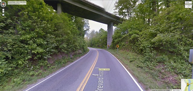
I’ve been enjoying creating time-lapse videos while driving. Unfortunately, I’ve just been driving back and forth to work or rehearsal, so the scenery doesn’t change much.

So while I was looking at Google Earth the other day it occurred to me – I could use the images from Street View to create the same type of time-lapse.

Read More “Street View Time Lapse” »

Local Paddling Venues

Posted on June 10, 2012 By Tom 1 Comment on Local Paddling Venues
Local, Paddling

After a spring full of multiple paddling trips, some on consecutive Saturdays, we finally had a weekend to ourselves with no paddling trips planned. Well, actually, I could have gone with my Lowcountry Unfiltered friends to Little Tybee Island on Saturday, but Laura and I really needed a weekend to ourselves at home. Even so, … Read More “Local Paddling Venues” »

Google Earth Meets Google Maps

Posted on April 28, 2010 By Tom No Comments on Google Earth Meets Google Maps
Geocaching and Maps

Google Earth is now accessible through a browser via the Google Maps page.  The plug-in for Google Earth has been available for quite some time now, so this is only a natural progression.  On the Maps page there is now an “Earth” view in addition to Map and Satellite.  Terrain has been relegated to the … Read More “Google Earth Meets Google Maps” »

More Disc Golf Resources

Posted on February 9, 2009 By Tom No Comments on More Disc Golf Resources
Entertainment, Geocaching and Maps

I realized that in yesterday’s post I didn’t get any maps or locations to the two disc golf courses I’d played.  The easiest thing would be to see if the Upstate Disc Golf Club website had links to maps on their course list, but there were not even any written directions. I thought I had … Read More “More Disc Golf Resources” »

Greenville in Street View!

Posted on June 11, 2008 By Tom 1 Comment on Greenville in Street View!
Geocaching and Maps

Much of the Upstate, including Greenville, is now available in Google Street View. Last night I discovered that Columbia and Charlotte had been added, and this morning Greenville was also on the list. The blue areas in the map below show the current coverage: In Google Earth, the coverage is a bit deceptive. There are … Read More “Greenville in Street View!” »

Embeddable Google Earth

Posted on May 29, 2008 By Tom No Comments on Embeddable Google Earth
Geocaching and Maps

The functionality of Google Earth is showing up in more and more places outside of the actual Google Earth software. Much of what you could do in GE is now available in Google Maps. Maps has had the ability to read KML/KMZ files for awhile now, and for the most part the imagery is the same for both systems. Well the folks at Google have blurred the line even more with the recent release of the Google Earth COM API.

The new API allows developers to create interfaces to the Google Earth data. Probably one of the best examples of this has been done by the folks at TakItWithMe.com. They have created a version of Google Earth than can be embedded into blog posts, web pages, etc.

In order to take advantage of this three things have got to be in place:

  1. Google Earth 4.x or higher must be installed on your computer.
  2. You have to install the Google Earth 3D plugin for the browser you plan to use.
  3. The KML/KMZ file you plan to use must be available online, either on hosted webspace or on the user’s My Maps folder in Google Maps.

If you have at least the first two of these already in place on your computer, you can click the link below to read more, and you’ll see a demonstration…

Read More “Embeddable Google Earth” »

Seero – Geospatially Aware Video

Posted on May 12, 2008 By Tom No Comments on Seero – Geospatially Aware Video
Geocaching and Maps

In my discussions about geotagging, one of the questions that always arises is the issue what location should be tagged. If you’re tagging photographs, should you tag the location where you took the shot, or should you tag the location of the subject. For example, if you were standing on an overlook on the Blue … Read More “Seero – Geospatially Aware Video” »

Hey! What’s That?

Posted on April 29, 2008 By Tom No Comments on Hey! What’s That?
Geocaching and Maps

Via the blog Free Geography Tools, I’ve learned about one of the coolest new applications to take advantage of the Google Maps/Earth interface. The service is called “Hey! What’s That?” and it allows users to create panoramas from any point on Earth. Think of it this way… You’re up on the Blue Ridge Parkway and … Read More “Hey! What’s That?” »

Super Geotagged

Posted on April 28, 2008 By Tom No Comments on Super Geotagged
Geocaching and Maps, Photography

One of the problems with native KML support in Flickr is that it only displays the last 20 geotagged images from the specified search criteria. If you want a more inclusive display of Flickr geotagged images, you need to use something like Metaltoad, Flyr or Loc.alize.us. Flyr gives you better granularity of control for searches … Read More “Super Geotagged” »

Posts navigation

1 2 Next

Categories

  • EdTech (200)
  • Entertainment (202)
  • Family (121)
  • Gear (115)
  • General Technology (99)
  • Geocaching and Maps (208)
  • History and Genealogy (266)
  • Internet (144)
  • Local (451)
  • Miscellaneous (550)
  • Music (196)
  • Paddling (248)
  • Photography (779)
  • Podcast (6)
  • Rambling (227)
  • Rants (161)
  • Recipes (34)
  • Religion (48)
  • Restaurants (165)
  • Science (48)
  • Things Overheard (29)
  • Travel (411)
  • Uncategorized (129)
  • Washington Sabbatical (113)
  • Weirdness (60)

Recent Posts

  • In Search of the Road Builder
  • The Phoenix Riots and Dr. Benjamin Mays – An MLK Day Ramble
  • An Obsession with Steak Knives
  • An Epiphany on Patriotism
  • Kayaking Bates Old River and Running Creek

Recent Comments

  • Walter Kokoszka on Mysterious Mayucha and The Wolf Pit
  • Elizabeth on The Temple of Health: Ground-Truthing in Antreville
  • The Bay Area Basketball Fan’s Guide to March Madness on FU All the Time!
  • Why You Should Root For This March Madness Underdog on FU All the Time!
  • Gregory Davis on Ghost Towns of the Pee Dee – Part 2, Centenary

Tags

blogging cemetery Christmas Columbia Edisto River edtech Entertainment family Flickr Florida Furman Furman University gear Georgia geotagging Ghost Town Ghost Towns Google Earth Google Maps GPS Greenville Greenville Chorale history Instructional Technology kayaking Lake Jocassee LCU Lowcountry Unfiltered maps Music North Carolina Paddling Photography rambling restaurant Restaurants review singing social networking South Carolina time-lapse Travel video Washington Washington State
March 2023
S M T W T F S
 1234
567891011
12131415161718
19202122232425
262728293031  
« Jan    

Copyright © 2023 Random Connections.

Theme: Oceanly by ScriptsTown