It was an absolutely beautiful day. I had planned to go to the gym then spend the day writing. Instead, I needed to get out of the house. About the time I made that decision, I got a text from Keith Dover asking what I was up to on this fine day. It sounded like a perfect excuse to get out and do some photography.
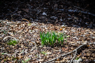
I had been wanting to get back to the ghost town of Chappells before spring and before foliage obscured the old buildings. Late February, early March is the perfect time for ghost towning. There are still no leaves and greenery to hide things. More importantly, though, daffodils are blooming. Daffodils are often tell-tale signs of old home places and former residential areas.
We got a later start. Also, it seemed to be much further down to Chappells than I remembered. As we drove through the countryside of Laurens County I kept getting distracted, wanting to explore side roads and other things. I have long learned that if I do that, I never get to my destination.
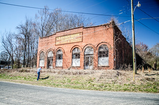
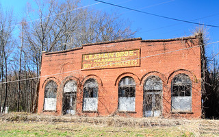
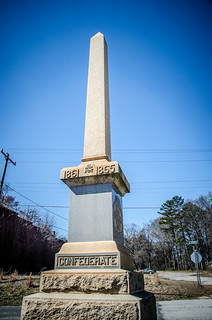
Keith had never been down this way, so we did pause in Cross Hill to take some photos of the old Leaman Brothers store front and Confederate monument.
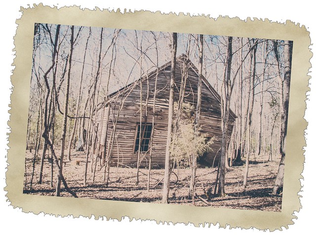
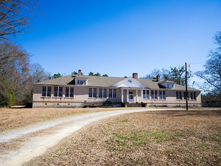
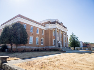
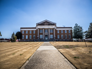
From Cross Hill we continued on southward on Highway 39. Just north of the town is the old Chappells School, which is now a community center. While the building appears to be in good shape, it doesn’t look like it gets much use. In fact, the last event on the sign out front was for sometime back in November.
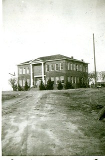
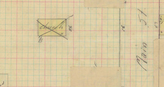
I wish I could find the location of the old high school. This was a two-story structure that was damaged in a tornado in 1923, then rebuilt. I don’t know if it was on the same location as this school or not. The photo below was taken after the rebuild.
We continued to the intersection of 39 and 34. For some reason I remembered the old Main Street as being further from the main highway. It’s actually quite close, and parallels Highway 39 just a block or so over.

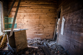
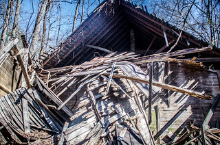
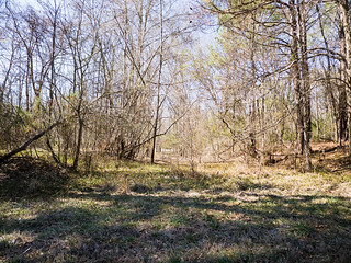
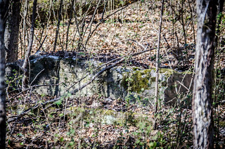
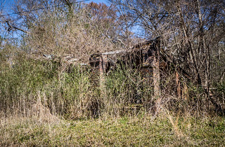
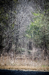
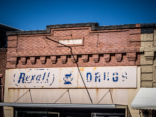
Keith and I parked close to the end of the drive, near the largest of the remaining structures. It seems like things have deteriorated even more since the last time I was here. Perhaps it’s just that the lack of greenery makes the damage more obvious. Even so, based on wall placement, it looks like there might have been a row of about four stores at this location. We got out and explored.
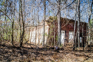

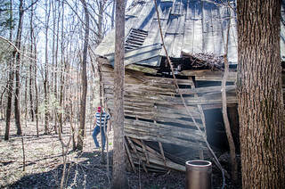
Set back off of the road was a building that at first glance looked like it could be an old meeting-house style of church.

As we approached we could see that it was a former house. There were clumps of daffodils around the entrance. The house was leaning, and much of it had already collapsed.
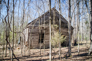
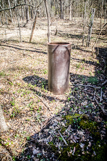
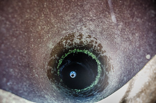
On the north side of the house was an old well. We could see water reflecting the sky about 30 feet down.
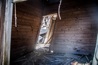
As we rounded the house we could see just how bad the state of deterioration truly was. The only thing keeping the house standing were two small trees upon which it was leaning. If those trees were gone, the whole house would collapse.

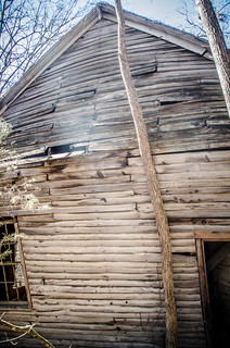
It wasn’t until I got home and checked the 1926 Sanborn Map of Chappells that I saw that this build HAD been a church. Our suspicions were correct. On the map the building is indicated as such a church, but there is an X over it. I also couldn’t find any record of the church in the GNIS database. It’s possible that it started as a church, and walls were added to form smaller rooms and it was used as a residence. There didn’t appear to be a large enough room for it to be a church.
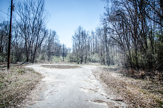
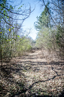
One thing I had not noticed on my previous trip was an old roadbed that runs beside the “church,” connecting the old main road to the highway. I’m sure there were other side streets, but I couldn’t spot them.
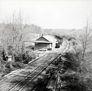
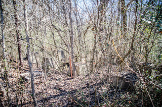
We walked back toward the car. I searched for any sign of the old depot, but couldn’t spot anything definitive. According to the Sanborn map it should have been right where I was looking. The old railway bed was obvious, but the only other remnants I found were a couple of railroad ties in a ditch and a concrete block about where the station would have been.
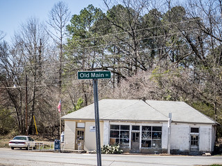
Back in the car we drove out, pausing for a moment to take a photo of the old service station. The top of the right-most column was collapsing much more than I remembered.
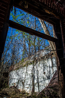
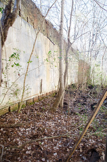
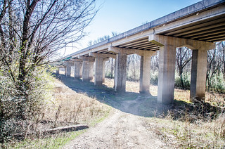
Keith and I drove on around to Highway 39 and headed slowly to the bridge over the Saluda. Without the leaves it was much easier to see the remnants of buildings through the woods. We parked on the north side of the bridge and walked down toward the old railway bed. We could see the remains of the trestle over the small side creek shown in the photo of the depot above, as well as the bed itself continuing to the west.
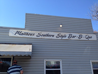
By this time it was a little afternoon. We were hungry, and about 15 miles in any direction from the nearest place to get something. Keith said he had never been to Saluda, so we headed that way. A quick online search found us Matthew’s Barbecue, so we decided to check it out. After a couple of missteps with the GPS, we found the place.
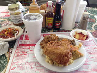
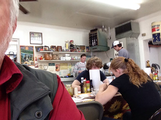
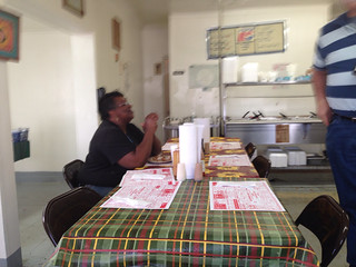
We walked inside and immediately intercepted by a young waitress who asked for our drink order. We were directed to a small buffet. There was mustard-based pulled pork, rice, fried chicken, and several vegetables. I loaded up my plate with more than I should have. Not only had our waitress bring our drinks, but had brought a small piece of strawberry shortcake.
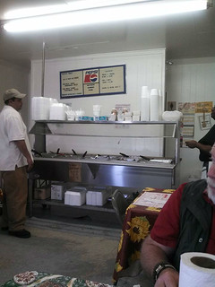
The place was simple. Keith and I were the only outsiders. Everyone else that came in knew everyone else there. The owner came out and sat down with his daughter, our waitress. A black woman came out and sat down with her meal. All treated us with some skepticism, despite our attempts to be friendly. Only the cook lightened up when we gave her copious complements on her food.
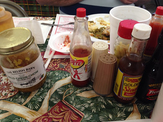
As for the food, it was tasty, and I’m sure it was fattening as all get out. There were lots of condiments on the table. I’ve always wondered about these – one clearly said “Refrigerate after opening.”
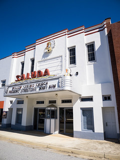
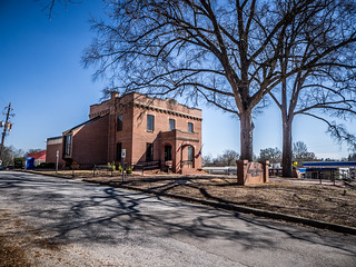
After lunch we headed back to the courthouse square. In our GPS-confused wanderings prior to lunch I had spotted a building for the local historical society, and want to see if they had information on a couple of other ghost towns. We parked and admired the old restored theater next to the museum.
The sign on the door indicated the museum should be open, but it was locked. Oh well. We decided to walk around the courthouse for a bit.
Behind the courthouse was a building that looked like a jail. Turns out it was the county library. I went in, first to kill some time in case the folks at the museum were still at lunch, and also to see if they had any of the information I needed. It was a tiny place, as far as libraries go, but they were helpful. I didn’t find any real new info, and I didn’t really have time to spend searching through their materials. I’ll save that for another trip.
We walked back to the museum. Still locked. Oh, well. It was time to move on.
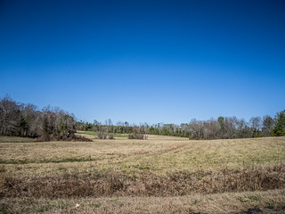
I still had the coordinates for the ghost town of Mount Willing in my GPS from when Tommy Thompson and I were down this way. It was only six miles away, so we decided to check it out. Off of Highway 378 there was a sign for Mount Willing Road, so we turned that way toward the coordinates.
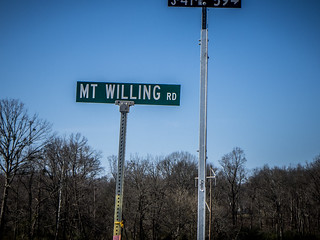
When we got there, there was not indication of a town – just an open field. I really needed more information from the historical society.
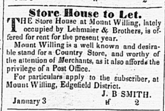
However, there was something there. This article from the Edgefield Advertiser in 1847 says that Mount Willing was “a well known and reliable stand for a country store.”
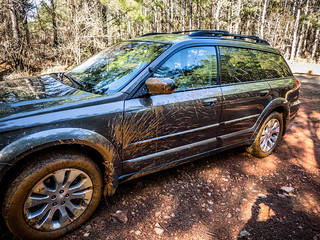
It was time to head back. On the way to lunch from Chappells to Saluda I had spotted a dirt road. With a name like “Union School Road”, I wanted to check it out. It turned out to be a long, very muddy dirt road. Unfortunately, we didn’t find a school. GNIS data shows that there was one called Hope Union School on a road that the dirt road eventually intersected. The only thing we got was a very, very muddy car. I was thankful for the Subaru’s all-wheel drive.
It was another good day of exploration. It seems we only had a few hours of exploration today, but I could easily spend several days exploring this area. I will definitely come back. Here’s all the photos from that trek:
[fsg_gallery id=”36″]
Whoa, new format? Do not like. 1/3 of the screen real estate is locked on the header, which looks nice, but could go to be scrolled off once I’ve seen it. I don’t think the font changes are an improvement either. I’m guessing you’re still playing around with it.
Yep, still tweaking. It’s time for a change, and I’m experimenting. Don’t worry. I wasn’t fond of that one, either. You just hit it as I was trying it out. 🙂
LOVE your photos and articles. I live in Greenwood, and have never seen many of the places you have written about – Cokesbury being the exception to that. Thanks for the pics and the writing.