It was another Second Saturday and time for a paddling trip with my friends from Lowcountry Unfiltered. For our September trip we had planned to do the western portion of Okefenokee Swamp, but we decided to put that on hold. I had told Matt that after our epic Morris Island excursion I wanted something with current, preferably going on the direction we were paddling. We got that…sort of…by paddling a section of the Savannah River below Augusta. However, any helpful current was offset by the length of the trip, a new record for Lowcountry Unfiltered.
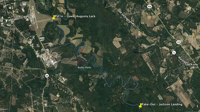
For this excursion our launch site was the New Savannah Bluff Lower Dam and Lock Boat Ramp south of Augusta on the Georgia side of the river. The take-out was the Jackson Landing on the South Carolina side. The shuttle itself was even longer than the river route we had planned. Much further than this and we would find ourselves on Savannah River Plant land with little or no access to a take-out for many more miles.
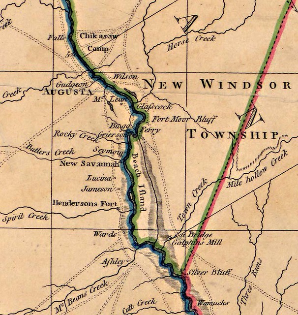
This route would take us through an area rich in history. The Savannah River was once the main route inland, so both Native American and Colonial settlements formed all along its banks. Many of these settlements were bypassed with the coming of the railroad, or consolidated into larger towns such as Augusta.
For this trip I’d be putting my new kayak racks to the test. Both Jim Leavell and Alan Russell would be coming along, so it was my first chance to try the 3-kayak configuration. I loaded up two boats on Friday and everything seemed stable.
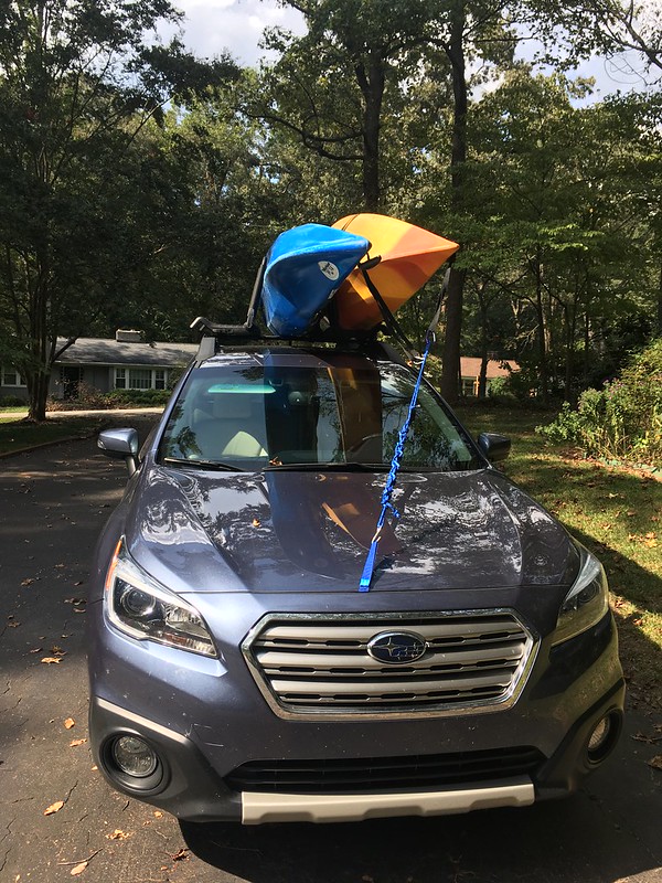
Saturday morning Jim arrived at my house early and we headed down to pick up Alan. The third boat went up on the car with no trouble, and everything seemed stable. We stopped for breakfast, then headed down for the long ride to the put-in.
It seems that there is no good way to get to Augusta from Greenville. Yeah, there is Augusta Road, but it turns into a two-lane country road below Greenwood. You could take interstates, but that would take you out of the way down to Columbia. Our route took us down through Clinton, then Saluda and across country. There was tempting scenery all around us, but we couldn’t stop to explore.
Eventually we reached the high bluffs overlooking the Augusta and the Savannah River Valley. I-520 provided an amazing view of the city. Sadly, that view was marred by smoke and pollution. The air looked just nasty, all most as bad as the smoke-filled air we had driven through out west.
We crossed over the Savannah River and made our way to the launch site. There was some activity, mostly folks fishing off of the boat ramp’s dock. Matt, Jerry, and Todd were meeting at the put-in at Jackson Landing and would drop off a vehicle, then meet us here. We unloaded our boats and prepped our gear until they arrived.
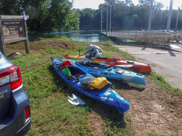
It took longer to shuttled from Jackson Landing than they had thought, but eventually Matt & Co. arrived and we got the rest of the boats ready for launch. It was about this time that I discovered that I’d left the frame for my GoPro at home. I had no way to mount it to my boat. I would only have my waterproof Fuji and my small Nikon.


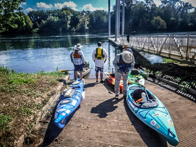
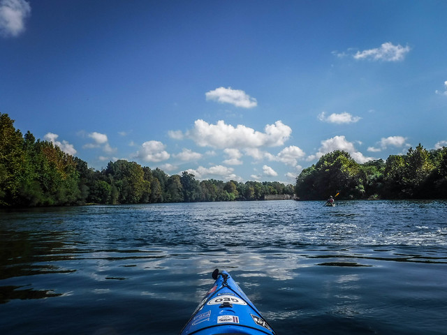
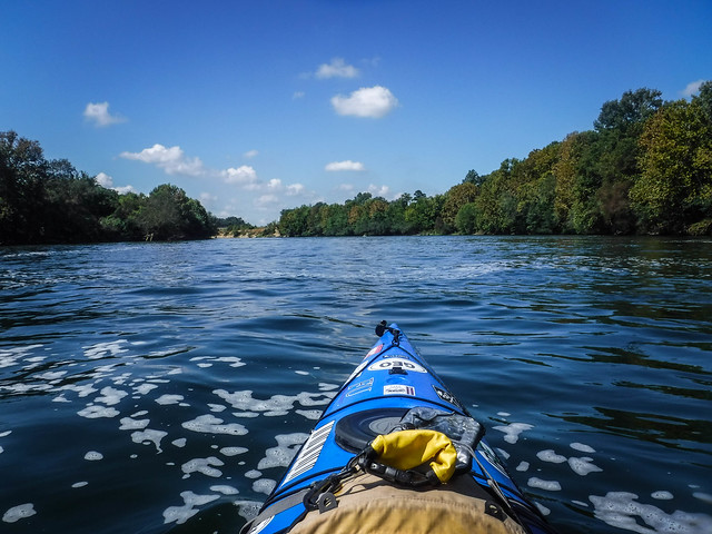
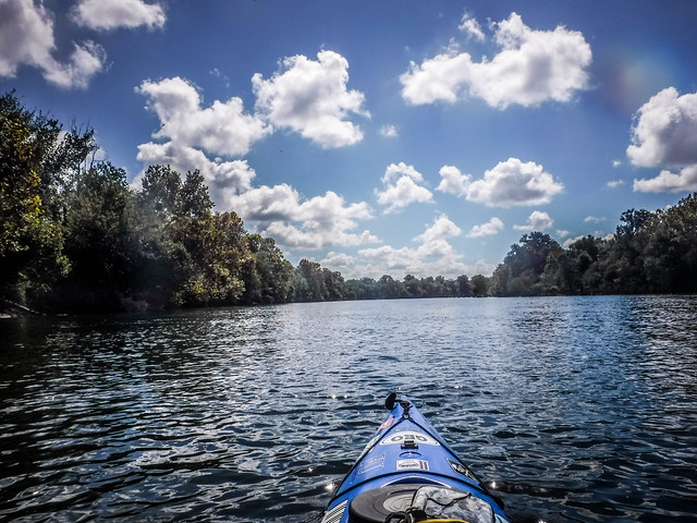
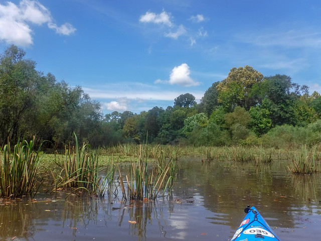
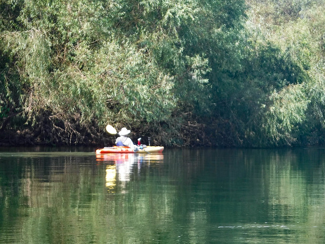
Finally we were on the water. The lock and dam were about a half mile upstream, so we decided to paddle up that way to check it out. It seems that so many of our LCU trips start out that way, paddling at least part of the way against the flow. I had just watched Midnight in the Garden of Good and Evil, so a paraphrased quote from the voodoo priestess Minerva in Gullah patois popped into my head.
To understand de downstream, you got ta commune wit de upstream.
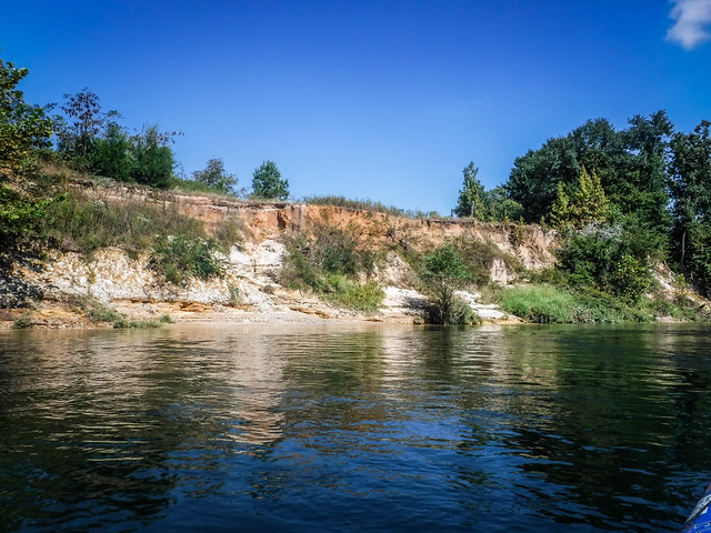
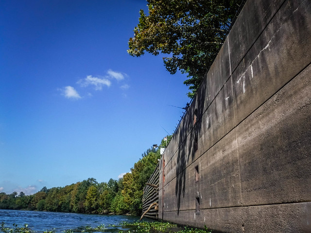
We paddled by high bluffs on the Georgia side, and eventually the dam and lock came into sight.


The boat landing, dam, and lock are part of a larger recreation area known as the New Savannah Bluff Lock and Dam Park. When I first saw the name I thought that it meant that this was a new park. Wrong. The term actually refers to New Savannah, a former settlement in the 1700s at this site. Boats stopped here to process tobacco. According to Wikipedia…
After the Revolution, New Savannah became a tobacco inspection. Tobacco leaf grown at local farms was packed into large hogshead barrels, and rolled to the town to obtain the official quality inspection necessary for its marketing. Sealed and quality-branded hogsheads were then loaded onto pole boats for transport to the seaport and market at Savannah, Georgia 215 river miles downstream.
https://en.wikipedia.org/wiki/New_Savannah,_Georgia
As we were driving into the park Jim had spotted an old cemetery. It turns out that this was once the cemetery for New Savannah. Had we known about the park and significance of the cemetery we might have explored a bit more. This might warrant another trip down this way.
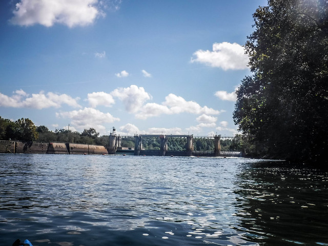
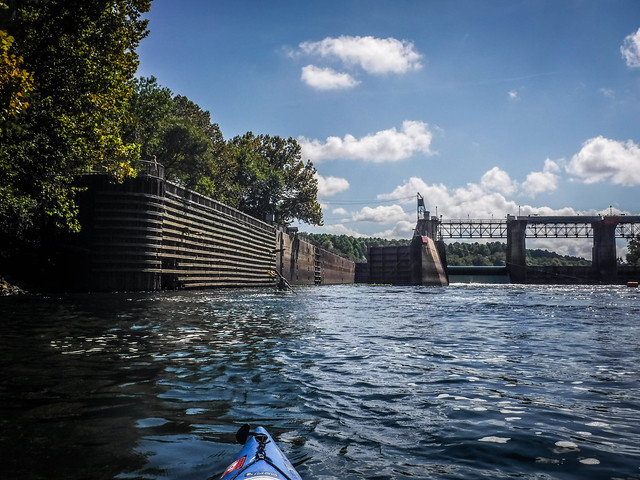
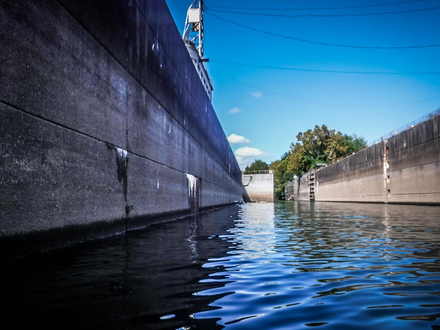
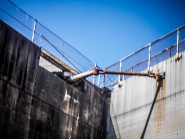
We approached the dam cautiously. Strong currents and roiling water created hazards at its base. A cable and series of floats prevented boats from getting too close. On the west side of the dam a channel opened into the lock. We ferried across the tricky currents and over to the lock entrance.
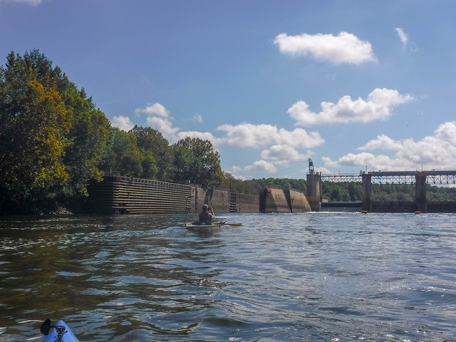
The dam and lock were built in 1937 by the Army Corps of Engineers to facilitate boat traffic from Savannah to Augusta. Up until 1979 barge traffic regularly plied these waters. The lock was decommissioned and in 1999 plans were made to remove the structure. However, it was not demolished, but incorporated into the park.
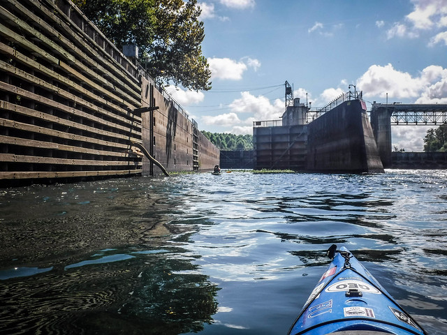
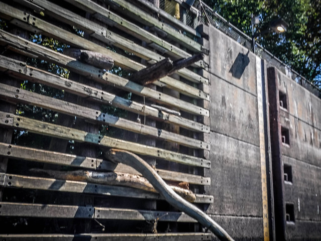
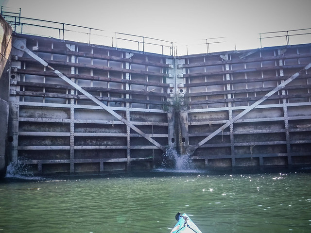
The lower lock door was permanently open. The upper doors were closed and water sprayed in through cracks. Water lilies floated at the entrance to the lock and fishing lines draped downward from folks casting from the wall up above. We paddled on in, dodging the lines.

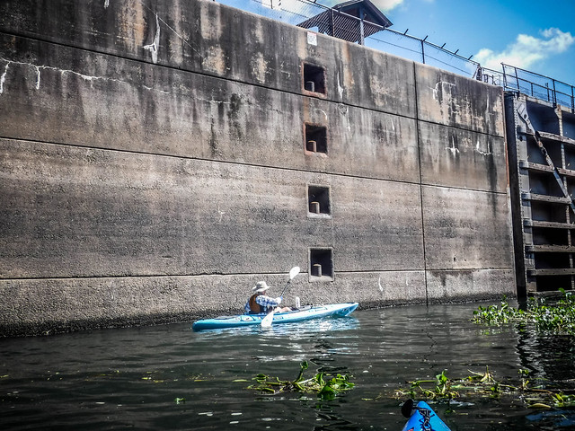

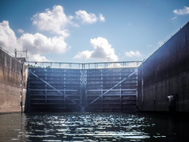
Alan and I commented on how this reminded us of our trip through the Pinopolis Lock on Lake Moultrie. Sound echoed off of the concrete walls and steel doors in much the same way. This lock is much smaller than Pinopolis, though. The lock is 56 feet wide, 360 feet long, and when in operation raised and lowered boats 15 feet.
I paddled all the way to the upstream doors where I spotted a turtle struggling on a ledge. It had gotten overturned somehow. I paddled into the spray from the door and righted the creature with my paddle blade, getting soaked in the process.
Only Alan and Matt had ventured into the lock with me. I headed back downstream to find them checking out the lower door mechanism. From there we joined up with Jim, who had been waiting outside the lock, then with Jerry and Todd to finally head downstream.


Just below the dam was another remnant of the days when commercial traffic plied these waters. An old barge sat derelict on the South Carolina side, almost becoming one with the river bank.


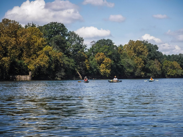
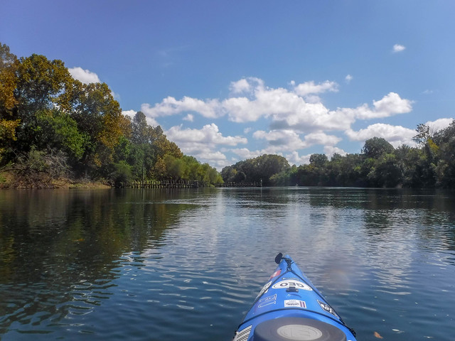
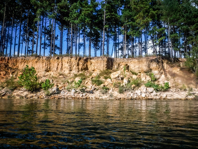
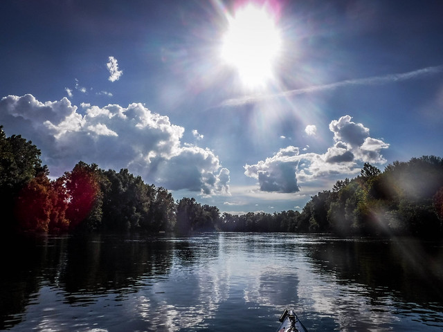
It was an absolutely spectacular day for paddling. It was good going with the current, but we had a long way to go. That meant doing more paddling that I was hoping to do on this trip. The river was lined with wooden jetties added by Army Corps of Engineers to keep the river clear from debris for navigation.


In addition to the jetties the ACoE had bypassed oxbows, straightening the rivers. Along these stretches they added rip rap to stabilize the bank. On one of our previous treks on the Savannah River we found military headstones embedded in the rip rap. I kept my eyes open for more anomalies like this, but I didn’t see anything out of the ordinary.
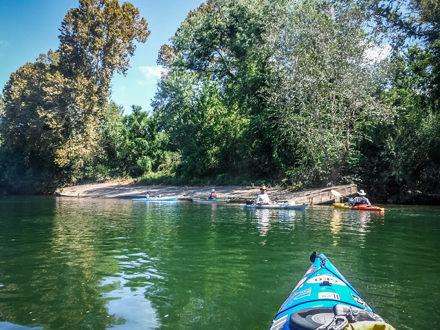
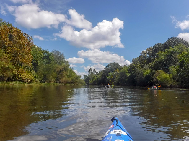
I’ve called our group the “ADD Paddlers” because of our tendency to get distracted. The truth is that we love to explore. Any side channel or oxbow presents an opportunity for further exploration. We headed into one such oxbow that we thought might connect further down the river. When I checked the map I saw that we were, in fact, headed north. We had to retrace our steps when we ran out of room about three quarters of a mile into the oxbow.

Normally such side explorations wouldn’t be a problem. However, today we had many river miles to cover and we couldn’t really afford time for further exploration. We had also gotten a later start than we had hoped. Even so, it was past lunch time and we needed to take a break.
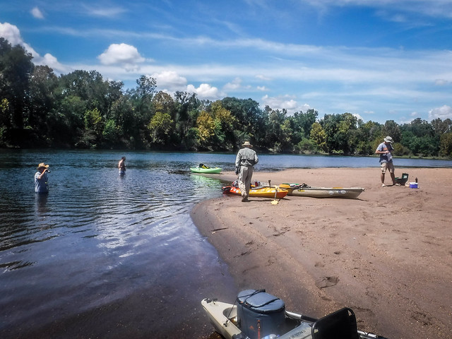
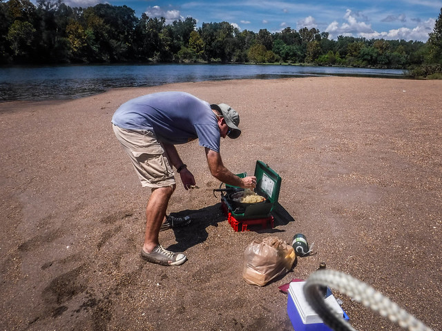
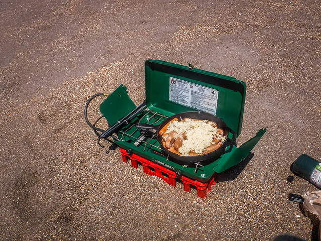
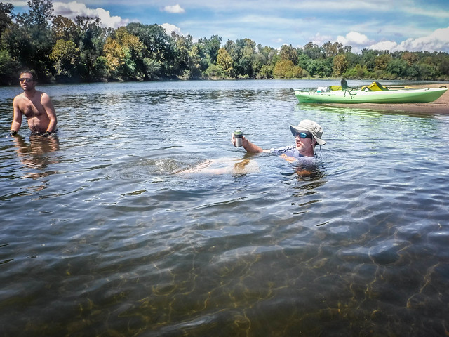
We found a very nice sandbar downstream and set up for lunch. We had our typical river fare – bratwurst and sauerkraut. We relaxed in the cool current with a couple of brews. Honestly, I could have stayed there a couple of hours relaxing.

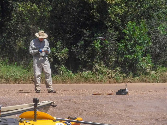
Jim also had a surprise. He had brought along his drone. He didn’t feel comfortable flying it over the river, but he did fly it over us as we relaxed at our lunch stop.


Not far down the river we found an old structure consisting of vertical logs. We paddled close for inspection, then quickly paddled back. Dark brown effluvia leached into the river. The stench was terrible. It was as if raw sewage were being released into the water. We were glad we had stopped for lunch UPSTREAM of this contagion.


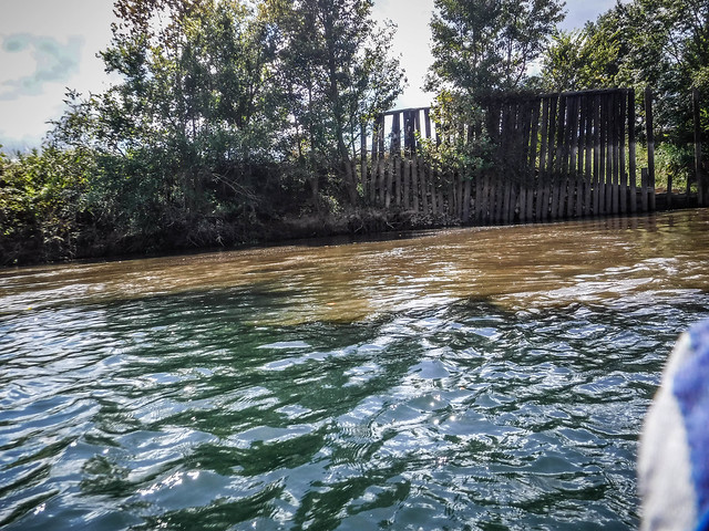
When I checked our route later, Google Maps identified this as a water treatment facility. It must not be doing its job. Even in the overhead images you can see the brown fluid entering the river.


The miles stretched on and on through deep bends in the river. We stuck to the main body of the water with no more side excursions. The sun was starting to get to me, so I covered up as much as possible to avoid burning. We tried to stick to shady edges as much as possible.


We were exhausted. It would have been nice to stop for a rest, but we had such a long way to go that we didn’t dare stop paddling. Even pausing to get a drink seemed like a luxury.
A high bluff appeared on the South Carolina side of the river. We had reached Silver Bluff, a historical landing on the Savannah. The landing was quite rough, but there was a dirt road down to the river. Matt offered to come by and pick up anyone who was too tired to continue. Everyone opted to continue the trek on down to Jackson Landing.


Silver Bluff was so named because it was thought that silver could be found in the area. Hernando DeSoto visited the area and it is said that his men attempted to cut a canal across one of the oxbows to divert water from the bluff so that it could be mined. The narrow neck on the point across from Silver Bluff is known today as Spanish Cut.
DeSoto didn’t find silver or gold, but that doesn’t mean that the area wasn’t prosperous. George Galphin bought the property in the mid-1700’s and established a trading post and large plantation. Galphin traded mostly with the Creek Nation, and during the Revolutionary War he was instrumental in making sure that the Creek remained neutral.
The plantation is now on the National Register of Historic Places. The Audubon Society purchased the property in the 1970’s and now maintains a 3400 acre wildlife sanctuary which includes the bluff. (PDF link – Archeological Survey of Silver Bluff) On a shorter trip we would have lingered and explored the property. I made a note of yet another place I’d like to visit later. Matt hung back to check out the high bluffs while the rest of our crew forged on ahead.
It was getting late. Fortunately, we didn’t have much further to go. Finally we spotted the landing and pulled in, exhausted.


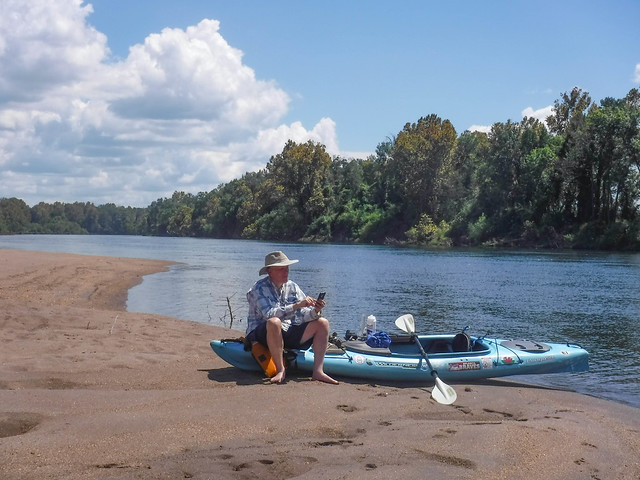
Total trip with the side distractions came to 19.3 miles, according to my GPS. This photo by Matt shows just how tired we were. I was still standing with one foot in my boat, too exhausted to lift my leg without fear of falling in. At this stage, that might not have been a bad thing.
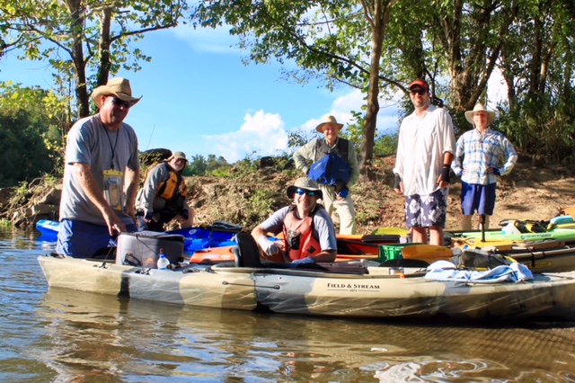
Photo by Matt Richardson
We loaded boats onto Matt’s trailer and prepared for the long, long shuttle back to New Savannah.


Jim at Alan remained with our boats while I road back with Matt to retrieve my car. If I’d know how long the shuttle was, I would have insisted that we all ride back with Matt. The trip was nearly 45 minutes each way. When I left the others at New Savannah we made tentative plans to meet at Duke’s BBQ in Aiken. By the time I got back down to Jackson Landing and we loaded our boats it was dark, and Duke’s was about to close. We missed out on our traditional end-of-paddle feast. We did manage to find food in Aiken at a Chilis that didn’t mind three soaked river rats.
Despite the length of the trip and our exhaustion, it was a great day on the river. There is lots more to come back and explore and I hope to do that sometime soon. It will certainly go down as the longest paddling trip made by Lowcountry Unfiltered…at least, until we find an even longer trip.
SIDE NOTE: This is the first extensive post I’ve created using WordPress’s new Gutenberg editor. I like the new block style and the ease of embedding external media, but I’m not sure it’s ready for prime time.
You’ll notice that the images in this post are larger than previous posts. With the embed feature I have no control over the image size. That’s not a good thing. I also have to add an empty paragraph after each set of images to make the spacing better. They need to improve the Flickr embed process.
There were also other wonky little problems, such as links not working correctly and autosaving failing at random times. It also took multiple tries to publish. I’m hoping WP gets these sorted out before the go live with the product.
Great post with alot of good information.