
Another second Saturday and it was time for another Lowcountry Unfiltered trip. It was also time to get back on the water. While our group loves any kind of exploration, from swamp stomping to biking, our preferred form of travel has always been water.
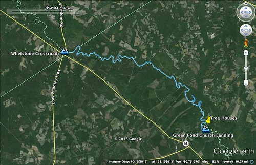
We bounced several ideas for the March trip back and forth. Finally, we settled on our old standby, the Edisto River. We would be doing a new stretch (for us) from Whetstone Landing down to Greenpond Landing. The route would be about 13.6 miles.
The route was in question right up until the last minute. Ice storms from last week brought down limbs and trees across the lower part of the state. One outfitter I contacted said that there was no way we would be able to get through. Another outfitter actually runs that stretch on a regular basis, and they said we would be fine. Even so, on the drive down I was worried. I could see the ice damage along the highway, and a stretch on I-95 went down to one lane for crews clearing limbs.
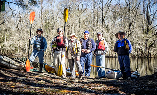
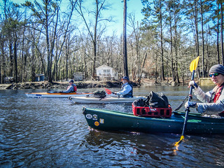
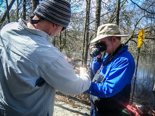
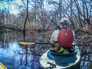
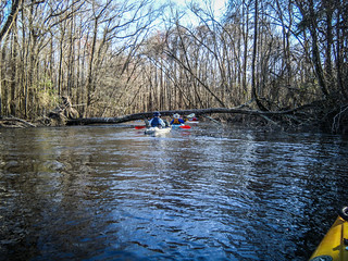
I arrived at the take-out at Green Pond Landing at the appointed time. Marc Epting from Columbia was already there, and Alan Russell soon joined us. I few minutes later the lowcountry contingent arrived with Matt Richardson, John Ring, and Jimmy Steinmetz. Six paddlers is a good group. We loaded up the boats, left two vehicles at the take-out, and drove on up to Whetstone Crossroads to the put-in.
At Whetstone the first thing I noticed was that Edisto River General Store was closed. On our trip from Zigzag Landing to Whetstone we found the best boiled peanuts at the little store. I was hoping to take a bag of those on this trip, and was quite disappointed.
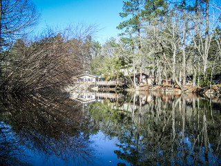
Temperatures were still cool as we unloaded the boats. I was wearing a fleece top and my paddling jacket. However, it was soon apparent that it would warm up nicely, so we started removing layers. With the boats unloaded, we paused for our pre-trip group shot.
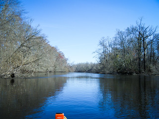
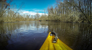
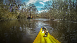
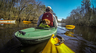
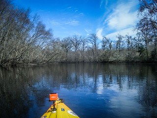
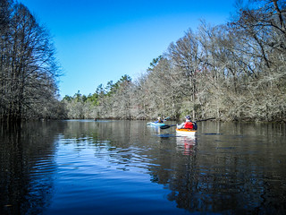
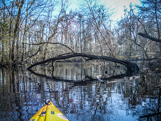
The current was swift, and the river was high, but not too high. There were none of the floods that plagued the river last summer. Limbs were down, but river accessed seemed clear. We got underway.
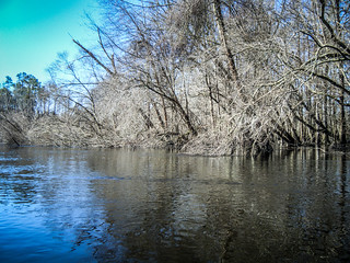
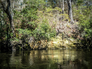
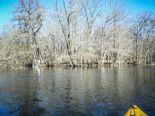
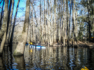
It always amazes me how different each section of the river can be. Part of it is that we have paddled at different times of year, but it seems that each part has its own characteristics. There are some similarities – cypress and tupelo swamps, brown water, and usually a good current. However, the remoteness of the river, the number of curves and accessible swamps, and the amount of development on the banks varies.
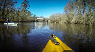
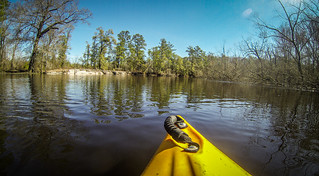
This section had a nice mix of remoteness and some houses on the banks. The river seemed wider and straighter than some sections we’ve paddled. It certainly didn’t have the dreaded switchbacks from the South Branch of the Edisto that we paddled back in October.
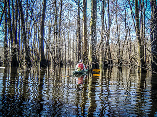
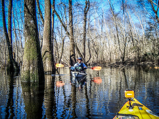
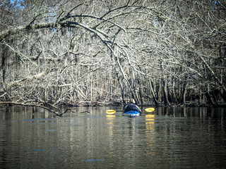
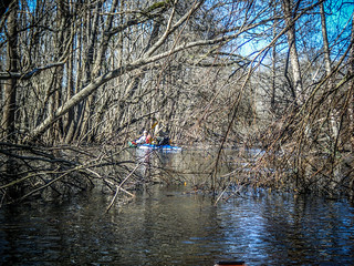
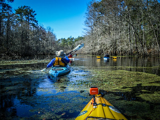
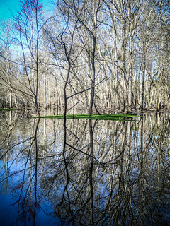
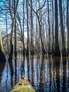
With the water high, we were able to get back into some of the swampy areas to explore. We branched off a couple of times.
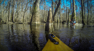
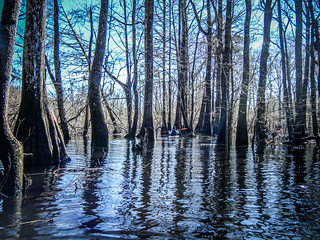
It was a good thing that the river was as wide as it was. Ice damage had topped some of the trees, and limbs were hanging into the river, blocking off about 15 feet on either side. The downed limbs also made it tricky to get back into areas that we might otherwise explore.
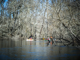
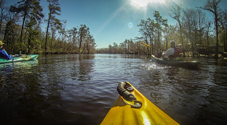
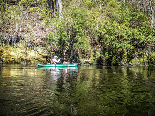
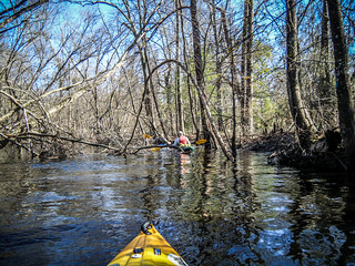
Several miles downstream we met up with two couples in two canoes. They were headed down to the tree houses at the end of the run. We would encounter them several times along the way.
This was a long stretch, but with the strong current the miles passed quickly. That current, combined with the down limbs, sometimes made for some tricky maneuvering. While the river was mostly clear, we encountered a few ripples that might pass for “rapids”, or as rapid as it gets on the Edisto. At one point we took a shortcut across an oxbow loop. As we emerged back onto the main stem of the river we hit a nice little rapid and a whirlpool of currents as the branch came back into the mainstream. Here’s a short video of me running the “rapid”, shot from my GoPro:
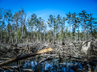
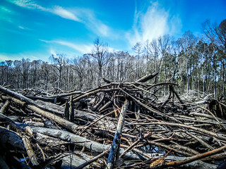
On down stream we noticed that a large area on the left bank was open, as if there were a lake just on the other side of the bank. As we approached was found that a large swath of the lake was clear cut, right down to the water’s edge. The devastation was hearbreaking. It looks like cypress and and other hardwoods, as well as the pines, we harvested and the stumps just left. I thought there were regulations about this on the Edisto.
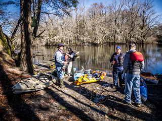
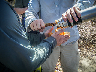
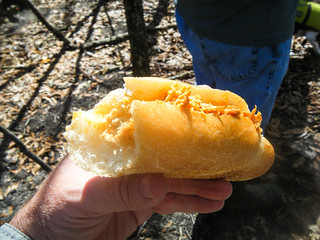
We passed more houses along the way, but soon came to a nice landing spot that would work well for a lunch stop. Instead of grilling brats on the river this time, Matt’s wife, Cris, had made up some of her world-famous Buffalo chicken sandwiches.

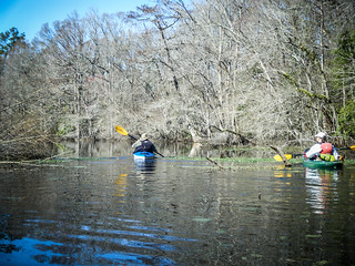
Suitably refreshed, we continued downriver. From this point on for miles and miles, the scenery did not change much. Current was strong, and we could make pretty good time just floating along. The weather was absolutely perfect. I was wishing I had brought my harmonica.
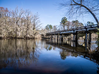
We passed a large bluff on the left bank with a limestone marl wall lining the river. We had seen one of these just upstream from Givhen’s Ferry, and that wall is one of the landmarks that we’re reaching the end of the run. This one was similar – lined with moss and other clinging plants. The riverbed itself is lined with marl, and at one point we found a small rapid where water was running over the marl. (Remember, a “rapid” by Edisto standards is really just a small ripple.)
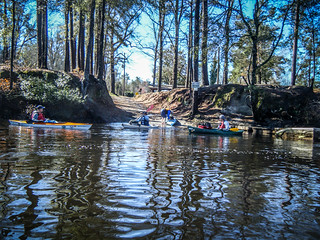
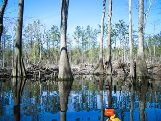
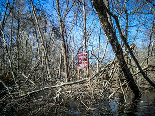
I had another oxbow lake marked on my GPS. We found the entrance to it and explored. There were signs indicating that it was a managed wildlife preserve. It was tricky getting through some of the deadfall to get to the lake, but the views were worth it.
Around another bend we found the entrance to yet another lake. This one was marked on our maps as “Cat Hole.” We were making good time, so we decided to explore some more. We missed the first entrance to the lake. The larger entrance was marked by some of the longest boardwalks out to docks on the main stream of the river that we had seen. It looked like something from the video game “Myst.” We saw a couple of fishermen in a john boat, and houses lined the banks, forming a secluded neighborhood.
We bushwhacked our way around the oxbow, eventually coming back out a bit upstream from where we entered Cat Hole.
It wasn’t too long before we spotted the tree houses that marked end of our trip. A local outfitter offers trips down the river with an overnight stop at the tree houses. While these looked really cool, $150 per person per night seemed a bit pricey for us.


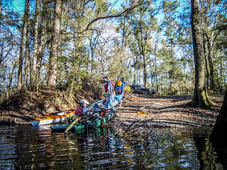
Greenpond Landing can be a bit tricky. It’s off the main stem of the river, and can be unreachable in low water. We had only launched from the site before, and were unsure of the landmarks for entering the landing. We turned in where there was an opening and where we thought the landing should be. However, we soon started to have second thoughts as the route got narrower. Soon, though, we were seeing houses along the banks. To our surprise, we came to the landing from the complete opposite direction from what we were expecting. We had taken a longer loop. We pulled the boats up at the end of a long, but very successful trip.
The route was supposed to be 13.6 miles long. However, according to the GPS, we had paddled 14.7 miles with all the side trips and extra exploration we had done.
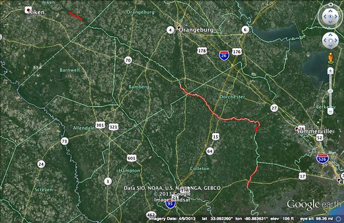
This trip plugged on of the gaps on our Edisto explorations. We have now paddled every section from ZigZag Landing down to Messervy Landing, or a total of about 54 river miles. Add in a section on the South Edisto starting at Aiken State Park and a section downstream from Martin Landing down to Jacksonboro, and we’ve covered a little over 72 miles of the river. We still have huge chunks of the South and North branches to complete, and a large section from Messervy to Martin’s Landing that we’re missing. We’ll have to fill in those gaps.
As usual, when five of the six paddlers are avid photographers, you wind up with lots of pictures. You can see Marc’s photos here, and John’s photos here. I’ll post links to Alan’s and Matt’s when they get them posted. In the meantime, here are the rest of my photos:
[fsg_gallery id=”37″]
What a nice report of this paddle adventure. Someday I will make it to the Edisto. We took a little paddle to Lake Tugaloo in the western Mts of SC. Lovely place.