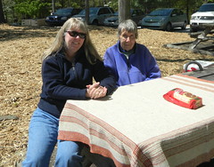
The weather Sunday was beautiful, albeit a bit brisk. We decided that we needed to get out of the house for a bit, so Laura, her mother, and I hopped in the car for a drive and a picnic.
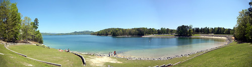
We started by driving up scenic Highway 11 past Table Rock, then on up toward Lake Jocassee. We had packed sandwiches, and had our picnic in the day-use area of Devil’s Fork State Park.
The wind off of the lake was really chilly, but the sun was nice and warm when the wind wasn’t blowing. We had to laugh, though. Down on the beach area there was a family – a man in trunks, a woman in a bikini, and two kids in nothing by diapers, running around and sunning themselves. We figured they must be Canadian.
After lunch we continued our Sunday drive. My target was Whitewater Falls. Along the way I wanted to find the Bad Creek Overlook. I had seen some reference to it in the news recently, and wanted to see what it might be. The only time I’d seen the Bad Creek Hydroelectric Project was from the lake itself while paddling.
We drove up Highway 215 toward the falls and the overlook. We came to a place with a huge fence and gate, and didn’t really look like it was accessible to the public. Laura was hesitant. The gate was open, and I pulled in just enough to read the signs. A map indicated a visitors center and overlook, so we drove on down.
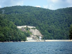
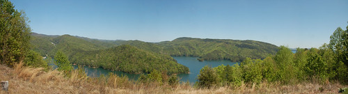
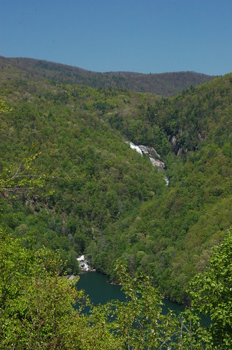
The Bad Creek Reservoir itself was locked away behind a chain link fence, and could only be glimpsed from the access road. That’s OK. What I saw wasn’t a particularly aesthetic lake. We did eventually reach a turn-off for an overlook. The view was not of Bad Creek, per se, but a broad overlook of Lake Jocassee itself.
I had paddled up the Whitewater River branch of the lake, and had seen its rocky entrance into the lake itself…

…yet, even though I knew that Lower Whitewater Falls was just upstream a bit, I didn’t realize how close it actually was to the lake until I saw it from the overlook.
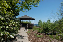
At the end of the overlook is a gazebo that looks out over the dam for Jocassee.
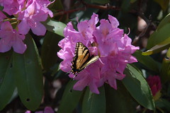
Rhododendron were in bloom, and butterflies were taking advantage of the open flowers.
This turned out to be our favorite stop of the day, and a nice discovery.
We rode on up to the Whitewater Falls entrance. However, it was going to be an half-mile hike just to see the falls. Even though it was a nice, flat, paved walkway, we knew Laura’s mom would be struggling, so we decided to head on back down the mountain. We stopped briefly at Hagood Mill and Glassy Mountain in Pickens County, then headed home to relax.
I’ve fished in that piece of the Whitewater River upstream? of the Bad Creek project. It was nice. The fish are wild, not stocked. I should go back.
Bad Creek isn’t really a “lake” in the traditional sense. Water is pumped into the reservoir at night with excess power generation from Jocassee. It runs the generators during the day. The lake is essentially a big hollowed out hole up there with a major league tunnel running down to the power plant. Quite an amazing project. My youngest brother does a good deal of work up there and at Jocassee. I’ve seen a good deal of wildlife on the road down to the overlook, particularly turkeys. But storms can creep up on you in a hurry there.