It was a beautiful day, so I decided to try to find some of these lookout towers I had been researching. I picked three that would be within driving range before it got dark. Since it was a quiet day I left the office at 4:00 and headed south toward my first target.
1. Hobbyville Lookout Tower
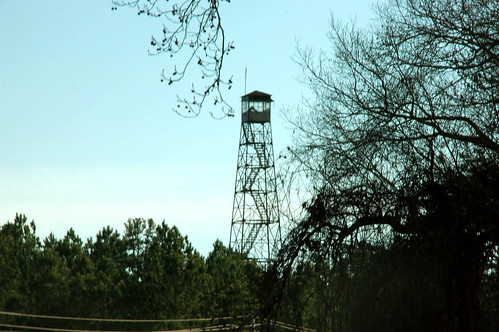
This was one of those towers that was on the FFLA list but not on any of my GIS data. I had an approximate location, and was hoping that I would be able to see it as I got close.
As I drove down I-26 I did catch a glimpse of the tower, so I knew it was still standing. However, I started to second guess myself as I saw cell towers and steel powerlines. Had I only thought I had seen it, and had it actually been one of these other towers? Soon, though I did find the correct road and was able to drive to the base of the tower.
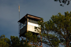
The story at the actual location was one that would repeat itself throughout the evening. There were lots of people living nearby, and a house a mailbox were right at the base of the tower. I pulled over to get a shot of the cab, but folks seemed mighty curious about my intentions.
At least I was able to confirm that the tower is still standing and ascertain its correct location. Both cab and tower looked to be in fairly good shape, given the age.
From the Hobbyville Tower I headed south on Mountain Shoals Road toward Enoree (once called Mountain Shoals), then took 221 to Ora. From Ora it was a straight shot to Barksdale and my second target of the evening, The Big Knob.
2. The Big Knob
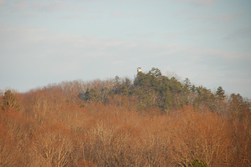
While growing up in Gray Court the Big Knob and its twin on the other side of Highway 14, the Little Knob were two of our most prominent landmarks. I’ve ridden my bike past the base of both hills many times, and when little I had nightmares about one or both of these hills turning into volcanoes (from watching too much scifi and Johnny Quest on TV, I’m sure.) I’ve never been to the summit of either.
I do remember that at one time there was a dirt road leading to a house at the base of the tower. This was visible from Bethel Church Road. However, now that road is long gone, and the only access to the hill is through a gate leading to the radio towers at its base, which, of course, is locked. I couldn’t find a view of the tower itself at all. The only view could be gained from about a half-mile away on Georgia Road. I was able to verify that the tower was standing, but have no clue as to its condition.
By this time the sun was sinking lower and lower, so I had limited time for my last target. I drove north to Highway 418 and took it west to Fork Shoals Road, then turned north. My goal this time was the Fork Shoals Tower.
3. Fork Shoals Lookout Tower
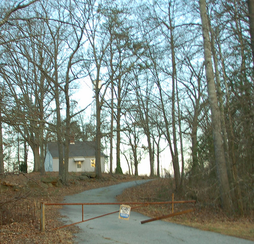
It may not look like it, but there’s a tower back there somewhere. I found Tower Road off of Fork Shoals Road with no problem. I couldn’t really see the tower until I actually got to the road and turned down it. This was one of the least friendly areas I had visited, with No Trespassing signs everywhere and barking dogs running up to the car. As I pulled in to get this shot, a guy in pajamas and a bath robe stood in his front yard and stared at me.
I took what shots I could, hoping one of the tower shots wouldn’t be too blurred to use. However, by that time of evening the lighting wasn’t great, so this was the only one that turned out.
The tower itself looked like it was in OK shape. It was still standing, and the cab looked intact. I couldn’t tell if anyone was living in the tender’s house or not.
Three towers in two hours was a bit more of a challange than I had bargained for. I couldn’t get photos like I had wanted. I would like to revisit each of these when I have enough time to set up a proper shot.
The map below shows the tower locations and the route I took…


This was a fun entry to read!
There’s a newish book on hikes to NC’s Lookout Towers that I’m excited about. (I have a copy and have given 2 now for presents). But I haven’t been back in NC enough yet to use it.
http://www.blairpub.com/outdoortitles/hikingnclookouttowers.htm
Haven’t seen a SC equivalent though 🙁