Pacolet, South Carolina
I’ve written about this before (In Search of Phantom Stairs, August 24, 2008.) There is something intriguing about old masonry. This is especially true of recognizable structures such as stairs, columns, and walls. While it’s cool to find a pile of rubble or old road bed or foundation in a field, a standing remnant goes beyond that. You can tell that something was here – something with intent and purpose. It’s the discovery of those ruins, as well as the exploration of what had been there that keeps me going on these photo treks For this particular photo trek I headed out across Spartanburg County, and found a wealth of such masonic hints of the past.
I was partly inspired by fellow explorer Mark Elbrecht’s recent trek to the Whitestone community and his explorations of the old Whitestone Springs Resort (Part 1, Part 2.) Mark had done an excellent job covering that area, so I didn’t want to repeat his trip (although I may check those spots out later.) My trek would take me across Spartanburg with a dip into Union and Cherokee Counties. Truth be told, I only had a vague idea where I was headed, and that was a problem. By omitting some additional preliminary research I just missed out on some very cool spots. More on that later, but for now, here’s what I found…
Anderson Mill
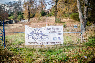
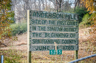
For my first start I wanted to check out the old Anderson Mill. As close as it is to my old office, I just never got around to visiting during my tenure. I knew that the Tyger River Foundation had been doing restoration on the mill with the intent of turning the area into a park, and I wanted to see how they were progressing.
My route took my down through Reidville and across country to Anderson Mill Road. I must admit, I still get the heebie-jeebies when crossing Spartanburg Five territory. I don’t think that feeling will ever go away. Even so, I soon crossed the border into District Six, and before I knew it I was at the mill site.
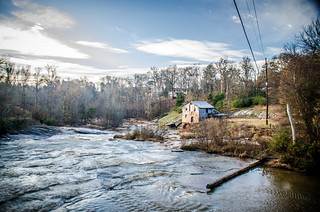
It wasn’t entirely what I expected. I guess that’s what ground-truthing does – reveals the true lay of the land that maps and Google Earth just don’t convey. For some reason I was expecting the mill to be more remote. While there is a large amount of farm land surrounding the area, housing developments are encroaching, and Anderson Mill Elementary School is right around the corner.
The mill is still not open to the public. I took what photos I could from the road and from the bridge, then continued on my way.

From Anderson Mill I headed west toward Spartanburg. In my GPS I had the coordinates for Grindal Shoals, one of the ghost towns on my list which knew to be on the Pacolet River. As I was following the route I saw signs for Croft State Park. I realized that I had never really visited the park, so I decided to check it out.
Croft State Park
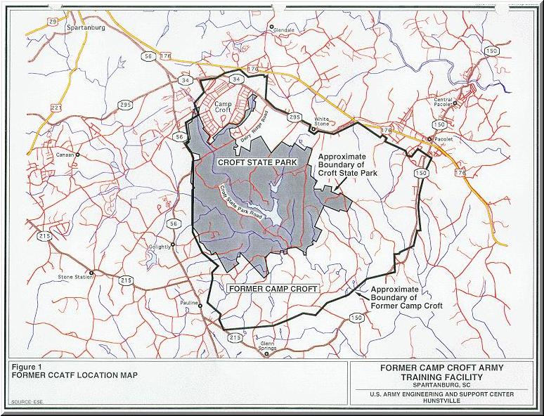
Camp Croft was an army infantry training center in WWII. The camp included a “cantonment” area for administrative buildings, barracks, and other facilities, but also featured thousands of acres of woodlands for wilderness training. After the facility closed the cantonment area was converted into a mixed use industrial and residential area, complete with a golf course. A large portion of the wilderness area became Croft State Park. The US Army Corps of Engineers map below shows the original outline of the camp, along with the modern state park and original cantonment sections.
www.schistory.net
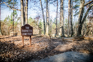
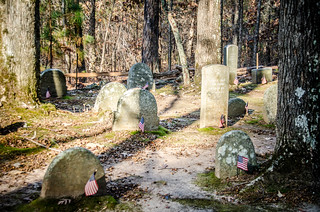
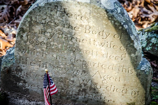
I drove on into the park, pausing briefly at the Barnette Family Cemetery. The headstones were very rustic, dating back to the early 1800s.
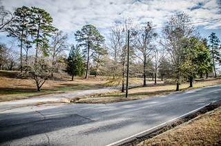
I continued down the main road until I came to the lake. It looked larger than I though it would be.
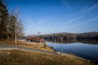
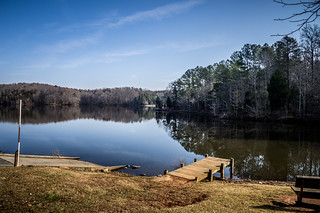
There were campgrounds, playgrounds and various trails, but not much else to be seen from the road. My stop at the park was spur of the moment, so I hadn’t really checked out what was available. I suspected there was much more to be seen by exploring some of the trails, and when I got back home I found I was correct. Explorer Slobot made several ventures to the park. Here are Parts One and Two of his explorations, as well as a post on the Bridges of Camp Croft.
From the park I continued southward, with a brief stop in Pauline for gas. I spotted that I was just around the corner from Glenn Springs, so I decided to check it out.
Glenn Springs
Glenn Springs was another one of the resort springs that once dotted Upstate South Carolina. As with Chick Springs, Harris Springs, and nearby Whitestone Springs, Glenn Springs sported a large hotel. However, it also had its own railroad depot, post office, and other businesses. Although the hotel and depot are now long gone, the remaining buildings in the area are now on the National Register of Historic Places.


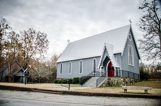
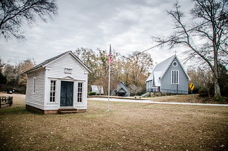
I drove through the community and found myself at Calvary Episcopal Church. This gray wooden structure was built in 1897.
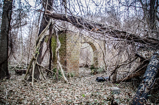
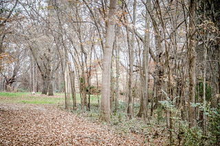
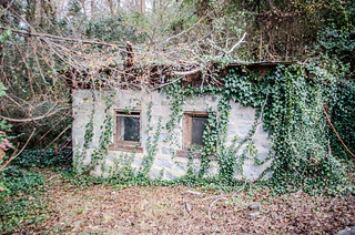
Across the road from the church was a parking area for the Palmetto Trail, and the old post office. I took a moment to wander down the trail until a tree blocked my way. At the top of a hill next to the trailhead were the remains of an old house with a cellar. More intriguing masonry…
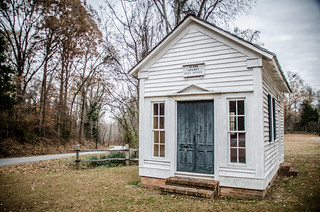
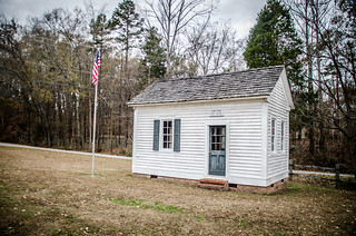
At the other end of the parking area is the old post office. I took a few moments to check it out.
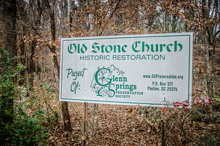
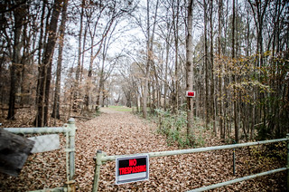
Across the road from the post office is an abandoned house that I later learned was the old Cates Store. Next to that is a building known as the Old Stone Church, the former abode of the congregation of Glenn Springs Presbyterian. Both of these buildings are under renovation by the Glenn Springs Preservation Society. The buildings are visible from the road, but there are no trespassing signs everywhere. I seem to remember that vandalism was a problem.
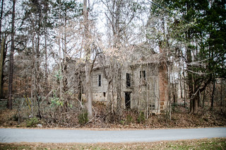
It figures. Slobot beat me to the area, and has done extensive photos inside and out of both buildings.
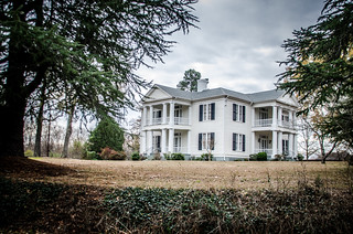
On the opposite corner from the post office are two imposing white houses. One is the old Zimmerman home. I didn’t get information or a photo of the other one, but its equally impressive.
Here again was a place where a bit of prior research might have led me to even more discoveries. The road that runs between Cates Store and the old post office goes down to the Glenn Springs Academy for Boys. According to their website the academy has just recently ceased operations. However, it owns the land where the old spring and pavilion can be found. Across from that is a church with another historic cemetery that I could have checked out. Oh well, maybe next time.
Grindal Shoals, Asbury, and Jonesville
It was getting later in the morning, and I had only hit one of my planned destinations. This time I followed my GPS without deviation toward Grindal Shoals. I crossed into Union County and skirted the edge of Jonesville before heading toward the Pacolet River.
Grindal Shoals is definitely on my list of ghost towns. It was an important settlement prior to the Revolutionary War, and a strategic river crossing. While no Revolutionary War skirmishes were fought at the site, Daniel Morgan did camp here before moving on to the Battle of Cowpens. After the war the area grew to a sizable settlement, with stores, lawyers, and even a small textile endeavor. A flood in 1852 wiped out most of the businesses, and the oncoming Civil War prevented the community from recovering. By 1885 all traces of the town were gone.
I actually had two sets of coordinates from GNIS data. The first was for the shoals themselves on the river. My GPS directions had me going down an old logging road to the river. However, when I got there active logging operations were underway. A logging truck blocked access to the road.
The next set of coordinates were marked simply “Grindal” as if it were for the settlement itself. This was across the river in Cherokee County. I found a road marked “Grindal Ford Road” and turned back toward the river. The pavement gave out, but I kept going until I cam to a dead end. I was a few hundred yards from my destination, but could go no further.
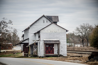
I had also marked the community of Asbury on my GPS. In Google Earth the crossroads showed several churches and a couple of schools in the area that were no longer there. When i arrived there wasn’t much of interest – just an old 1960s vintage store that was closed and couple of old houses. Once again, my lack of proper research bit me in the rear end. Just a half mile from there was the old Mulberry Chapel, which I totally missed. Here’s a photo from Panoramio from user herdintheupstate.

by Panoramio user herdintheupstate
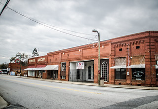
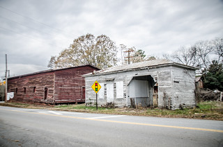
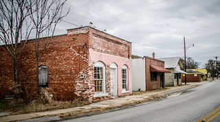
From Asbury I headed back to the town of Jonesville. It was getting to be lunch time, and I was keeping my eyes open for someplace interesting. That was not to be found in this depressing little town. I took a few photos of some of the buildings, then headed north.
Pacolet
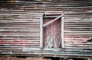
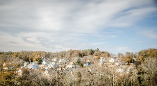
Here is where I hit abandoned masonry paydirt. I’ve always been intrigued by the hillside setting of the little mill village, but I hadn’t taken the time to explore it until today.
Pacolet is actually in several sections. Central Pacolet is on the railroad, closer to the main highway, and Pacolet Mills is right on the river. I started with a quick drive through the area, beginning with Central Pacolet.
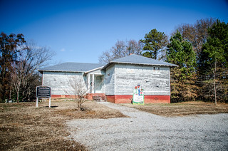
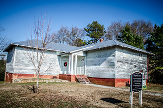
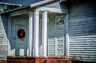
Circling through the area I came upon Marysville School. The school served the segregated African American population of the Pacolet community. While not a Rosenwald school, it has classic school architecture. The front wing was added later, hence the three separate entrances.
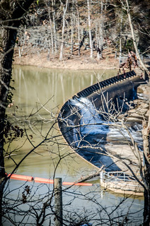
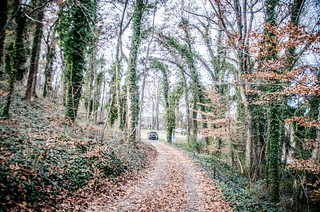
Eventually I made it to Pacolet Mills. Situated on the banks of the Pacolet River, this textile mill village has a distinct mountainous feel. As I entered the village I saw old roads and overgrown walkways going off in different directions. As I descended the hill I spotted an old set of steps and walls on the right as I drove down into the village. I looked for a pace to park and explore, but couldn’t really find anywhere. I opted for a quick lunch before exploring further.
I finally decided just to pulled into one of the abandoned areas and decided to explore. The first thing I noticed was that there were decorations and lights everywhere, even on some of the old foundations, handrails, and steps.
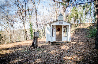
Across the road was a small chapel, which turned out to be another decoration.
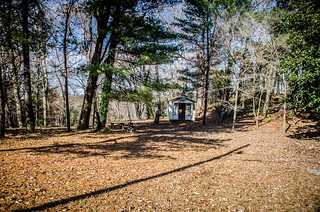
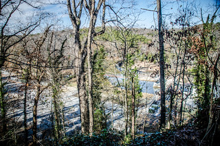
Above the chapel was a significant hill that looked like it might have a good view I climbed on up to get views of the old mill site, river, and dam below.
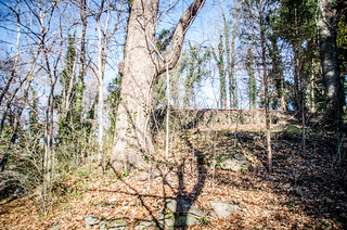
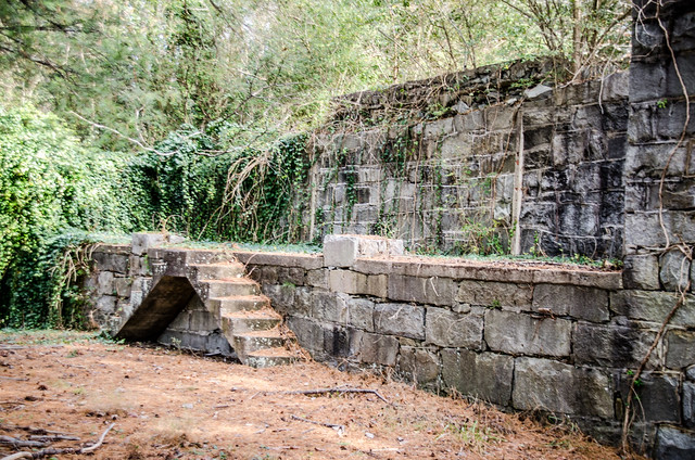
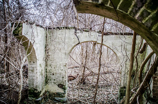
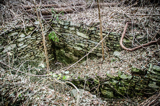
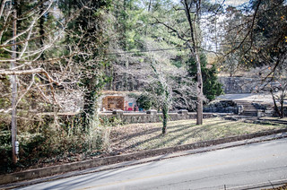
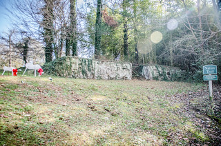
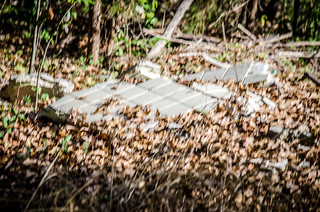
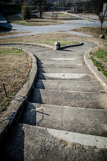
Speaking of old masonry, this place was full of it. There was an obvious roadbed lined with a stone wall. Columns marked the entrance to the top of the hill, and old stone steps were overgrown and barely recognizable.
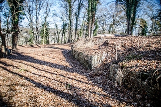
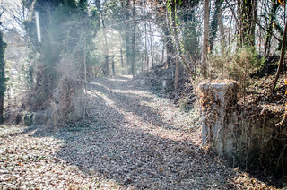
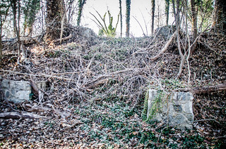
I could only imagine that some important house or something occupied this prime spot. I could see the old foundations where I parked across the way.
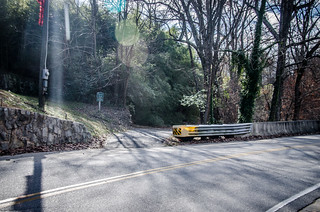
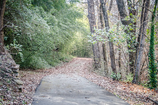
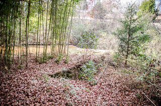
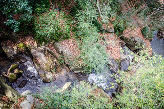
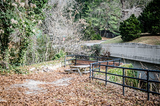
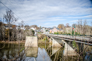
I wandered down the hill and crossed back to the the bridge to the entrance of the Pacolet Nature Trail. The paved walkway winds next to a creek. The creek cascades over a small dam, then through a steep ravine over an amazing series of falls. Unfortunately, there seemed to be no way to see the falls except from overhead. Bamboo and more masonry lined the way.
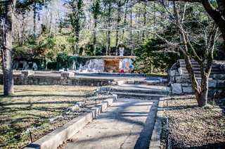
On the other side of the road, ravine, and bridge, and at the top of another hill was a set of stairs and the Pacolet Amphitheater. Work crews were busy putting up even more Christmas lights.
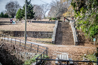
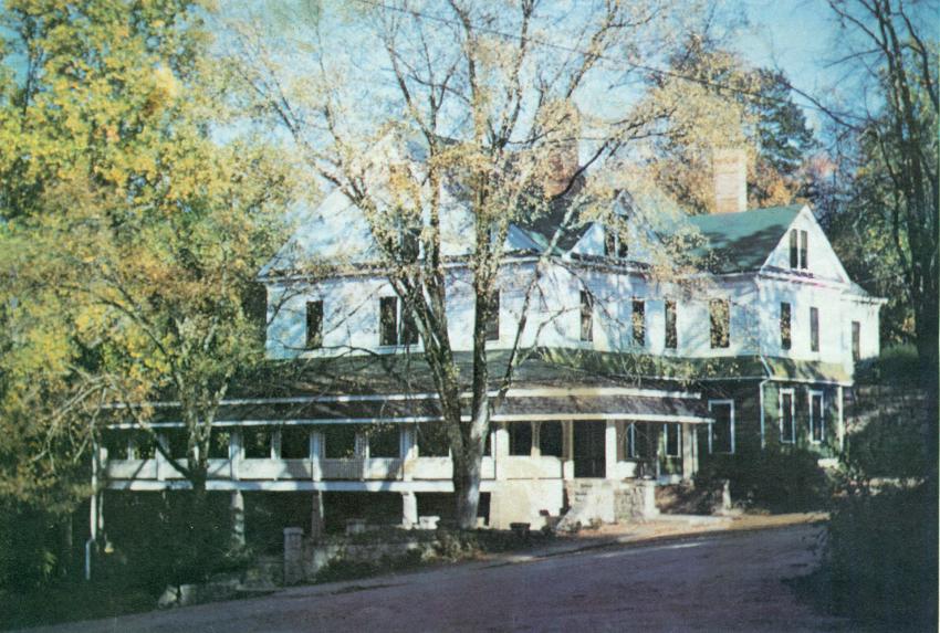
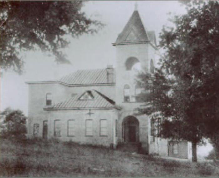
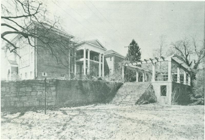
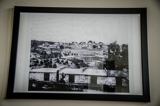
I had just sent a text to Laura saying that we needed to get back over here after dark some evening to see the town lit. Just as I was doing that a woman in a white SUV stopped and asked if I were a photographer. My reply was that sometimes I was. She introduced herself as Ellen Harris, the mayor of the town. We had a delightful conversation. Mrs. Harris told me that the ruins across the street were the remnants of the old Victor Hill Hotel. The schools were at the top of the hill above the amphitheater. Teachers used to live in the hotel, and would walk across the old bridge and up the stairs to the schools. Here’s a shot of the hotel and the schools from the Pacolet Memories website.
Pacolet, SC
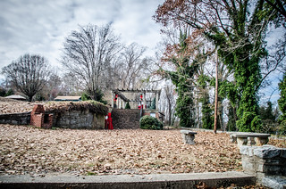
I gave her a card, and before she left to check on the workmen, she told me to take as many photos as I like. I took that as tacit approval to explore the old hotel grounds. I crossed back over and explore the old walkways and the park that had been on the other side of the hotel. I did find some rubble in addition to the masonry. A pile of tile was all that was left at the top of the hill. It looked like it could still be turned into a neat park.

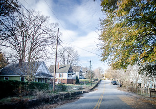
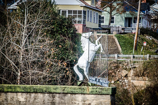
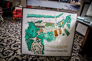
Mrs. Harris had told me that the town has big plans for the area. They have some incentive funds, and have developed a master plan for the area. She also said that I should check out the town museum if I was interested in the history of the area. I wrapped up my photography and headed down that way. Before heading to the museum I took a spin through the little town. Neat mill village houses ringed the hills on both sides of the river. The famous Pacolet White Horse stood on the upstream side of the bridge.
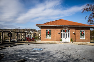
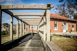
I headed over to the town hall and museum. The town hall is housed in the old textile mill office, surrounded by more stairs and masonry. I took a stroll down toward the museum on the lower level.
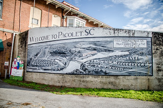
Unfortunately, the museum was closed, so I did pause to admire the mural of the town.
I headed back up to the main floor and headed inside. The clerk was getting ready for an evening meeting and didn’t have a lot of time for chit chat, so I paused to look at the master plan for the town and a couple of old photos of the town. At least she did tell me that the area at the top of the hill with the views was the doctor’s home. I haven’t been able to verify that with anything yet.
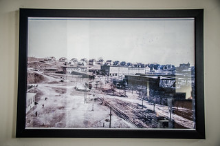
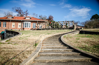
Before leaving the town I paused to look at the grounds of the old textile mill, torn down in the last decade. This could be a very depressing site. However, for some reason, what could be a depressing site seems somehow hopeful.
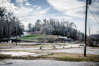
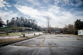
While the old hotel and schools are long gone, the masonry and grounds have been left in place. There’s a strong sense of history here, and it looks like they have big plans for the future.
It was a great day out and about, and I obviously so much more than I was able to record here. Here’s a link to my notes for this blog post, and the map and slideshow are below:
View Spartanburg Ramble in a larger map
[fsg_gallery id=”28″]
Your first paragraph resonated with me for some reason. 😉
The Zimmerman house you photographed is the John C. Zimmerman house. John owned the hotel for a while. Next door, the other impressive house, is the Charlie Zimmerman house (Charlie was John’s son). John is buried in the Calvary Episcopal Church cemetery (located across the road from the school).
Croft State Park does indeed have a lot to offer if you like ruins and family cemeteries. I know I’ll be back.
When I first saw the title, I thought this was a post about a Dan Brown book.
I grew up in Huntington Woods – the SW part of the Camp Croft developed residential zone. Lots of “old masonry” out there – we used them as “forts.” Wish I’d had a camera back then and particularly a digital one. Some fascinating ruins out there. Many are gone now due to development or land clearance. Never did figure out why some foundation structures were designed as they were.
I found this website earlier this year doing some Spartanburg County research. Pacolet Memories http://pacoletmemories.com/