Thursday, June 25
This was supposed to be our best day, weather-wise, so we had reserve a place on a Puffin Cruise that was supposed to sail from Port Clyde. However, things didn’t look quite as nice when we got up. We started out anyway, headed back south through Camden and Rockland. We had just stopped for a bit more coffee when I got a company from the Monhegin Boat Line that the port was socked in, and that the cruise had been canceled.
They did rebook us for Friday, but it put us in something of a quandary. We had wanted to head back to Acadia at some point, especially before any weekend crowds gathered. Now, though, we were on the opposite side of Penobscot Bay, and we were possibly obligated for tomorrow. We decided to continue in this direction and see if we could find some of the lighthouses along these lower peninsulas.
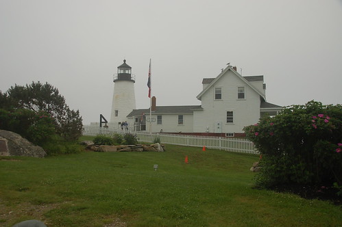
Our first target was Pemaquid Point. I had remembered visiting here from our previous trip to Maine, and remembered the fort and beach. I thought it might be a good diversion.
The drive down to the point was much, much longer than I had thought it would be. The trip was made even longer due to the horrible condition of Maine’s roads. 45 mph would have been a dream. We passed more scenic farmland and unique architecture. Eventually, though, we reached a place where we saw signs for the Pemaquid Point Lighthouse, so we turned in that direction.
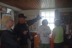
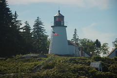
There is a park surrounding Pemaquid Point with an admission fee, but we paid and headed on in. It turns out that you could actually go all the way up the lighthouse, and tour the inside. We listened to some information about the lighthouse as we waited our turn to go up. We were informed that this is the lighthouse that appears on the Maine state quarter, and is the only one in Maine that allows visitors to both the lighthouse and keeper’s house.
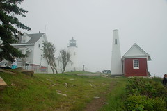
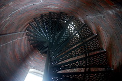
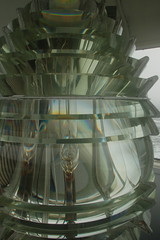
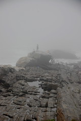
We climbed the spiral staircase up the short tower to where we could look at over the point, and take a closer look at the Fresnel lens that houses the light. The view was spectacular (despite the fog) and we wanted to linger, but knew others were waiting to climb up to the tight confines.
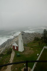

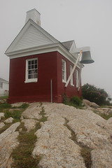
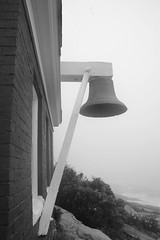
Back downstairs Laura found a nice perch where she could watch the tide roll in, and i went to explore the bell tower and house and the rocks further out the point.
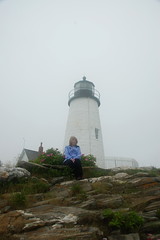
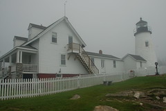
We had noticed that most of the Maine lighthouses are much shorter than those we had seen in South Carolina, North Carolina, and Florida. The same concept that applies to the lookout towers I’ve been visiting applies here. The towers in the mountain areas tend to be shorter since they are already on high ground. The towers near the lower part of South Carolina are taller. Likewise, the lighthouses in Maine are usually on high bluffs overlooking the water, so they don’t need to be as tall as the ones on our coast.
This turned out to be a great stop, and we lingered, watching the waves crash. It was very peaceful.
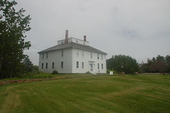
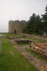
From the lighthouse we headed to nearby Fort William Henry. The fort and accompanying house were not the ones I remembered, but were still neat places to visit. I had stopped here on my previous trek, but the place I had in mind was at Popham Point. Regardless, we walked into the circular stone keep and enjoyed the views from the top of it.

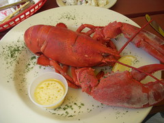
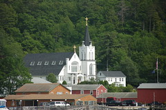
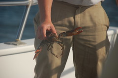
We turned inland, thinking that we might explore some of the river areas and look for more moose. It was about lunchtime, so we stopped in the twin towns of Newcastle and Damariscotta, located on either side of a scenic river. As we sat outside with our lunch (mine was a $10 lobster meal), the sun finally came back our and it turned into a wonderful day.
Since the sun was shining, and we really wanted to do a boat ride, we checked to see if any trips were running from Boothbay Harbor. We knew it was a tourist area, and there was sure to be something going on. Turns out we were correct, and we were able to reserve a place on a 3:30 seal watch boat tour. We just had to get there on time.
The trip down the peninsula to Boothbay went fairly quickly. It took us awhile to find the tour place, and after a couple of missteps and a parking adventure, we finally got our tickets and made it onto the boat.
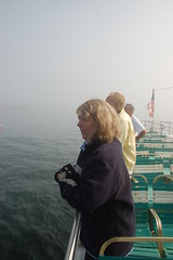
The tour wasn’t crowded. This was a large tour boat, and we sat on the upper deck as we left the harbor.
Leaving the harbor seemed a bit tricky with all of the lobster floats out there. I wondered how bad of a navigation hazard these things posed. It made the place colorful, but I imagine that these could get to be a nuisance.
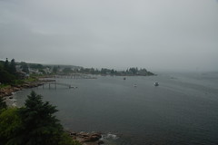
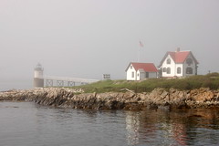
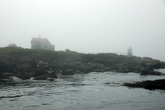
As we left the harbor, the fog rolled back in. We soon approached Ram’s Head Light, located on a remote island out from Boothbay. We circled the little island, then headed toward where we could see seals.
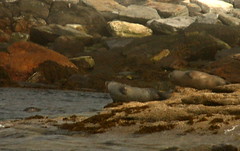
The seals were located on several small sets of rocks. There were quite a few out sunning themselves or swimming nearby. These were harbor seals, smaller than the sea lions found out west.
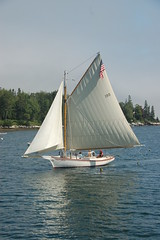
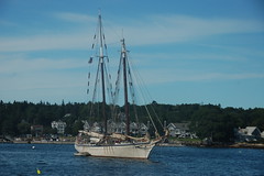
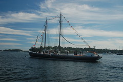
There are many sailing ships that sail out of Boothbay, and these took on a ghostly look in the mist.

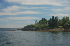
We rounded by one more lighthouse on Burnt Island on our way back into the harbor.
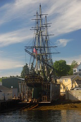
We paused briefly to check a lobster trap, then headed on in past several large sailing craft. According to our guide not only is Boothbay a center for sailing, but a center for repairing tall sailing craft.
Back in Boothbay Harbor we wandered through a few of the tourist shops. Some were appalling, akin to what one finds at Myrtle Beach and other tourist traps. Some were quite nice. Laura was able to find a couple of nice prints in one of them.
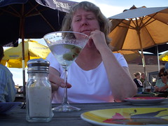
We found a restaurant with an upper deck that had a great view of the harbor. Our intent was to have a couple of martinis and appetizers, then wander elsewhere for dinner. However, both the drinks and appetizers were larger than we realized, and we were tired, so made that our meal as we relaxed on the deck and enjoyed the view for awhile longer.

I have severe case of lobster envy.
And a good case of lighthouse envy too…lol
Hi Tom & Laura,
My name is Jocelyn and I am with Dwellable. I am looking for fun and authentic blogs about Mid-Coast Maine and yours happened to catch my eye. If you’re open to it, shoot me an e-mail at jocelyn(at)dwellable(dot)com.
Hope to hear from you soon!
– Jocelyn