Skip to content

Random Connections

A collection of photography and exploration focusing on Upstate South Carolina and beyond.

  • Home
  • About Us
  • Photos
  • Resources
  • Other Voices
  • Post Archives
  • Podcast
  • Home
  • Paddling
  • Paddling to Capers Island
  • Page 3

Paddling to Capers Island

Posted on August 15, 2019August 15, 2019 By Tom 4 Comments on Paddling to Capers Island
Paddling, Photography, Rambling

Paddling to Capers Island

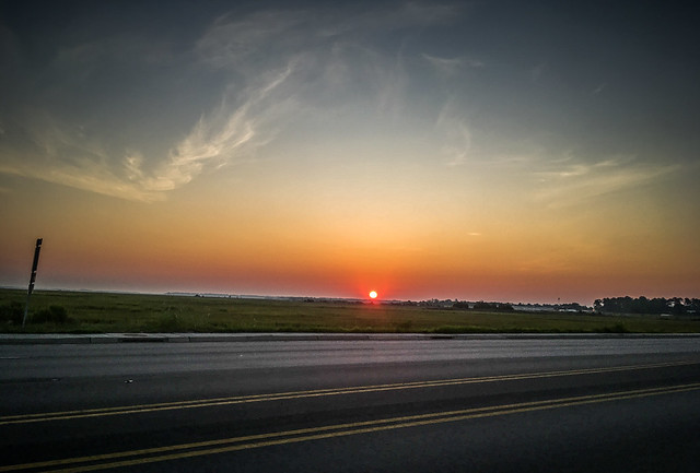
I drive through Beaufort and cross the bridges to Lady’s Island, then St. Helena Island just as the sun was rising. It was already a hot, humid day.

Station Creek Falls to Capers Island with LCU-19

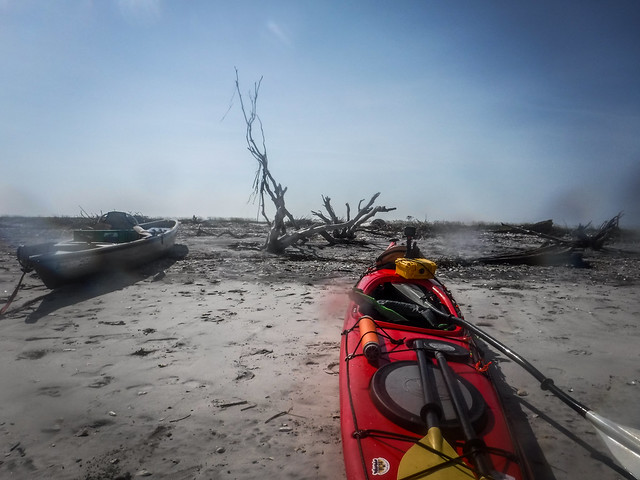
I found my way to Station Creek Landing. I was the first to arrive and I was early, so I decided to explore a bit. I drove on around to Land’s End and looked at the houses bordering the Beaufort River. I didn’t have time to explore the Fort Fremont area, so I headed on back to the landing. There I found Tim and George unloading their boats.

I decided to do the same. However, the bugs, specifically, gnats, were nearly unbearable. I remembered that I had mosquito netting to go over my hat, so I retrieved it. The netting helped.

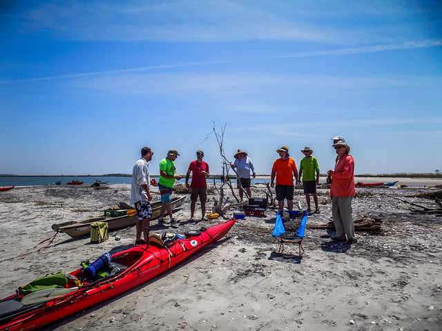
We were joined by another Tim, then Todd and his father, Ray. Matt, Chris, Alan, and Brian rounded out the group for a total of 10 paddlers. There was an inordinate number of red boats. One of the Tims had a red Tsunami 175 almost identical to mine

Station Creek Falls to Capers Island with LCU-73
Station Creek Falls to Capers Island with LCU-74
Station Creek Falls to Capers Island with LCU-75
Station Creek Falls to Capers Island with LCU-77

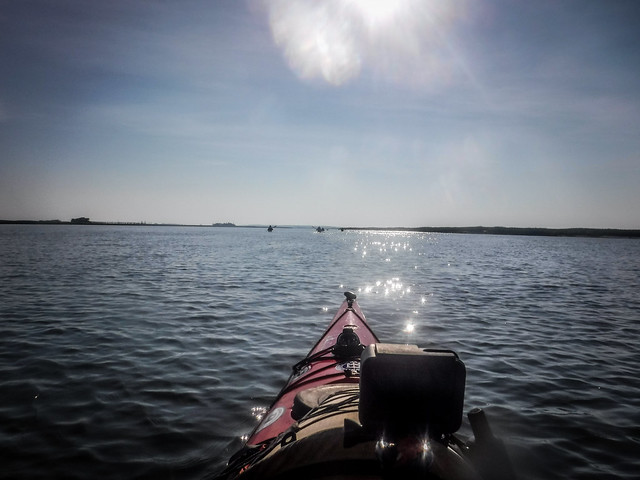
We headed out into the unrelenting heat of Station Creek.

Station Creek Falls to Capers Island with LCU-79
Station Creek Falls to Capers Island with LCU-78
Station Creek Falls to Capers Island with LCU-81
Station Creek Falls to Capers Island with LCU-82

Not far from the landing we saw some splashing along the shore. A pair of dolphins were feeding along the bank. Brian said that they would toss fish onto the bank with their tails. We stopped to watch the activity.

Station Creek Falls to Capers Island with LCU-83
Station Creek Falls to Capers Island with LCU-84

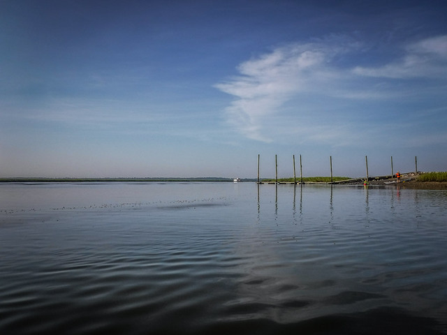
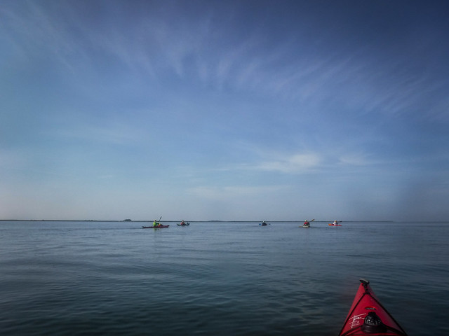
We continued onto Harbor River toward Trenchards Inlet. The route was mostly salt marsh, but there were a few isolated houses along the way.

Station Creek Falls to Capers Island with LCU-85
Station Creek Falls to Capers Island with LCU-86
Station Creek Falls to Capers Island with LCU-89
Station Creek Falls to Capers Island with LCU-87
Station Creek Falls to Capers Island with LCU-88

These houses were on narrow spits of land an only accessible by boat. Here’s a Google Earth image of the house in the previous photo:

Isolated Houses

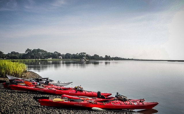
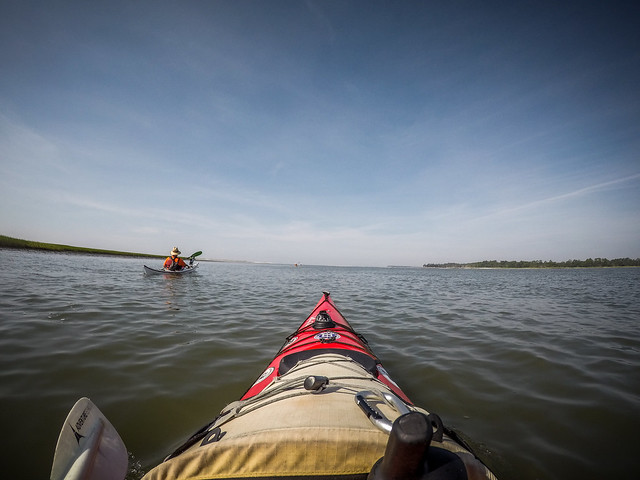
We made the turn onto Trenchards Inlet and headed toward our destination. We were making good speed. Matt had calculated the tides precisely, so we were paddling with the current. The air was as still as death, though. Plus, there was no real place to stop and take a break until we got to where we were going. We did the entire 6.5 mile stretch with no let-up.

Station Creek Falls to Capers Island with LCU-86
Station Creek Falls to Capers Island with LCU-90
Station Creek Falls to Capers Island with LCU-18
Station Creek Falls to Capers Island with LCU-19

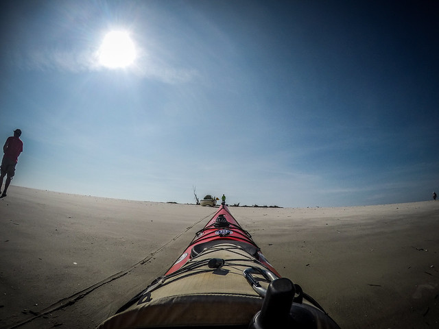
In the distance we could see a sandy strip. Part of this was the end of Capers Island on one side of the inlet, and part of it was a spit that extends out from Bay Point on the other side. Our target was the Capers Island spit. The beach curled back around into the inlet creating a protected space to land so that we wouldn’t have to paddle out into the ocean surf.

Station Creek Falls to Capers Island with LCU-20
Station Creek Falls to Capers Island with LCU-21

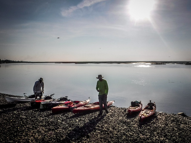
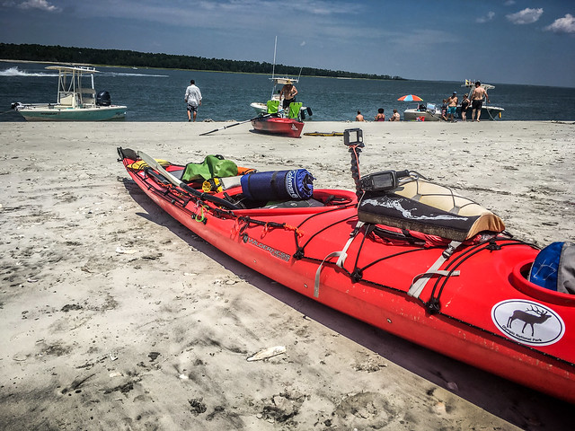
We weren’t alone. Several other large boats had the same idea and had pulled up to the spit. We drug our boats up a steep hill to the top of a dune where a small boneyard of trees provided no shade.

Station Creek Falls to Capers Island with LCU-23
Station Creek Falls to Capers Island with LCU-92

With base camp established we started exploring the island. We walked around to the ocean side of of the beach just off the beach we found the rusting remains of an old bulldozer. Apparently this was abandoned sometime in the 1950s. Matt, George, and I were the only three who braved the surf to climb out onto the old equipment.

Station Creek Falls to Capers Island with LCU-99
Station Creek Falls to Capers Island with LCU-98
Station Creek Falls to Capers Island with LCU-95
Station Creek Falls to Capers Island with LCU-100
Station Creek Falls to Capers Island with LCU-104
Station Creek Falls to Capers Island with LCU-101
Station Creek Falls to Capers Island with LCU-108
Station Creek Falls to Capers Island with LCU-109
Station Creek Falls to Capers Island with LCU-110

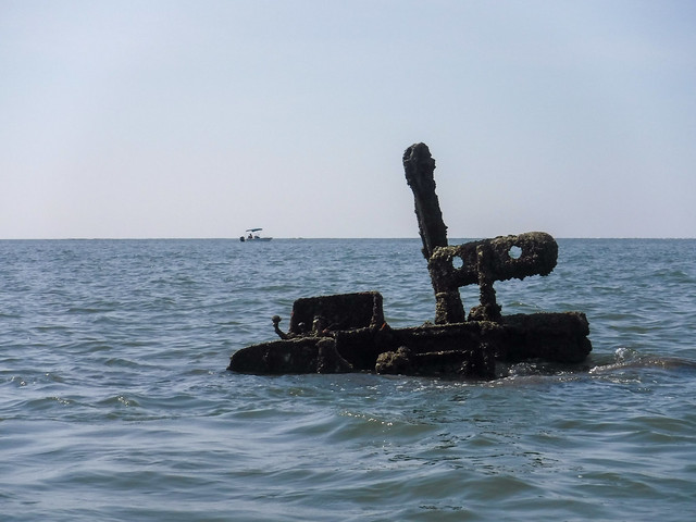
At high tide the bulldozer would be under water. The current low tide provided lots of beach to explore. There was an abundance of shells, including whelks and sand dollars. I didn’t pick up any but others did.

Station Creek Falls to Capers Island with LCU-115
Station Creek Falls to Capers Island with LCU-112
Station Creek Falls to Capers Island with LCU-114
Station Creek Falls to Capers Island with LCU-116

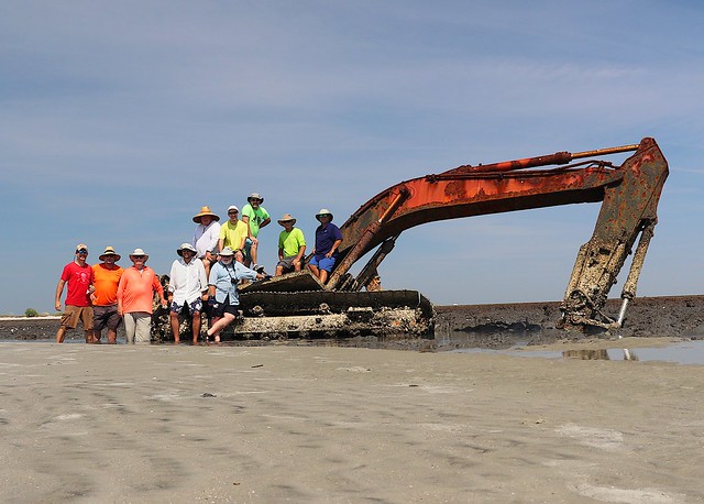
We walked along the beach for about a mile. We could see looming in the distance what appeared to be an artifact from some dystopian future. This was our destination, an old backhoe that had been abandoned by a local homeowner some years back.

Station Creek Falls to Capers Island with LCU-118
Station Creek Falls to Capers Island with LCU-120
Station Creek Falls to Capers Island with LCU-122
Station Creek Falls to Capers Island with LCU-121
Station Creek Falls to Capers Island with LCU-124
Station Creek Falls to Capers Island with LCU-126

We decided that this would be a good spot for a group photo.

LCU Capers Island Group Photo
Photo by Matt Richardson

There was no respite from the heat. I walked back the mile to the boats with my feet mostly in the surf, trying to cool down.

Station Creek Falls to Capers Island with LCU-128

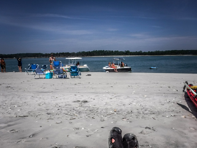
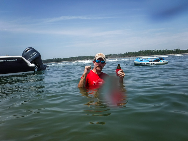
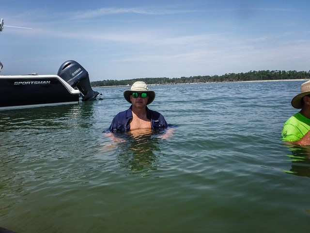
Back at the boats it was still miserable, and it was getting crowded. Several more boats arrived while we were hiking and others were pulling up. They all seemed to know each other. Matt set up the stove and got lunch underway while we tried to cool off in the water.

Station Creek Falls to Capers Island with LCU-130
Station Creek Falls to Capers Island with LCU-129
Station Creek Falls to Capers Island with LCU-134
Station Creek Falls to Capers Island with LCU-136
Station Creek Falls to Capers Island with LCU-137
Station Creek Falls to Capers Island with LCU-139
Station Creek Falls to Capers Island with LCU-141
Station Creek Falls to Capers Island with LCU-21
Station Creek Falls to Capers Island with LCU-155
Station Creek Falls to Capers Island with LCU-145

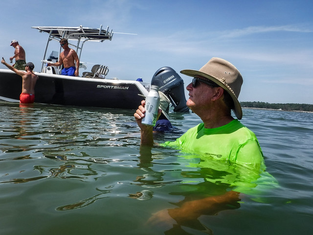
Then it was time for lunch.

Station Creek Falls to Capers Island with LCU-148
Station Creek Falls to Capers Island with LCU-147
Station Creek Falls to Capers Island with LCU-150
Station Creek Falls to Capers Island with LCU-151
Station Creek Falls to Capers Island with LCU-152

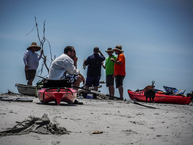
More boats were arriving and it was getting quite crowded. It was time for us to leave. Plus, we had delayed long enough for the tide to change. We needed to head out if we were going to have a favorable current.

Station Creek Falls to Capers Island with LCU-158
Station Creek Falls to Capers Island with LCU-154

This is where things really started to go downhill for me. I was delayed because I thought I’d dropped my camera. Then the cable on my rudder broke. Finally, the GoPro adhesive mount gave way. I was frazzled and on the verge of heat exhaustion.

Station Creek Falls to Capers Island with LCU-25

It was a slog back but I kept at it. Without a functioning rudder my big boat was a point and shoot. I was expending more energy than I should just keeping it on track. Even with navigation problems and as tired as I was, I was making good time. I don’t think I took any photos along the way, pausing only to re-hydrate.

When we got back to the landing the gnats were back, so I donned my bug net. Before loading boats or anything else I just sat in the car with the AC going for a bit.

Our total trip ran 15 miles – 13 miles paddling and 2 miles hiking, all in 100ยบ heat.

Capers Island Route

Once loaded I said my goodbyes and headed pretty much straight back home. It had been a long, hard trip and I had to be at church early the next morning.

Pages: 1 2 3

Post navigation

❮ Previous Post: Returning from Samish Island
Next Post: Finding Camp Meeting ❯

4 thoughts on “Paddling to Capers Island”

  1. Daniel Brinneman says:
    September 4, 2019 at 8:28 pm

    Do you purposely take pictures or do you have a GoPro mounted on your chest that’s always taking pictures?

    Reply
    1. Tom says:
      September 4, 2019 at 10:13 pm

      Both. I have a waterproof camera that I use for specific shots. I also have a GoPro mounted to the kayak itself. The GoPro is set to do time-lapse shots at one image every ten seconds. I used to do full video, but I found that I wasn’t using the video. It was just taking up storage space. Now I just do time-lapse with an occasional video.

      Reply
      1. Daniel Brinneman says:
        September 4, 2019 at 10:15 pm

        Thank you!

        Reply
  2. bestringtoness.com says:
    September 13, 2019 at 4:39 am

    Capers is not for the faint of heart. Plan on at least a long weekend trip, and know your paddling limits before committing to something you can t handle. If you re unsure of paddling out to the island, make arrangements to borrow a jon boat, or contact Barrier Island Eco Tours. They have access to a ferry, but only for parties of seven or more. This is an incredible island that is certainly one of the more unique places to be found on our coast, and there s no better time to visit it than now.

    Reply

Leave a Reply Cancel reply

Your email address will not be published. Required fields are marked *

This site uses Akismet to reduce spam. Learn how your comment data is processed.

Categories

  • EdTech (197)
  • Entertainment (201)
  • Family (123)
  • Gear (114)
  • General Technology (98)
  • Geocaching and Maps (208)
  • History and Genealogy (275)
  • Internet (141)
  • Local (458)
  • Miscellaneous (557)
  • Music (202)
  • Paddling (264)
  • Photography (781)
  • Podcast (15)
  • Rambling (233)
  • Rants (161)
  • Recipes (36)
  • Religion (48)
  • Restaurants (165)
  • Science (48)
  • Things Overheard (29)
  • Travel (413)
  • Uncategorized (142)
  • Washington Sabbatical (113)
  • Weirdness (59)

Recent Posts

  • Six Layer Bourbon Grits Bowl
  • How’s the House? Part 2
  • Carolina Ghost Towns – Merrittsville
  • Gimme Shelter
  • From Kingsbury to Stoneboro – Rambling in Lancaster County

Recent Comments

  • Curtis V Fink on Chasing the Swamp Rabbit – Part 3, Sievern and Edisto Academy
  • Bobby Stan Gillespie on Exploring Jacks Township
  • Richard Thornton on Paddling Up the Long Nose
  • John Guerrant on From Kingsbury to Stoneboro – Rambling in Lancaster County
  • John Guerrant on Gimme Shelter

Tags

blogging cemetery Christmas Columbia Edisto River edtech Entertainment family Flickr Florida Furman Furman University gear Georgia geotagging Ghost Town Ghost Towns Google Earth Google Maps GPS Greenville Greenville Chorale history Instructional Technology kayaking Lake Jocassee LCU Lowcountry Unfiltered maps Music North Carolina Paddling Photography rambling restaurant Restaurants review singing social networking South Carolina time-lapse Travel video Washington Washington State
May 2025
S M T W T F S
 123
45678910
11121314151617
18192021222324
25262728293031
« Apr    

Copyright © 2025 Random Connections.

Theme: Oceanly by ScriptsTown