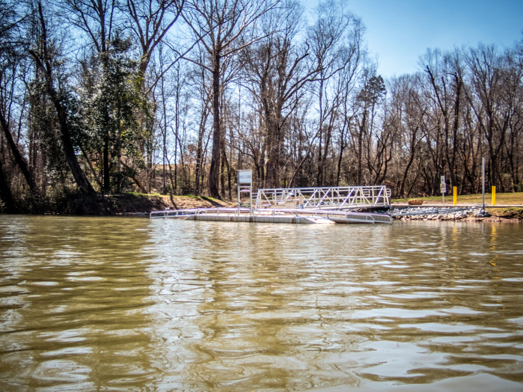
Duke Power has been installing ADA accessible kayak launch ramps all along the Saluda River. I had used the one upstream of the Saluda Dam several times, as well as one on the Tyger River at Berry Pond. These are a great asset for all paddlers, not just those with disabilities.
Alan and I wanted to try out the new launch at Cooley Bridge back last fall, but it had not been completed. There wasn’t a good way to launch without trudging through lots of mud. We decided to head up to the Pelzer launch for that day. A couple of weeks ago Alan sent me a text with a photo of the completed ramp.
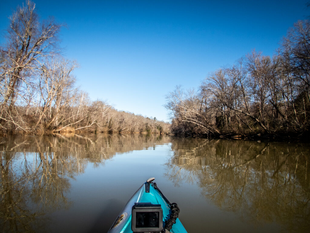
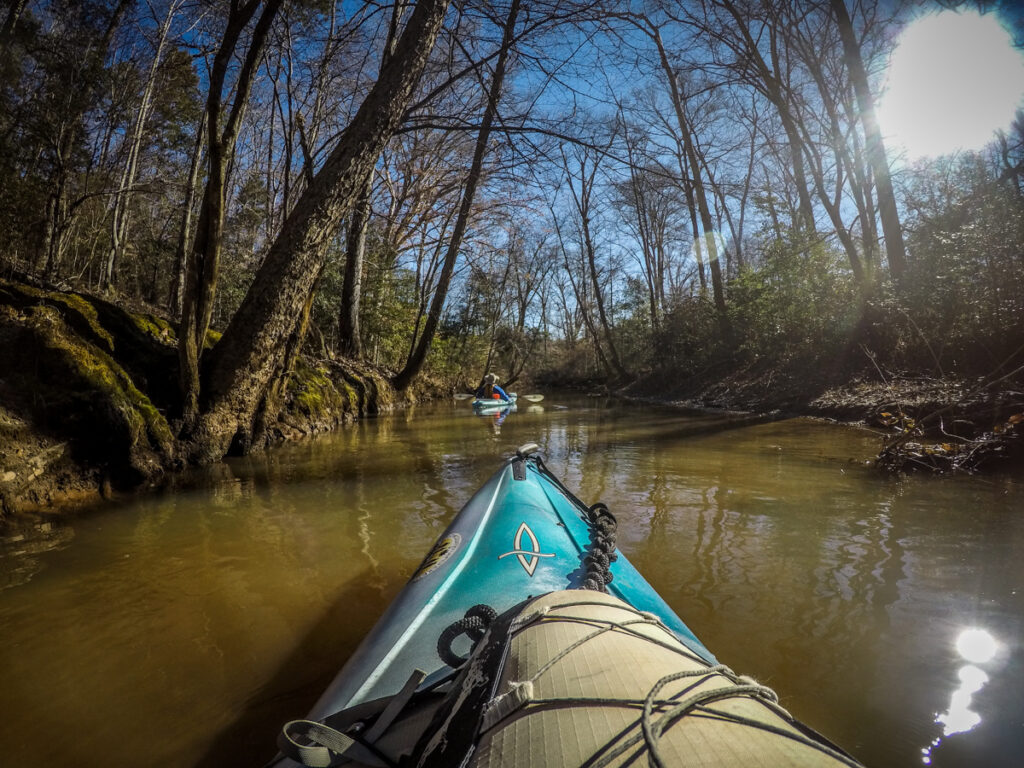
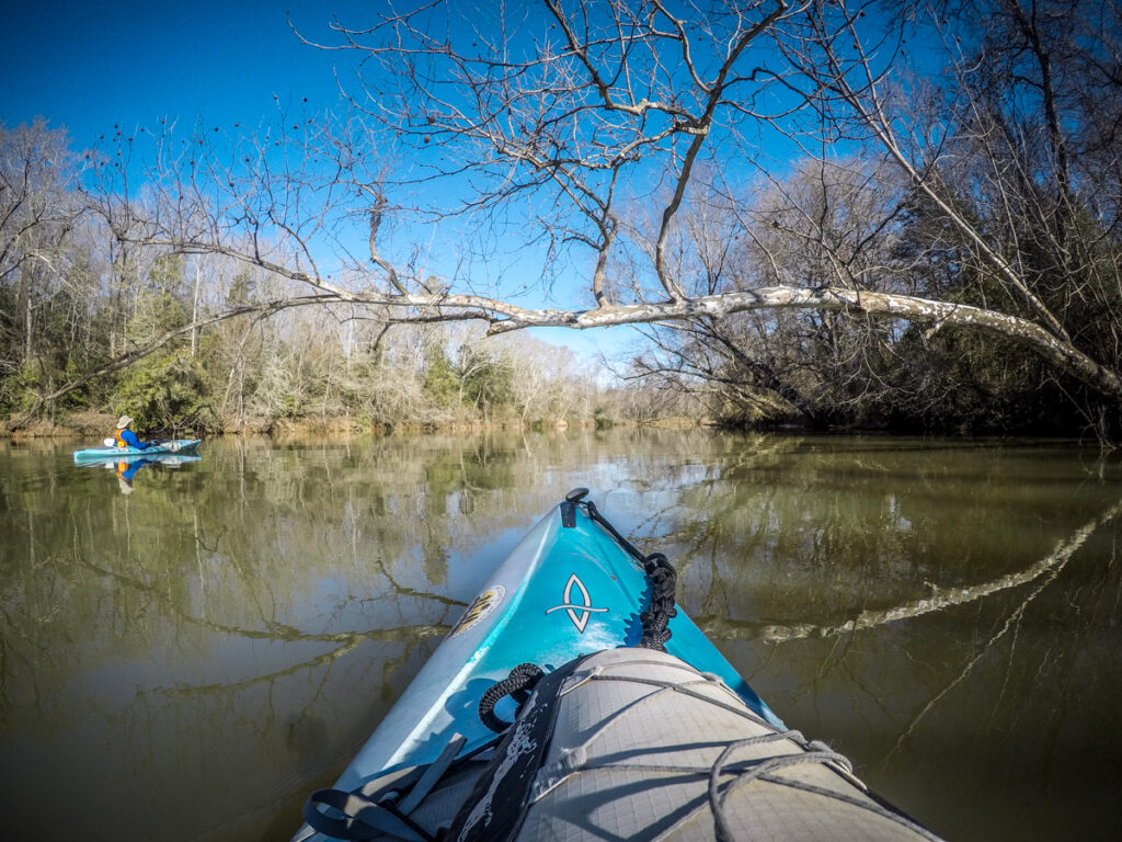
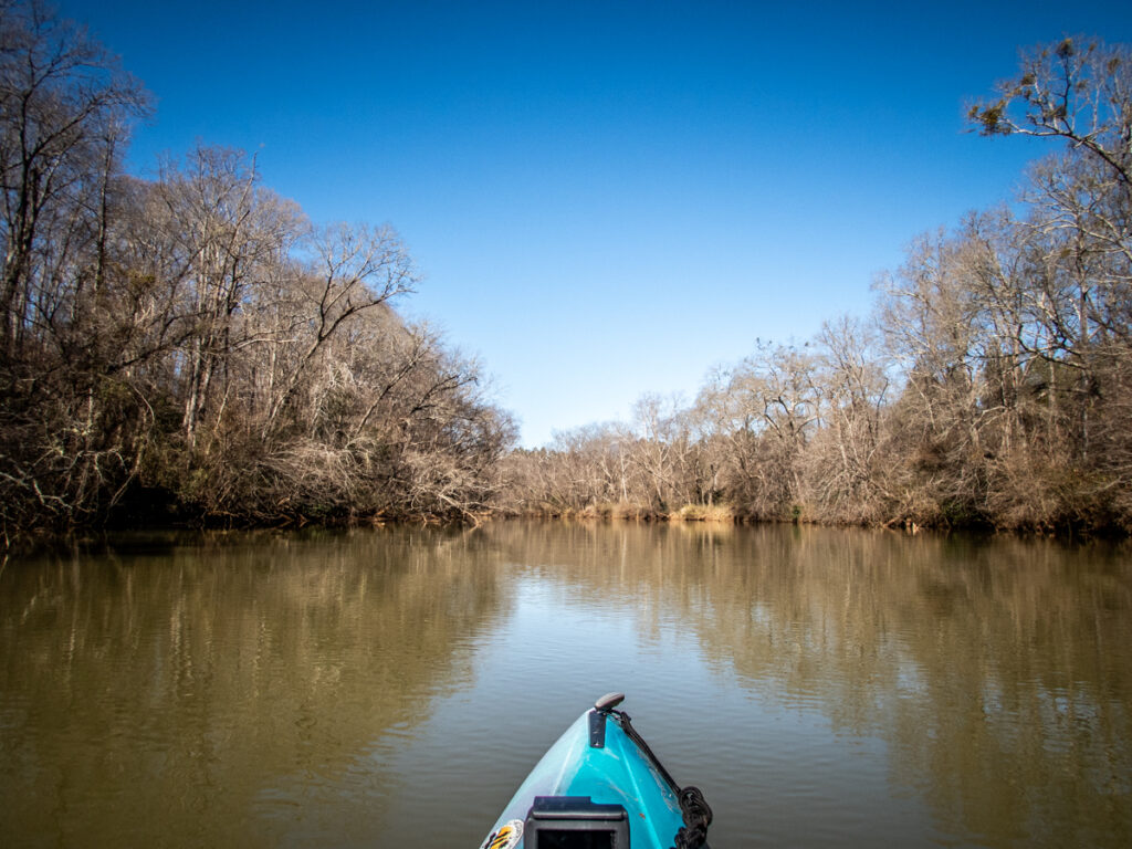
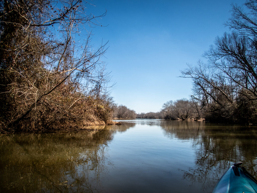
With the weather finally turning decent we decided to give it a whirl. It would be my first time out since my shoulder injury. This would make a good first outing. The ramp launches into the impoundment about 3 miles above Holiday Dam, so the river is more like a lake. From there we could paddle downstream toward the dam, or against the slight current upstream then take a relaxing paddle back. As an out-and-back we could adapt the trip depending on how my shoulder was feeling.
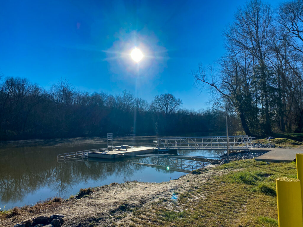
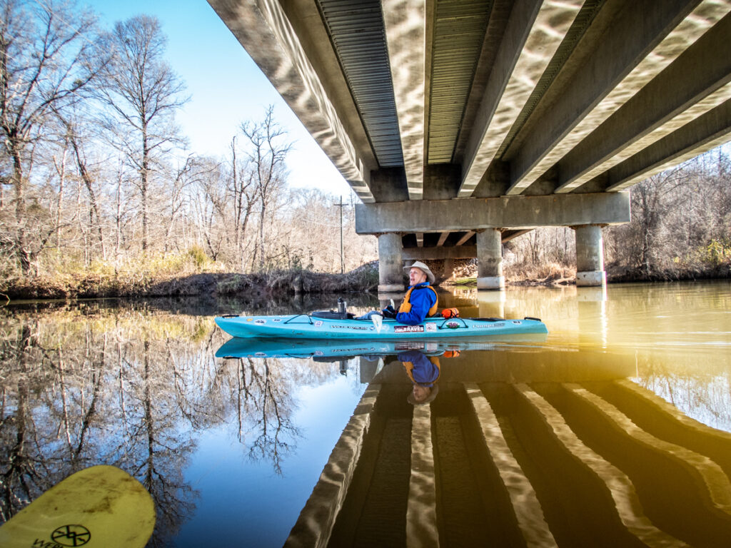
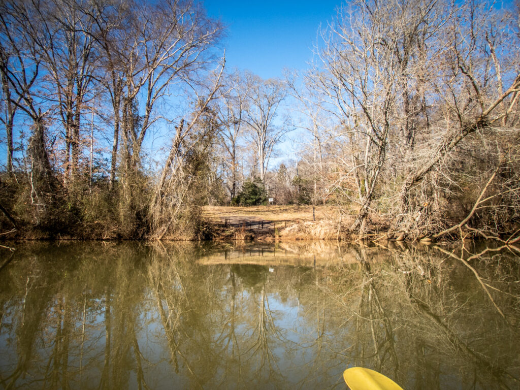
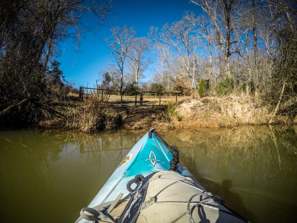
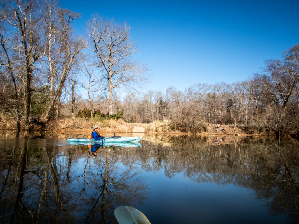
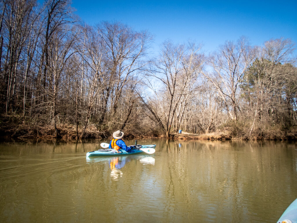
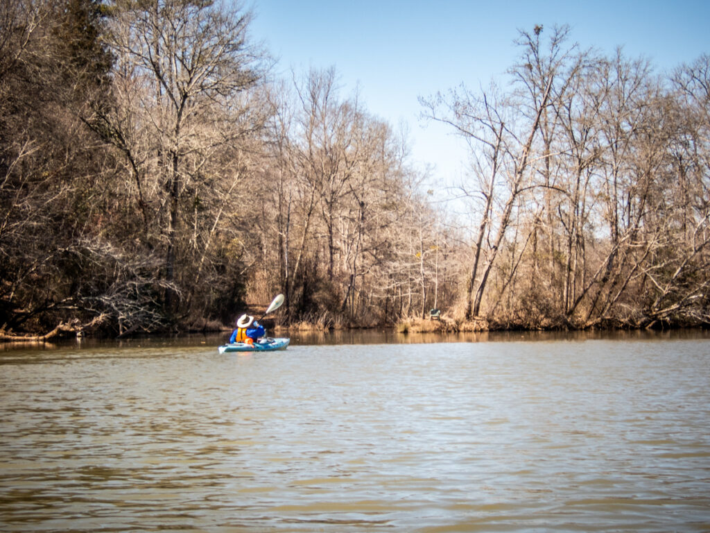
I arrived first, just as the morning mists were starting to dissipate. There were already a couple of vehicles in the lot and, sadly, a good bit of trash. There was no trash can around, so people decided to use the ground instead. Alan arrived shortly thereafter and we got the boats ready for launch, Alan on one side of the ramp and me on the other.

We decided to head upstream first, for a couple of reasons. First, I always like doing the hard part first so the paddling is easier after I’m already tired. This, especially with an injured shoulder.
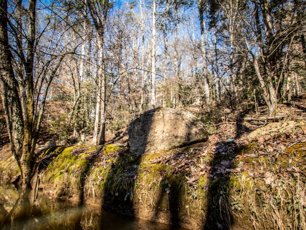
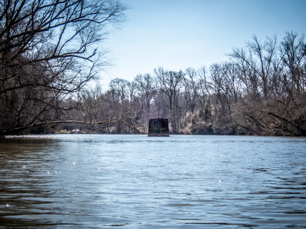
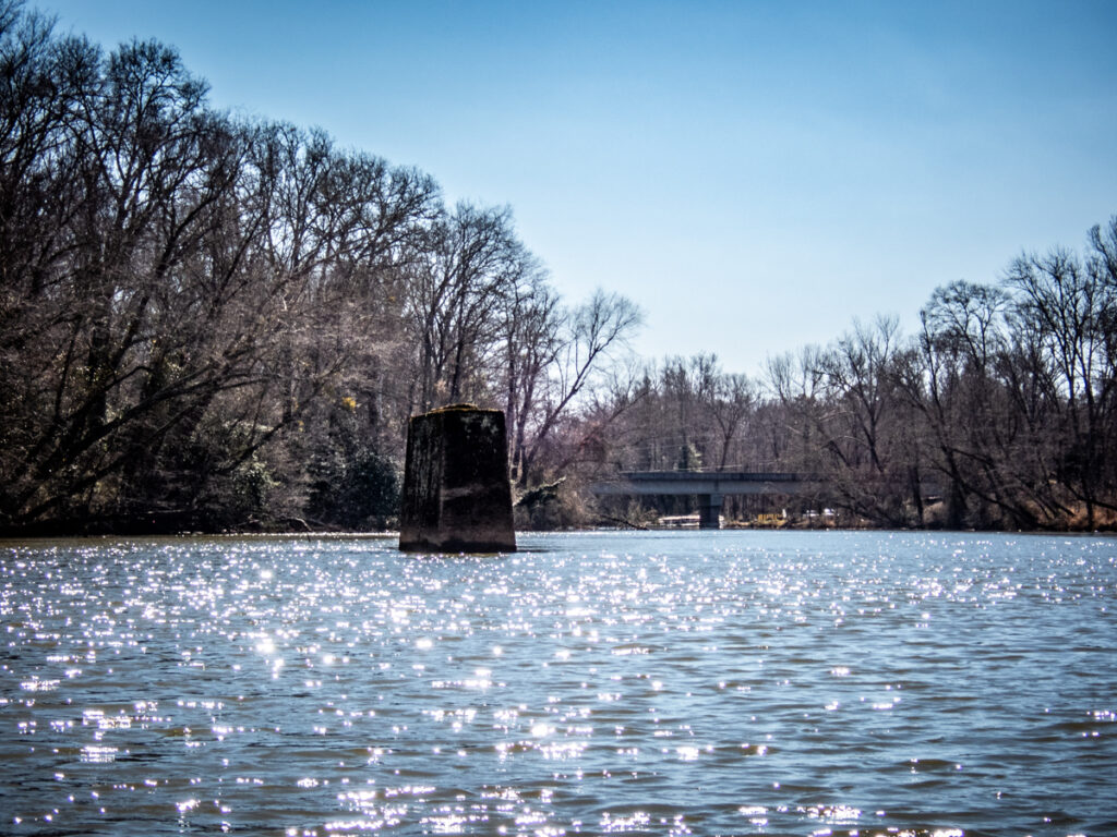
But there was a second reason for our trek upstream. This section of the river is rich in history. It has served as a crossing since before white settlers came to the area. There are even remnants of a possible ghost town. I knew I had to check it out.
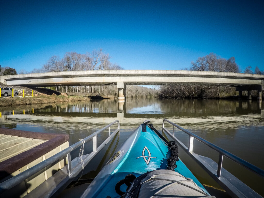
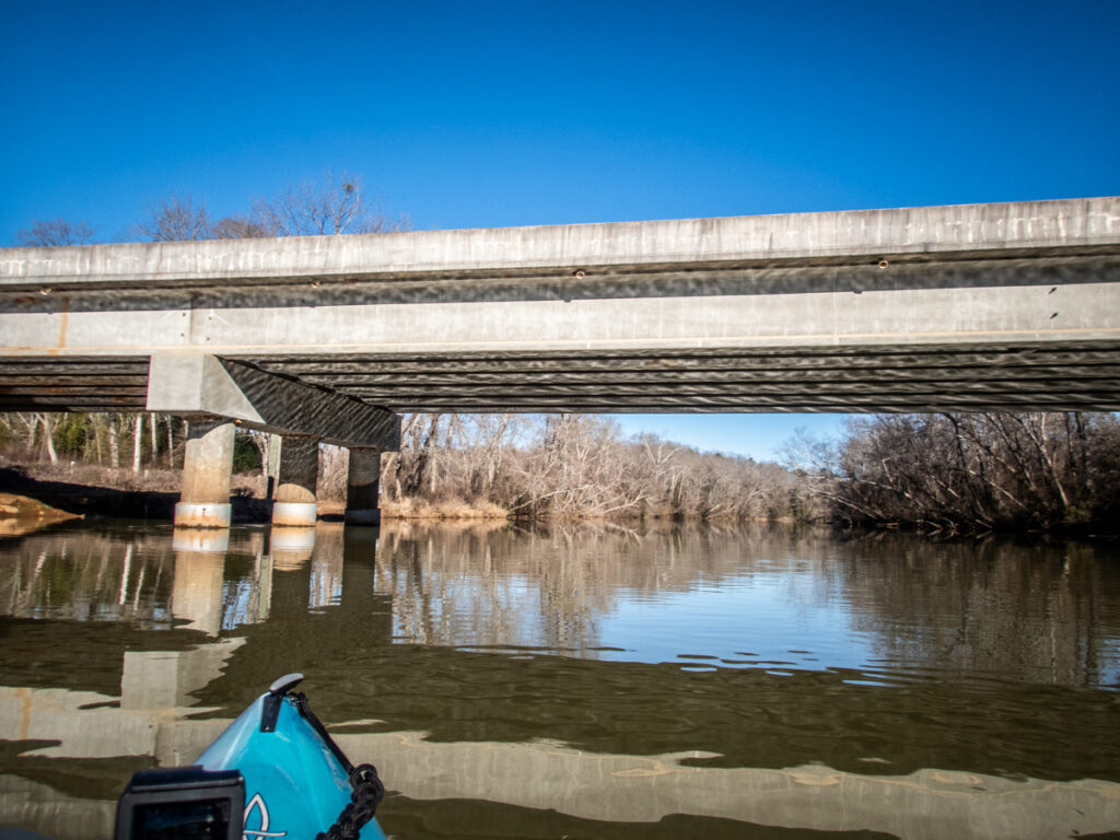
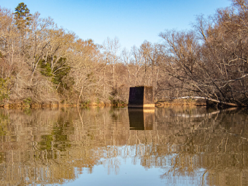
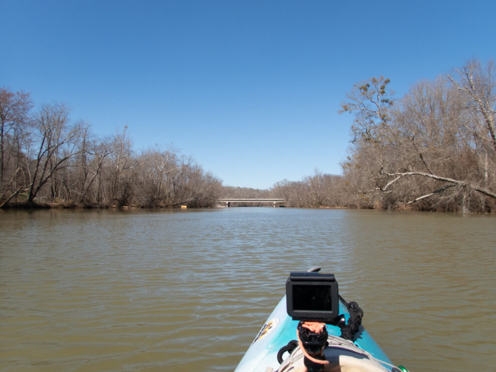
The current bridge was built in 2001. The previous one was in the same location, but before that the bridge was upstream. Now all that remains is an abutment in the middle of the river.
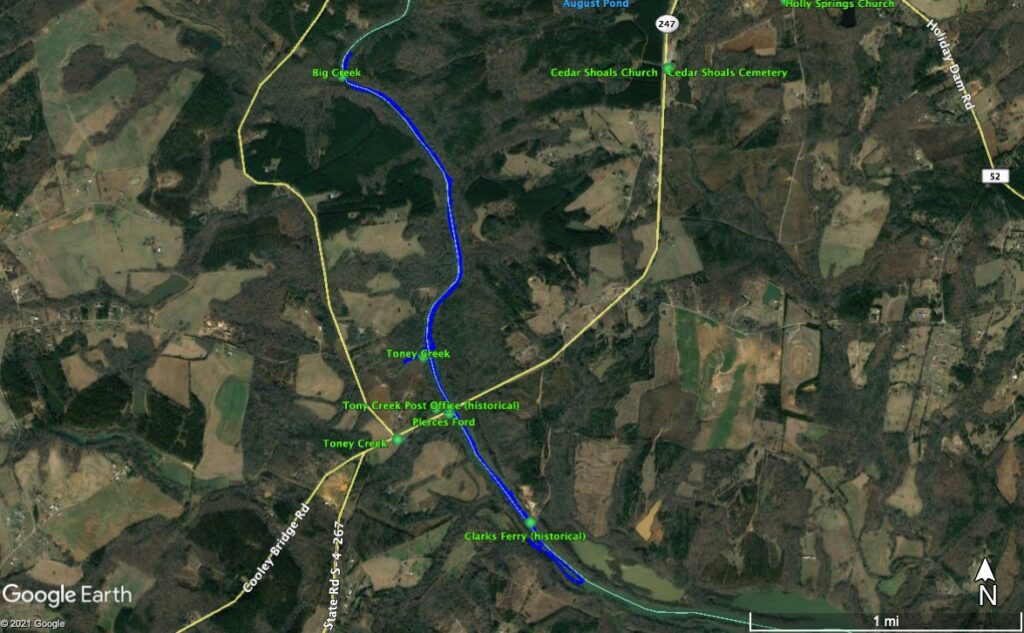
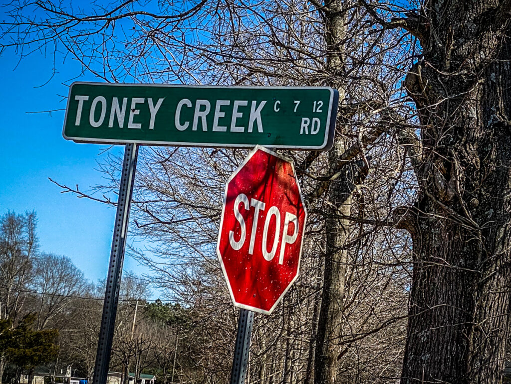
As I was planning this trip I came across several place names. In addition to Cooley’s Bridge local names included Pierce’s Ferry, Clark’s Ferry, and Toney Creek. Of course, I was intrigued by these names. Who were Pierce, Clark, and Toney?
As usual, I first turned to old maps. Robert Mills’s 1825 Atlas showed Pierce’s Ford and Clark’s Ferry for both the Greenville and Pendleton Districts.
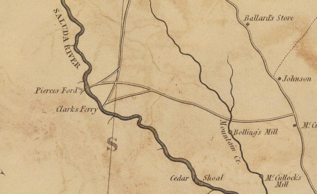
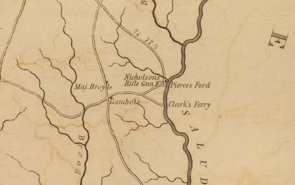
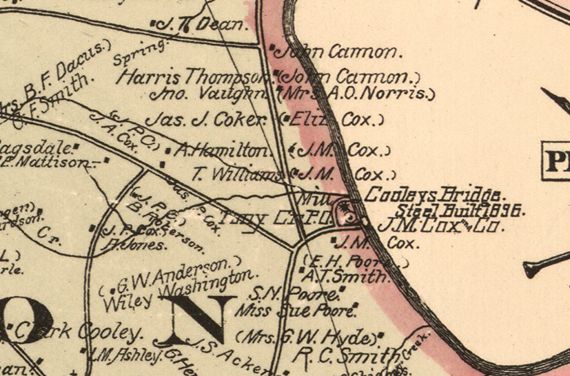
Interestingly, the Pendleton District also shows “Nicholsons Rifle Gun Ferry.” The Kyzer 1882 maps of the same area only showed Cooley’s Bridge, but also showed “Tony Creek PO” on the Anderson side.
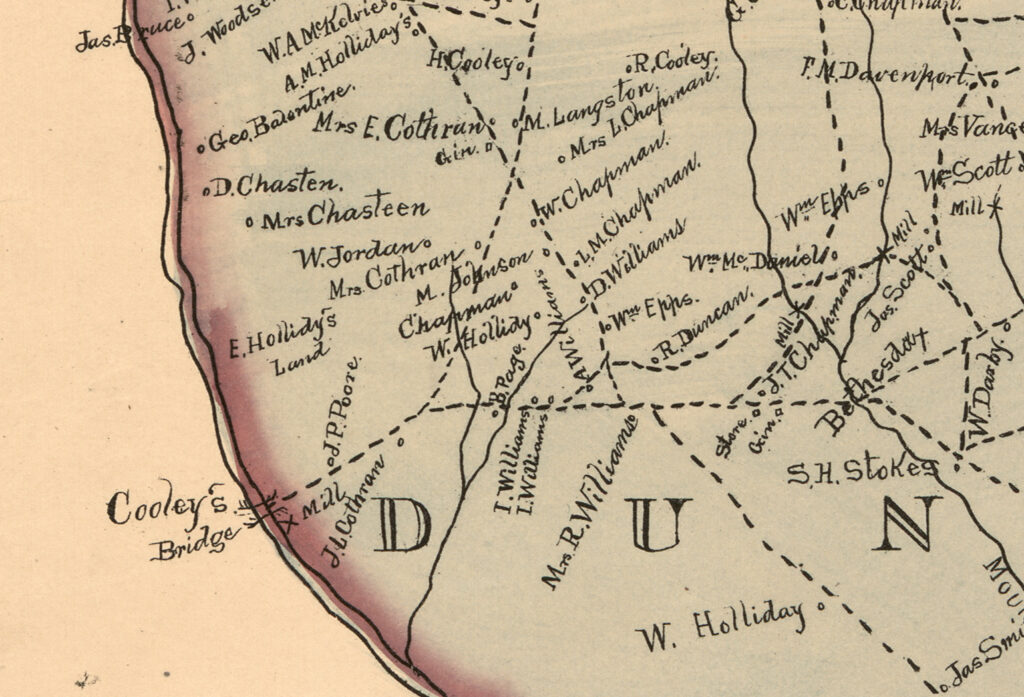
These names also show up in the GNIS data for the area. I had added these to my GPS for further exploration.
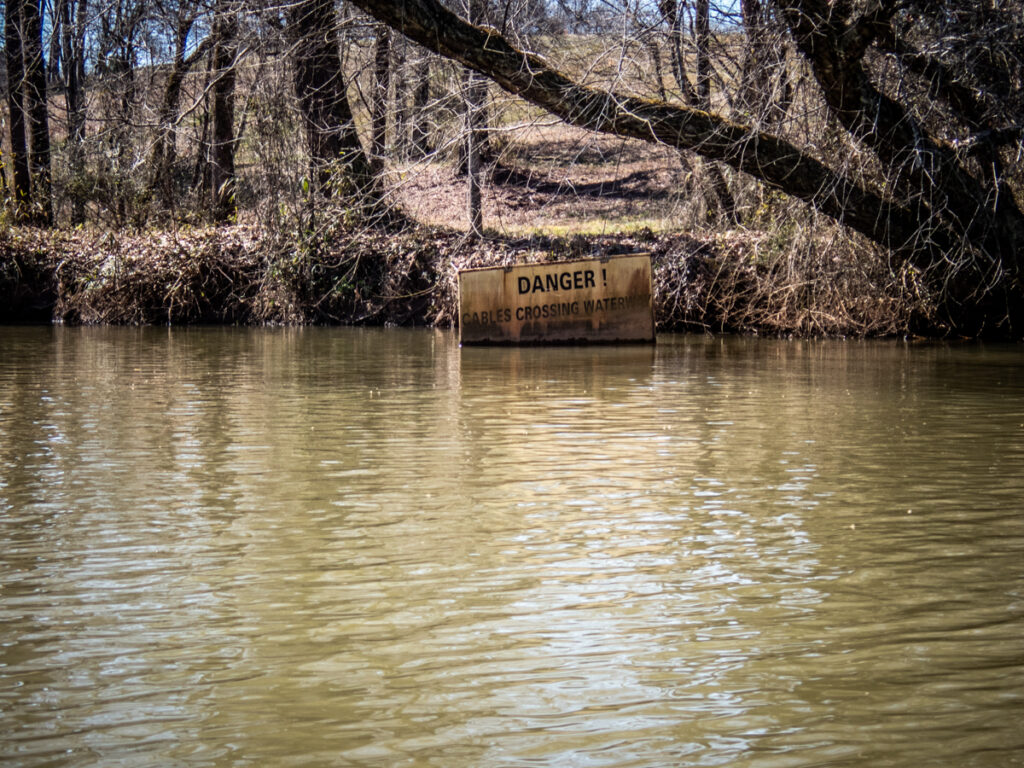
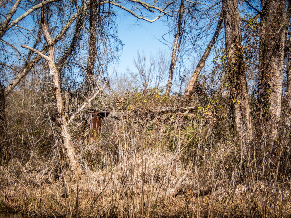
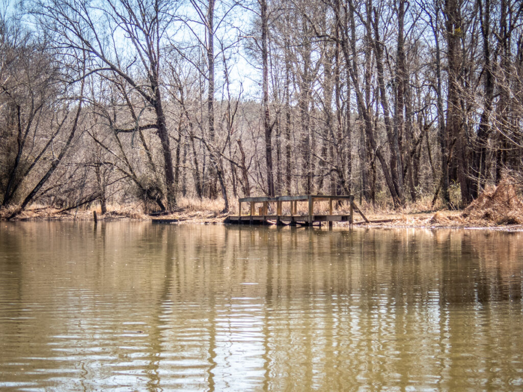
Alan and I paddled up to the abutment, then spotted where Toney (or Tony) Creek entered the Saluda. Just downstream was a cleared field with a ramp, barred by a gate. Just beyond was a cryptic sign that read, “No Trespassing. Experimental Area.”
My mind wandered back a couple of hundred years. Who were the people who settled this area? Name spellings complicated things. It took some digging, but I think I found some answers.
The crossing was first known as Pierce’s Ford, but also shows up as Pierce’s Ferry. I wasn’t able to find much on Pierce, but there is a possibility that it was William Pierce, who also operated a ferry across the Savannah River. Pierce was brutally murdered in 1817 “not for plunder or robbery, not for anything he had done, but because he knew too much about the nefarious traffic of a band of rum-runners who used the [Savannah] ferry in their business,” according to historian Louise Ayer Vandiver in her 1928 book Traditions and History of Anderson County.
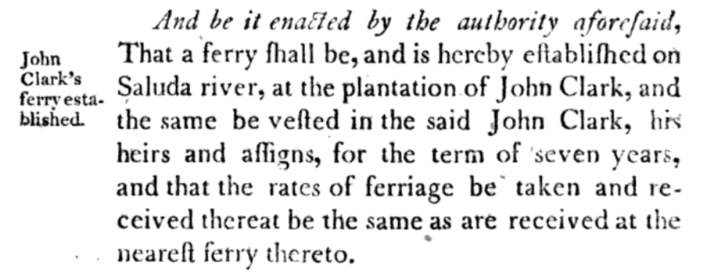
South of Pierce’s was Clark’s ferry, operated by John Clark. In the Acts and Resolutions of the General Assembly from 1808 there is a record that Clark was granted a charter to operate the ferry.
The historical marker on the east side of the bridge says that it was named for Hiram Cooley, who operated it as a toll bridge. Prior to that it was called Poor’s Bridge. Here’s where spelling wreaked havoc. The prior owner was either Hugh Poor, or Hough Poore, or some variation thereof. Regardless, Poore requested a charter for the bridge in the early 1800s. This is a request for his renewal from 1831.
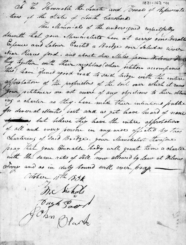
Interestingly, the request for charter is signed by John Clark, the ferry operator. Also, the proper spelling of Hugh Poore’s name is shown by his signature, despite the multiple references I found with alternate spellings.
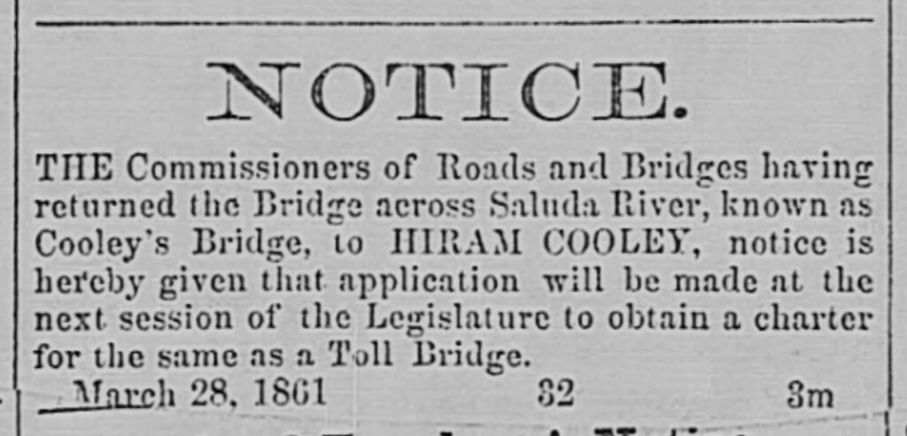
In 1841 Hiram Cooley took over the bridge from Poore and began operating it as a toll bridge. At this point this was just a single lane wooden bridge. Here’s an 1861 article requesting a requesting a renewal of Cooley’s charter.
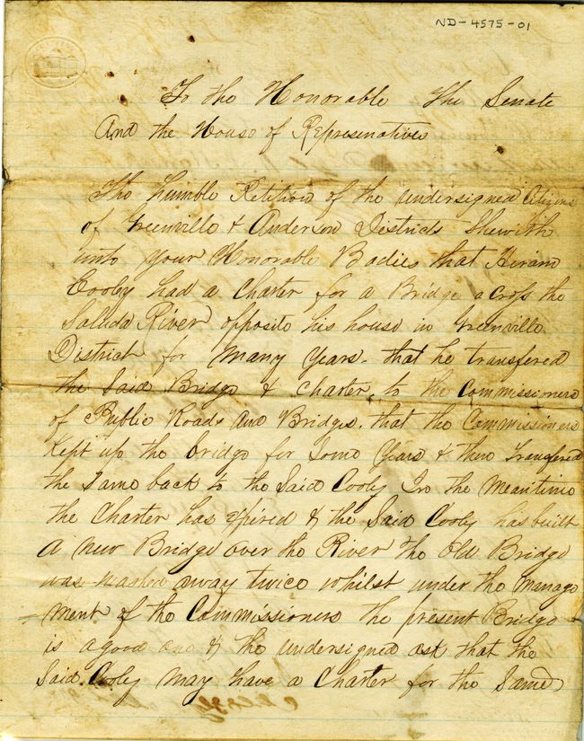
Control of the bridge went back and forth between Cooley and the state commissioners for bridges and ferries. The local denizens complained about Cooley’s exorbitant toll of 5 cents per crossing. When the Commission had control they complained about upkeep, especially after the bridge washed away a couple of times. This complaint found in the state archives is signed by many of the local citizens.
A Cooley Family genealogy website had the following summary of the history of the bridge.
The first bridge built across the Saluda River was built near Pierces Ford and Clarks Ferry in the early 1800’s. On March 10th 1836, Hough Poor sold his half interest in the bridge to Hiram Cooley and then on March 16th John C. Cothran also sold his half interest to Hiram. Poor had owned the Anderson county side and Cothran had owned the Greenville County side. The sale include the privilege of landing rights in each county, and also the rights to build and rebuild forever, Since the bridge was now privately owned it became a toll bridge. In 1841, Hiram was given a charter to operate the bridge in his own name, and so was called Cooley’s Bridge. During the early days of the bridge people had to pay a toll of 5 cents to walk or ride in a buggy or wagon across the bridge. The people complained that the toll was such an extravagant price, being about a full days wages. But since the ferry was so far down the river and it being dangerous most people decided to pay the toll to cross. The main use of the bridge, was for the Cooley families who lived on both sides of the river. After Hiram’s death in 1864, the wooden bridge fell into disrepair, until November 6th 1895, when a contract was given to J.H. Whitner of Knoxville, TN for a steel frame bridge with a wooden floor for $4800. This steel bridge served the public until August of 1927 when it was washed away in a flood. In the early 1930’s a new concrete bridge was built a short distance down stream from the old bridge site and the road was rerouted to it, and the road was named Cooley Bridge Road.
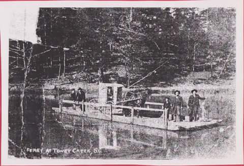
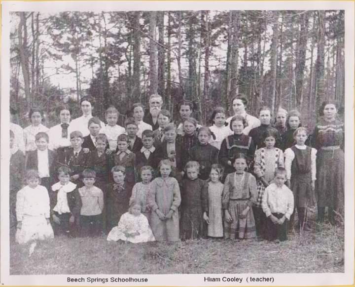
UPDATE: Reader Denise Hamby is a descendent of Hiram Cooley and she was kind enough to share two photographs. The first is a photo of the old ferry across the Saluda. The second is of Hiram Cooley as a teacher at Beech Springs School. My thanks to Denise for sharing these!
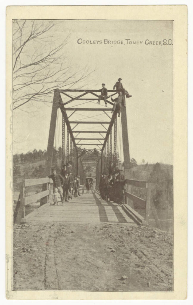
As stated above, in the late 1800s the wooden bridge was finally replaced with an iron truss bridge. This image is from the Bridgehunter website.
The 1930s bridge that replaced this one was a concrete bridge built at the modern day location.
Then there’s the matter of Toney Creek. There are two possible sources for the name. From a 1964 volume of Names in South Carolina it states that the name originated with the Cherokee. It states that, “The Indian Chief was named Tony. A small creek by his camp was, and is now, Toney Creek.”
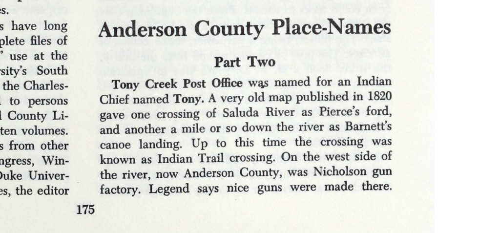
The name “Toney” is one that comes up several times as Cherokee surnames, so this is a possible explanation. But then there is also Col. William Toney. He was a large landowner near Fork Shoals and even owned The Mansion House in Greenville, one of its early hotels. He also operated a store near his farm off of the old Fork Shoals Road. There is now a historical marker at that location. It’s possible that the creek was named for him, or that some combination of this is the real story.
Toney was born in 1776 and died in 1878, which would put him in the right time frame for naming the creek.
The community grew and was quite active in the 1800s. According to the Names in South Carolina resource…
About this time Cox and Poore built a big country store stocked with everything from coffin tacks to corsets. From the beginning they did a good business. Soon came a public blacksmith shop. The mill, being a carpenter, made coffins of all sizes. The post office was moved from the mill to the store. Soon a R. F. D. route was in operation serving lower Greenville County. J. M. Cox was the first postmaster and served more than fifty years. At his death Edith Cox served until Tony Creek office was abolished…
Belton Power and dam completely covered where the once happy little community settlement thrived. It was known for its Cooley’s Bridge picnics, its hospitality, its baseball teams, its horseshoe pitching, and its many fist fights.”
I found multiple references to the Toney Creek community in the Anderson Intelligencer. According to the paper this was a hotbed of prohibition as the “Sons of Temperance” were quite active.

But back to the present…
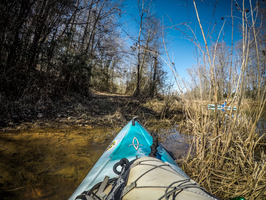
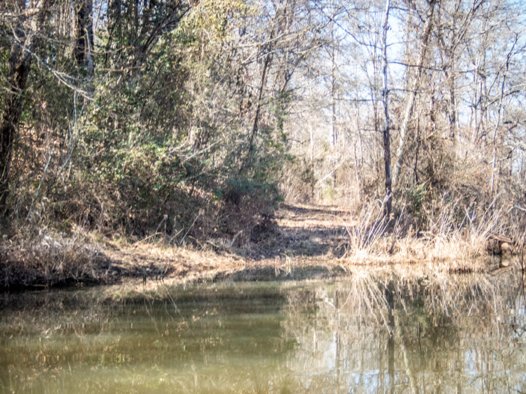
Being the ADHD paddlers that we are, we decided to paddle up the creek as far as we could. We looked for the path of the old road. There was a ridge area that could be part of that road, but it was hard to tell.
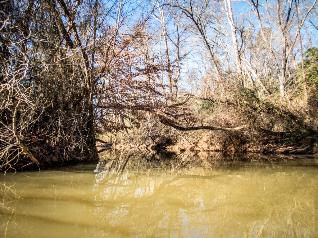
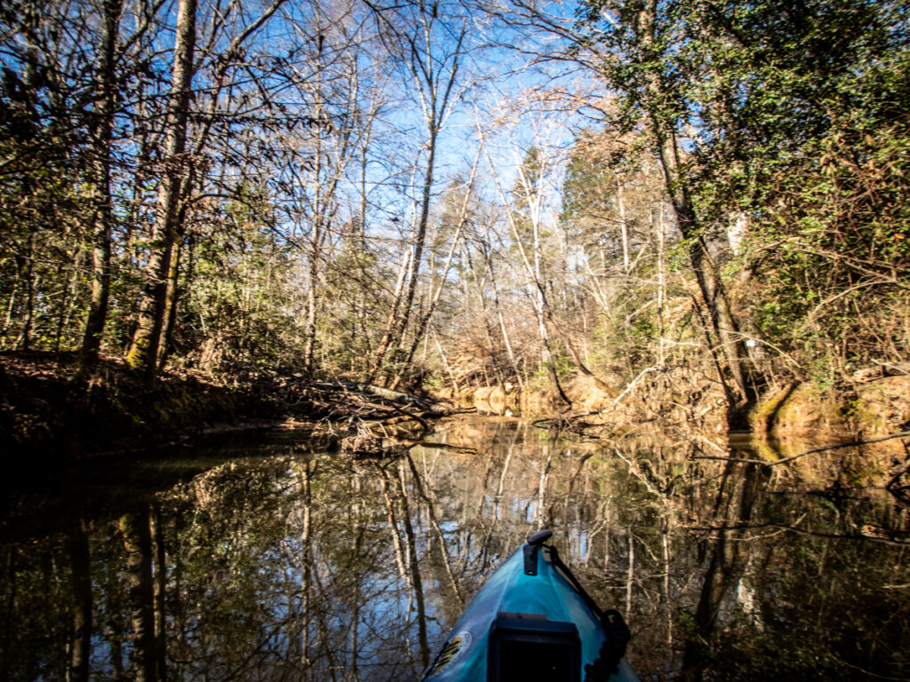
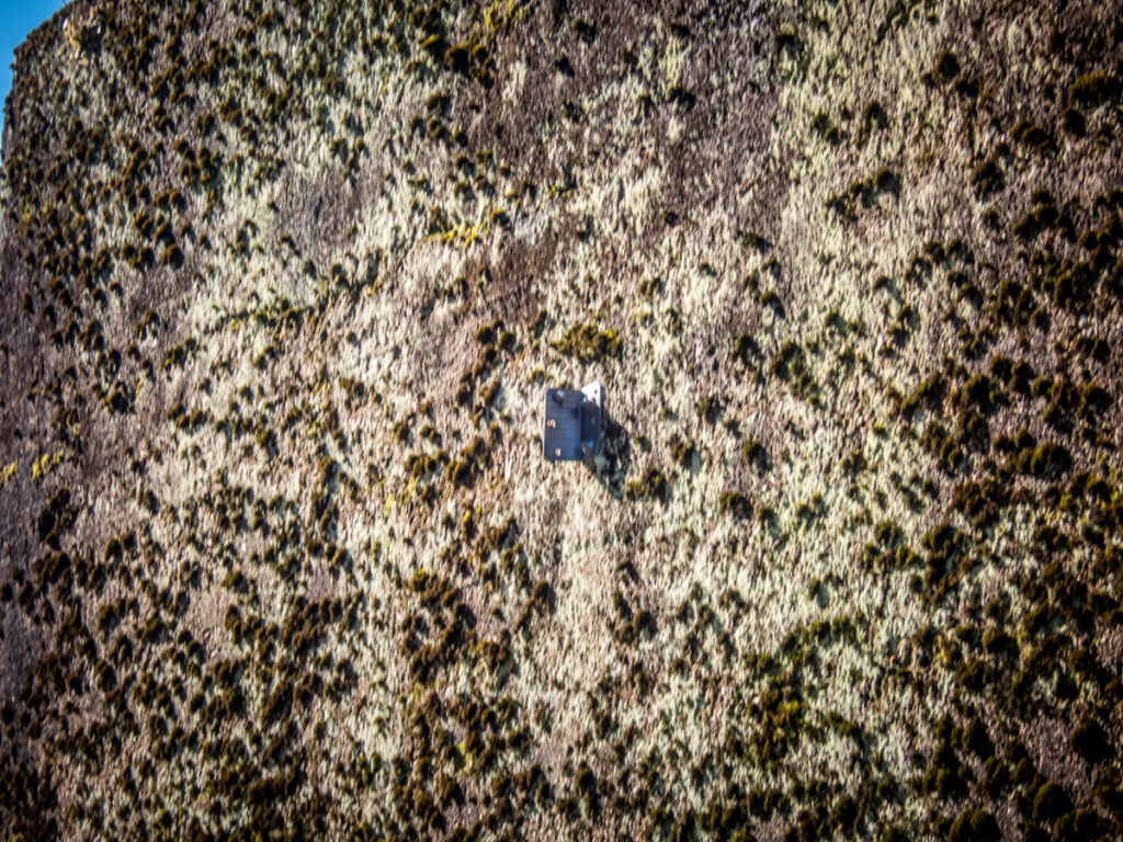
On the north bank of the creek there were rounded boulders that we first mistook for headstones.
We reached a point where it got too shallow to proceed further. No signs of the former community could be seen. We retraced our steps back to the Saluda.

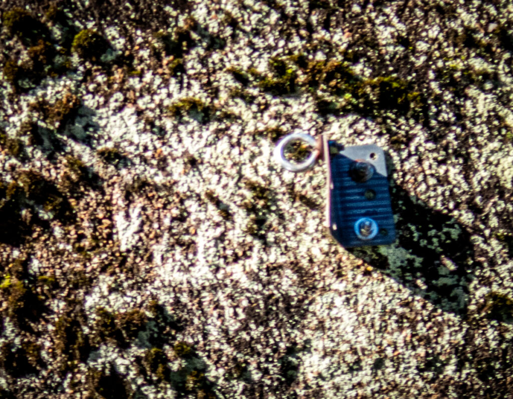
On closer inspection of the bridge abutment had a metal bracket and eye hook attached to the Greenville side. It looked rather shiny and modern. It was/is probably used for boat tie up, or, as Alan suggested, “a zipline with a rather abrupt stop.”
The Greenville side of the river was quite low. I thought I caught a glimpse of another abutment hidden in the trees, but I think it was just a trick of the light. Perhaps my mind was just filling in the blanks, because there would have to be other support structures given the height of the extant abutment.
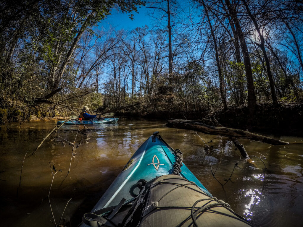
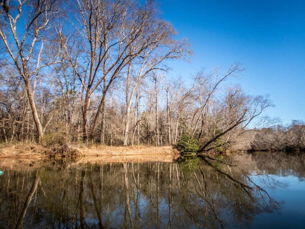
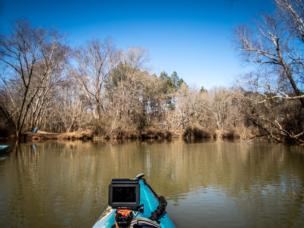
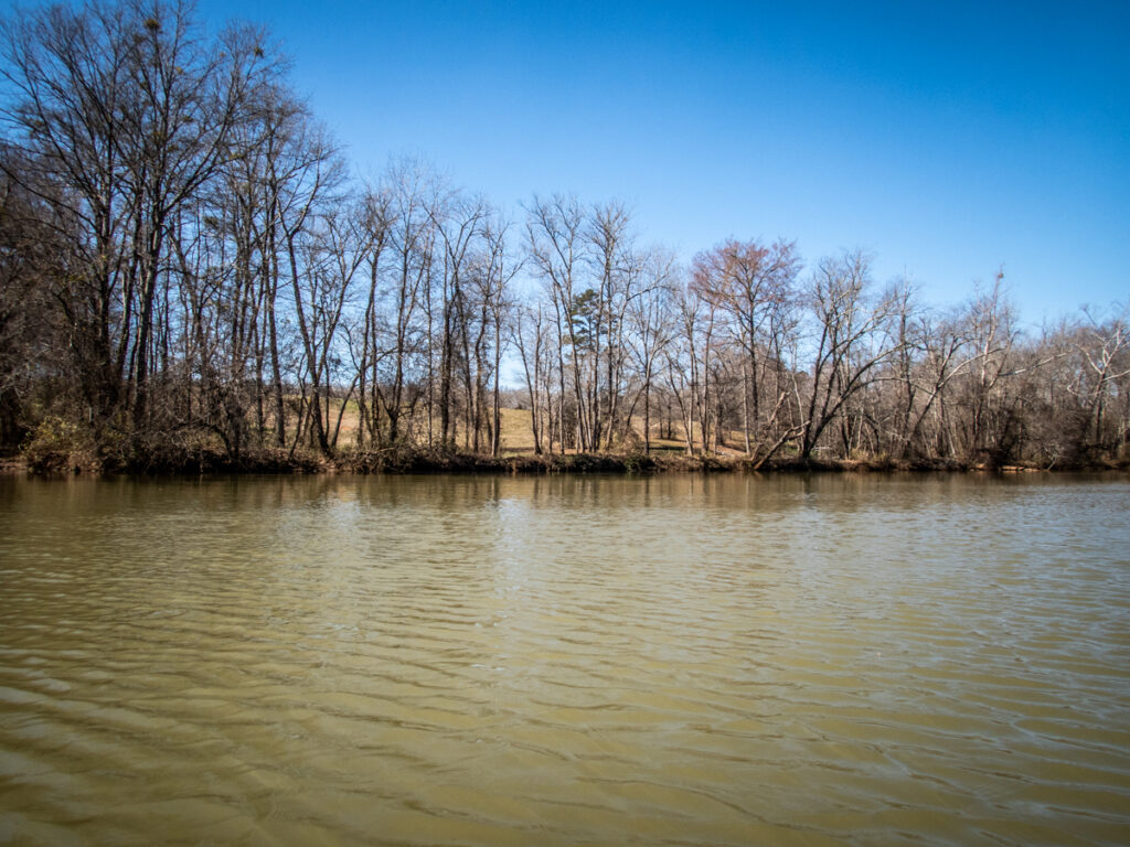
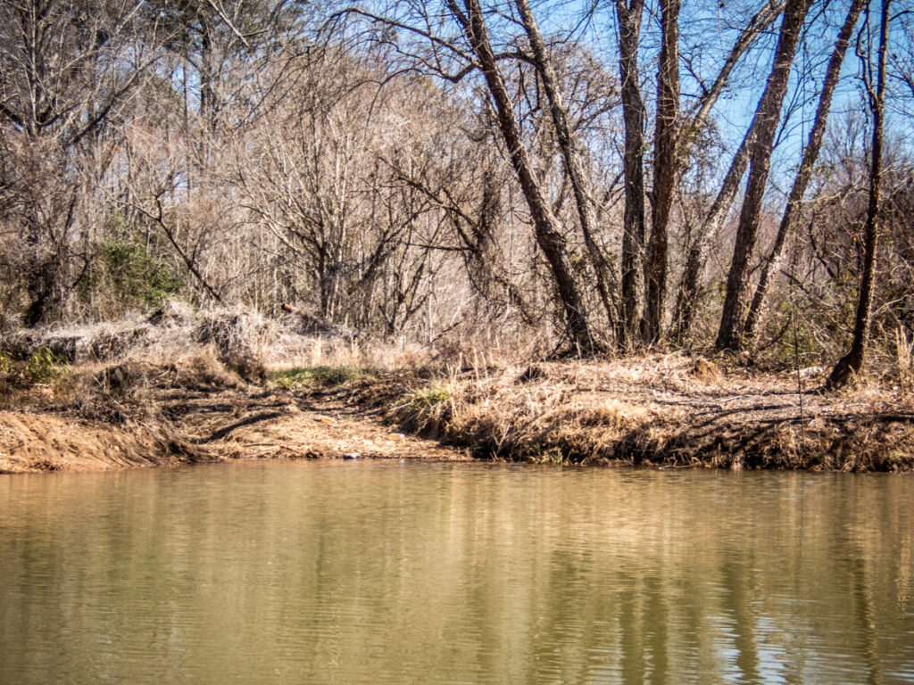
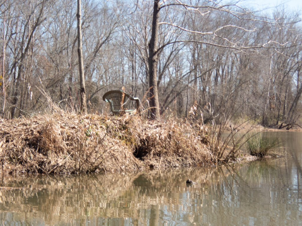
We continued on upstream. The banks held a mix of farmland and wooded areas, but with very few visible houses or other structures along the banks.
Whether hiking, biking, or kayaking I’m always tempted to keep going just to see what’s around the next bend. Such was the case this beautiful morning. However, the current was getting more noticeable to further we got from the dam, and my injured shoulder was starting to let its presence be known.
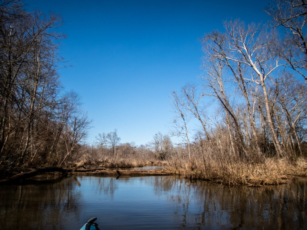
We reached a deep bend in the river and its confluence with Big Creek on the Anderson side, marked by a blue garbage can. Beyond that was a beautiful farm. On my maps it looked like Big Creek was worth exploring. While it looked deep and navigable, the entrance was blocked by a fallen log.
We made it past Big Creek and around the bend, and my shoulder decided that it had enough of the current. We turned back around and enjoyed a more leisurely paddle back to Cooley’s Bridge. We had traveled about three miles upstream before turning around.
Even though we were back at our starting point we weren’t done with this part of the Saluda River. I wanted to paddle downstream a bit, at least as far as where I had Clark’s Ferry marked on my GPS. I figured it wouldn’t be a problem with my shoulder since we would be closer to Holiday Dam and there would be less current.
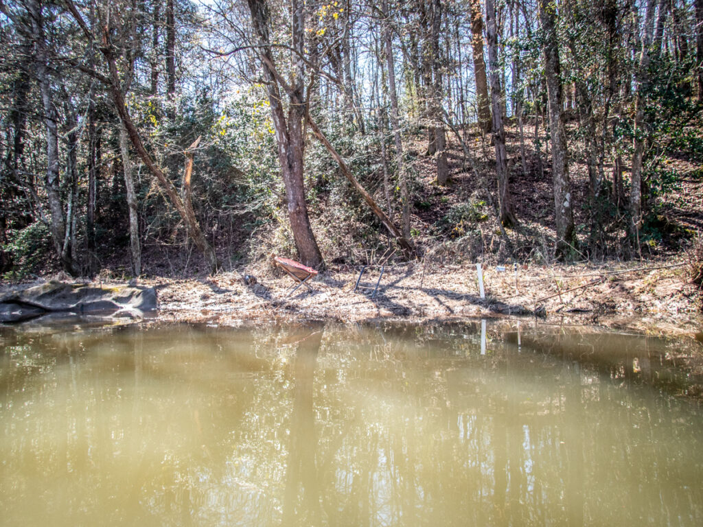
This part of the river is much more lake-like because of the impoundment. On the Anderson side wide beautiful pastures line the banks. On the Greenville side there was a dredging operation. Most of the equipment appeared to be old and rusted, as if it hadn’t seen action in ages.
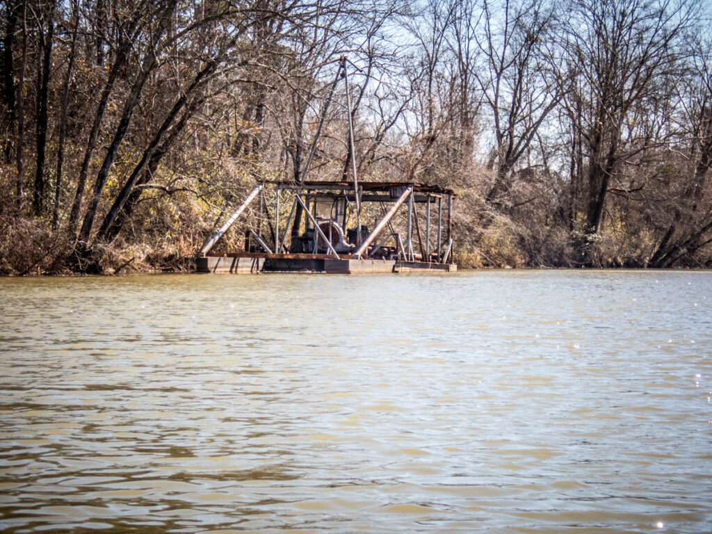
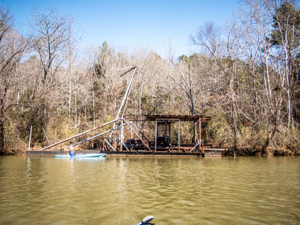
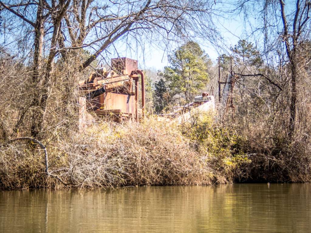
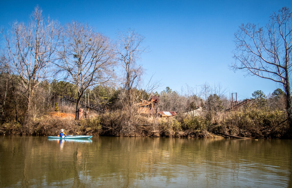
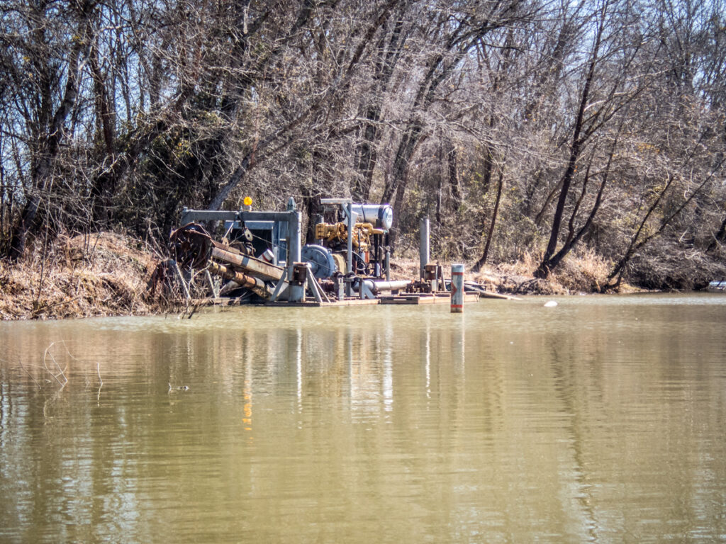
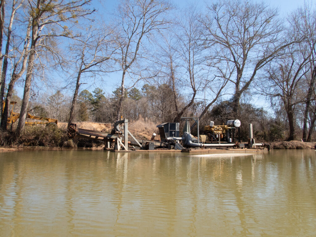
In Google Earth the dredging operation looks quite extensive, as if the sand were being used for other purposes once removed from the river.
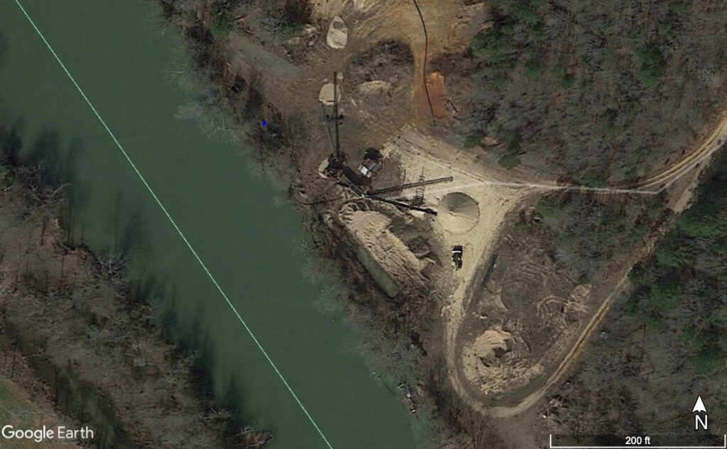
The downstream end of the dredging operation marked the location of Clark’s Ferry. There was a rough boat ramp or access to the water, but I doubt it had anything to do with the ferry. That was over a hundred years ago, and with construction of Holiday Dam there shouldn’t be any remnants of the old ferry remaining.
On the Anderson side across from the ramp there was a point, and behind that an open cove. When we went to explore there was another ramp and an old dirt road. While it may just be a farm road leading down to the river, I like to imagine that it was part of the original path to Clarke’s Ferry.
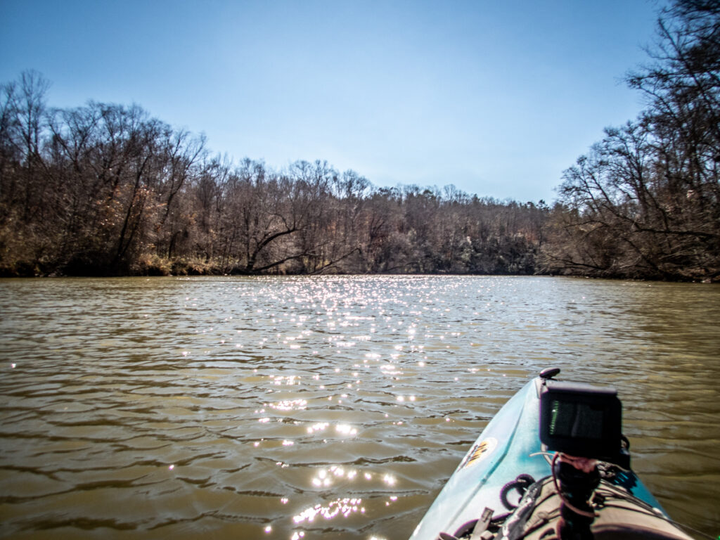
We explored the cove as far as we could, then continued downstream. My GPS showed large open areas to the east. While I would have loved to explore those, it was getting later in the day and I knew we had to paddle back upstream.
We continued downstream for a a bit, circumnavigating a small island. Alan commented on the amount of furniture along this stretch. This was obviously a popular place to fish.
We turned around and made our way back to the launch.
When we arrived there was much more activity. A man was showing his four year old son how to fish. The cute little boy was much more interested in our boats and asked us lots of questions. We tried to answer them as we loaded our boats. The boy rejoined his father, posing for a perfect Andy Griffin-esque photo which I failed to capture.
According to my GPS track in Google Earth we paddled 6.85 miles, which was pretty darn good for a first time out after an injury.
As usual, I had my GoPro do a time-lapse of the trip.
Alan and I parted ways, but I wasn’t done exploring. I first checked out the Anderson side of the river, exploring as much of the Toney Creek area as I could by road.
There were a couple of older farm houses that could have date from the time of the community, one located right on the creek.
On the other side of the river I had gotten coordinates for the Cooley Cemetery from Find-a-Grave and found the cemetery in Google Earth.
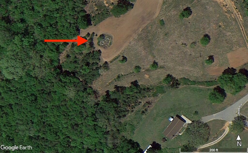
Sadly, there was no good way to get to it without crossing private property that was marked with No Trespassing signs.
I continued to explore, driving down both sides of the river and crossing at the Holiday Dam Road. It was time to head home, though, after a full day of exploration.
My final thoughts about this stretch of the Saluda? This is an excellent place for a simple out-and-back paddle. There is lots to explore both upstream and downstream between the river impoundments. The river banks range from pastoral to wooded, not littered with too many houses along the way.
The only public access to this stretch is from the Cooley Bridge launch. I hope the community can come together to preserve and maintain this asset. Trash is already starting to build up in the area. The ADA launch in Pelzer has already damage as someone tried to use the launch bench as a diving board. I’m hoping this launch has a kinder fate.
While I prefer free-flowing rivers to those with multiple dams like the Saluda, this is still a great place to get out and kayak.
One quick note regarding William Pierce….Louise Ayer Vandiver says that Pierce was murdered in 1917. I haven’t found any reference to that 1917 murder, which should have been in all of the papers of the time. Any reference I can find for a William Pierce has him placed in the early 1800s. Since Vandiver’s work was written in 1928 I suspect that this is a transcription error, so in the post above I used 1817 as the date of Pierce’s death.
I love this! We went up river there from a different launch that isn’t available now but we used a John boat. It was Trent, Jeremy & myself. Of course they were fishing but I was trying to see stuff along the River. The place where the sand equipment is used to be called sand suction area I think. My grandpa Goode used to go cut willow branches there to make his furniture. I’ve still got a couple of pieces he made. Thanks for posting this.
Carolyn Coker Patterson
Enjoyed your story and pictures. Brought back many good memories as I was growing up. My grandfather and great uncle worked at the power plant. I climbed and played all around H/Dam, up and down the river. Such good way to grow up. The time I spend there was from the 50s to 70s, sure do miss it. Thanks again for your story.
That was a very good morning!
I recognize lots of the names on the Greenville side of the Mills map. Many of those families are still in the area.
Thank you for the article and the pics. I’m a Cooley so enjoyed it very much!
Enjoyed reading your post and the pictures.
I lived on Toney Creek for a few years. It’s a beautiful part of the county. I enjoyed this article very much. I did learn about some of these stories during the time that I lived in that area!
Glad you enjoy the river. I have live in the area for 39 years.And love this river. The blue trash can you saw was mine. Both creeks goes to a bridge on Cannon Bottom road. Second creek goes all the way to the Williamston Park. The spot going down the river is a man made boat ramp which there are several more going to the dam where owners made ways to put there boats in to fish. From the bridge going up on the Anderson county side belong to the late Fred Jr. Cox. The boat ramp above the bridge was put in by Lee Steam Plant on Mr. Cox property encase they had a spill from the power plant. Yes alot of History on this stretch of river. One thing hope all the ones that enjoy the new ramp pick up there trash or if it not yours lets everyone keep this area clean for all to enjoy.
Truly enjoyed this story. I love reading real stories like this. I grew up on the Pelzer Mill Village, just a skip and a holler from the river. My grandmother Roberts of Finley St. had 5 boys and they fished and frog gigged along the Saluda when I was a little girl. They are all in Heaven now. This story brought back some very fond memories of the early 40’s Thank you for sharing your adventures.
Love your story! Hiram Cooley is my great great grandfather, and was also the school teacher at Beech Springs School. I have a picture of the ferry, which was actually a postcard.
Wow! I’d love to see that photo!
I wish I could post it here in the comments, but, I can’t seem to find the option to do so.
Hi I am also Old Hirams granddaughter. I love that you wrote about this area that’s so rich with history! Excellent read. The picture of Hiram at the school though isn’t old Hiram . It is Hiram Edward Cooley. He is old Hirams grandson. And the son of “JJ” John Joseph Cooley. You should be able to go to the cemetery up there too. The law states they must give you access to it. I’ve been up there several times but when the little old lady who used to live there met some of my fam w her shot gun when they tried ! There’s some very interesting stories about the cemetery and who’s really buried there. The spot that shows Susan , Hirams first wife (I’m not sure they were married) is not who’s buried there. If you look at the date of her death and compare to the census, she was still alive in the 1850 and 1860. Shows her living w her son John then the next one she’s “housekeeper” for the Autry family who must have lived next door. I cannot find anything after 1860. It like she disappeared. But I was told it was Hirams house maid who’s buried in her place. They had at least one son. But from what I found it was after his second wife passed away though. There’s a lot of info on the Cooley’s out there. It does get confusing bc there’s so many w the same names and their record keeping back then just wasn’t very good. Thx again !