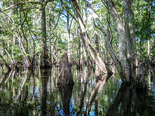
It’s a Second Saturday, and time for another Lowcountry Unfiltered adventure. This time LCU would be taking on the mighty Ogeechee River south of Savannah, Ga. The Ogeechee is Georgia’s Edisto River. It’s a nearly 300 mile free-flowing blackwater river. The section we would be floating would include cypress swampland, as well as some tidal flow.
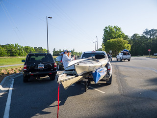
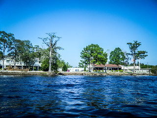
Having spent the night nearby, I had plenty of time to get a good breakfast and head over to our rendezvous at the take-out at Kings Ferry Park on Highway 17. I was the first to arrive, and took the opportunity to catch some photos in the morning light.
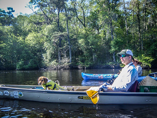
The next to arrive was Marc Epting from Columbia. Shortly thereafter we were joined by a newcomer. Jerry Crisp is a fellow tech director in South Carolina, and has been a long-time friend. He had been wanting to join our band for awhile, and finally got a boat and was ready to dive in. Jerry showed up with his wife, Cindy, who would taking off to Savannah for a day of shopping while we were on the river. They had camped nearby.
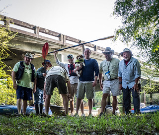
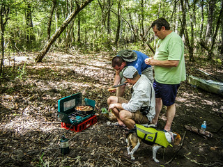
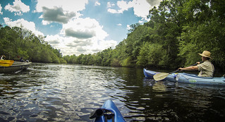
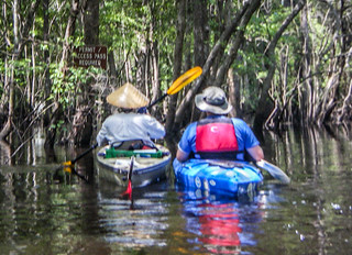
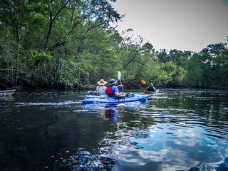
The Lowcountry contingent soon arrived. Rounding out the group were Matt Richardson and James Brown, John Ring, and his son-in-law Sean Jansen, who was celebrating a milestone birthday today. We had seven in our group – a nice number for a paddling trip. Matt’s beagle, Lucy, rounded out our crew.
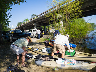
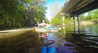
There was a slight delay as Jerry locked keys in his truck, but we were soon back on track. We left Marc’s vehicle at the take out, and drove up to the put in at Morgan’s Bridge on Highway 204. This was a smaller river access, and was already jam-packed with fishermen launching boats. Fortunately, there was a decent launch for kayaks away from the motor launch, and we were able to find a place to park the vehicles. We got the gear ready and posed for our traditional pre-launch portrait. James, of course, had to show his best side.
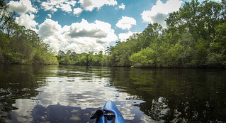
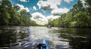
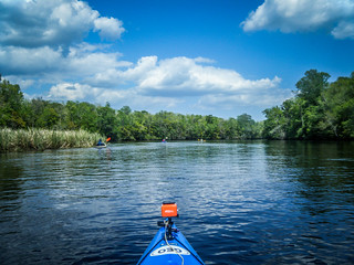
We got underway a little before 10:00 am. That was a good thing, because we had a LONG way to paddle. The weather was excellent, and there was a swift current, so the distance wouldn’t be impossible.
We were not far from Fort Stewart. As we were setting out we heard several loud booms. Each of us had radios in case we got separated, and a conversation went something like this…
Matt: Hear those booms? Must be Fort Stewart.
— pause, followed by another boom —
Matt: Tanks
Me: You’re welcome!
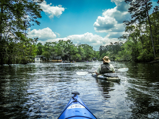
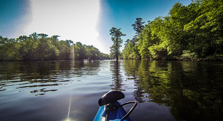
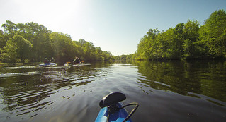
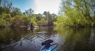
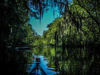
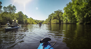
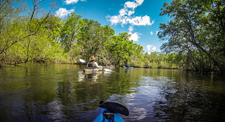
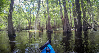
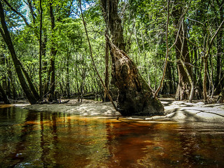
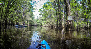
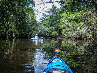
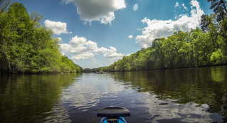
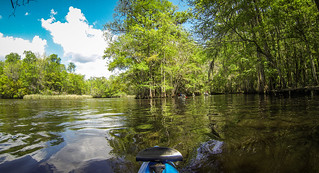
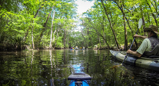
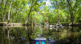
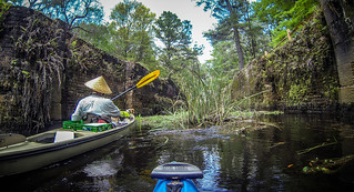
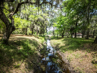
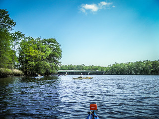
The river scenery really was spectacular. The river was wide with swooping bends, and was lined with cypress swamps on either side. We spotted one rope swing, but rejected it because of the rickety boards nailed to the tree.
Matt and I had marked lots of potential side channels for exploration. However, given the length of the trip, I wasn’t sure how distracted we really wanted to get. I was really happy that we had our radios, though, when Matt, Marc, and James took a detour through an oxbow. We were ahead, and missed the turn off. Matt said that their path took them to a nice open lake area. The rest of us continued on the main course, then turned up into the swamp to meet them.
While we got back together with no problem, we decided that if we were going to take a side route, we should ALL take that same route, radios not withstanding.
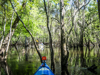
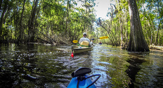
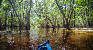
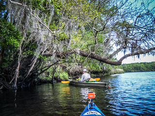
…and we had a couple of opportunities to do just that. We snagged a couple of shortcuts across oxbows that took some distance off of our route. The path was tight at times with the strong current, but never seemed to be blocked.
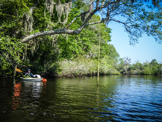
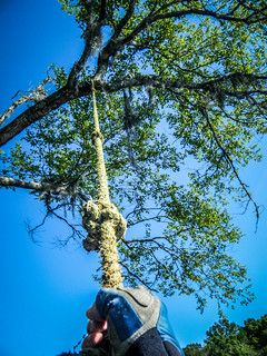
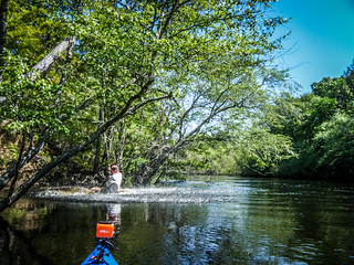
We found another rope swing. This one appeared to be much more accessible. The river bank was high, and it looked like you could swing right from the bank. Matt decided to give it a shot. It was not as successful as our Edisto ropes, though. Matt’s butt hit the water on the way down. There was no way to get high enough up on the rope for a good swing.
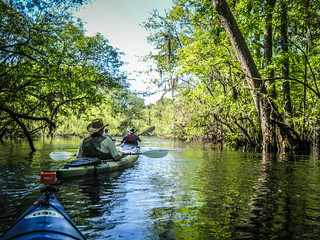
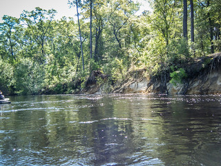
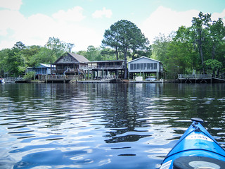
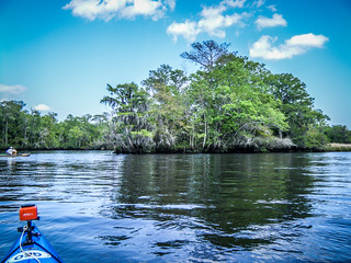
The route continued past high eroded bluffs. There were some houses along the banks, but for the most part it seemed quite remote.

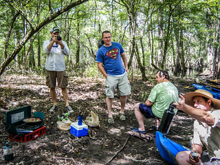
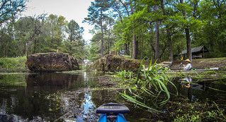
I found a nice little sheltered area out of the current, and decided that it would make a good lunch spot. John Ring had been calling for lunch since before 11:00, but I thought we should wait until at least 11:30. Since it was 11:45, the time was right, and I thought I’d found a good spot with a nice shallow landing. We pulled up the boats and got fixin’s underway for our traditional river meal – bratwurst and sauerkraut with beer.
Suitably sated and back on the water, we were once again reminded of the three minute rule. This rule states that no matter where you stop for lunch, there will be an even better spot three minutes downstream. In this case it was less than three minutes. We took another shortcut which led us through a sheltered path with beautiful sandy landing areas. As lovely as it was, though, we continued on our way.
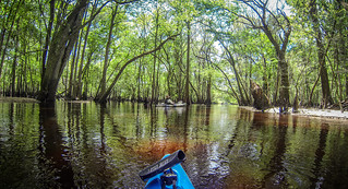
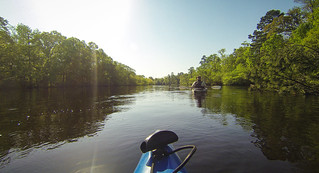
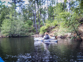
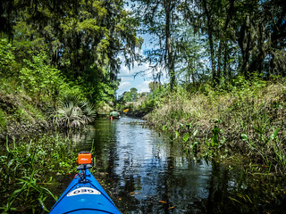
The river continued in much the same vein for several miles. The scenery was great, but unvarying.
The river split into two courses. Matt and I had agreed that the southwestern route was narrower, but didn’t have as many twists, and might be a bit shorter. When we got to the turn-off there were some disturbing signs. One was a brown sign that said that access was by permit only, and there was a number we were supposed to call. The other sign said that we were entering Fort Stewart Reservation.
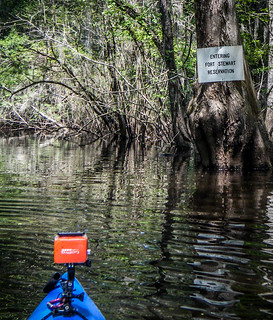
We paused. Having heard the booms earlier, we didn’t want anyone taking pot shots at us. Thinking that was not likely, we decided that the signs referred to landing on the area, and decided to continue on. The route was narrower, but was easily navigable. The entire time there was great current.

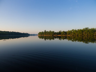
At the confluence of the two routes the river took on a different character. It was much wider, and there seemed to be more houses along the banks. The confluence was right at the Fort Argyle community. Even though it was wider, there was still a good current.

We had another stop along the route. About a mile down from Fort Argyle is the entrance to the Savannah-Ogeechee Canal. The canal was built in 1831 and connected the Ogeechee River with the Savannah River over its 16 and a half mile route. It carried barge traffic through a series of locks – two tidal locks at the entrances to the Ogeechee and Savanah Rivers, and a four lift locks along the course. It was in operation until the 1890’s, quite a long time for a southern canal.

Since it was in operation so late, there exist photographs of the canal while it was in operation.
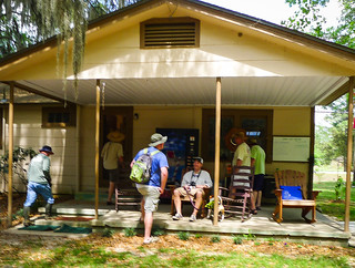
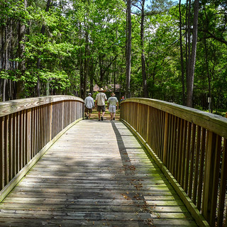
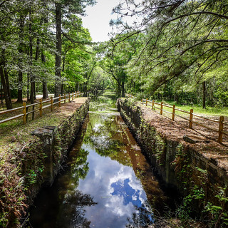
The Savannah-Ogeechee Canal Society now operates a museum on the Ogeechee side of the canal. There are boardwalks along the canal to the river, and a small museum hosting artifacts from the area.
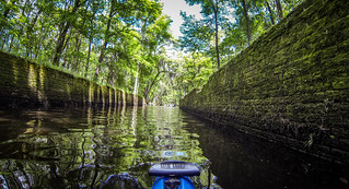
The entrance to the canal was marked by brick walls that once lined the tidal lock. We turned in and headed up the canal.
The canal was about thirty feet across, and we paddled several hundred yards away from the river. We passed one fishing boat, and continued until we reached one of the lift locks.
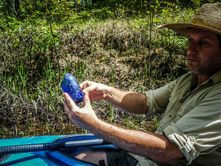
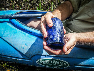
We continued past the lock and under a bridge near the museum displays. The canal narrowed down to about 12 feet. Here James found pieces of a blue bottle with a date around the end of the canal’s operation.
At the highway 204 bridge I could go no further. Unfortunately, a twelve foot channel made turning around in a fourteen foot boat difficult. I had to backtrack until I could do a multi-point turn, but eventually I got turned back around.
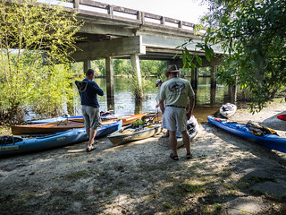
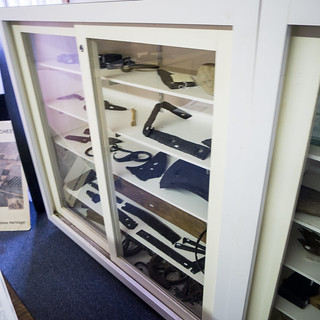
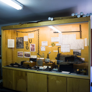
On the other side of the lift lock we decided to get out and check out the museum. There was a model of the lock mechanism and several other displays.
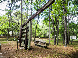
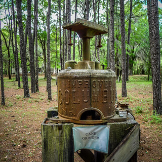
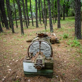
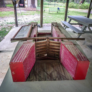
The museum itself was small with only a couple of rooms. There were display cases with artifacts.
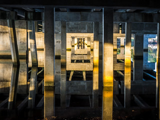
After relaxing a bit we headed back to our boats. The bridge across the canal had nice views of the route.
We headed on back to the river. Across the river from the canal was a series of pilings that marked the location of a bridge that had been destroyed by Confederate troops to prevent Union troops from getting across.
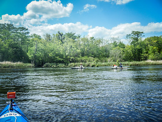
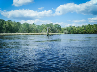
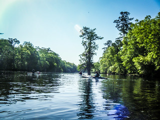
The river stretched on for several more miles. By this time boat traffic was increasing, and there was a distinct change in the type of boats we were encountering. Instead of small john boats, there were pontoons and flats fishing boats with larger motors. The wind also picked up, and I think we were getting some tidal influence. We were also tired, and paddling against the wind was not fun.

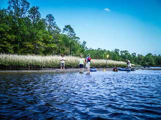
We had marked several geocaches along the route, and Matt and I stopped at an island to find the first one. When it looked like we would have to do some bushwhacking, we gave up and continued on our route. The rest of our group was waiting for us on a sand bar downstream.
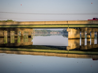
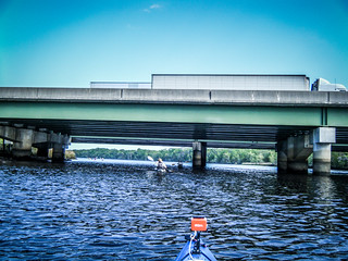
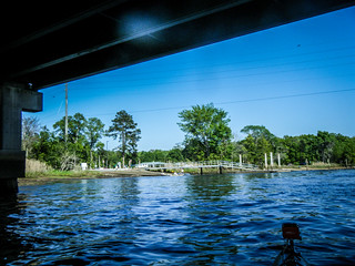
Eventually we reached the confluence with the Canoochee River, and beyond that, the I-95 bridge. We had been hearing traffic from the Interstate for quite awhile, so we knew we were close. I always get a bit nervous floating under interstate bridges, especially with large trucks and lots of traffic.
Now it was just a short hop to the Highway 17 bridge and our take-out. On the upstream side of the bridge was Love’s Seafood. Prom couples in fancy dress were posing down by the riverbanks. We thought about photobombing them. Eventually, though, we reached the end of the trek. It was 4:30 and we had been on the water for six and a half hours.
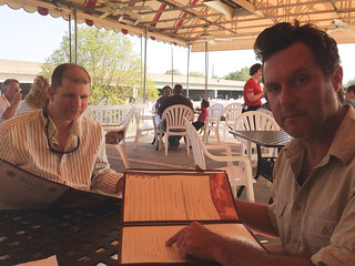
We ran the shuttle and got the boats loaded back up. The others had places to be, but Matt, James, and I were hungry. We decided to try out the local seafood. It was crowded, but there was room for us on the deck. Even dressed as river rats they let us in and amongst the prom crowd. The food was excellent, and it was a great end to an incredible day of paddling.
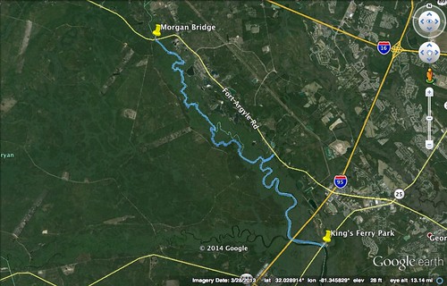
In all we had paddled nearly 16 miles. Here’s the route:
John Ring has posted his photos here, Matt has his photos on his Flickr site here, and the slideshow with all of my photos is below:
[fsg_gallery id=”43″]
What a great paddle. Nice write up Tom.