NOTE: Once again, I’m playing catch-up. I had interrupted my Newberry ramble with a couple of other posts that were a bit more time-sensitive. Now we’re back to our trip from a couple of weeks ago.
My sister Glynda and I had been on a photo trek across Newberry County searching for old schools and churches. We had left Newberry and dipped down into Saluda County for a bit. We would eventually make our way back to Newberry and make some more discoveries.
From Corinth Church in Saluda we briefly dipped into town, then decided to visit the old Emory School while we were close. This is probably one of my favorite old schools in the state, and is in an excellent state of repair. I’ve taken many photos (one of which appears on the SCIWAY link above), but decided that a couple more were in order.
From Emory we headed back into town, then took a route that took us past things that I’d photographed many, many times, but that Glynda hadn’t seen. Subsequently, I didn’t take many photos along this stretch.
We left Saluda on US 39 and headed north, crossing back into Newberry County over the Saluda River. I took a quick detour to admire the new river access point on the Saluda County side of the river. This is MUCH better than the steep haul we had last time we tried to kayak this stretch.
We reached the intersection of Highways 34 and 39, and I turned down the old Main Street a block away so that Glynda could see the Ghost Town of Chappells. I’ve written about and photographed the old town many times, the latest being an article for the South Carolina National Heritage Corridor. This time we just observed, and I didn’t take any photos.
We headed east on 34, toward the town of Silverstreet. Before we got there, though, I spotted Old Town Road. It was a dirt road, and our rambles MUST include at least one dirt road. There were other reasons I wanted to check this one out, though.
The Saluda Old Town Site was once a town occupied by a branch of the Cherokee. In 1755 a treaty was signed by the Cherokee, basically ceding control of the land to the King of England. A mural in the town of Saluda commemorates the event.
The site is on the National Register of Historic Places, but since it is still an active archeological site, the location is redacted. Even so, the GNIS data for the site had it placed at the end of this road, and I wanted to at least see where it went.
The road led past farm lands and logged fields. Deer stands dotted the area. A couple of miles down we finally came to a gate with a No Trespassing sign – end of the road, literally. I suspect the old town was on the banks of the Saluda River, but there would be no way to check at this time.
Back out at the intersection of Old Town Road and 34 we noticed something strange. There was an older farm house, and behind this someone had built a miniature town, complete with church, and other buildings. There wasn’t a good way to take photos, but I want to come back down this way.
We headed back east, and soon found ourselves in Silverstreet. We took a turn through the town, passing the old school, but not stopping for any more photos. I guess we were getting tired by this point.
I had a couple more spots I really wanted to check out. These were north of Newberry. GNIS had a Quaker cemetery located in the Bush River community. Our father had started his teaching career at Bush River High School, and we wanted to check out that location as well. We only drove past the old school location with out stopping. The old gym is still there, but the school burned about 20 years ago. We didn’t stop for photos.
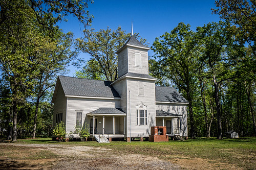
The Quaker cemetery also turned out to be a bust, but led to an even more interesting discovery. The location GNIS had indicated was actually the cemetery for Bush River Baptist Church, located behind the church building. The headstones were far too new, and didn’t really catch our attention.
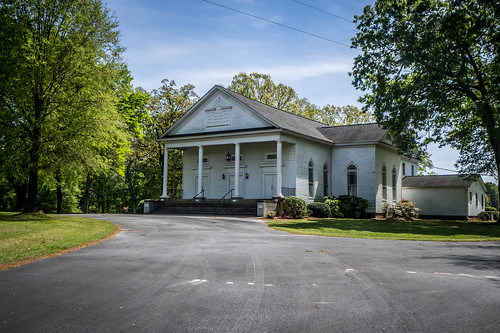
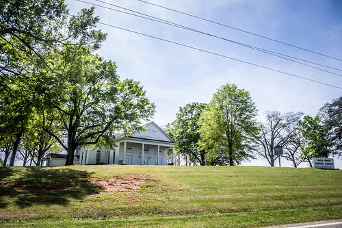
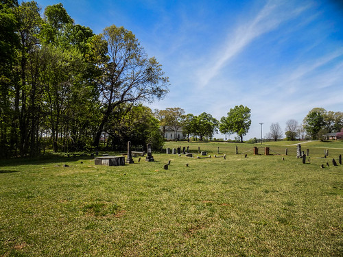
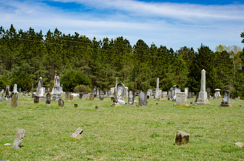
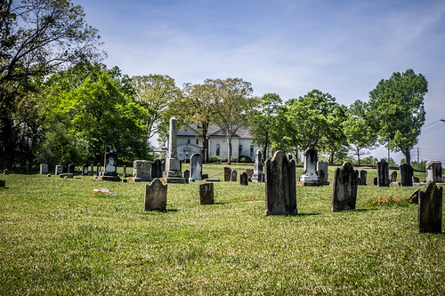
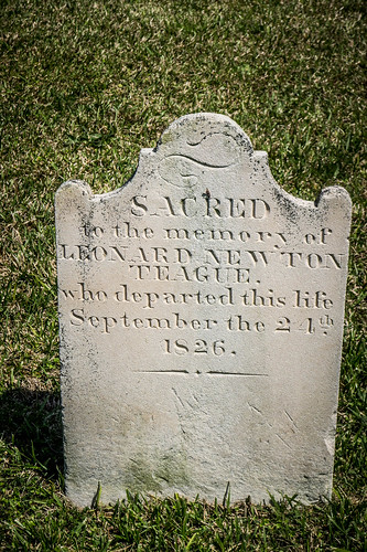
We were about to give up and head back home when we spotted a much older cemetery just south of the church. It turns out that this was the original, and the one behind the church is the newer cemetery.
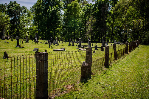
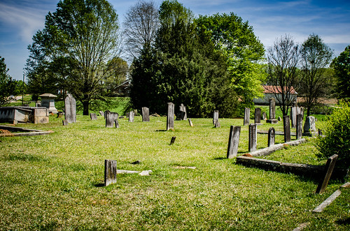
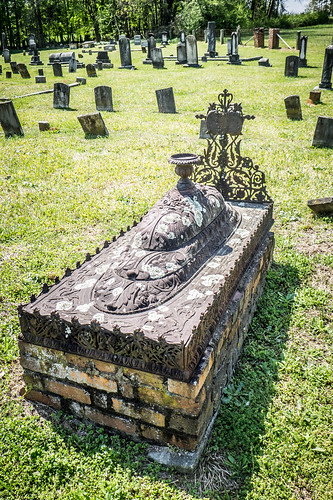
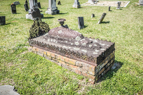
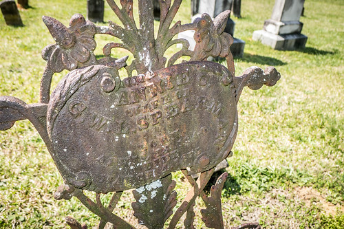
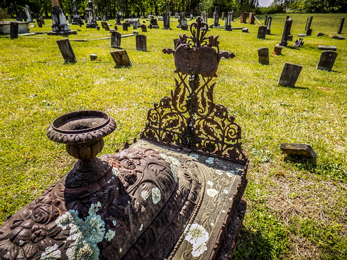
The stones here were very old. This first thing that caught our attention, though was a very unusual cast iron crypt. The crypt was ornate, and included a place for a vase on top. The grave was for Annie Spearman, who had died in 1875.
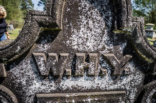
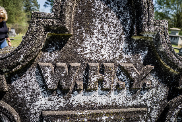
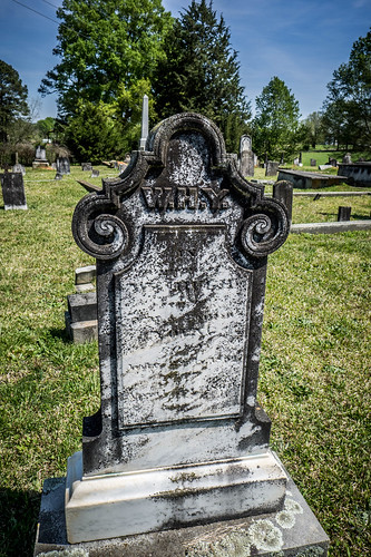
Another headstone caught our attention. This one seemed to ask the question Why?

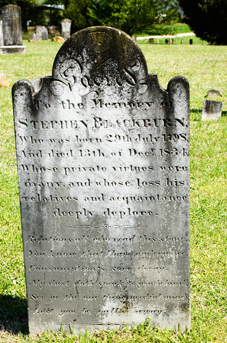
It wasn’t actually a question, but the initials of the deceased, William Hugh Young, who died in 1884.
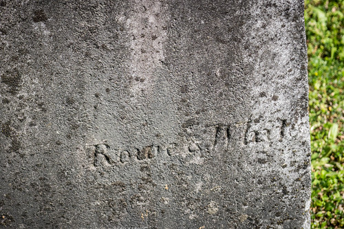
There were a few signature stones here, including one from the firm of Rowe and White.
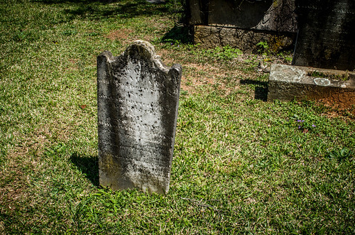
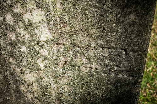
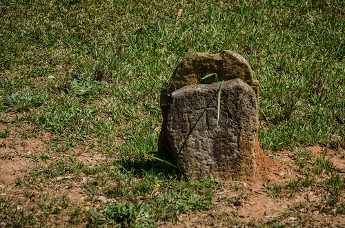
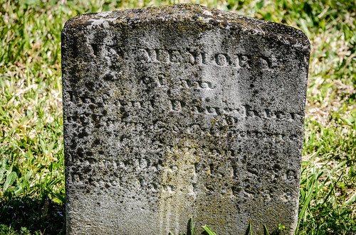
There were a couple I didn’t recognize. The letters had weathered too much, and were now illegible.
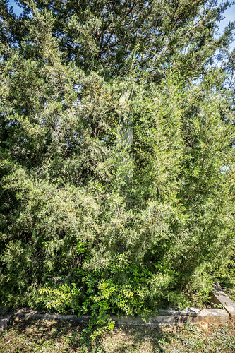
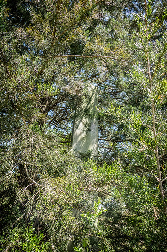
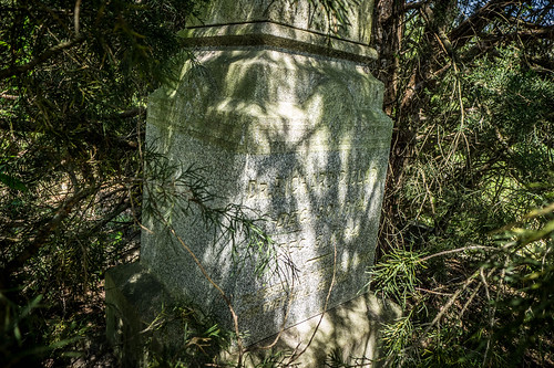
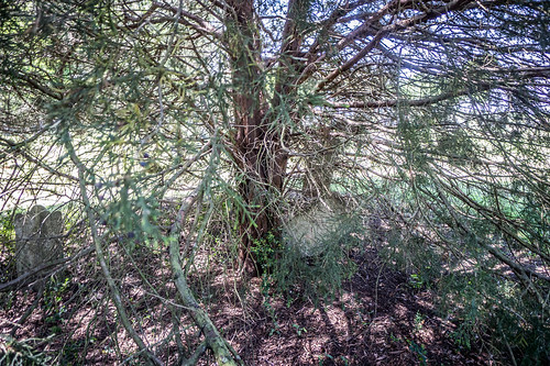
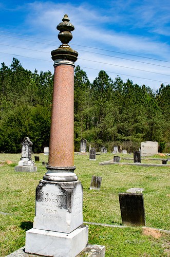
There was a tall obelisk that had been completed consumed by a cedar tree. It was part of a family plot, and there were smaller stones hidden beneath as well.
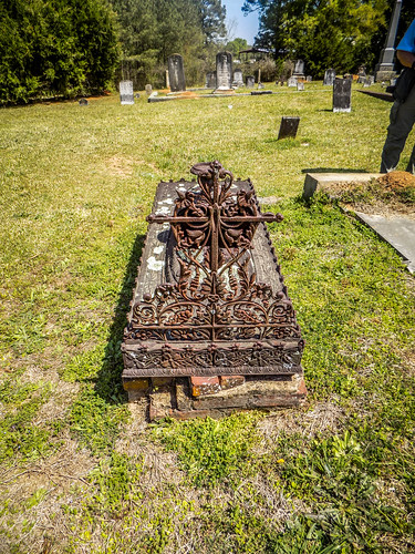
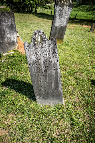
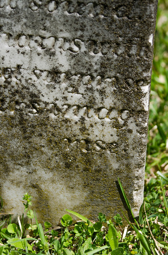
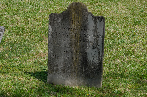
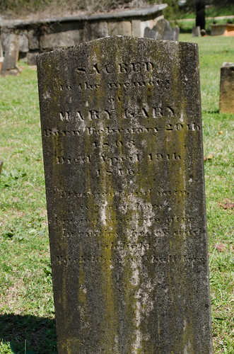
We wandered among the historic stones, looking at the funerary art and inscriptions.
By this time we were worn out. We had visited several historic schools and churches, and had tons of photos. It was time to head home.
As for that Quaker cemetery we missed, turns out GNIS had the wrong location. Not the first time that’s happened. The actual cemetery is located southwest of Newberry on Dennis Dairy Road. I was able to find a listing for it on Find-a-Grave. Maybe next time.