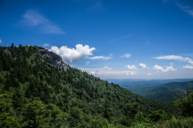
Three times this week I have made treks northward, crossing the Blue Wall into the mountains of Western North Carolina. Two of those trips covered similar ground. Only one was in the new Mini convertible. All three covered ground I’ve traversed recently, so some of the photos may look a little…familiar.
Monday – Picnic at Davidson River
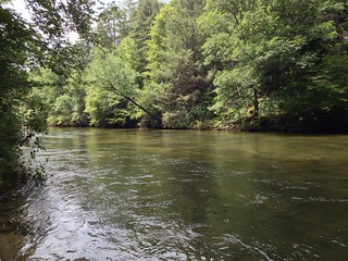
Last weekend Laura’s sister and mother were with us. The weather looked good for Monday, so we decided to take a trek up to Pisgah Forest for a picnic. We had done this trip with Laura’s cousins a couple of years ago, and her mom had loved the sound of the Davidson River rippling past our picnic area.
For this trip we loaded everyone into the Subaru and first headed up Highway 25 toward Hendersonville. We took a brief detour through Tuxedo, then turned toward Flat Rock. At Flat Rock we took Little River Road toward Crab Creek westward, toward Brevard. The weather was clear and spectacular, with large fluffy white clouds and blue skies.
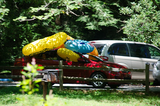
We reached Sycamore Flats and found it hopping for a Monday. With the extra rain and higher river levels, there were lots of tubers. However, we were able to find a table near the river.
After lunch we continued on up Highway 276 into Pisgah Forest. I had planned to stop at Looking Glass Falls, but close parking was impossible. We continued on. As we drove up the mountain we spotted lots of picnic tables along the road with water running close by that would have also made nice picnic spots. We’ll have to remember that for next time.
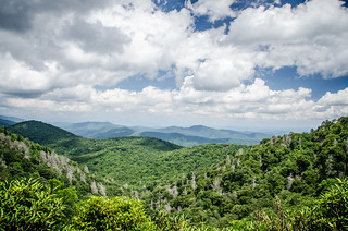
We reached the parkway and decided to turn west. The skies were truly spectacular. We stopped at several overlooks and generally took our time meandering along. Several locations, such as Graveyard Fields, were quite crowded, even for a Monday, so we didn’t stop at those.
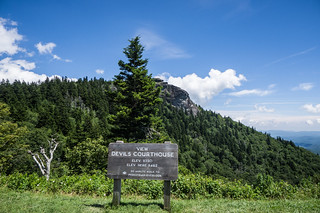
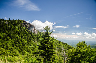
We reached the overlook for Devil’s Courthouse and decided we better check our route. As I looked at the map I realized that there wasn’t an easy way to get home given the way we were heading. We decided to retrace our steps back a bit, then head eastward toward Asheville.
We had a brief stop at Mount Pisgah, then continued on our way. It was a great day to be out on the parkway and in the mountains.
Thursday – Back to Brevard
On Thursday my sister Glynda and my mother came up to the house, and we decided to take another trip into the North Carolina mountains. The day was a bit foggy and overcast, but the forecast was good, so we got an early start to the trip. This time the route was a bit different. Instead of heading up Highway 25, we took 276. The day was a bit foggy and overcast, but the forecast was good.
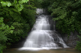
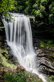
Our first brief stop was at Wildcat Wayside. Since it was still early morning, the lighting was great to do some longer-exposure shots of the waterfall.
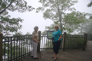
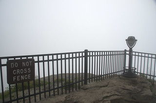
We continued up the twisty road to the top of Caesar’s Head, where we decided to stop and take a look. The overlook was completely socked in. From below we had seen a cloud hanging over the mountain, and now we were in the midst of it.
We continued on our way toward Brevard. We drove through the town looking for a place to stop for lunch, but eventually found ourselves at the entrance to Pisgah Forest, yet again. We stopped at a barbecue place called “Hawg Wild” for lunch, then continued on into Pisgah.
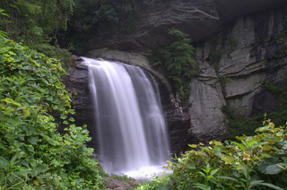
By this time the clouds were starting to build. We weren’t having the nice sunny weather from Monday. Mom had wanted to see Looking Glass Falls, so that was our destination. It was just as crowded as it was on Monday when we arrived, with no parking. However, we circled back around in time for a place to open up for us, so we stopped. As many times as I’ve shot these falls, it’s worth it do take a few more photos.
Unfortunately, as I was taking my shots the rain started. I rushed back up the steps to get the car unlocked so everyone could get inside. I still wound up getting a bit damp.
We headed back toward Brevard, crossed through town, then headed west on Highway 64. My niece is getting married up here in September, and we wanted to check out the wedding venue. We reached the town of Rosman, then turned southward on 178. However, that route was short-lived. 178 was blocked off due to rock slides caused by the recent rains.
We took East Fork road, which wound through the farmlands along the banks of the east fork of the French Broad River. It was some of the most scenic farmland, with the rippling river next to the road. I didn’t stop for photos, but we drove on enjoying the view. Eventually we did find the venue, and pulled in to take a look. Again, I didn’t really take many photos for some reason.
We continued on East Fork until we got to Gladys Fork Road. This road wound through the mountains until it connected with the road that leads to the top of Sassafras Mountain. The was more traffic than usual on this route, as it was part of the 178 detour. We decided to head to the top of the mountain and visit the overlook there.
By this time Mom was getting tired, so we decided to head on toward home. We took 178 through Rocky Bottom and back to Highway 11, then on home. It was another great day out in the mountains.
Friday – Waterfall Hunt with Ken
I had to take Laura to the airport for a weekend meeting. That meant that I got to drive the convertible. After dropping her off I headed to Clemson to check out Ken Cothran’s new digs. He had just moved into a new place, so I used it as an excuse to drive the convertible a bit more to come over for a visit. Ken had the day free, so we decided to drive even more, still, and go hunt some waterfalls.
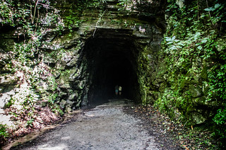
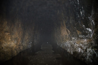
We first headed north across the lakes, stopping briefly in the town of Newry. We drove on through Walhalla and headed up Highway 28 toward Stumphouse Tunnel, where we stopped for a bit. With the heavy recent rains, the tunnel was very damp, with only a narrow path that wasn’t flooded. I didn’t have a flashlight with me, and made a mental note to equip the new car with one. Neither of us were wearing proper footwear, so we didn’t really venture inside, but took a few photos around the entrance area.
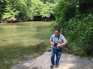
We continued northward on Highway 28. We stopped for a few minutes at the banks of the Chattooga River at the river access before crossing the SC-Georgia border. As always, it made me long for a boat to put in the water here.
We continued on up Highway 28 until we reached the town of Highlands. We found a place to park and grabbed a bit of lunch in the little. As always, the place was jam-packed.
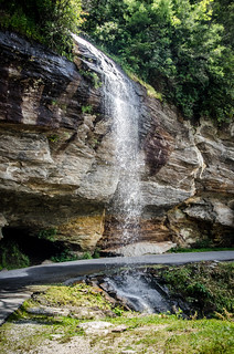
We decided to continue on up the Cullasaja Gorge and photograph the waterfalls along that way. First up was Bridal Veil. There were lots of bikers and other visitors at the falls.
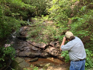
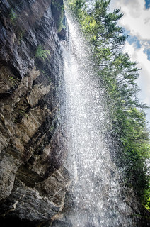
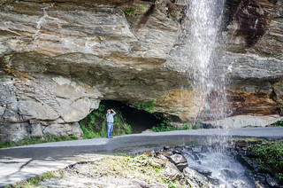
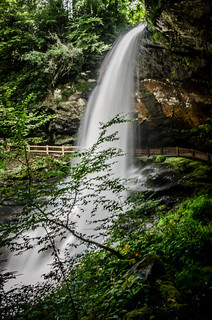
Not far on up the road is the pull-off for Dry Falls. We spend a good bit of time here, walking down to the falls and passing behind them to the other side. The rains meant there was lots of water coming over the falls.
We had hoped to stop at Cullasaja Falls, but the road there is treacherous, and stopping for a photograph is problematic. You can only stop if you’re coming from the other direction, and even then the pull-off is barely enough to get you off of the road. I wish they could develop a better overlook.
We continued down the gorge until we got to Franklin, then headed on 441 toward Silva, roughly tracing the same route I had taken a few weeks earlier. Once again, at Dillsborough we headed south through Cullowhee, along the banks of the Tuckaseegee River. We drove along without stopping until we got to Cashiers, then headed on down Highway 107 southward.
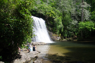
At the pull-off for Silver Run Falls I stopped and pulled in. There weren’t as many cars as when I had stopped on my previous trip. It was getting to be nearly 4:00 pm, so I figured there wouldn’t be many folks. We hiked down the short trail to the falls.
These falls make the perfect swimming hole. At the base of the falls is a shallow, sandy area perfect for wading. Beyond that is a deeper area for swimming. While it’s still warm weather I’m tempted to come up here early and just hang out for a few hours.
As we hiked back we passed at least three families on their way down. I guess the after work/after school crowd was starting to gather. A large SUV had parked next to me, and backing the Mini out onto the busy mountain road required Ken’s assistance to watch for me.
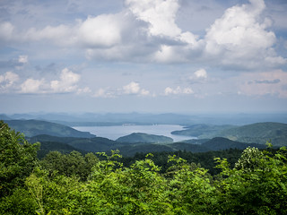
We continued down 107 until we got to Highway 130. There we turned toward Whitewater Falls. Along the way is one of the best overlooks for Lake Jocassee.
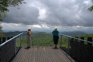
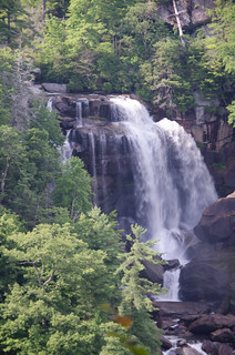
At Whitewater Falls we just walked up to the upper overlook. I hadn’t brought a tripod, and I was in the mood to tackle the 150 steps down to the main overlook. Still, the views were spectacular.
At this point I was feeling a bit sunburned from being out in the convertible all day. We drove on back to Clemson where Ken and I parted ways.
So, three days, three mountain routes, and at least 10 waterfalls later (only a few of which we actually photographed), I think I’ve fairly well covered the mountains along the North Carolina-South Carolina border this summer.


I’ve said it a number of times already, but I’ll say it again. Y’all made a great choice in buying that Mini. Wow! Haven’t enjoyed a car ride that much in forever. And Silver Run Falls …. yes, that has to be a “hang out” one day. Spectacular “fun” location and beautiful place. Thanks!