It was as I suspected. The new Flickr Maps application does not use EXIF data, but some proprietary format. If there is existing EXIF or GPS data for an image, Flickr can import it, but other than import it doesn’t use that data.
This means that if an image is geotagged using Flickr’s handy map feature in Organizr, it will not be readable by Robogeo, Flyr, or Yuan Maps unless the image is triple-tagged, or if GPS information is already in the EXIF data.
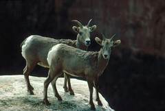
 I tried an experiment with one of my images. This shot of sheep at the Grand Canyon was geotagged using Yahoo’s interface. It wouldn’t show up at all in Flyr. I added the tag "geotagged" without adding the other two tags, and even that wasn’t enough to get it to work. If you want your images to play well with all applications, you’re still going to have to either triple-tag or put the data in EXIF. Fortunately, there is a quick way to convert from Yahoo’s data back to triple tags. Flickr user aemkei has created a bookmarklet app called "loc.alize.this" which will read the Yahoo location data and convert to triple tags. It’s still a workaround, though.
The reason for this confusion is fairly simple. Flickr is a Yahoo company and would like everyone to use Yahoo maps. The above mentioned applications use Google Maps and Google Earth, Yahoo’s competitors. Yahoo has no interest in making this easy.
It seems to me all of these companies could agree on an XML-based system for geotagging. Google Earth’s KML format would be a step in the right direction. Once again information standards take a back seat to competition.
[tags]geotagging, Flickr Maps, Flicker, Yuan.cc, Robogeo, loc.alize.this[/tags]