So far it had been a great week in Florida. I had gotten out on the kayak for at least one paddling trip each day. In some cases, twice. Doesn’t hurt when you’re staying at a place with a boat ramp right into the Indian River.
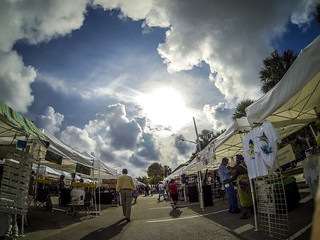
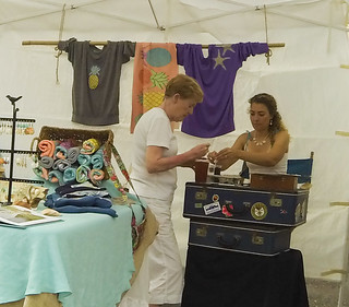
This was our last full day in Fort Pierce, and we were going to jam it full of activities. The morning started with a trek out to the Saturday morning Farmers Market in downtown Fort Pierce. We got some vegetables, did some people watching, and Laura was even able to find a cool hat to wear in the Mini Convertible out on the artists section of the market.

When we got back from the market, Laura and Amy headed out for some shopping, and I headed out on the kayak. Most of my treks had been averaging about four miles, and I was determined to get at least one long trip in.
Earlier in the week I had checked out the old inlet area. However, I just scratched the surface. I had noticed that it looked like the edges of the mangroves were pretty straight and somewhat unnatural in that area. The channels are wide, but are too shallow for larger boats.
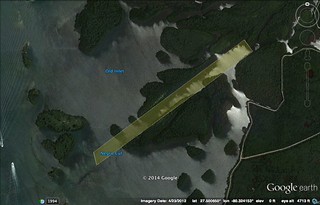
According to Amy, the old channel opened to the ocean at the current location of Pepper Beach on North Hutchinson, and led to the Indian River right across from the old Saint Lucie Village. That’s why Saint Lucie is where it is. Amy had said that the old inlet had been the primary inlet until a hurricane closed it. I wanted to get more data. When did this happen? Which hurricane?
It took awhile to find some information on the old inlet. It must be said that I found all of this information AFTER the paddling trip. It might have been helpful to have it while I was out there.
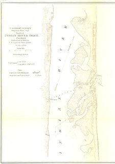
The Indian River Inlet was a natural, albeit unreliable inlet. A sediment analysis report of the Fort Pierce Inlet I found had a description of this area…
A preceding natural inlet also known as Indian River Inlet existed approximately 2.85 miles to the north of the present Fort Pierce Inlet. The inlet channel shifted regularly remaining navigable for small boats (Walton, 1974). After 1892 when St. Lucie Inlet was opened, Indian River Inlet became unusable due to shoaling. The development of the deepwater port of Fort Pierce started with the dredging in 1921 of a channel and an artificial inlet through the land barrier separating the Atlantic Ocean from Indian River east of the town of Fort Pierce, Florida.
That answers part of my question. It shows up on old maps as Amy described it, however, on maps much later than the sediment report suggests. The earliest one I could find was from 1861 and shows the old channel, as well as the predecessor to Saint Lucie, Fort Capron.
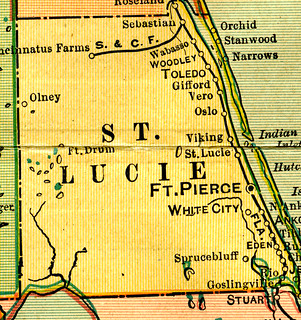
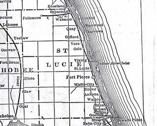
The new Saint Lucie Inlet was opened in 1892, yet maps from 1905 and as late as 1920 still show the channel at the old inlet location.
I still didn’t have a clear answer, and I couldn’t find any record of the hurricane that Amy described. All I knew was that the channel was there, and now it isn’t.
But, back to the morning’s paddling trip…
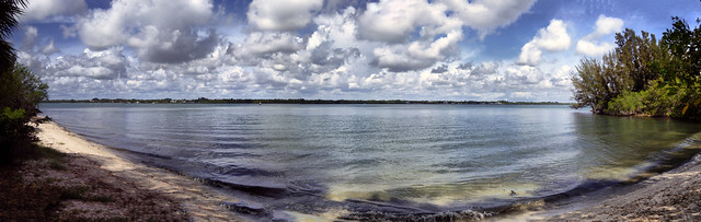
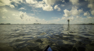
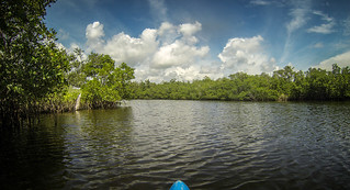
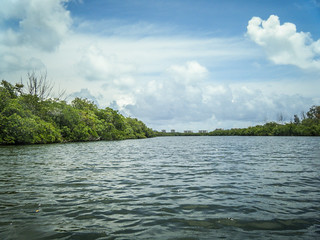
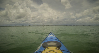
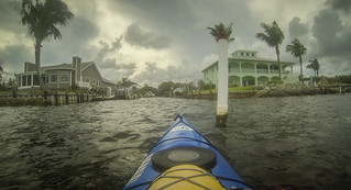
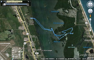
It was a recipe for disaster. All I had was a vague notion of where I was going I had no waypoints uploaded to a GPS, and I was heading out during the heat of the day during summer in Florida. At least I had emergency shelter should a rainstorm arise. I headed out on a slightly bumpy channel with a breeze, roughly imitating my trek from earlier. Even with a slight bump, the water was exceptionally clear, even far out into the river.
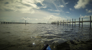
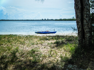
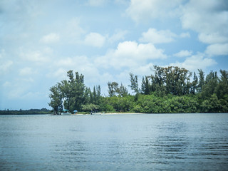
This being a Saturday, there was LOTS of boat traffic out and about. Even so, I was able to cross the ICW channel at its narrowest point without incident. I crossed over to the spoil island and pulled around to the little beach on the other side.
Once I caught my breath a bit, I considered my objective. I wanted to make it at least to Jack Island, where Laura and I used to enjoy birding. In Google Earth it looked like there could be some channels leading westward that might lead to Little Jim Bridge. There I could grab a burger and a cold one before paddling back. Boy, was I wrong.
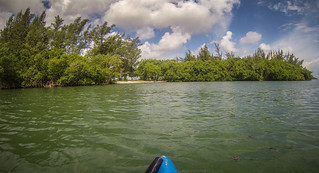
I headed into the shallows. Mullet were jumping all around me and the water was still crystal clear. I turned onto the old channel, and before long was completely lost and turned around. I was zig-zagging through the mangroves, and it was blazing hot.
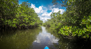
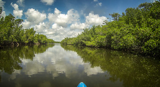
Every channel looked the same as every other on. It was a maze.
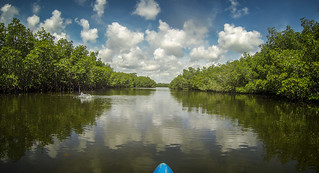
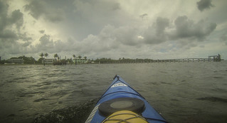
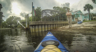
Eventually I saw that the condos on the island were much closer. I was getting close to the inlet. Instead of mangroves there was actual land, and what appeared to be a road along the water’s edge. I thought I had made it to Jack island.
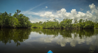
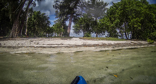
Finally I found myself in a lake-like enclosure. However, the only way in or out was the way I’d come in. There was no outlet. I tucked back into a bit of shade and retrieved my iPhone to check the map.
I learned two things. First, the map was almost totally useless for navigation. There wasn’t enough contrast between water and mangrove for me to make sense of it. Secondly, I was hell and gone from Little Jim Bridge. I wasn’t even halfway there. My best course of action was to try to find a way back out to the main channel and head home.
As I was looking at the phone I drifted a bit. The bow of my kayak ran into the mangroves, knocking the GoPro off of its adhesive mount. Shades of Bear Creek lake flashed before my eyes. However, I had it safely tethered, and it was floating safely beside me. I retrieved it.
I finally found myself on the long straightway I’d seen earlier in Google Earth. After a few hundred yards of paddling I could see boat traffic out on the main river in the distance. I was no longer lost.
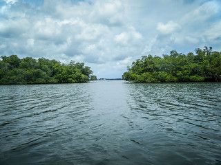
Back out on the main river I could see that I had come out not far from where I had entered the mangroves. It was a bit disappointing, really. I pointed the boat back to my favorite spoil island and headed back for a brief layover before pushing home.
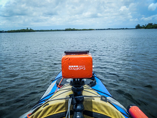
My island had gotten much more crowded. There were several boats, including one guy who was new to kayaking (he was in a motor boat right then) and wanted some pointers. Another group was asking questions about my GoPro, which I now had sort of rigged right behind my deck bag. I answered their questions, but none of them offered me a cold adult beverage in return. It was time to head back home.
It was an exhausting, long paddle back. Mermaid heads formed in the waves as I finished off the last of the water I’d brought.
I made it back safely to find Laura waiting with concern on the boat ramp. My text message that I was lost had worried her, even though I’d sent a follow-up that I could see the channel and all was well.
Even with getting lost I’d only covered a little over six miles. I’ve done much longer trips, but it seemed this one was more tiring. Perhaps it was a cumulative effect, from all of the other trips taken during the week.
Regardless, it was a great week of paddling. In the morning we would be leaving early for the ten hour drive back to Greenville. Now THAT would be truly tiring.
Here’s the slide show from ALL of the places that we visited this time around:
[fsg_gallery id=”49″]
You confused your inlets. The St Lucie inlet (1892) was further south & had nothing to do with Fort Pierce, Fort Capron or St Lucie Village. The old Indian River inlet was replaced with the Fort Pierce Inlet.