
The original plan for today was to paddle Sparkleberry Swamp at the upper end of Lake Marion. However, one of our fellow paddlers fell ill, and he was the one who had suggested the trip. While Sparkleberry would have been great, we used this as an excuse to stay a bit closer home, so Alan and I headed back up to Lake Jocassee.
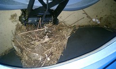
The weather was not cooperating. I loaded the kayaks into the truck in a light sprinkling of rain, which increased to a downpour just after I got them tied in. It didn’t help that I found a bird’s nest in one of my boats. This is especially weird since I had used that same kayak just two weeks ago. This nest was complete, with broken eggs. Those birds must have been busy. Since the nest looked abandoned and broken I didn’t mind removing it.

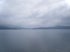
It rained on us just a bit more as we drove up to Jocasee, but by the time we got there the rain had ended. There were clouds and fog, but it looked like we would be OK weather-wise.
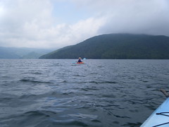
Our float plan was to follow a path I’d taken back in August. This was the first time Alan had paddled the lake in nearly 20 years. Back then we took my old battleship Coleman canoe across to Double Springs Point and back. Alan had never been to any of the waterfalls. So, we decided we would hit Wright Creek Falls first, then play it by ear from there.
When I was here about a month ago I had bought a really cool map of the lake at the Devil’s Fork State Park camp store. Not only does the map show the lake, but it shows depth contours underneath the water, as well as the roads and communities that were inundated when the lake was formed in 1973.

As we crossed the choppy water, it was hard not to think about Attakulla Lodge, Mt. Carmel Church, and the other communities that had been flooded. It’s been said that some older long-time residents of the area stay away from the lake because of the cemetery beneath the lake.
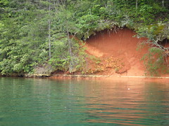
We crossed the main body of the lake and entered the Thompson River branch. As with my paddle earlier this spring, the water levels were quite high. Once again the beach areas of the various coves were under water. However, the water wasn’t quite as high as the last time. Running around the lake at exactly the same level was a yellow line of pollen. It almost looked like someone had taken a chalk line and snapped it around the lake shore.
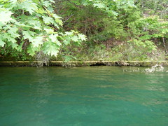
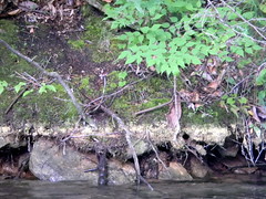
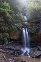
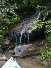
We found one small waterfall on an unnamed creek and stopped to explore. Someone had put together an improptu grill and used the place as a camp area. The falls themselves had lots of downed limbs and other trees, making photography difficult.
It was about noon, and Alan asked about lunch. I made the comment that there would be some nice lunch areas at Wright Creek Falls. Boy, was I wrong.
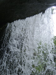
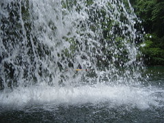
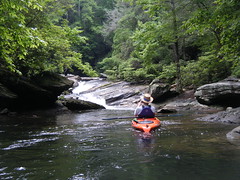
We got to the falls, and the creek was falling directly into the lake. Here’s what it looked like when we arrived…

And this is what it looked like when I was there back in August…
Back in August I could walk behind the falls…
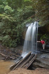
…but this time we were able to paddle our boats behind the falls…

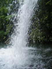
It was cool being able to paddle behind the falls. There was also a deep overhang where one could paddle completely under the rock.
Despite the lack of a beach, we had a floating lunch in a beautiful setting.
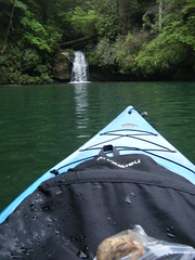
From Wright Creek Falls we decided to explore the Thompson River arm a bit more. This was farther up this arm than I had ever explored. As we paddled we would hear running water in the various coves, and would go to explore. Most of these were small trickles, and I imagine that many would be non-existent in dryer times.
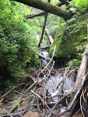
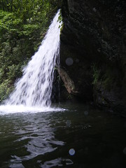
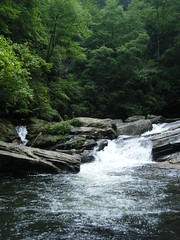
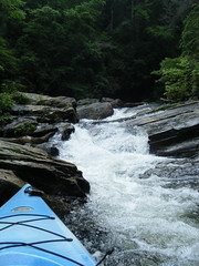
Finally we reached the point where the Thompson River enters the lake. There was a significant rapid, but even above that there was another waterfall from a tributary.
By this time we were getting very tired, and we had a long paddle back. I lost count of the number of waterfalls we saw, but it was quite a few. In all, we paddled 12.67 miles, according to the GPS. I think the next time we may explore the Horse Pasture and Toxaway River areas.

And finally, here is the slideshow of all of my Flickr photos from that paddling trip…
What a trip!
Another area that might (or might not) be fun to check out is the upper area of lake Keowee right below the dam. The Eastatoe (sp) flows in just below the dam. That river is a nice stream, though likely way too small for paddling. Probably not too many waterfalls if any in that area.