
So far my paddling trips to Lake Russell have been fraught with intrigue. Last time I dubbed the trip the “Paddle through Mordor” because of all of the smoke from forest fires in the Blue Ridge Mountains. This time Bennie Waddell and I would tempt fate by going kayaking on Friday the 13th.
Two weeks into the new year and I felt like I was already behind on my kayaking. Last year I started with a first light paddle on January 1. This year we came home before New Year’s, but weather and a snowstorm kept me off the water.
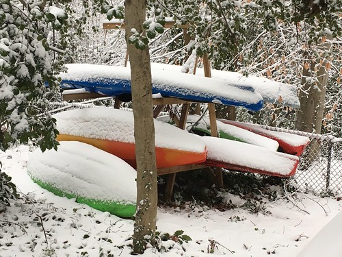
Less than a week after temps were in the teens and I almost ran my car off of an icy road it had warmed back up to the 70s – perfect paddling weather. Despite the fact that Friday was the 13th, Bennie and I made plans to head down to Lake Russell to get a start on 2017’s mileage.
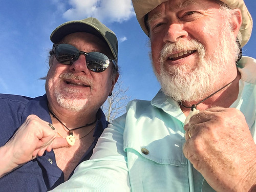
We did take precautions. I had my Swamp Thing spirit animal with me, and we were both wearing Maui Hooks, talismans for safe passage over the water that had been sent to us by our good friend and fellow paddler Dave Freeland.
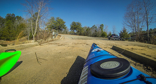
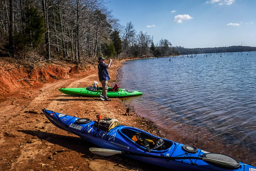
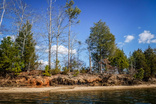
We decided to launch from the same place I had previously, the ramp at Mountain View Recreation Area on Craft-Magee Road. I mentioned this last time, but for the second time Mountain View struck me as a bit…forlorn, and this time it had nothing to do with smoke. The entrance sign was falling apart, which doesn’t give one a good first impression. While the ramp and parking area were in good repair, I could see that the park might have been quite a bit larger. One blocked road had a sign that read, “Closed for the season,” but the overall feeling was that it had been closed off permanently. Looking at the area in Google Earth confirmed overgrown parking areas. I wasn’t able to find any further information on the Army Corp of Engineers website.
When we arrived there was one boat trolling under the dock, but it didn’t look like it had launched from the ramp – ours was the only vehicle there. Another truck pulled up as we were unloading and a couple pulled out chairs, a cooler, and gear to spend a day fishing on the dock.
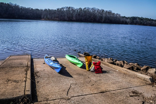
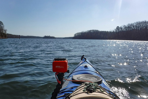
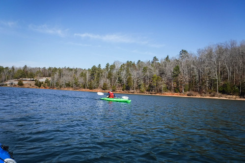
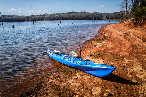
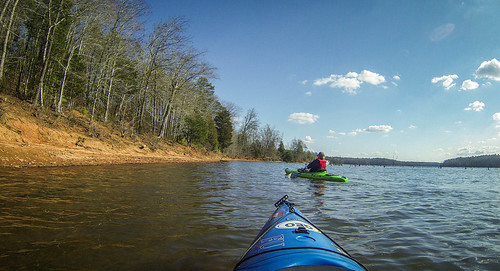
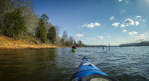
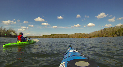
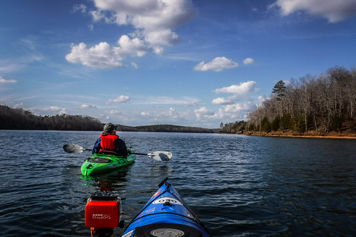
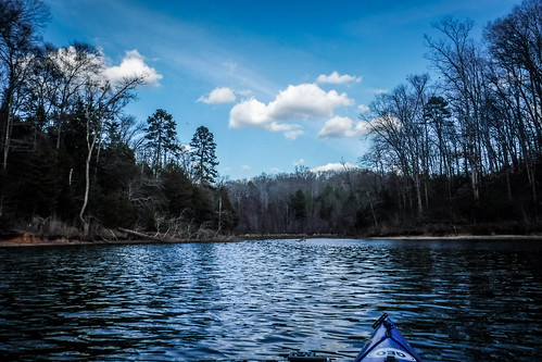
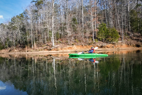
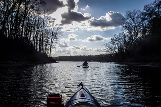
We got squared away and got underway. There was a bit of a breeze running from north to south. Normally I like to head against the wind first, but we wanted to check out the boneyard of trees and Seb Craft Island, so we headed south, downstream.
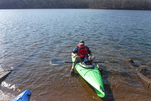
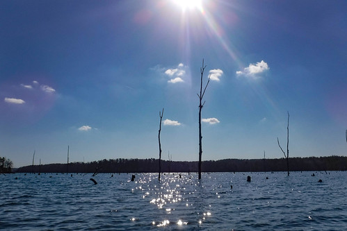
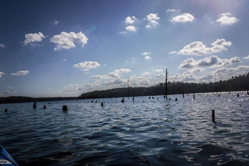
The boneyard was trickier to navigate than I remembered. I had stayed mostly to the edges away from the island. This time we intended to land on the island, and the stumps were a bit thicker as we approached. I bumped off of a couple of submerged stumps, but it wasn’t too bad. I was just glad that most seemed to be soft and weathered, rather than still sharp.
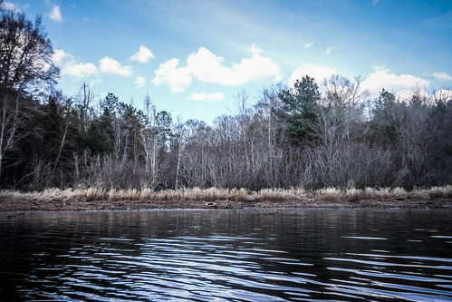
We landed on a nice narrow beach just south of where I’d spotted canoes camping last time. This would make a good lunch stop for us. We climbed up the bank a bit and found a good log that would serve as a bench for us.
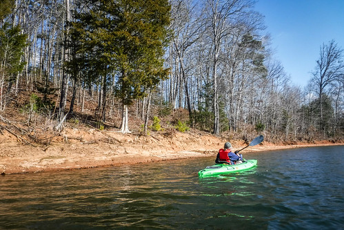
We didn’t spend much time exploring the island. We had really just gotten underway, so after a fairly quick lunch we hit the water again. We decided to circumnavigate the island, then paddle back up the other side, much as I had done last time. Closer to the island we didn’t have any problems with the stumps.
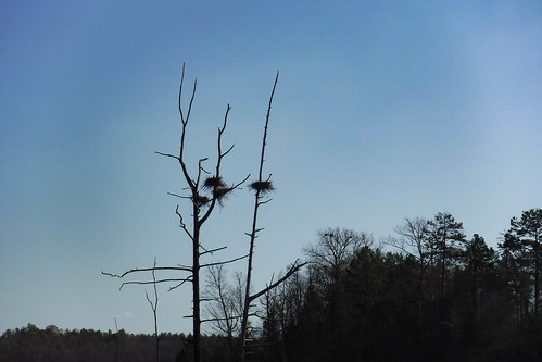
At the north end of the island are a couple of osprey nests lower to the water. There are several nests up higher, and I recognized these as heron nests from my many trips to the Lake Connestee Nature Park and its heron rookery. We found more of these nests on the east side of the island as we paddled upstream. There was no activity, but I’d like to come back later in the spring.
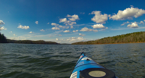
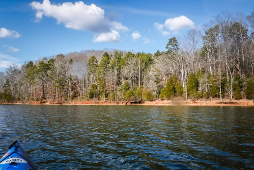
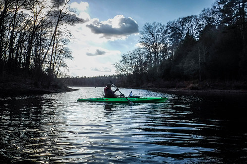
We continued northward. We were paddling against the wind, but it seemed calmer than our last trip on Lake Hartwell.
Soon we found ourselves back at our starting point at Mountain View. Another family had joined the first couple, and they were fishing down on the banks of the cove next to the ramp.

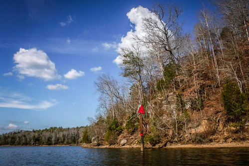
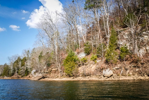
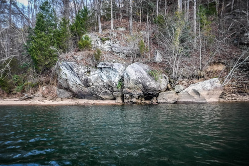
We decided to see how far north we could paddle before we ran out of time and/or energy. As we passed the ramp we began noticing large boulders along the lake. We weren’t that far from Elberton, so it make sense that this granite would be everywhere in this area. The other thing that we noticed were amazing echos from the east bank. Our normal conversation was being broadcast back to use as if it had been shouted across the lake. It was weird. We attributed it to the granite and the shape of that particular valley.
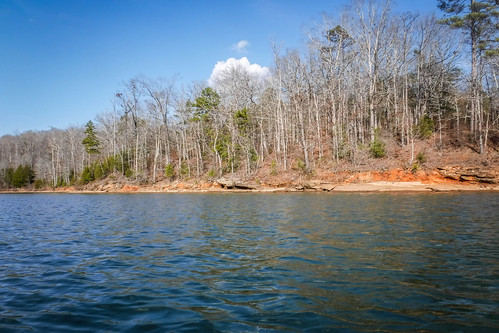
Another rocky outcrop looked like it would be the perfect place to kick back and relax on a summer afternoon.
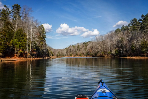
The play of light and shadow from the clouds really messed with our depth perception. We would see what looked like an island or an open area, only to see that feature as something completely different when the light changed. It also threw off our sense of scale. Targets that appeared doable now looked like they were beyond today’s reach. I was hoping to get to a point where I could at least see the Smith-Magee Bridge, but we didn’t get that far. We decided to turn around just below where Cedar Creek enters the lake, a little over two miles below Smith-Magee, and about four and a half miles below the Lake Hartwell Dam.
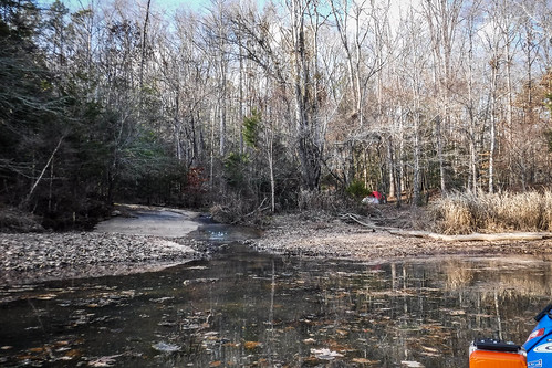
Turning back, we decided to explore the cove near the rocky area. It was a quite, shallow area fed by two smaller streams.
Back out on the main lake we continued back south toward the ramp. The changing light revealed more details. As we passed by our echo chamber, we saw large built-up walls. This was the reinforced parking area that had been closed off, and our voices were bouncing off of those surfaces. Mountain View was much, much larger than we thought.
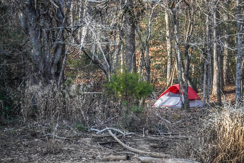
When we got back I wanted to check out the large cove just south of the ramp. It was much larger than the other cove we had just explored. We could hear the sound of water over rock, and found a nice little stream tumbling over some of the granite. Next to that was a tent. Looking back in the Google Earth imagery it looks like the tent was there when that image was captured, so it might be someone’s squatter settlement. We didn’t get out to explore.
We were off the water by about 4:00. We had paddled about five and a half miles, which was a good start to this year’s excursions.

As we drove on back home we had one more discovery in store. On the way down I’d spotted a potential old school in a community south of Anderson. It was a two-story brick building that looked out of place in the mill village where it was sitting. I’d asked Bennie to remind me of it on the way back, and he did. We turned toward the village of Gluck Mill to check it out.
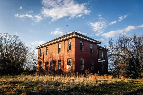
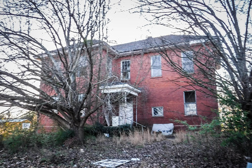
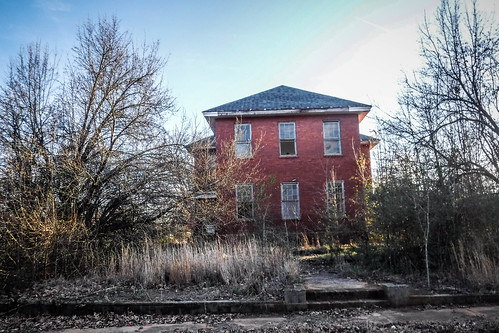
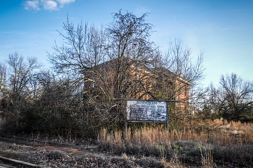
This didn’t look like a school design with which I was familiar. It looked more like a boarding house. There was no GNIS data for this location, so I couldn’t confirm its existence as a school from my normal sources. After making a few queries online I found out that it had been both – an old school from the early 1900s and a set of apartments in the 1960s and 70s. Those online queries also revealed a history worthy of another blog post. More to come on that once I get through documenting this weekend’s adventures.
When you are at Oconee point boat ramp looking at the island is the cemetery to the right, left or center of island