
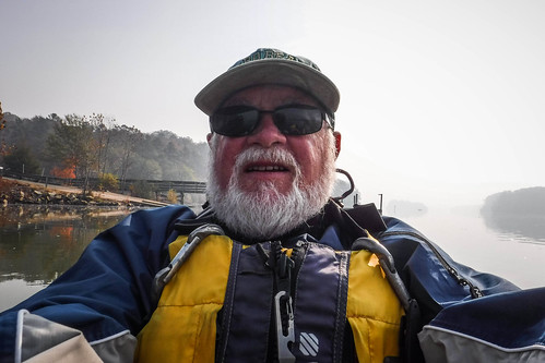
I was in serious need of some hydrotherapy. I’d been in a funk ever since the election. To make matters worse, wildfires in the mountains of North and South Carolina had cast a pall of hazy smoke over everything. I told someone that I guess it was appropriate that the world looks like Mordor now that Trump has been elected. Add to that all of the other anxieties in our family life right now, and it was time to hit the water. I was able to find some solace, but it came at a price.
Bennie and I had made plans for our sorta-semi-weekly paddling trek. We looked at venues toward the south, away from the smoke. We decided on Lake Monticello in Fairfield County. It was a new venue for both of us, wasn’t too far away, and should be away from the worst of the smoke. Sadly, Ben’s plans fell through. I contemplated just staying inside, away from the smoke. But, I had the boat already loaded. I decided to head out anyway, but I wasn’t sure Monticello was where I wanted to be.
While searching for the Temple of Health in Abbeville County a few weeks back I checked out a couple of landings on Lake Russell. There were a couple that were only an hour or so away, so I decided to head down that way. I selected a landing I hadn’t visited, but spotted in Google Earth next to the Highway 187 bridge. At that point the lake narrows, and isn’t too far downstream from Hartwell Dam. I thought it would make for some interesting paddling.
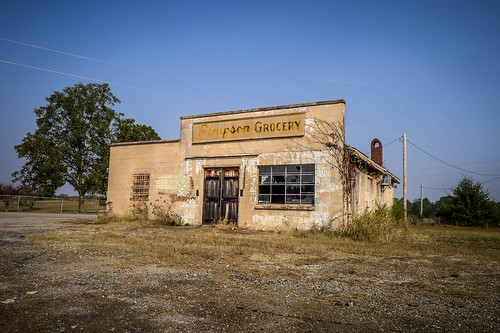
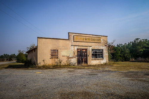
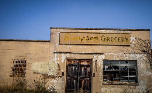
I drove down through Anderson County, passing some cool old buildings and places I’d stop to explore on a normal day. I had half-way hoped that the smoke and haze might impart some cool effect that would show up well in a photo. I just wasn’t inspired, though.
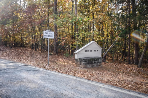
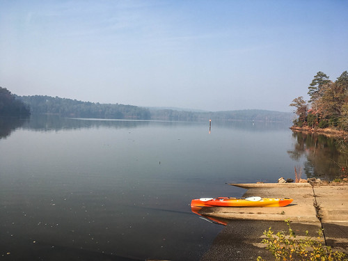
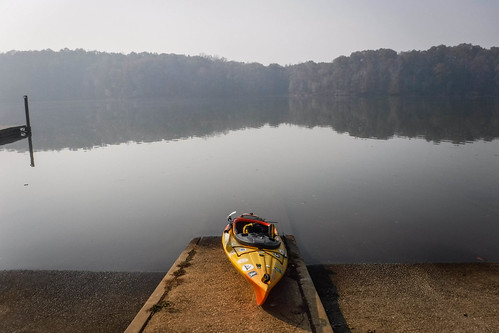
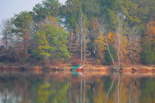
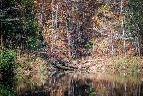
When I reached Highway 187 a brown sign pointed toward a landing. However, it wasn’t the one I had marked. This sign pointed to one further upstream, so I decided to head that way. Following the signs, I eventually reached the Mountain View Landing. The landing itself was in good shape, but it looked like something was…missing. The building I thought was a rest room was blocked off from access and boarded up. Another concrete path led to a no longer extant feature. Even the sign for the landing looked like it had seen better days. I guess there was just enough money to keep up the landing, but not any amenities.
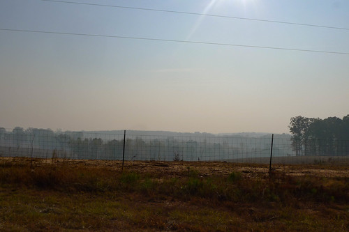
I made a quick survey of the area before unloading the boat. I was appalled at how smokey it was in this area. It was enough to make me turn around and just head on home. Yet, the venue itself looked compelling.
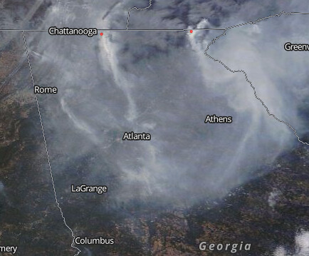
What I didn’t realize, and only learned after the trip, was that the Savannah River Valley was acting like a trough, channeling the smoke from the mountain wildfires down to the coast. I wasn’t heading away from the smoke, but into the thick of it. This NASA MODIS satellite photo shows how bad it was along the Georgia – South Carolina border.
I didn’t give up, though. I was here. I decided to make the best of it, even if it was just a short paddle. I got the gear unloaded.
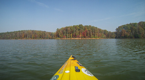
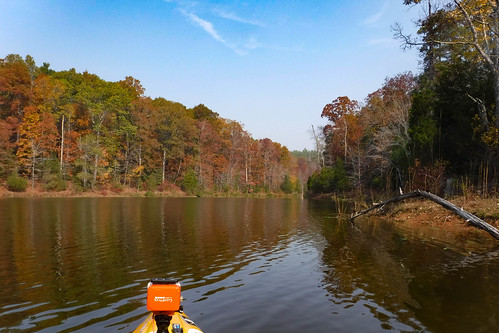
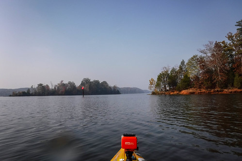
I started paddling north, upstream. My thought was that I could try to reach the Smith-McGee bridge below the Lake Hartwell Dam. That was only about three miles upstream and probably within easy reach for me. I was surprised to see red and green channel markers along the way.
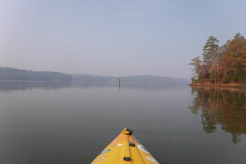
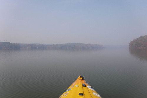
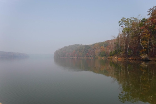
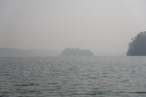
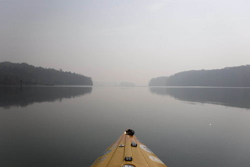
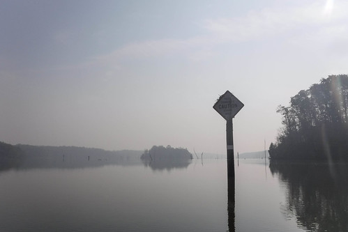
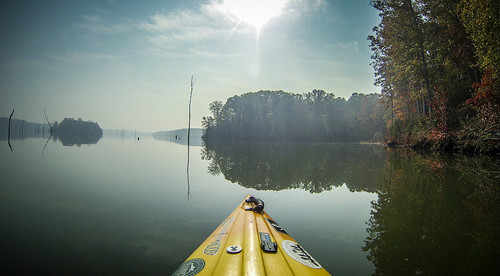
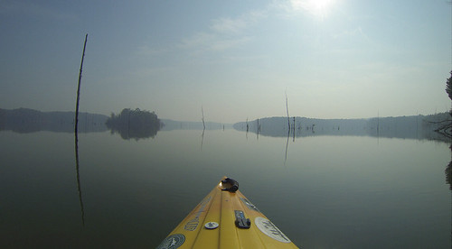
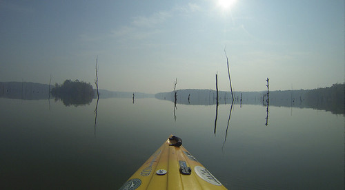
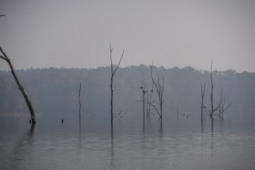
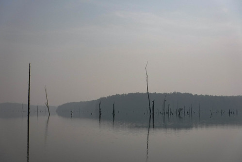
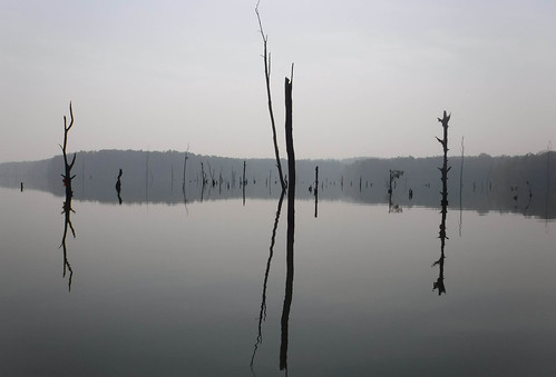
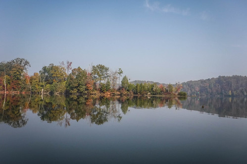
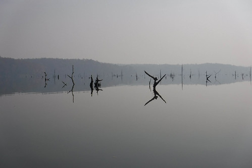
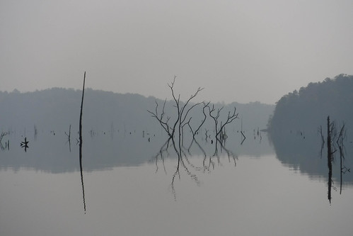
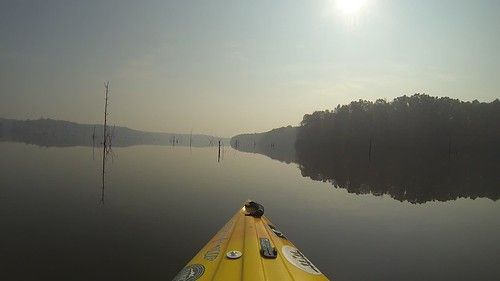
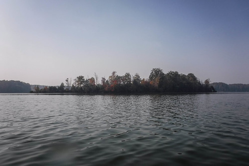
While that would have been an interesting paddle, I kept looking over my shoulder, downstream. The smokey haze was backlit by the morning sun, making the landscape even more stark and Mordor-ish. To add to the drama, an island was sitting in the middle of the lake surrounded by a boneyard of dead trees. From a photography standpoint, that was much, much more interesting. I gave up on Smith-McGee and headed downstream.
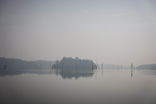
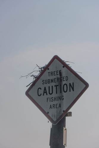
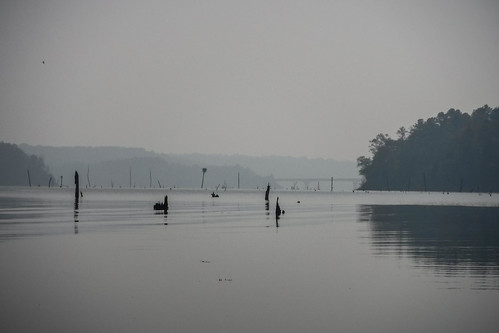
As I got closer I could see osprey nests on some of the old trees. Through my monocular it looked like none of them were occupied, but this might be an interesting paddling trip in the spring. A sign warned of submerged trees. Channel markers continued on the east side of the island, safely away from the boneyard.
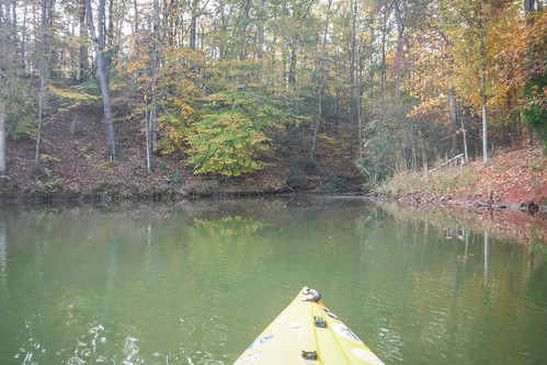
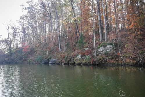
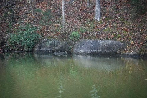
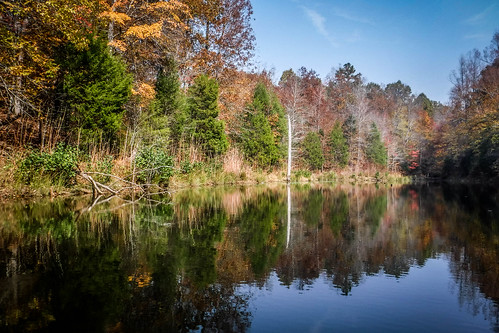
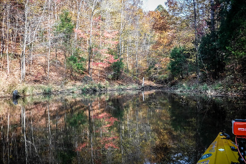
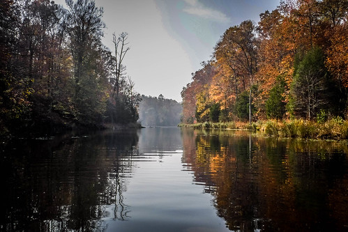
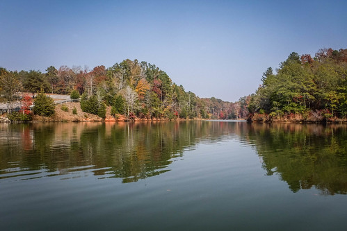
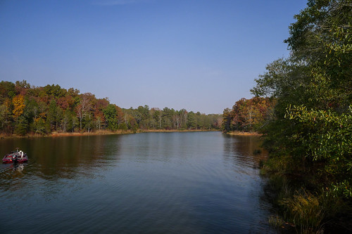
I pulled into a small cove on the Georgia side of the lake. I’d noticed lots of these deep coves, and was regretting that I hadn’t studied this area in Google Earth more closely. Lake Russell has no shoreline development, and is wild, much like Jocassee. Although the water quality isn’t as good as Jocassee, these coves are still scenic and quite interesting. This one was lined with the same granite mined in nearby Elberton. It looked like I could spend an entire day just exploring the tributary creeks in this area.
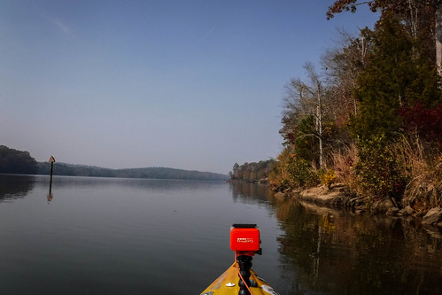
So far I had only been shooting with my Fuji waterproof camera. I had the GoPro with me, but hadn’t set it up because I wasn’t sure if I was even going to paddle, or for how long. I decided the scenery warranted a bow-mounted camera, so I fired it up just in time to enter the boneyard. I continued to take photos with the Fuji.
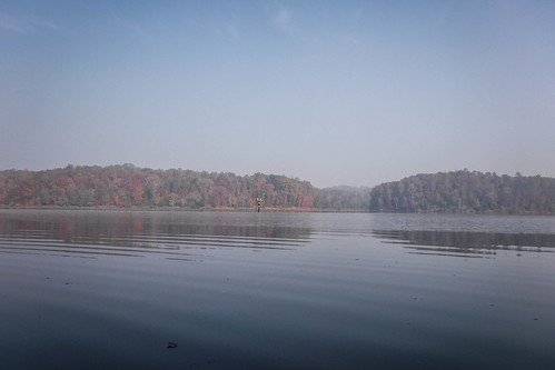
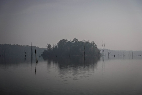
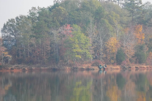
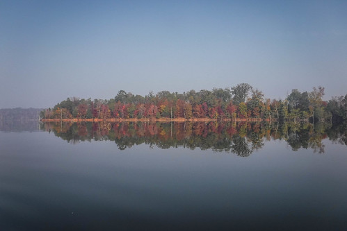
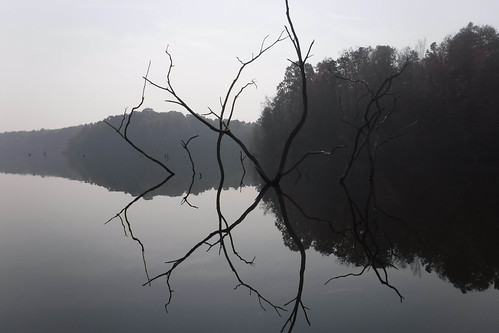
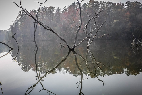
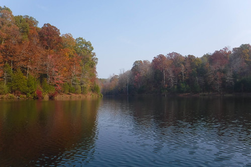
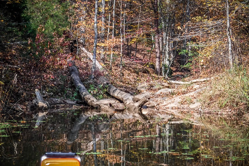
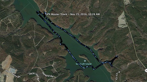
The large island in the middle of the lake is Seb Craft Island. As I paddled past on the west side I heard voices. When I got closer I saw two canoes pulled onto the bank. Apparently a group had either camped on the island, or were using it as a stop. The north end of the island was wider, with a high bluff. The downstream end narrowed and was lower. The last of the autumn colors broke through the haze.
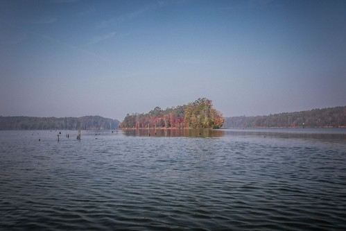
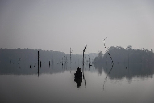
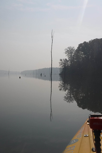
The boneyard itself was tricky. There were many more submerged stumps than were visible above the waterline. It looked like some of these were cedar, with sharp eroded ends that could even puncture a kayak a moderate speeds. I took my time paddling through them. The water was completely glassy, and I caught myself taking photo after photo of stumps reflected in the water. The symmetry with the reflected shoreline muted by the haze was just weird. I was still expecting Orcs around the next corner.
The video footage from this section is really creepy and somewhat disorienting, especially when it gets to the stumps about halfway through the clip.
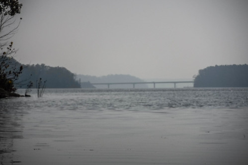
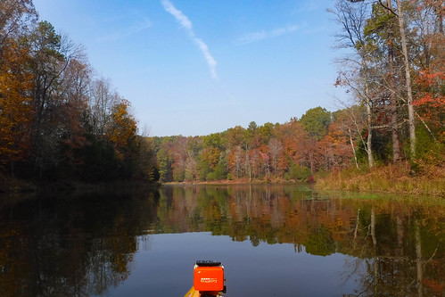
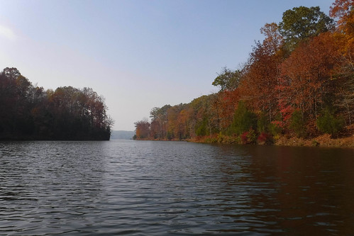
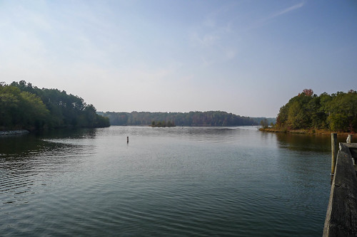
Further downstream from Seb Craft Island I could just barely make out the Highway 187 bridge. For a brief moment I was tempted to paddle on down to the bridge. As with Smith-McGee Bridge, I could have made it with no problem. That is, on any other day. Already the smoke was making my skin feel weird and the day was hotter than I expected. I’d worn my paddling jacket as the day had started out cool. I shed that as I rounded the lower end of the island.
There was a deep cove on the east side of the lake. It looked appealing so I decided to check it out. I thought I’d explore a couple of these, then paddle on back along the other side of the lake.
Sticking with the Tolkein metaphors, I’d stumbled into Rivendell, or, perhaps, Lothlórien. The sky above was blue, and the colors of autumn kept the smoke from Mordor at bay. The deep cove was soothing. The tributary streams were small. I had hoped to find a small waterfall, but the geography just wasn’t right.
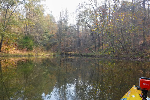
The fires from Mount Doom were still just over the horizon. The entrance to the cove was tinged with smoke.
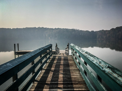
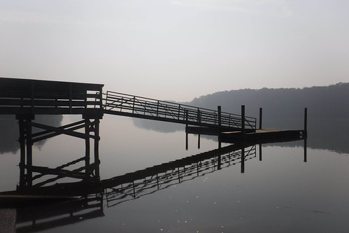
Back into the haze of the main lake, I headed back upstream. I paddled pretty much straight back to the landing. Another deep cove just south of Mountain View Landing tempted me, but I decided to save it for another time. Somehow I’d missed it when heading out. A couple of fisherman were trying their luck on the dock as I pulled out the boat and loaded up.
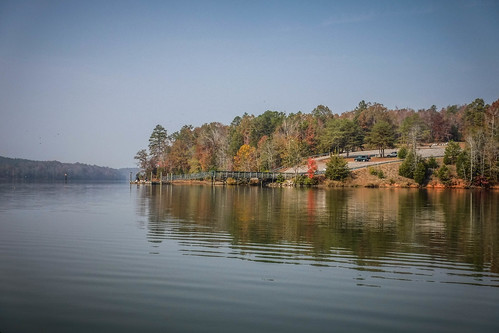
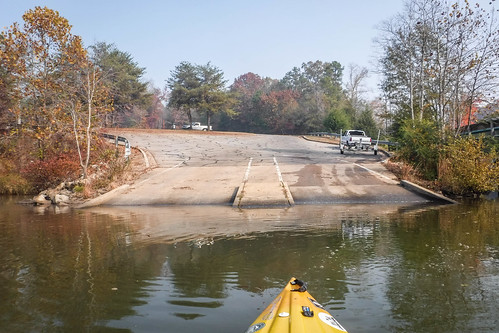
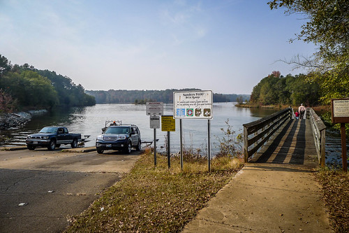
Back in the truck I decided to check out the landing I had marked originally for launch. I drove back to Highway 187 and found it at the bridge across the lake. Sanders Ferry Landing was much busier than Mountain view. There were boats coming and going. The facilities seemed a bit nicer, too.
It looks like we could put together a good point-to-point trip from one bridge to another. It’s only about six miles from Smith-McGee Bridge down to Sanders Ferry. With side explorations that would make for a nice day’s paddling.
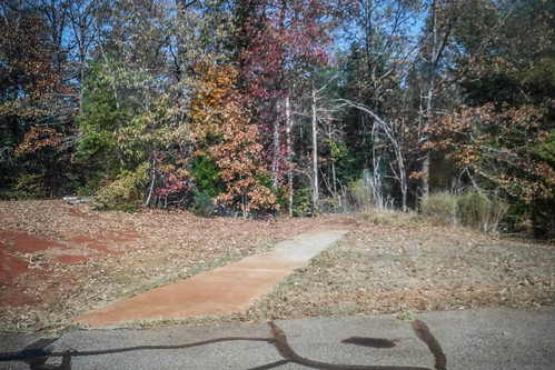
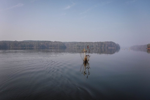
I headed on back home following the shortest route indicated by my GPS. I paused for a couple of photos.
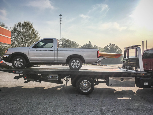
…and here’s where it got expensive. I stopped for a cold drink and a snack at a convenience store just north of Starr on Highway 81. When I returned to the truck my key wouldn’t turn at all. It was completely locked. There was nothing. That also meant that the steering column and gear shifter were locked. I was stranded.
I called AAA and Laura, who graciously interrupted her day to drive down and help me out. We towed the car to Greenville. Yep, it was the ignition switch assembly – over $600 for repair.
So, despite the smoke and car troubles, it was a good day on the water. I paddled almost 5 miles, 4.8, to be precise.
Lake Russell shows promise, and I now want to explore more of it. I think I’ll wait until the skies are less like Mordor, though.

I have only been on Lake Russell one time. I think the landing you were shooting for is where we put in. Rather than a kayak, I was in a very fast bass boat. One of those that you trim out at about 45 kn and only the prop is in the water. If you ever have the need for speed, that is the way to go. I saw some of the islands in the boneyard tap tree areas. Beautiful habitat.
Loved your adventure minus car trouble. Landscape was beautiful, haziness added a sense of mystery. And video seemed like you were stationary and the world was passing. Maybe a Beatles song. Wish I could have been there.
I enjoyed your documentation of Lake Russell. I camped at the state park located on Lake Russell and thoroughly enjoyed every minute of the weekend. Beautiful landscape and exceptional waterfront camping sites. Although I have kayaks, I opted for the relaxation of “floating in the cove” on the standard blow up float. One of the best weekends of my life and I plan to explore all that Lake Russell has to offer. Especially enjoyed the photos that made it seem you were the only inhabitant on the lake ! I have experienced that while camping at the state park in Santee – what a peaceful feeling !