I hadn’t been out on a photo ramble in a long time. So, Saturday morning I grabbed my cameras and headed out. I only had a vague target in mind (as usual). I knew I wanted rural scenery so I could capture some old farm houses. I wanted to try some new post-processing techniques. My route took me down across Southern Greenville County and finally into Lower Anderson.
This time of year the lighting is always oblique. You don’t have to wait until the “golden hours” just after sunrise or right before sunset to get some interesting shots. The day was clear and bright, and it looked like the lighting would produce some interesting shots.
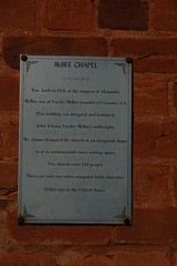
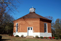
My first stop was in Connestee at McBee Chapel (Map). I had photographed it many times before, but I thought I would see what other angles I could bring to it. I don’t think they are still having regular services here, but I would love to attend one when they have a special service.
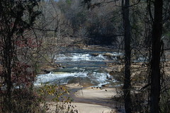
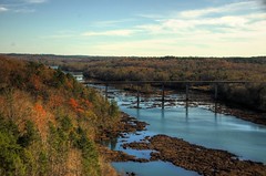
From Connestee I headed south toward Fork Shoals. I stopped briefly at Cedar Falls (Map)to take a few shots of the Reedy River.
It’s my understanding that Greenville County is building a park in this location, but there are no signs of it. In fact, there are multiple “No Trespassing” signs everywhere. The area looks ripe for photographic opportunities, and I will definitely visit again when the area is open to the public.
The next several miles brought exploration but no real photography. I headed west, crossing Augusta Road and heading into the heart of Possum Kingdom. I drove by the old Beech Springs Campground (Map), where I spent summers as a youth at Bible camp. My earliest memories of this place are of a wooden open-air tabernacle with sawdust floors and uncomfortable bench seats. When I was there for camp the wooden structure had been replaced with brick, but was still open-air. I remember when storms would come up, and rain would blow into the tabernacle. Now the building has been enclosed, and is no different from any other large church.
From Possum Kingdom I headed across country roads toward Belton. I paused briefly at Cooley Bridge (Map) to look at the Saluda River. There were conflicting signs – one showing canoe access to the river, and large No Parking signs at the same location. I guess you can drag your boats down to the river there, but would have to park several miles away. I didn’t stop to take photos because of the parking situation.
This is one time where my GPSs failed me, and I wished I had brought along my trusty DeLorme Atlas. I had toyed with the idea of exploring some of the other Saluda River access points I had mapped in my SC Rivers project. I knew I was close to the Holiday Dam area, but wasn’t quite sure where it was. Not wanted to go on too much of a wild goose chase, I decided to continue westward on into Anderson County.
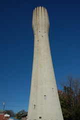
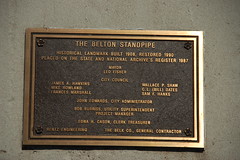
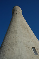
In Belton I stopped at the town’s landmark, the Standpipe (Map). The unusual concrete water tower was built in 1908 to serve the needs of the community, and was refurbished in the 1990’s and added to the National Register of Historic Places. Each year Belton celebrates its landmark with the Standpipe Festival.

I crossed more farmland, and eventually reached the town of Iva. At this point I was more interested in lunch than in photography, but I really didn’t find anything interesting other than fast food. Unfortunately, I didn’t see anything that caught my eye photography-wise, either. The town of Starr presented the same problems – an old textile town that had been bypassed by the main highway and was now in decline.
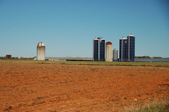
The area along Highway 81 between Starr and Anderson is mostly industrial. Just south of Anderson I spotted an unusual water tower off to the east, and had to check it out (Map). It looks more like one of the invaders from H. G. Wells “War of the Worlds” rather than a water tower.

Since I was this close, I decided to ride out and see Hartwell Dam. I headed west on Highway 29 toward the Georgia border. As I was heading out of town, I spotted a lookout tower off to my left that wasn’t in my GPS. I had to explore further. I found a road that eventually led to the top of Little Mountain (Map) so that I could get some photos.
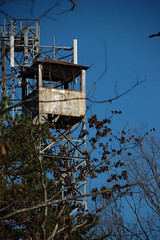
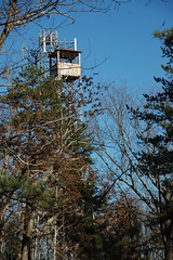
The tower was in typical condition. The floor is missing, and I’m sure the bottom flight of stairs is gone. I didn’t get too close since there were warnings about radiation from the microwave towers that were also in the area.
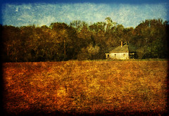
I continued westward on Highway 29 until I got to the intersection with Highway 187. At the crossroads there was a large scenic farm, so I paused to take a couple of photos.
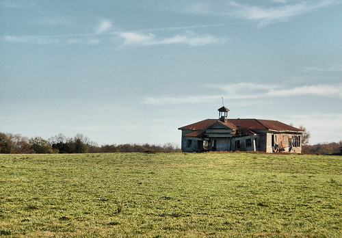
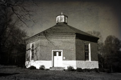
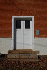
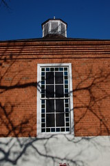
A few miles further along Highway 29 I stumbled across a place I had wanted to visit. I had seen photos of the ruins of the old Shiloh School (Map), but wasn’t sure where it was. It was in a field off to the left just off of the highway. Situated as it was, it evoke lonesome imagery, and I had to stop for awhile and get some shots. I first took a few from Rainey Road, then some others from Highway 29 so that I could get different angles.
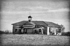
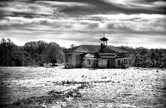
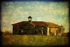
As I was taking photos I had no information about the school. I didn’t even know its name until I did a GNIS search for historical schools in Anderson County. I still don’t really know anything about the school, such as when it was in operation or anything else. However, I was able to find an interview on the Anderson Independent Mail website with former teacher and principal Helen Glaze, who taught at the school for only one year in 1942.
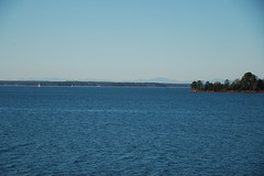
From the school it was just a few miles on to Lake Hartwell (Map). I pulled into the overlook parking lot and walked along the trail to the dam itself.

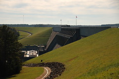
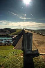
I had to cross the Savannah River on into Georgia. At the other side, I circled around and came on back.
It hadn’t occurred to me at the time, but my travels so far were very much church-related. There was the campground, but the route through Belton to Anderson and on past Lake Hartwell was the route we would take to Emannuel College in Franklin Springs, Ga. Most of my siblings attended the college at one time or another. Regardless, the afternoon was slipping away, so I continued back through Anderson, then headed on back to Greenville without further stops.