Wednesday I left Laura and her mom to get settled into the house a bit more, and I headed out to explore. I kind of had a couple of destinations in mind, but I wasn’t really sure where I would wind up. as it turns out, I did a ton of hiking in several locations.
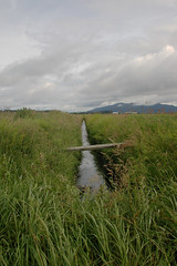
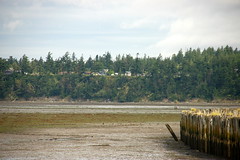
My first stop was at a wildlife observation area just about a mile from the island. You have to have a permit to park there, so I park out on the road and walked out anyway.
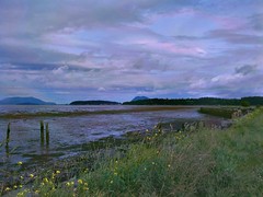
I followed a trail along cultivated fields, heading toward the dike that keeps Padilla Bay from flooding the farmlands.
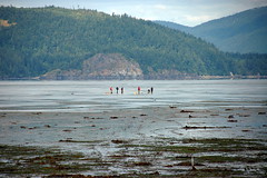
I eventually made it out to the dike. It was low tide, and there were a few clammers out on the bay.
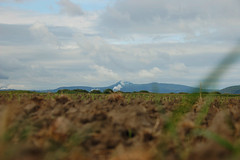
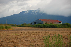
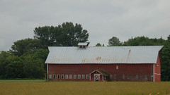
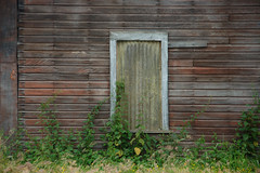
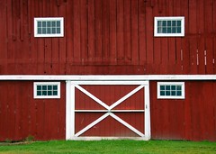
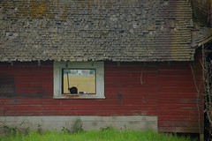
I wandered out through the farms for a bit, zig-zagging roughly toward town. There are so many old scenic barns that it was tempting to stop and photograph them all multiple times. I caught a few.
The schizophrenic Washington weather seemed to be at it again. It was a bit rainy and misty, and looked worse up the valley. However, blue skies seemed to be poking through over the islands, and that was the direction I decided to go.
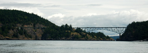
I crossed the Swinomish Channel onto Fidalgo Island, then turned south. Before I knew it I was at the dramatic bridge crossing Deception Pass.

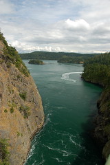
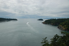
Deception Pass is the only inlet to the bay behind Whidby Island almost until you get down to Seattle. The tides and currents tend to be fierce as the water is forced through the narrow passage. It does result in some dramatic scenery, though.
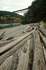
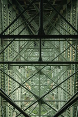
I crossed the bridge onto Whidby Island and parked at the other end of the bridge. I intended just to walk back across the bridge, then head over to Rosario Beach State Park. Those plans changed, though. From the parking lot there are steps the head under the bridge and a trail running right and left. I headed left looking for a good shot of the bridge from the side. The trail I was on looked like it continued on down to the beach below the bridge, so I decided to check it out.
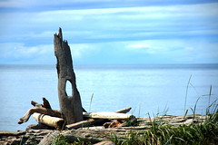
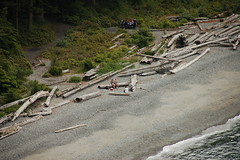
At the bottom of the trail I found the type of beach typical for Washington. There were small round stones and lots of driftwood logs.
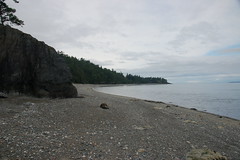
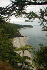
Looking westward I could see that the point at the end of the pass wasn’t too far away. From there I could look out over the open water of the Strait of San Juan de Fuoco and out toward the Pacific Ocean. I decided to hike on along the beach.
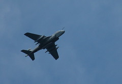
It was still a chilly overcast day. However, I could see some blue sky over Rosario on the other side of the pass. There were a few families coming out to the beach, but it wasn’t crowded at all. An occasional jet from the Whidby Island Naval Airbase flew overhead.
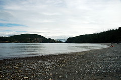
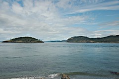
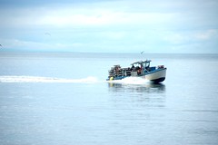
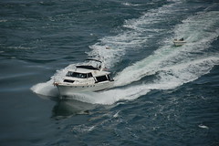
I eventually made it around the point to the west side of the island. There was much more open water here, and I watched several boats coming by.
There was a parking area here, and folks were starting to arrive. By this time I’d been hiking awhile, and it was past lunch time. I hadn’t brought food or even water, and was beginning to wonder if I’d have to hike all the way back. Fortunately there was a snack bar just up the way on Cranberry Lake, and I was able to get a quick lunch before heading back.
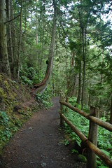
For the hike back I stayed mostly toward the interior of the park. The trail was up and down and steep in some places, but was a bit easier than walking on the loose stones on the beach. Eventually I made it back to the bridge.
I still wanted to cross the bridge on foot. I passed under the bridge to the other side, stopping to take a few photos along the way.
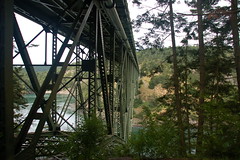
The walk across the bridge can be a bit intimidating. In addition to the height, large vehicles whiz by fairly close. It’s not for the faint of heart. However, the views are incredible.
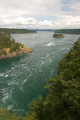
I watched several boats struggling against the current, including a jet-powered tour boat that makes regular runs through the pass.
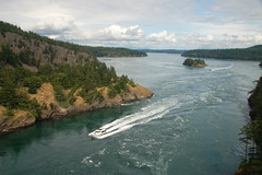
Deception Pass consists of two channels, and there are actually two bridges that cross the divide between Fidalgo and Whidby Islands. Between the channels is a large island with stairs from the bridge allowing for more views and exploration. The narrower channel on the north side of the island is known as Canoe Pass, although I couldn’t imagine trying to paddle a canoe through those tricky currents.
I headed back on the other side of the bridge. This gave me views out toward the west and open water. I could also look down at the beach where I had been earlier.
I finally made it back to the car. I drove on down toward the town of Oak Harbor, but between road construction and increasing traffic, I decided it was time to head back for the day.