August 13, 2013
With the rain last night Laura and I didn’t even attempt to go out and look for any more meteors. Instead, we got a good night’s rest and got up the next morning to head out. We had several options, but decided to play it by ear, depending on the weather. Our general plan was to head northeast first, then cross over to the Monongahela National Forest. Several of those highways were marked with green dots on our AAA road map, indicating scenic roads. We thought we would check them out.
We first detoured into the downtown section of Fayetteville. Signs on the main highway had proclaimed that it was the “coolest downtown.” While a neat place, it looks like it was populated mainly by outfitter stores for whitewater companies, with a few galleries and restaurants thrown in. It was a cool place, with a neat old courthouse, but we didn’t linger.
Just beyond Fayetteville is the bridge. Crossing it this morning was a totally different experience. Everything was fogged in, so there was not the sense of height we had on our first crossing.
There were several places we had been told were can’t-miss locations. However, most of these involved long scenic views. That just wasn’t going to happen this morning. We did cross Summerville Lake, which looked like a fantastic place to kayak. High sandstone cliffs along the banks were capped with the dense greenery of forests. I’d love to come back up here with a boat.
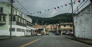
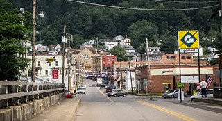
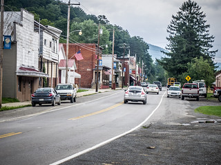
At Summerville we headed east on Highway 39. This crossed the lake once again, and pointed us toward the national forest. The route took us over several twisting roads and ridge crests, and eventually brought us to the town of Fenwick. Here the highway turned right and began to parallel the Cherry River. This continued until we reached the town of Richwood. The little mountain town seemed completely unlike the first four letters of its name. While there were interesting quaint buildings, unemployment seemed high. There seemed to be lots of down and out folks just sitting out on front porches everywhere.
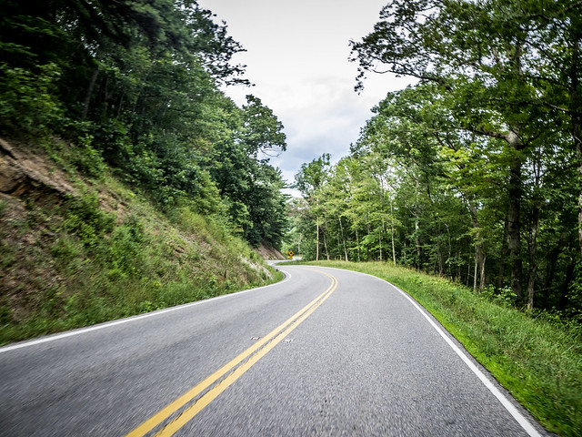
We left Richwood and entered We had entered the national forest proper, and the road became designated as the Highland Scenic Highway. The road continued along the upper branch of the Cherry River. The scenery was impressive, but for some reason I wasn’t taking photos along this stretch – just enjoying the ride. Eventually we came to a pullout for the Falls of Hills Creek and decided to check it out.
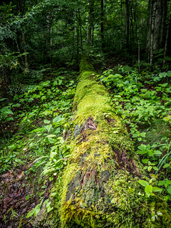
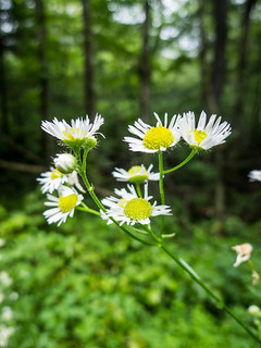
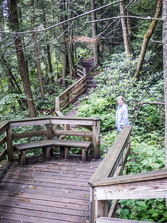
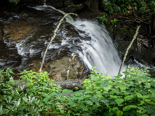
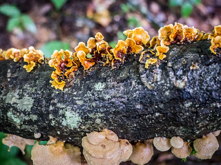
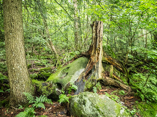
The trail down was lush with the morning rain. Ferns, flowers, and various lichen lined the paved path. The trail itself ended at a boardwalk at the top of the upper falls. The remainder of the trail to the middle an lower falls (and better views) was marked as strenuous. Since we weren’t sure of our time frame, we just stayed at the top for a bit before heading back to the car.
Back on the road, we stopped briefly at the Cranberry Fields Botanical Area…
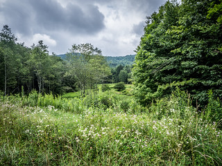
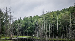
…then continued on our way. Eventually we reached the junction of Highways 39 and 219, where we headed north on 219. The road passed through several small towns and communities, then re-entered the national forest.
We saw signs for the Snowshoe Ski Resort, and decided to check it out. Quick lunch at the bottom of the hill, then we headed up the drive to the top of the mountain. The rain had gotten harder, and by this time it was downright chilly. Laura got her chance to check out the seat warmers and heater in the Mini.
There was a huge development at the top of the mountain, with condos, hotels, shops, and lots of things to occupy skiers when they weren’t skiing. Unfortunately, most were closed for the season. We knew there had to be spectacular views all around us, but the weather just wasn’t cooperating. We headed back down the mountain without taking any photos.
We continued on 219, enjoying the views of the scenic highway. We had planned to drive to Elkins, find a place for the night, then head into Virginia the next day. When we got to Huttonsville we decided to take Highway 250 into Virginia, putting us a bit closer to our ultimate destination of Washington DC.
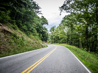
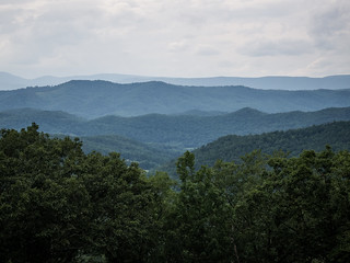
Highway 250 proved just as scenic as our other routes. But this time the sun had come out and we were able to put the roof back on the Mini. Crossing into Viriginia brought us into the George Washington National Forest. The roads twisted over mountain passes, then would open into spectacular views of valleys below with villages and farms.
We reached the little town of Monterey, Virginia, a quaint little village on on of the valleys. It had interesting architecture, old houses, and looked like it could be a place to spend some time.
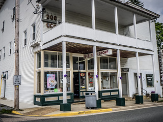
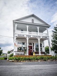
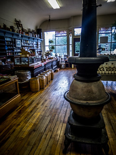
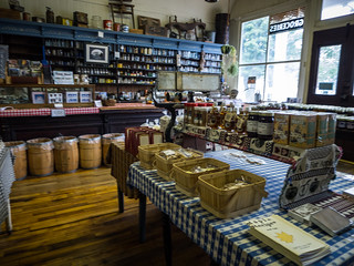
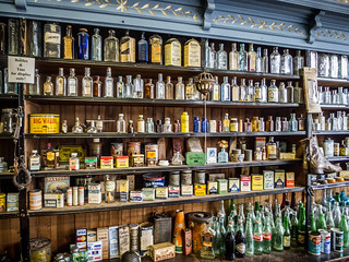
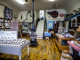
Up and over another ridge, and we found ourselves in the community of McDowell, Virginia. Here we found the Sugar Tree Country Store, and I decided we had to check it out. The store was full of antiques, but their main product was maple syrup, and variations thereof. The Mennonite lady who worked there said that this valley was known for its maple syrup production. I had to buy a small sample.
At this point we switched drivers so that I could do some passenger seat photography. Plus, Laura wanted to drive her car some more. I had been selfish. I set up the GoPro camera on the windshield once again and captured bits of the twisting Virginia mountain road.
The road continued its scenic pathway past several Civil War battlegrounds and sites. We stopped at the Confederate Breastworks overlook because it had nice views (yeah, I’m making middle school jokes here.) Laura asked if Confederate Breastworks were the same as Rebel Boob Jobs. After reading the interpretive signs, we were still unclear as to what “breastworks” were.

Eventually we reached the town of Saunton, Viriginia, and found a nondescript motel next to the interstate for the evening.