I had tons of work I needed to do around the house – cut grass, vacuum the floors, and blow the pollen off the decks and driveway. Instead, I loaded up my bike and drove up to the northern end of the Swamp Rabbit Trail in Travelers Rest.
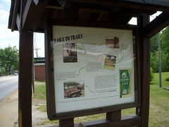
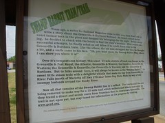
The Swamp Rabbit Trail is part of the rails to trails movement, and is named for the former Greenville and Northern Railway that used to run from downtown Greenville to River Falls in the Jones Gap area. The railway got its nickname from the various wetlands it passed through. The plan is to pave the railway from Greenville to Travelers Rest, and to eventually run trams on the path on a regular schedule.
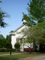
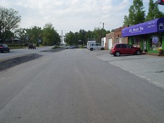
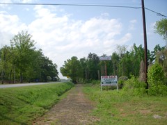
I parked at the Travelers Rest trailhead and headed south. At this point the trail is grassy and a bit bumpy. It passes through the middle of Travelers Rest, past TR Methodist, where Laura and I got married, and through the middle of a parking lot for several businesses. From there, the trail took a route more separate from the populated areas.
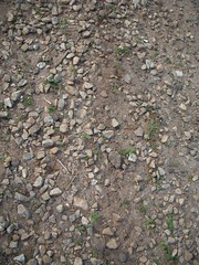
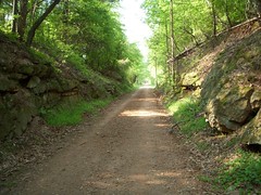
Initially, the surface was very rocky and jarring. The rails and ties had been removed, leaving the loose rocks in place. My mountain bike is an older one without the shock absorbers found on newer models, so I felt each one of those rocks. I was beginning to think that I wouldn’t get very far if the rest of the trail was like this. However, the trail did smooth out, and eventually took on the characteristics of a rough dirt road.
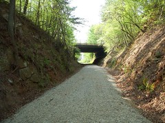
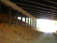
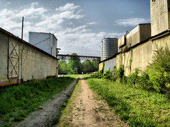
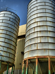
An underpass got the trail to the other side of Highway 25. As I rode by, there was one guy just hanging out under the bridge. Not quite sure what he was up to. Immediately on the other side of the highway the trail enters the old W. R. Grace fertilizer plant property. Buildings are close on either side, creating a man-made canyon. I saw another individual wandering the grounds, and wondered who else might be lurking in the abandoned buildings.
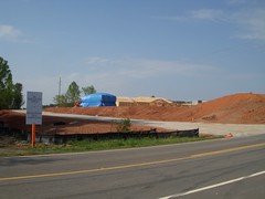
On the other side of Roe Ford Road the trail passes by construction for the Woodlands at Furman – a misnomer if ever I heard one. What woodlands there might have been have been stripped to build these assisted living condos. This is the outgrowth of another trend, that of putting homes for the elderly next to college campuses so that they might take advantage of activities. I guess keggers appeal to all ages. I do know that these condos are VERY expensive.
The trail passes on the back side of Furman’s lake, separating the main campus from its golf course. When I was in school here, I remember trains using these tracks. Back then there were only two points where one could cross the tracks. There was a trail leading to the golf course, and one leading to Montague Village, which was then auxiliary housing. Now two additional access points have been created so that Furman folks can get to the trail.
Off of campus, and on the other side of Duncan Chapel Road, the trail passes fraternity slums. Multiple grills, remains of beer cases, and a variety of state license plates are dead give-aways as to the nature of the residents. Just pass these one can see a nascent Reedy River and the eponymous wetlands. Other creeks feed into the Reedy’s floodplain from various directions.
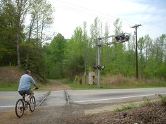
At Watkins Bridge Road another cyclist came up behind me and we stopped to chat. He said that he rides the trail regularly from TR, but that it is rough. His suggestion was to ride the trail down to Highway 253, then take surface streets back. He took off, while I lingered to shoot a couple of pictures.
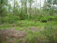
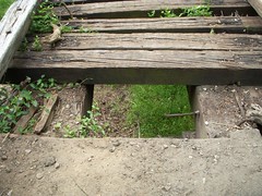
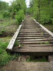
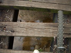
On one of the tributary creeks there was what could loosely be called a bridge. There were wide gaps between the railroad ties, and there was no way to ride a bike over it. I walked tentatively, and at one point a rotting tie almost gave way under might foot. It was a bit scary.
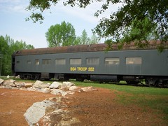
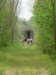
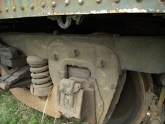
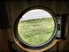
Past the bridge I encountered a group of hikers from a local church. There were about twelve of them strung out along the trail. At Sulpher Springs Road, the rest of the group had stopped for snacks at an old railroad car. Some of the kids had climbed into the car to explore, so I decided to do the same. There was some weird old mechanical devices in the car, whose purposed I couldn’t divine. It was obvious that this car was utilitarian and not for cargo.
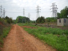
The group was planning to hike all the way to downtown. I thought that might be a good goal, despite the advice from my cycling friend. I continued past the industrial areas on Sulpher Springs and continued on the trail. At this point the trail is criss-crossed with red dirt trails created by motocross bikers. One roared nearby, but it didn’t look like they were actually using the trail.
Finally I reached Highway 253. I crossed and immediately there was another railroad tie bridge similar to the first I had crossed. Beyond that, the trail was overgrown and grassy. I looked at the trail, then looked at my watch, and realized the day was getting away. Considering that I would have to ride all the way back for my truck, I decided that half of the trail was about all I could do for now. I also decided to return on surface streets.
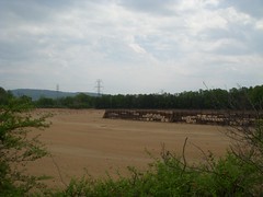
I road east on 253, then turned onto Old Buncombe. A large group of serious cyclists passed – part of some organized group ride. At Lakeview Middle School I stopped to take a picture of the non-existent lake. It looked like it had been drained a long time ago, but I do remember where there was actually water in the lake.
One of the first things I noticed was that even though the pavement was much smoother, there are many more hills on surface streets. The railway had stayed fairly level. By the time I reached the intersection of Old Buncombe and Sulpher Springs Roads my legs were feeling a but rubbery. I continued on, and when I reached University Square, I decided it was time for a break. Laura was out and about, so I called her to join me at Karrie’s for lunch.
Suitably refreshed and relaxed, I continued on Old Buncombe, then took Roe Ford Road back to the trail, entering at the old Grace plant. I passed several others using the trail, and even one pickup that had pull onto the trail to pilfer some old iron rails. There was a bit of an incline toward the end. With some effort, I finally made it back to my truck.
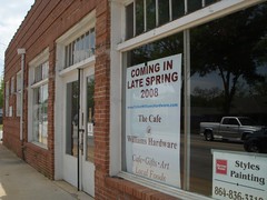
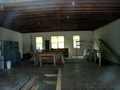
After loading up the truck I took a look around. The buildings surrounding the parking area have been purchased by our friends Nancy and Joyce McCarrell. They are planning to put in a cafe and wine shop to cater to the trail crowd. The sign said opening in “Late Spring 2008”, but it looks like they still have a ways to go. I’ll look forward to visiting when it is open.


I really enjoyed your photos and writing on this. I didn’t know about this trail and I think it is a place I’m going to have to try out. How long did you ride to get that amount of distance?
It’s been a while since I’ve gone on a long ride, but I used to do day trips all the time.
I started at about 9:30 am and finished up around 1:30. I used to do long day trips on my road bike, but I’m terribly out of shape. Plus, I now tend to stop and take pictures, which REALLY slows down a ride!
Let me know if you’re interested. We could start in TR and leave a vehicle downtown and do a one-way trip.
We walked this trail from TR all the way into downtown Greenville in the early Spring and had a blast doing it! It was great fun exploring the long-forgotten trail, imagining what it was like “back in the day,” and always being on the lookout for the sometimes-hidden trail ahead.The snaggle-toothed trestles/bridges were an exciting challenge, and at one point, we found ourselves “trapped” as we followed the trail through the parking lot of an old mill…we only got out by finding a hole in the chain link fence! Now we want to try to follow it the other way….any ideas?
Kathy,
Eric over at A Day’s Drive from Greenville posted his attempt on his blog:
A Day's Drive from Greenville, SC: Swamp Rabbit Tram Trail
It looks like he ran into the same problems you did. I know the plan is to connect downtown and TR with a paved path, but they are not quite there.
You can start behind the Peace Center at the Linky Stone Park. This is underneath the Highway 123 (Academy Street) bridge. The trail is paved and goes about a mile and a half before it ends.
Great photos and text! I’ve made the trip several times now, but never all the way to Greenville.
Even when the temperature is in the high nineties the shaded trail is delightful and the grade much better than any of the street options. The only problems I have (other than the scary bridge) are the areas of LARGE gravel.
i think this was very intresting. that could be a very cool vacation.
Would love to know more of this trail…Have recently started riding a bike and would love to more of this trail…Since I am a beginner at 52 this month, would love to have somewhere to ride without all the highways like White Horse Rd. of which I live off Saluda Dam Rd….Where exactly does it start in TR?….And is there places I would have to walk?Lol…Do I need to pack a lunch?Would love to hear from you on this trail….TY very much for finding it.
my grandfather and my dad were the engineers on the Swamp rabbit RR. I think there should have been more on the actual RR, but glad everyone can enjoy the trail. It use to carry timber from the saw mills and textiles all the way to Cleveland, SC. I use to ride the old steam engine with my dad, and even after they converted to diesel engines.
enjoy
chuck stowe
I was called Charles when I grew up in Greenville
I grew up in Marietta and now live in Greenville. I’m very excited to hear about this trail. Where in TR is the trailhead??? Thanks!
This is great! I am working with the TR Historical Society. Please get in touch with me. We have a meeting at City Hall on May 19 at 7PM.
The meeting of the TR Historical Society will be held at Northwest Middle School, tonight at 7. Hope that you will come.
This trail will be the best once completed. Wonder if is wide enough for future masses?? Only place I’ve found unpaved is between Furman and back behind Amtrack. Haven’t noticed any constuction activity on this section as of late.
It’s my understanding that the portion of the trail through the old W. R. Grace plant is awaiting demolition of the buildings before paving. Also, the section through the city of Travelers Rest is delayed until fall – something to do with getting city permits, etc. I think they are also negotiating rights to extend the trail northward.
I read the message from Chuck Stowe above about the Swamp Rabbit. I am researching the Greenville and Northern Railway and would like to speak with Mr. Stowe. Do you still live in Greenville County?
I talked with a retired Southern RR engineer yesterday who know hsi father and grandfather.
Lynn
The Rec Dept of Greenville doesn’t give very good information except that the trail is closed except for the downtown area and advises it is against the law to be on any other part of it until it is completed? From this post, it looks like everyone can go ahead and use it regardless of the advise. I’m there!
Roger – Is there a link to the Rec Dept information? As many people as I have seen using the trail, I find it hard to believe that they would enforce anything about it being “against the law to use until completed.”
That being said, there are some sections just past downtown that are not clearly marked. One could easily wind up trespassing if not careful.
I remember seeing a GM turbo train on a siding somewhere in the area of this line in the mid 60’s. I’m glad to see you’re helping to preserve railroad history here. As one can tell by my E-Mail addess I’m a model railroader. Thanks ED
I worked on the G&N from 1973 to 1979. Jake Stowe was the engineer and retired not long after I went to work there. Dwight Looper was the conductor. I was conductor and General Foreman when I left in 1979.
I am the grandson of Dwight Looper. My grandfather worked for G&N railway from 1945 to 1982. I rode the #70,#75 and the #9 from Greenville to Travelers Rest many times.Those were great times with my papa.I have a lot of memories growing up around the railroad depot. I do not think the city of Greenville gives enough recognition to the railroads history and the people who worked there.
Ican’t tell you how much I enjoyed this! We’ve been trying to remember the entire route and just couldn’t get past Furman. I hope to see more from you when you’ve had the oportunity to ride the NEW Swamp Rabbit Trail!
Thanks for the great pictures as well!
LN
Just wanted to let everyone know that the entire trail from downtown Greenville to Traveler’s Rest opened on May 12th. The entire distance is 13 miles between the 2 trailheads.
Great news, Roger! I’ll try to get out there and ride the entire length when I can get a chance.
Hey Tom, Have you heard anymore info about paving the section at the W.R. Grace Plant?
Great story and pics! My wife and I usually ride the trail every other day.
Anyone have any info on the abaondoned southern railway car with the porthole windows?
I was wondering if anyone knows where I might be able to find photographs of the Greenville & Northern Railway, taken in either the 1950s or 1960s? I have seen lots of photos from the surrounding decades, but sadly very little from the 50s or 60s. Specifically, I am hoping to stumble across photos of two locomotives that operated on the G&N during these two decades, namely G&N #78 (the line’s only GE 44-tonner) and G&N #21 (a leased GE 70-tonner from the Montpelier & Barre in Vermont). Any help you can provide on this would be greatly appreciated. Thanks in advance.
For Nate see my entry above. I operated the G&N 70 & 78 locomotives while I worked at the G&N during 73-79. We also had the #9 while I was there that was brought in from the home office in Vermount.
Sad the line has become a rail trail. Shame it could not be saved or have some tourist line potential.