So far we had already had a great trip to the South Carolina Low Country. Yesterday we explored Beidler Forest and the ACE Basin, and the weather looked great for more exploration today. The day was already hot and humid, so we decided it would be more of a driving trek than hiking. The trek took us through a large swath of the Francis Marion National Forest.
We started the day by driving onto the Charleston peninsula and touring the area South of Broad. There was the obligatory drive along the battery, but what we enjoyed most was driving through the residential areas and looking at the stately homes with their enclosed gardens. For some reason, I wasn’t in much of a photography mood, so I don’t have any photos of that part of the trip.
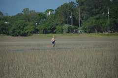
From Charleston we crossed the new Cooper River Bridge into Mount Pleasant, then headed north on Highway 17. Eventually we came to the Cape Romaine National Wildlife Refuge. I had already checked online, and the ferry out to Bull’s Island doesn’t run on Sundays, so we walked out to the pier and watch birds and boat traffic out on the ICW.
From the landing we tried to stay on smaller side roads most of the time. This took us through some very poverty-stricken areas, with houses so dilapidated that we wondered who might be living in them.
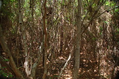
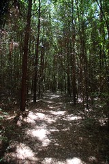
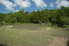
Eventually we came to a sign for the Sewee Shell Ring. Curious, we decided to check it out. A half-mile hike led us through some very dense vegetation. Laura was actually getting claustrophobic and little bit spooked, but we pressed on.
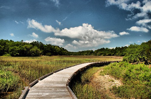
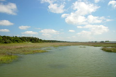
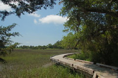
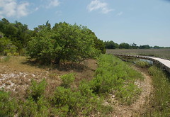
The shell ring itself was on the edge of the marshland. It’s thought to be about 4000 years old, and is thought to have served as a ceremonial feast site, as well as garbage dump, for a group of Native Americans that predate the Sewee Indians. A boardwalk winds around the ring.
We continued along the loop trail and made it back to the car without getting any more spooked. However, by this time we were hot, tired, and ready for lunch. We drove on up Highway 17 to the little town of McClellanville. First, we drove through the little community, with its intriguing historic houses. I can’t remember if I’ve ever been through here, but I love the quaint little town. We had lunch at a local seafood cafe, along with most of the town’s population.
Lunch took much, much longer than we had anticipated. By this time we were tired, and had a long drive ahead of us. From McClellanville we headed northwest on Highway 45 through Francis Marion Forest. Our route took us through historic areas and through densely forested pine lands. Eventually we drove between the two large lakes in the area, Lakes Marion and Moultrie, crossing the diversion canal between the two lakes. Finally, and the town of Santee, we hit the Interstate once again and headed home.
As we were driving through Francis Marion Forest and Berkley County I wanted to stop many times and take photos. However, the afternoon was slipping away. This always seems to happen to us. We spend more time at the coast, and miss all the neat stuff a little bit inland. Sometime we’re going to have to plan a trip and specifically check out some of the locations in Berkley County. Maybe this summer…