
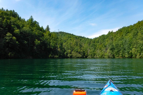
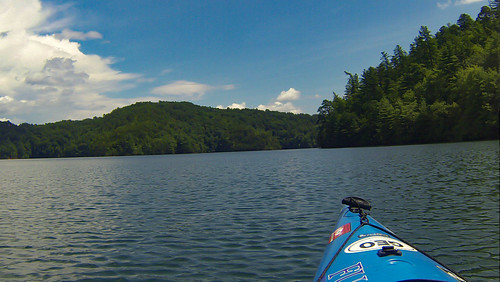
Jocassee can be many things. Beginning paddlers can hang close to the bank and still get to some cool geological features and small waterfalls. Intermediate paddlers and venture further up to Wright Creek Falls and the Thompson River and Whitewater River areas. Experienced paddlers can take longer trips across open water to the Horsepasture and Toxaway arms of the lake. Regardless of the route taken, conditions on the lake can change in an instance, turning a leisurely paddle into a real challenge. That was really born out on my most recent trip to the lake.
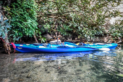
The day turned out much differently than I’d planned. Bennie Waddell and I had planned to take the boats up to Cascade Lake in Dupont State Forest and paddle up to Hooker Falls. However, he was under the weather and had to cancel. I decided to swap boats from my Pungo to the Tsunami and change venues. Jocassee is about the same distance as Cascade Lake, but I’ve had a craving for the waters of Jocassee, so I set off in that direction. Making the changes meant I got a later start than I like for a Jocassee trip.
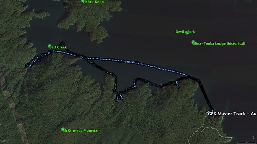
As for the weather, the skies were clear blue, but there was an 80% chance of rain for today. Seemed a bit weird to me. With the late start and the forecast, my plan was to stick to the west bank of the lake, closer to the Devil’s Fork boat ramp.
The ramp wasn’t crowded at all. School has started back, and it’s mid-week, so I was able to off-load the boat and find a parking place with no trouble.
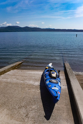
There was another reason I decided upon my route. Last Saturday the Greenville Sea Kayak Meetup had a trip I couldn’t make. Supposedly there are four small waterfalls along the west bank, and they were going to see if they could find all of them. I decided I was also up for the challenge. I had an advantage in that I’d already visited most of them, but what the heck?
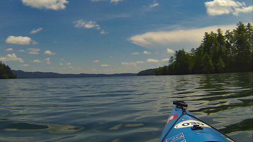
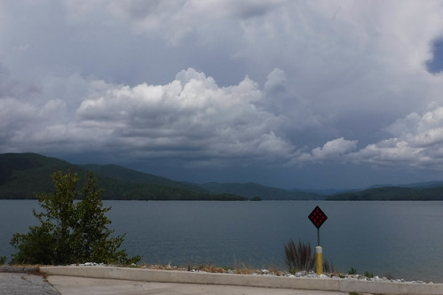
As I set out I noticed that my perfectly clear blue skies now had nice little fluffy clouds coming in over the mountains. These were not as innocent as they looked, and I knew I’d need to keep an eye on them.
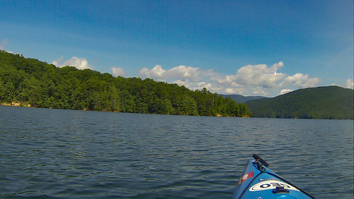
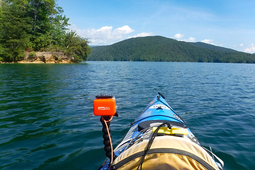
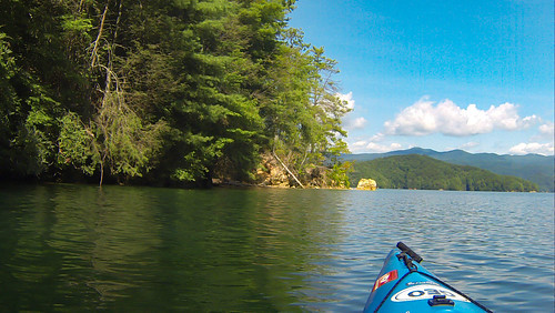
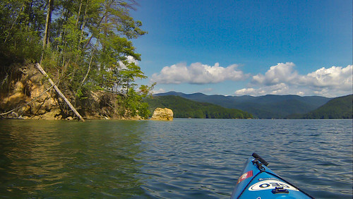
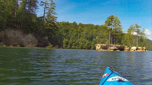
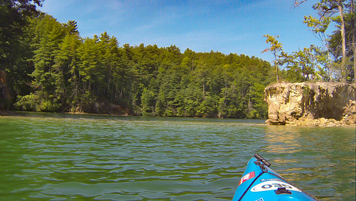
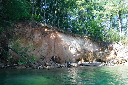
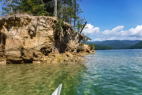
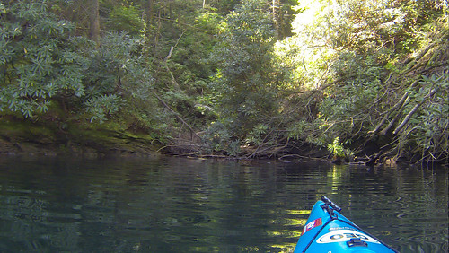
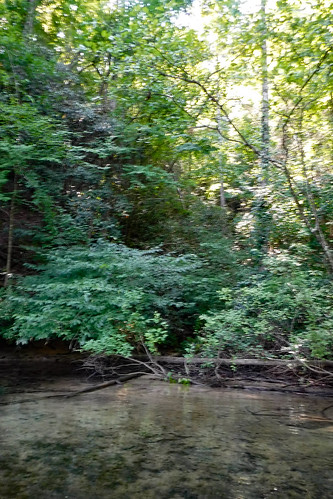
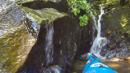
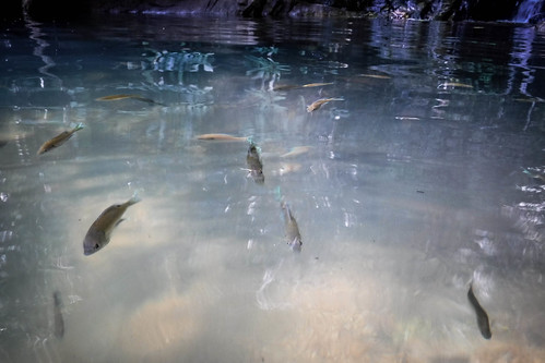
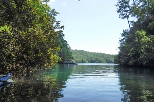
I dipped into every little cove. As with my last trip, the water was fairly high, but there was still some cool geology visible. The water was crystal clear as always.
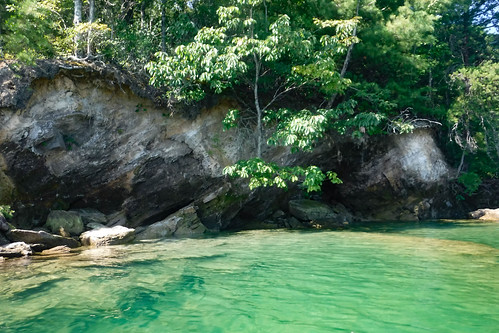
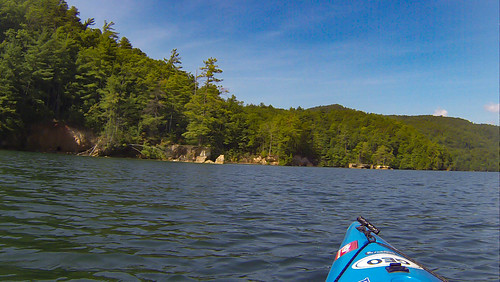
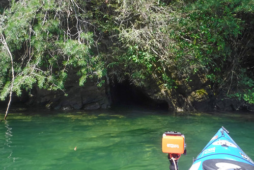
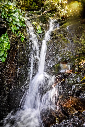
I found two of the smaller waterfalls. Well, “found” probably isn’t the correct word. I never saw them, but I could hear the distinct trickle of water. At least I photographed the coves where I found them.
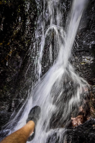
Eventually I reached the deep cove where the largest of the four waterfalls can be found. I could hear it clearly as I approached.
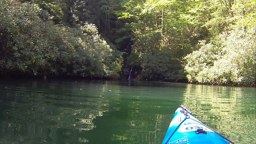
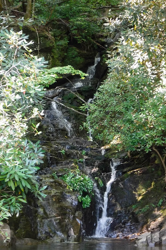
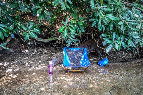
Just to the right of the waterfall there was a nice little pebble beach. I figure it was the perfect place to have lunch, so I set up camp, as it were.
I walked up to the falls. As cool as the water was in the lake, the water coming in from the falls was downright icy.
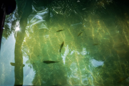
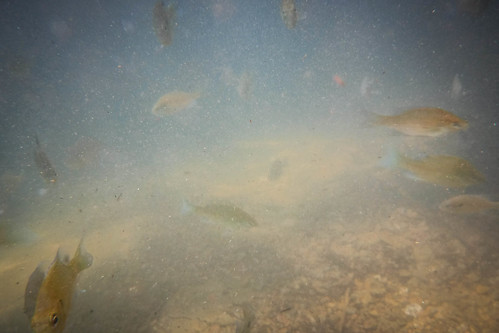
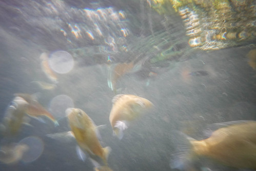
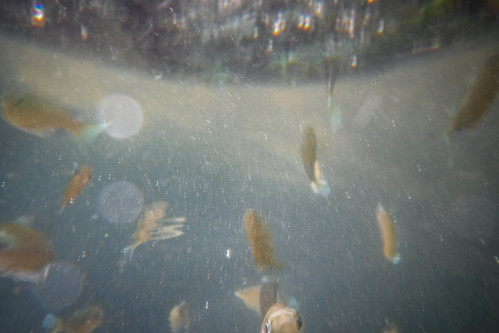
The lake water seemed warm, in comparison. I decided to go for a swim. I had a few friends join me. A school of fish started circling me. It started out friendly enough, then turned…ominous. I decided it was time for lunch.
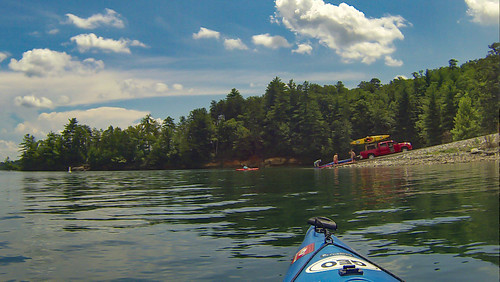
The fish weren’t the only ones to disturb my lunch. A pontoon boat pulled up. A sign on its side said it was from Jocassee Lake Tours.
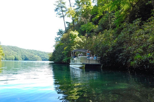
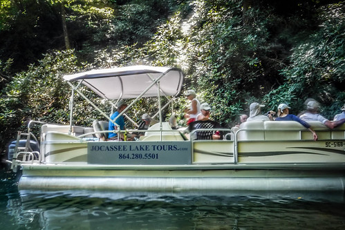
I had taken a tour with this group before, using the pontoon to reach the upper parts of the Horsepasture River arm of the lake. I recognized Brooks Wade, the tour operator, but he didn’t remember me. I didn’t expect him to. Even so, I invited them to share my beach. Most of the tourists stayed on the boat and ate their lunches, but one couple decided to go for a swim.
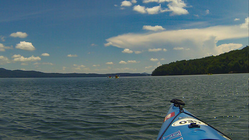
The boat left, heading to their next stop at Wright Creek Falls. I relaxed in my camp chair for a bit more, and decided I could make there as well. After all, the weather was still perfect, as far as I could see from my little cove. I was amazed at how wrong I could be.
Even before I reached the opening of the cove I heard the thunder. Skies overhead were still clear. However, a dark cloud was descending from the mountains to the north. Even more worrying, jagged lightning was striking from the front of the cloud. It looked weird, and even more threatening with the clear sky in the background.
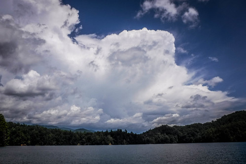
I’ve been caught on this lake in bad weather before. Last trip I had to battle headwinds and whitecaps. I have paddled the lake in pouring rain, where there was fortunately no lightning. Long before I started blogging and before I got my first kayak, Alan Russell and I raced a storm back from Double Springs in my old heavy Coleman canoe. I knew well that the weather could be fickle and I wasn’t going to take chances. I made a bee line for the boat ramp.
I wasn’t the only one. There was a line of boats coming from the Thompson River arm, and a group of kayaks ahead of me was also trying to make it back. I quickly outpaced the kayaks. It was a two-mile sprint.
I made it back safely, and joined the crowds rushing to take boats out.
I was able to get the boat loaded up and safely into the truck long before the storm clouds reached Devil’s Fork. Another boat was even launching despite the storm. However, it looked quite threatening.
I actually made it all the way back home and was able to get everything but the kayak itself put away before the first drops of the deluge started to fall.
I had paddled six miles according to my GPS track. The first four miles were a zig-zag exploration of the coves. The last two were a mad dash.
Even though it was a short trip, it was enjoyable. It was also a reminder to me why I always carry emergency gear, including temporary shelter. There were a couple of times I thought I might need to pull up and ride out the storm. Fortunately, it’s never come to that.

I’m not so sure your original plans would have worked out anyway. Your story reminded me the Cascade Lake Campground closed permanently back in December as reported by WLOS. I think that was the only way to access the lake?
Wow! Somehow I missed that! I’ll be very curious to see how this pans out, especially with the ruling about the Picklesimer estate and public access.