I have a confession. When things get chaotic I have occasional bouts of depression. One of the best ways to combat this is to get away from the house and start exploring. Such was the case Tuesday of this past week. I needed out of the house. I wasn’t sure where I was headed, but preferably somewhere interesting where I could take some photos. I headed east. It was familiar territory, and places I had already visited and photographed, but even familiar ground can yield new discoveries. My explorations took me across Spartanburg County and to the mills along the Pacolet River Basin – Glendale, Clifton, and Pacolet itself, with a couple of outliers thrown in for good measure.
Fairmont Mill
Insular communities always fascinate me. Sometimes these are in the heart of a larger political boundary, such as a city, yet they retain their own personality. The mill villages that dot Greenville are prime examples. Sometimes these communities are isolated by geography. This is more characteristic of the communities in Spartanburg where I worked. Reidville, Startex, Lyman, Duncan, Wellford – these always seemed to stand apart. Even though some were only a mile from each other, no amount of redistributing or school consolidation could really bring them together. There was football at the one high school for the district, but beyond that lots of smaller rivalries thrived. Some old timers even looked back longingly to when each community had its own high school.
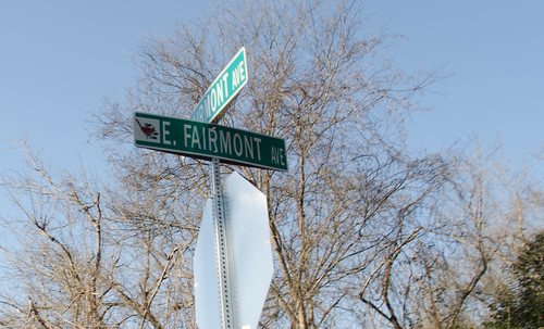
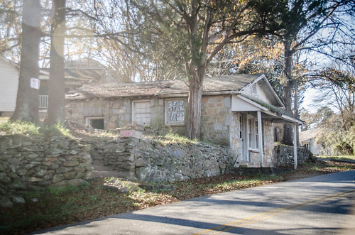
One such community was Fairmont Mill. Located south of I-85 along the banks of the Middle Tyger River, there once was a large textile mill here. Now there seemed to be nothing but a couple of churches and a few houses remaining. I would occasionally drive through on my way back from lunch or while out visiting one of my schools just because it seemed a bit…alien. For today’s trip this was one of the outliers on my explorations, since it’s the Tyger Basin rather than the Pacolet River.
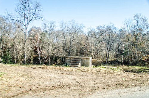
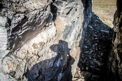
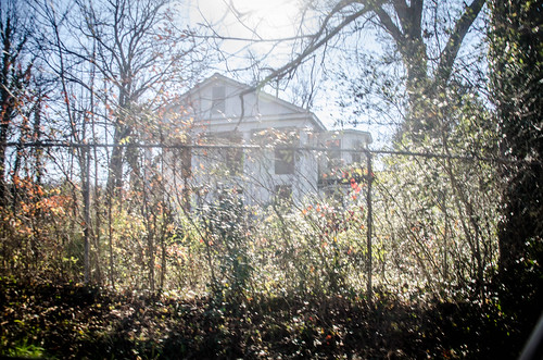
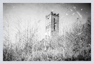
I arrived to find a large housing development under construction on the north end of the community. The homogeneity of style threatened the unique cottages of the old village. At the bridge over the Tyger an old church sat abandoned. The latest incarnation was the Unity in Christ Church. There was nothing in the GNIS data to indicate a previous name, but I suspect that it had changed hands at some point. The doors were boarded, and windows broken out. A river bottom with an intriguing concrete block with steps were back behind the church.
I drove through the community. The streets were narrow and twisting. The houses were in various states of upkeep, some maintained nicely, some with clutter and junk, and some left to absolute ruin. I got a few friendly waves masking a certain air of suspicion. I was an outsider.
Given the name of the community, I knew there had to have been a mill here at some point. According to the information I could find, the namesake mill was built in 1846, and the town was known as Crawfordsville. The name was changed to Fairmont in the 1870s after ownership changed hands. At one point it even made Hula-hoops for Hasbro. Fairfield Mill ceased operation in 1962, relegated to being just a warehouse, and finally burned in 1977. Try as I might, though, I couldn’t find any trace of the mill.
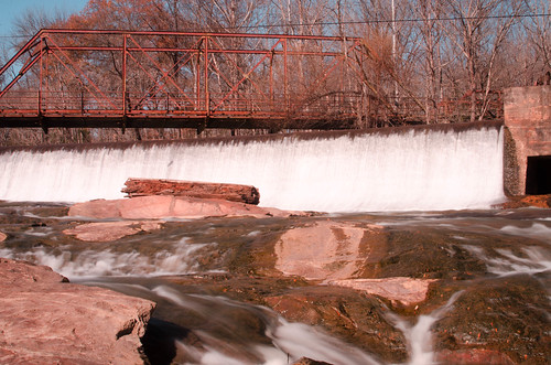
Finally I found the dam that powered the mill just a bit upstream from the bridge I had crossed earlier. Water was rushing through the floodgates. I would have loved to have explored further, but there were No Trespassing signs everywhere.
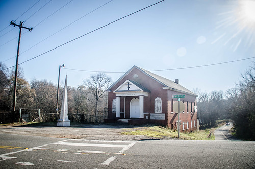
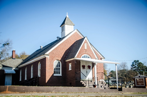
I had other places to explore, but I wanted to keep Fairmont Mills on my list for further explorations. So far I’ve not been able to find much online information, such as a location for the mill, but I’ll save that for later. I did pause to take a photo of the Baptist Church in the heart of the community.
Arkwright Mill
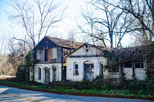
I took Reidville Road toward Spartanburg. I didn’t really want to go into town, so I tried to skirt the southern side of town. A street sign caught my eye, and I actually did a U-Turn to check it out. “Ark Main Street” raised questions. Was this the main street of yet another insular community?
I had stumbled on another outlier. This was the mill village community for the Arkwright Mill. Named for the inventor of the spinning frame, Richard Arkwright, the mill opened in 1898 and closed in 1979.
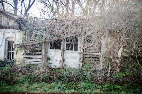
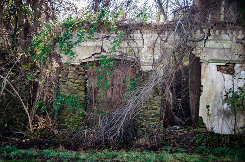
I actually missed most of the mill because I’d stumbled on this without any prior knowledge of the site. Apparently there are still a few ruins and a dam on Fairforest Creek.
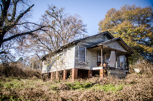
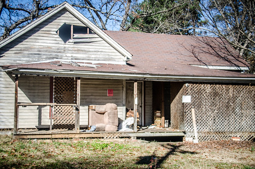
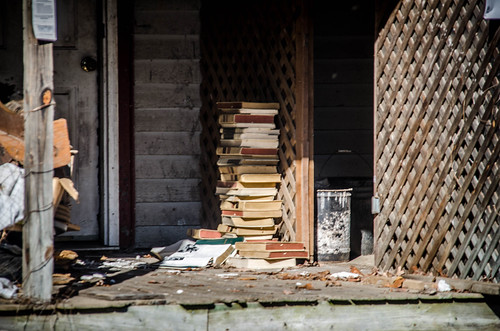
I did take a photo of one old abandoned house. I just liked the lighting on the old stack of books on the porch.
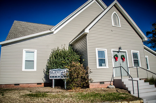
Glendale Shoals
I continued zig-zagging across the south side of town until I reached my first target, Glendale Shoals. I had visited this area a couple of times before and taken photos, but hadn’t spent any appreciable time here. I decided I’d have to do that today, even if I didn’t make it to any other stops.
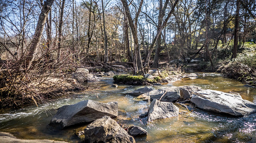
Glendale isn’t on the Pacolet River itself. It is on Lawson’s Fork Creek, which is a major tributary to the Pacolet, so it still qualifies as being part of the river basin. The shoals at Glendale seemed a perfect spot for early industry. From 1772-1776 James Buffington and William Wofford established two iron works concerns. These supplied munitions and other items for the Revolution, and Wofford’s iron works were destroyed by “Bloody” Bill Cunningham in 1781. The region continued to produce iron until the Civil War, when production was given over to the more lucrative cotton industry.

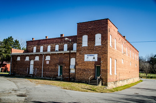
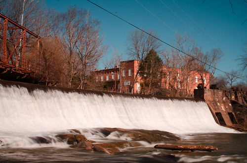
In 1832 Dr. James Bivings brought in workers and built the first cotton mill. The area was known as Bivingsville until 1876, when it was renamed Glendale. Dexter Converse and Albert Twitchell took over the mill in 1856, and it continued in operation until 1961.
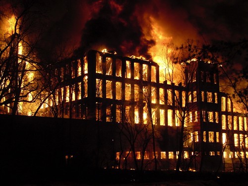
The mill sat empty on the banks of Glendale Shoals until March 21, 2004 when it caught fire and burned down. Terry Gilmer was there to document the fire. More of his photos can be seen on the Glendale History website.
The Glendale Shoals Nature Preserve was established in 1993 with a donation of land from Billy Tobias. In 2008 Wofford College dedicated the Goodall Environmental Studies Center in the old mill offices that survived. The Glendale Outdoor Leadership School was also established in the community’s old Methodist church, and trails were set up along the banks of the shoals of Lawson’s Fork.
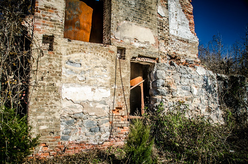
That’s how I found things on my visit on this particular day. Back to my initial comments regarding insular communities, one of the things about such communities is that they tend to have unique architecture, or at least one or two unique buildings. As a mill village, many of the Glendale houses have that characteristic mill village look. However, on the other side of the river are several old buildings built into a hillside. These are now falling into ruin, but have always intrigued me.
The buildings look quasi-commercial, and I’ve wondered if this was the town’s commercial center. There are houses set back just above these, so I don’t think they were residences. There are No Trespassing signs all around them.
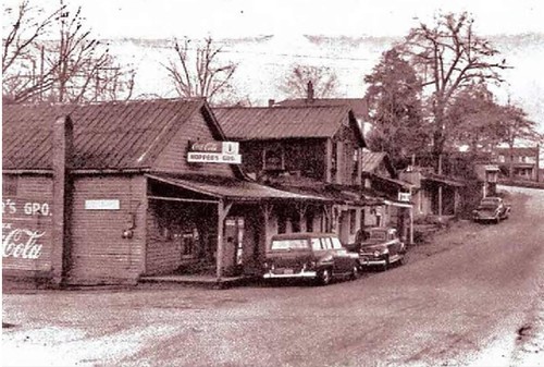
UPDATE: Just as I was about to click “Publish” on this post I came across another image on the Glendale website, contained in a PDF on the site. This file identifies the buildings as the “Corner Grocery (Across the Bridge.)” There’s a sign on the store with another name, but I can’t quite make it out. I did a screen capture of the image to post here. The image is undated, but from the automobiles I would guess late 1940s, early 1950s.
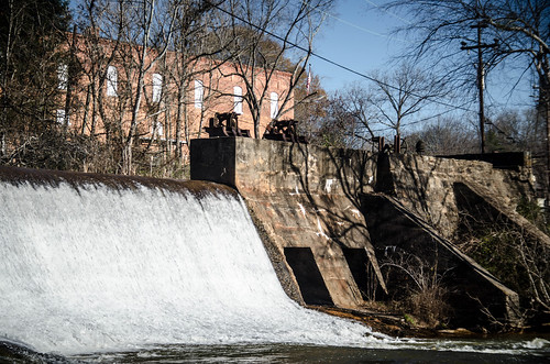
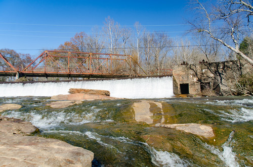
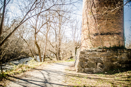
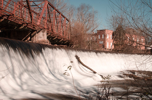
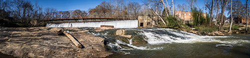
I had parked just across from the “commercial” buildings at one end of the old iron truss bridge. The bridge is now maintained as part of the trail system, and one can still walk across it, though it’s been closed to vehicular traffic since construction of the new bridge. The bridge sits at the top of the dam, which, in turn, is at the top of the shoals.
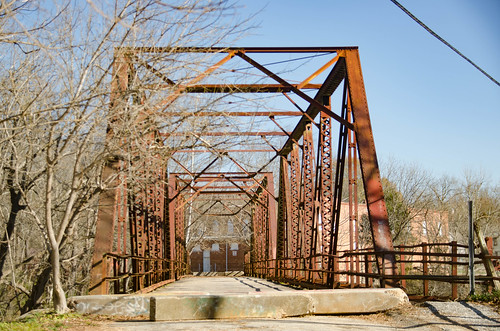

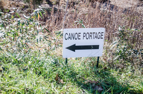
As a kayaker both Lawson’s Fork Creek and the Pacolet River have intrigued me. I haven’t paddled either of them, but I have been impressed with efforts to set up a blueway along the rivers. Where I had parked my car was the take-out for a canoe portage around the dam and shoals. I spotted another put-in down below the shoals, and meant to check that out, but for some reason didn’t get to it. I have seen videos of more adventurous paddlers running the dam and shoals, but I wouldn’t suggest it.
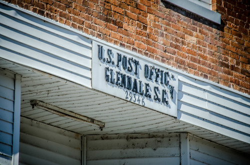
I walked on across the bridge, eager to explore the mill ruins on the other side of the river. First up is an old building that serves as a Masonic lodge and post office. The post office is still active.
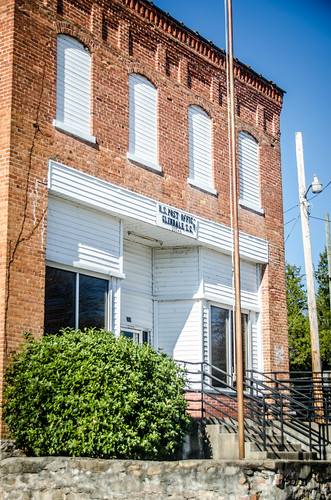
Across from the post office sits the old mill office. This has been remodeled and is now in use by Wofford for the Goodall Center.

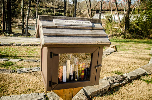
The Glendale Shoals Nature Preserve trail starts here. Behind the office is a garden, and amphitheater, and even a small free library.
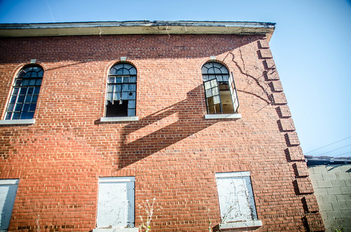
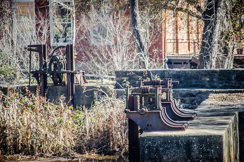
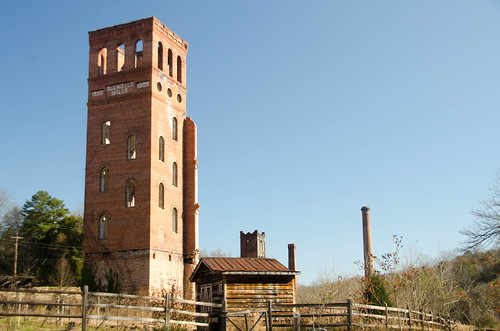
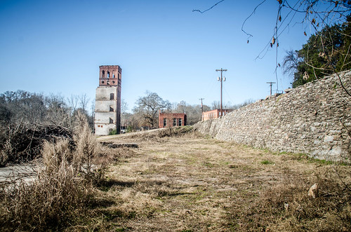
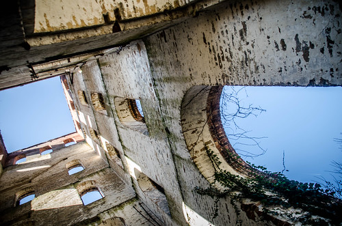
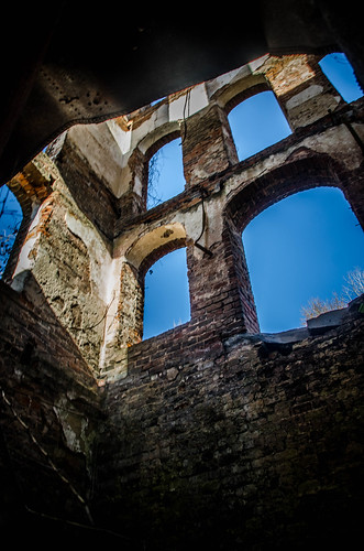
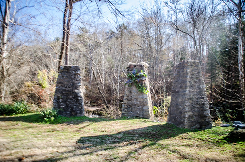
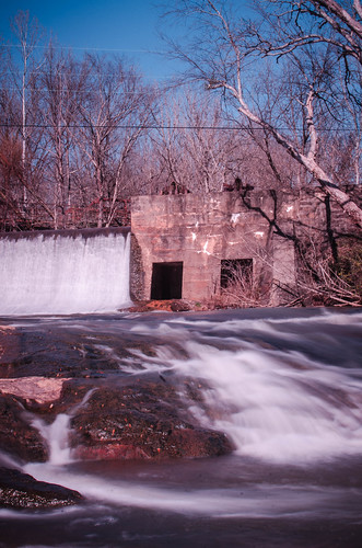
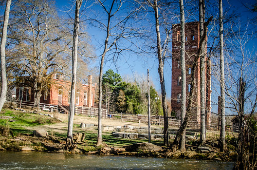
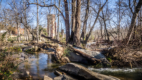
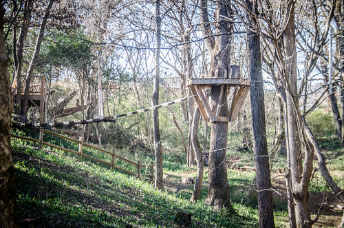
From there the trail follows the river, running between its banks and the footprint of the old mill. The mill’s towers and smokestacks are the most prominent remains.
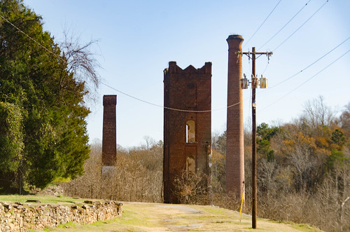
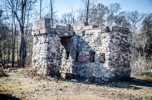
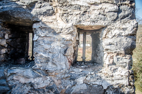
There were a couple of very thick-walled structures at the lower end of the mill. Looking back at the image of the intact mill, this must have been part of the foundation/basement structure, hence the thick walls. There was one smaller extension of the mill out toward the river.
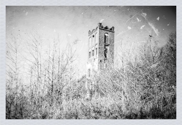
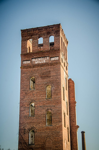
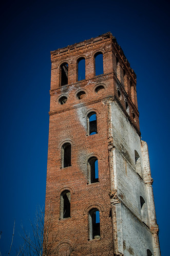
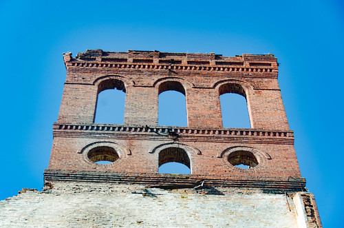
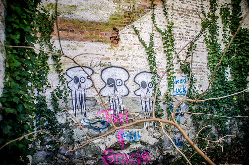
I decided to check out the larger of the two towers. This once supported the staircases for the various mill floors. The arched windows are staggered, following the descent of the stairs. The top of this tower has the words “Glendale Mills, 1852-1902”. I’m not sure of the significance of the dates. The staircase burned in the 2004 fire, so all that remains is an open interior, now covered with graffiti.
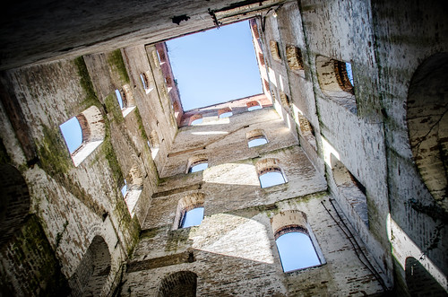
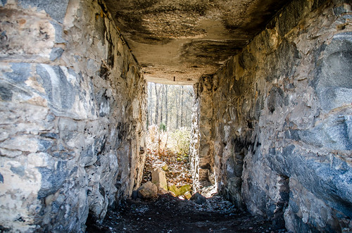
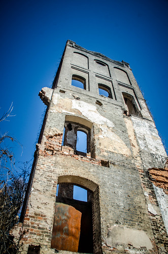
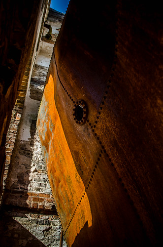
A similar, smaller tower sits at the other end of the mill. The entrance to this one was mostly blocked by a large iron plate, possibly the remains of a boiler or other tank. I was able to get a couple of interior shots, though.
About equidistant from the two towers, on the banks of the creek, the Wofford group has built a labyrinth. These have become popular as a tool for meditation and retrospection.
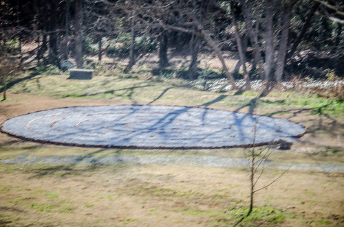
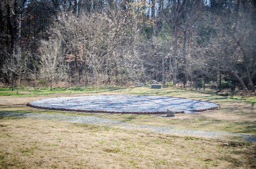
From my higher vantage point, the circular labyrinth reminded me of I’itoi’s Maze. The image was everywhere when we lived in Tucson for awhile. This symbol of the Tohono O’odham people of Arizona is meant to symbolize their primal ancestor’s journey from the center of the earth – a type of creation myth or origin story. It also serves as a metaphor for life’s journey.

I wandered down to the maze and began my own metaphysical journey. By coincidence, I had been listening to “Imaginary Worlds,” a excellent podcast about science fiction, comic books, and fantasy by Eric Molinsky. I had actually just listened to the very first episode while driving to Glendale, entitled “Origin Stories,” in which the origin stories of various superheroes and comic book characters are examined. The episode argues that the most compelling and enduring characters have very clear origin stories. Also in this episode psychologist Dr. Robin Rosenberg states that the inability for one to create their own origin story is a sign of mental illness. How did I get here?
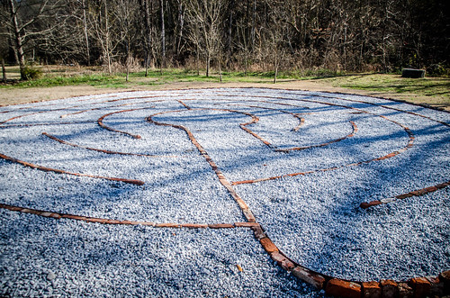
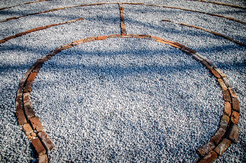
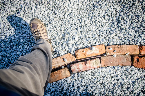
As I walked the maze I contemplated my own life, reflecting on my own origin story and what led me to this point. I came to the realization that this labyrinth only has one route. Every step is predetermined. Deciding that I needed to take control of my metaphorical steps and not leave everything to a predetermined path, I purposefully stepped across the brick lines, breaking free. Perhaps this labyrinth isn’t a good metaphor for life after all. However, it served its purpose well – getting me to think deeply about my own direction.
Breaking free from the maze, I continued on the trail past a set of stone supports, then over to the remaining smokestacks. These were like many I’d seen at other mills. It looked like access to the interior had been cut off.


I thought about continuing on around the two mile trail, but decided to head back. I had some other photographs of the dam and bridge I wanted to take with different lenses and my tripod, which meant a trip back to the car. As I walked it occurred to me that there had to be a geocache or two in the area. I pulled out my photo with the geocaching app, and, sure enough, I was right on top of one. As I approached the location I spotted another couple coming towards the same spot with GPSs in hand – fellow geocachers.
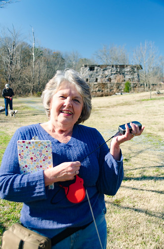
Carroll and Kay Poteat live nearby in the Camp Croft area, and had already found several geocaches in the Glendale area. Together we found two more. We walked and talked quite a bit. Turns out we knew lots of folks in common. The active geocaching community is somewhat close-knit. It was great chatting with them for awhile.
The day was getting away from me. It was already noon and I had some photos I really wanted to take. I went back to the car and got my tripod, 35mm prime lens, and my neutral density filters. I was hoping to use the filters to get some longer exposure shots, even though it was midday. I climbed down onto the rocky shoals, aiming back up at the dam. I wasn’t terribly thrilled with the results.
As with my Whitewater Falls shots from this past October, I had to do a TON of color correction. Perhaps my cheap neutral density filters aren’t as neutral as I might have hoped.
I took a few more shots of the shoals area with my little Lumix before heading back to the car.
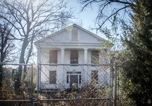
Back in the car I crossed the river and drove through the Glendale Mill Village. There was one large home sitting abandoned. Turns out this was the home of Dr. James Bivings, and later Dexter Converse. It served as the home for other mill supervisors down through the years. I hope there are plans to preserve it.
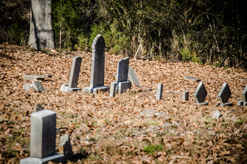
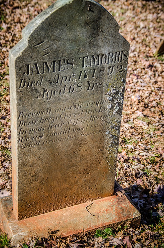
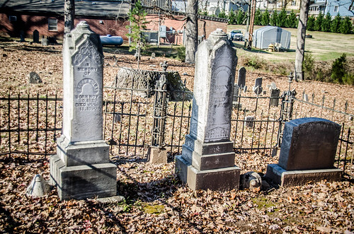
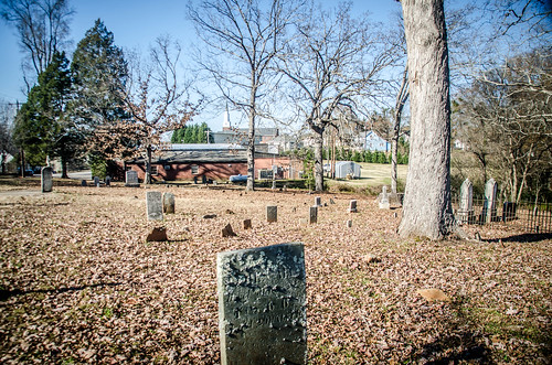
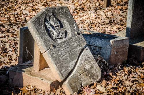
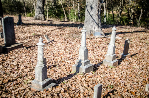
I reached an old church and cemetery. This was once the Glendale Methodist Church. It has sense been preserved and serves as headquarters for the Glendale Outdoors Leadership School. A small angel on a large pedestal caught my attention, so I stopped for a bit.
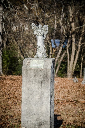
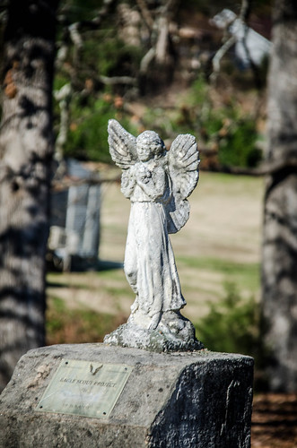
I couldn’t tell if this were actually a grave, but a faded plaque said something about an Eagle Scout project. I wandered through the cemetery exploring a bit.
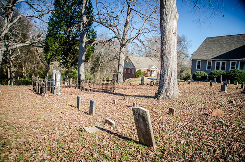
Behind the old church the outdoor school had set up an elaborate high ropes course. I had to chuckle at the irony of a potentially dangerous activity this close to a cemetery. Convenient.
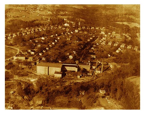
It was well past lunch and I wasn’t done for the day, but a long shot. I had many more mills along the Pacolet I wanted to explore. Those will come up in Part Two. For now, though, I’ll leave you with this aerial view of Glendale circa 1946.
I can identify with your opening comments. Happens here too.
One day it would be cool to check out the rock ledges just upstream from Glendale. I have seen it on Google Earth, but never been over to the site in person.
Enjoyed the post a lot.
We definitely need to get back over there. The rock ledges you mentioned were part of the Wofford Iron Works. There is a chute carved into the rock that makes a great kayak run. I’ve been wanting to try it out.
Another interesting one, Tom. Regarding the name of the grocery store, I’m pretty certain that it is Hopper’s Groc. I found another link entitled “Glendale Merchants – From the Early 1900’s Through 1970’s” ( glendale.com/stores.html ). The third paragraph in the article states that: “LeMaster’s Grocery was one of the cluster of moderate size wood frame store buildings/businesses located at the west end of the Glendale Bridge. The building and business was owned and operated by John C. LeMaster. It was stocked with a good variety of groceries along with a limited supply of fresh meats. Having a storage room adjoining the building, a good variety of feeds for animals and pets were also stocked. Limited delivery was made when requested, Mr. LeMaster operated the store for many years before his retirement in 1941 at which time the business was sold to Elbert C. Hopper.” Hopper seems to fit the look of the sign on the store in the old photo. Please keep ’em coming….
That’s my grandfather’s old grocery. Elbert C. Hopper
I too identify w/your opening comments, I enjoy your blog very much and at times take myself on imaginary trips to see all of these historical places. There is a mill off of Highway 11 in Fingerville that I would like to explore.
According to a story on goupstate.com, the Unity in Christ Church building was once First Baptist Church of Fairmont
I really enjoyed your story and pictures of Glendale. I’m local and we live on the eastside so we’ve been there many times. I’ve also done some posts on Glendale on my blog. http://sharonscrapbook.blogspot.com/search/label/Glendale
If you look at the damn from the bridge, the mill was on the left of the river. It sat along the edge of the water. I watched the mill burn down on Halloween night. I grew up in Fairmont.
The mill was across from the old Baptist church in your pic the other church is the Methodist church where my family is buried i cam gove you any info you need.
If you need any info on Fairmont my grand father worked there the old house was my cousins my sister still lives on the hill.my parents or burried at the Methodist church the one you called Baptist.
Not sure if this blog is still active but to give you a small piece of background on the Fairmont Mill. My great grandfather CP Mathews owned that mill around 1900. Not sure when he purchased the mill but it was closed by floods sometime in the early 1900’s. He did sell what was left and the property before 1910. Don’t have the name of the company that bought the mill. My great grandfather was active in the cotton trade through the 1950’s.
Great pictures of Glendale. If you still haven’t found the Fairmont mill, it is on the west bank of the Middle Tyger river, just upstream from the bridge. There is still one low brick wall standing, facing the river. You can park at the corner of Fairmont and Sunset Cir., directly across from the Unity Church. There’s an old paved driveway that you can pull into, parallel to the river. I was there on 10/19/16.
I love the random stack of books at that one house you photographed. Somehow I seem to have missed everything awesome about Glendale! I must go back now that you’ve opened my eyes. The Wofford Labyrinth is really cool. I didn’t know about that. A lot of this I didn’t know about. Your post, as always, are extremely informative and interesting to read. I make it a point now to always see if you’ve written about any place that I plan on visiting.
I moved to Glendale from Spartanburg last year and love it. I used to drive around the town and liked seeing the shoals, and what was left of the old Mill. I sold my house in Spartanburg, and decided to drive through Glendale. Low and behold a For Sale sign had just gone up in front of a cute, well cared Mill house. I bought it the next day. I like the small town feel, that takes you back to a simpler time. I enjoy walking the dogs by the shoals, and seeing the ruins. Soon the bridge will be complete, adding another attraction. Wofford is a great asset, and hopefully they will restore the “mansion” soon.