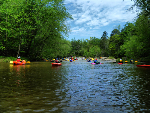
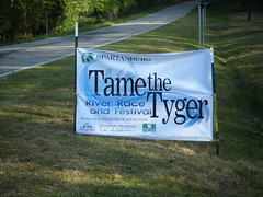
Saturday I joined 191 fellow kayakers for the 13th annual Tame the Tyger river race. The race is sponsored by the Tyger River Foundation and the Spartanburg County Parks and Recreation Department.
I’ve run the Tyger River several times, but have never participated in the Tame the Tyger event. It falls on the second Saturday of April, and that’s when I usually have a Lowcountry Unfiltered paddling trip. This year our LCU trip got postponed for a week, so I had the weekend open.
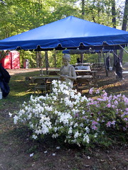
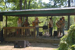
The event consists of an actual race, where participants are timed, and participate in various categories. There is also a “fun float” for those wanting to run the river, but not compete. Since I’m dreadfully out of shape and have let my whitewater skills lag a bit I signed up for the fun float. Live music and a barbecue dinner round out the event at the take-out.
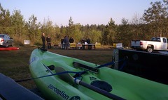
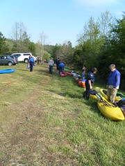
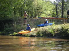
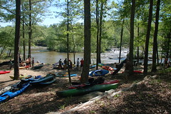
Since I had never participated in Tame the Tyger, I wanted to get an early start. I knew it would be crowded, so I wanted to get settle before things got crazy. I drove over to the put-in on the North Tyger River, arriving around 8:00 am. There were already a few paddlers there, but for the most part it was fairly quiet. I picked up my registration packet, then drove down to the river and dropped off my boat.
It felt a bit weird just leaving my gear there, but there were other boats around, and things seemed to be well-organized and supervised. I left put-in and drove down to the take-out, about eight miles downstream, to park the truck and wait for the shuttle back to my boat.
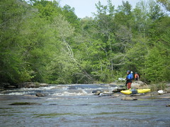
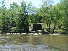
There was hardly any activity at the take-out. I got a prime parking space since I was so early, and I had time to walk out over the bridge and take a few photos while waiting for the shuttle bus to come back.
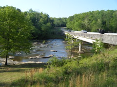
It’s probably been eight years since I’ve paddled this river, certainly before I started keeping this blog, because I have no record of those trips. Bob Donnan and I ran a section of the river through Rose Hill a few years ago, but it has been quite awhile for this section. One of the reasons we haven’t run this section has been a lack of river access. Our traditional put-in and take-out locations are now marked as Posted – Private Property. It looks like the event organizers have made arrangements with the land owners to grant access for the race. As I stood at the take-out looking at the nice campground and access (along with all of the Posted signs), I wondered if one could arrange access for other private excursions.
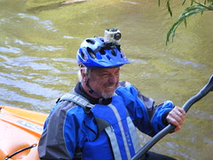
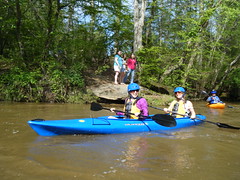
Several other paddlers joined me, and soon the shuttle bus arrived and we boarded. It seemed like we were taking a round-about trek to the put-in, but it gave me a chance to meet some of my fellow paddlers. There were two girls from North Carolina who live near the Nantahala who decided to come down for the race. Two other guys were speaking only French – turns out they were from Canada and worked at Michelin. One other guy with a camera on his helmet joined us, and one guy with his daughter who was serving as a safety boater boarded the bus.
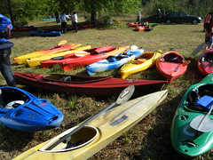
Eventually we made it to the put-in. The crowds had started to gather, as more boats were unloaded. It was a bit tricky walking down to the river. A four-wheeler with a trailer was hauling boats down from the parking/registration area.

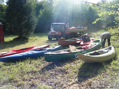
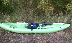
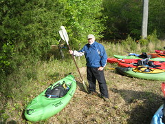
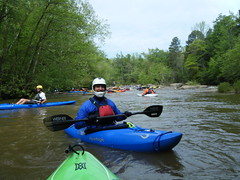
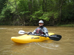
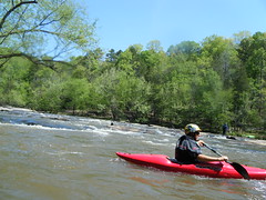
I figured there would be a variety of boats. And, I guess I could have figured there were going to be some rec boats since this was called a “fun float”, even though the race rules said that all boats had to be whitewater approved and participants would have to have helmets and PFDs. At least I felt like I was sufficiently outfitted for the trip.

It was about 9:30, and even though the fun float was supposed to start at 10:00, there were already quite a few paddlers on the river. The two Michelin guys, Chris and Johann, and the helmet cam guy, Jim, decided that we could team up and head on down the river. We launched, sliding on down the bank and into the river.
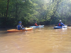
Jim’s helmet cam was one of the little Hero cams. Johann also had one mounted to the front of his kayak. These little waterproof video cameras were quite popular today, as I saw several helmet and kayak mounts. Chris had a waterproof Fuji similar to mine, and it seemed all of the paddlers had some sort of waterproof camera. I guess that just makes sense.
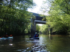
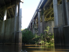
The put-in was further upstream on the North Tyger than I had paddled. We went under the I-26 bridge, then came to bridge where Bob and I had put in.
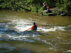
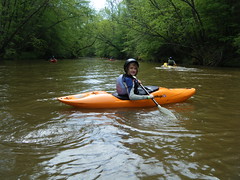
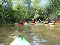
As it turned out, Chris and I were the only ones with any whitewater experience. Jim and Johann were novices. We ran into trouble right off the bat. There were a few ripples, but the first rapid of any consequence was a simple chute with a 2-3 foot drop. Chris made it through with no problem. Johann followed and wiped out, but was able to recover. Jim had more problems. He flipped, and for several tense moments could neither roll his boat nor pull the release on his spray skirt. He was trapped. Chris was able to help him recover, though, but I’m sure it was scary. Fortunately, I followed up without incident.
The two paddling sisters from North Carolina cleared the rapid just behind us…
That was just a minor rapid, so I was a bit worried about how these guys would do on down. I was worried about my paddling skills, and was happy to have some light stuff to get reacquainted with my boat.
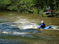
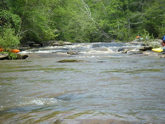
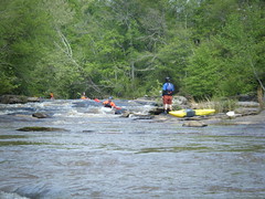
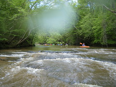
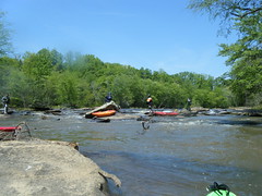
The next major rapid, Nancy Thomas Shoals, was soon upon us. I was glad to see rescue boaters at the base of the shoals, given what we had just been through. Fortunately, I remembered this rapid and some of its quirks. A few paddlers had caught up with us, and I watched them take two different lines. Some ran it straight down the middle and found themselves somewhat beached on rocks. The cleaner, less evident route was the one I remembered – drop left, then immediately back right finish out the rapid. At low water I’ve been known to paddle hard left back upstream after the first drop, then catch the far river left.
My paddling partners got out to scout, but I stayed in the boat. After watching a couple of others go through, I felt confident enough to try it. My line worked perfectly, and soon I was at the bottom of the shoals. Chris soon followed my lead.
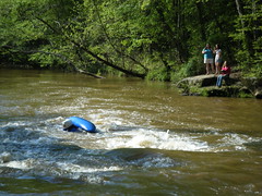
Johann tried, but flipped again on this rapid. He made a recovery and pulled out river right. Unfortunately he knocked his camera off the front of his boat. It was a good thing he had it attached to a leash. After his initial scare, Jim didn’t even want to attempt it. He started scouting for a route around the rapid.
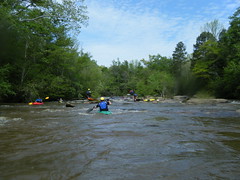
As we waited for Jim the river started to get crowded. Several young paddlers misjudged the route and got hung up on the rocks. Several other paddlers joined them in the collision, creating something of a pile-up.


We waited and waited and waited for Jim. As other paddlers came through, I heard someone call my name, and looked over to see my good friend Tim Hawkins with his daughter Rachel. Tim and I both grew up in Gray Court and went to Furman together, so I’ve known him for ages. He’s now a big time whitewater paddler, tackling the upper Green and other rivers that I just won’t try. His daughter is just as avid a paddler as he is, and she was handling the Tyger rapids like they were nothing.
Even though we’ve stayed in touch via Facebook, Tim and I hadn’t actually seen each other since Furman. I bade my farewell to Chris, and decided to head on down the river with Tim and Rachel (and a bunch of other paddlers.)
At the top of the next little rapid I ran into trouble. The rapid itself was nothing of consequence – just a straight shot down a little shoal. However, I snagged a submerged rock at the top of the rapid and flipped. It was more embarrassing than anything. Tim helped me recover my boat and paddle and get settled. I turned to take a photo of my nemesis, with water droplets still on my camera lens.
One of the reasons I wiped out was because of that blasted camera. I was putting it away when I hit the rock. That reminded me of the problems with whitewater photography – you better be concentrating on your line and paddling, or you’re going to wind up in trouble. Even on flat water these whitewater boats will spin when you stop paddling, which messes up most of your other shots. The general rule is that you shouldn’t expect decent photos unless you are stopped.
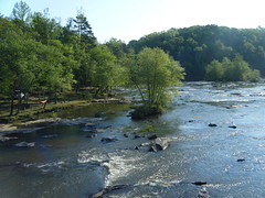
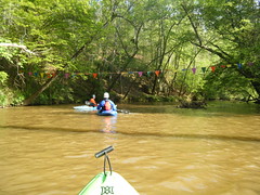
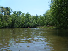
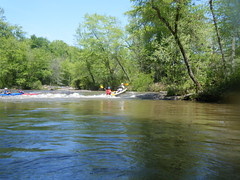
On the next rapid, Harrison Shoals, I got stuck on one more rock, but was able to free myself without spilling. I don’t have any shots of that rapid because of the aforementioned problems. Continuing on down, we soon found ourselves at the confluence of the South and North Tyger rivers.
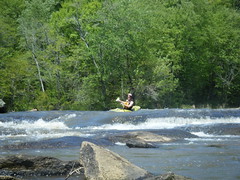
At this point the river widens and Nesbitt Shoals begins. The top of the rapid is a boulder garden with a few chutes and ledges. The tricky bit is near the Nesbitt Bridge on Walnut Grove Road. I had a major wipe-out here last time Bob and I paddled this section, leaving me bruised and bloodied. Even though that was at high water, I still decided to get out and scout.
By this time the actual racers had caught up to us. In the rules for the race it said that the folks on the fun float were to be considered as “river obstacles.” Now, I take my duties as river obstacle seriously, but the thought of being broadsided by and angry racer in a pointy boat didn’t really appeal to me. That added even more pressure to picking the correct line and getting through it quickly and efficiently.
I picked a line with which I was familiar, around a curve down river left. Unfortunately, it looked like most were going down the center, and only a few venturing on my path. Even the description of the rapids in the race materials described that route as “squirrely.” I started to second guess myself. By this time Tim’s daughter, Rachel, was tired of waiting for me to make up my mind, so they headed on downstream. I decided to go for it anyway, and ran it without problem.
Past Nesbitt Bridge I was on new territory – I had never paddled this section. I was going to miss my friend with more experience on the river, but I can understand them continuing on down. Just past the bridge there was another set of shoals at the old Nesbitt Bridge. I made it through without incident, but was still trying to stay clear of the racers.
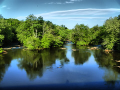
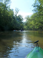
By this time I was getting very tired. Everyone, racers and fun floaters alike, were paddling to beat the band. No one seemed to just be floating along with the current. There were many more long flat stretches on this section, and I decided to heck with it, I was going to float. Of course, every time I tried to do that my boat did a Crazy Ivan, blocking the path for some oncoming racer. Then there was the wind – every time we hit open flat water a stiff headwind seemed to blow us back upstream. I had no choice but to buckle down and paddle.
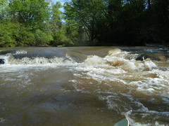
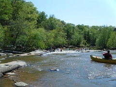
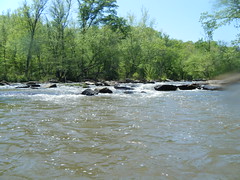
There were several more sets of shoals. I would hang back and watch the routes others took, then followed suit. A couple of the drops were quite significant, and you could easily wind up in trouble. Having read the rapids descriptions helped. On one set of shoals, the obvious route is on river right. However, that sweeps you under a low hanging limb. I took a route down the middle, picking my way through the rocks, and made it through OK. I watched several get snagged on the tree. The safety guys and rescue boaters were busy.
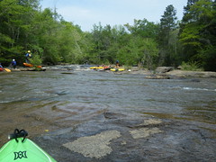
I did OK in unknown waters. I got snagged a couple of times and had to rock my boat off of submerged rocks, but I didn’t flit or lose control. I don’t have many photos of that section, but here are a couple…

The last rapid of any significance was a drop over several shoals, then a hard right around a curve over a nice little surfing wave. I managed it without a problem, boat a tandem canoe wiped out on the surfing wave.
I was exhausted. When I finally came around the bend and saw Hills Bridge I let out an audible sigh of relief.
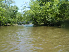
There was one more set of shoals that ended right at the take out, but I’d had enough. I pulled out at the bridge and called it a day. It was now 1:30, meaning I’d been on the river for 4 hours. The winners were running it in 1 hour and 17 minutes. I was glad I did the “fun” float.
Once I got my gear squared away I went on up to the party and grabbed a plate of BBQ in my dripping wet clothes. I didn’t care. A Bluegrass band was playing, and the race was winding up down below.
I met back up with Tim and Rachel, and we caught up even more as we had lunch.
Overall it was a great day, and I’m glad I participated. It must be said, though, that this is not an easy river to paddle. To me, the rapids seem much more technical than the Green, Tuckaseegee, or even the Nantahala. It could be that I’m just more familiar with those rivers, and lack confidence on this one. Laura reminded me that inner tubes regularly float the Green, and they don’t – they couldn’t here.
What this trip did was whet my taste for more whitewater. I think I’ll have to head back up to the Green in the near future. But, as a breather, I’ll do more flat water next weekend on the Edisto with my friends from the Lowcountry.
View Tame the Tyger in a larger map
Looks like it was a great day!
Cool! looking at the Saluda below Holliday Dam on GoogleEarth, I can see how these upcountry rivers would be challenging. The Tyger never seemed to be a big river to me, so I’m glad it’s big enough for a great and challenging experience without constant groundings on sand bars.
Ken, I’ve seen some of the rapids on the Saluda at Erwin Mill near Ware Place, and they look interesting.. The Saluda has been dammed (damned?) more times than the Tyger, but it still have some decent whitewater. My thoughts is that it will be flatter than the Tyger, but with some bursts of excitement.
I liked your descriptions of finding the best path around some of the areas. Nice photos as well.
Hi Tom!
One of the paddling sisters, here! I really enjoyed your account of the river and your photos. Thanks for sharing and hope to see you again soon!
Hey Abigail! I’ll send you a link to a full resolution copy of your photo. Hope you guys had a good time. That was a fun trip.