Thanksgiving has come and gone and we now find ourselves no the first day of December, 2018. I didn’t do any great explorations or historic research over the past couple of weeks, but I did get out and about. Perhaps I should start a series similar to my “Random Skagit” posts from last year in Washington State. Regardless, here’s a roundup of a few of the happenings over the last week or so.
Clydesdales in Greenville
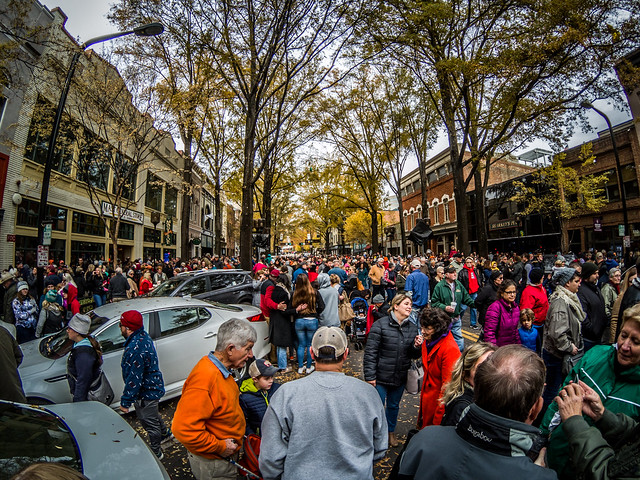
The Budweiser Clydesdales were in Greenville last Saturday and Laura really wanted to see them. Laura’s sister, Amy, was with us for Thanksgiving, so we headed downtown and found a spot in a parking garage, then wandered over to the Hyatt. The Budweiser wagon was parked out front on Main Street along with two large Bud trucks. They would be stopping along the route and making deliveries to restaurants on Main Street.
When we arrived the crowds were incredible. I got photos of hands raised with cell phones, but not much else.
We made our way on down to Coffee Street where we were able to get a little closer to the street, but the view really didn’t improve. Eventually the horses made their way to our location.
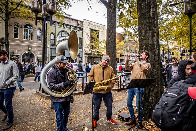
I can’t remember when there were this many people downtown. we lingered a bit stopping into several shops, which, I guess, was the whole point of this event. There were even a few buskers taking advantage of the crowds.
That was all well and good, and I didn’t mind the crowds so much. The problem came when we tried to leave. Traffic was backed up in the parking garage and we couldn’t get out. We waited nearly an hour. Finally some heroic soul stood under the exit gate so that it wouldn’t close, allowing the cars to exit without delay.
With the death of my aunt earlier in the week I’d been thinking about my parents quite a bit. My father was a strict Pentecostal Holiness preacher – no rock and roll, no alcohol, no “rated” movies (whatever that meant.) I couldn’t help wonder how disapproving they would be to see the crowds (and us) gathering to watch a beer delivery. Times change.
Crosswell School
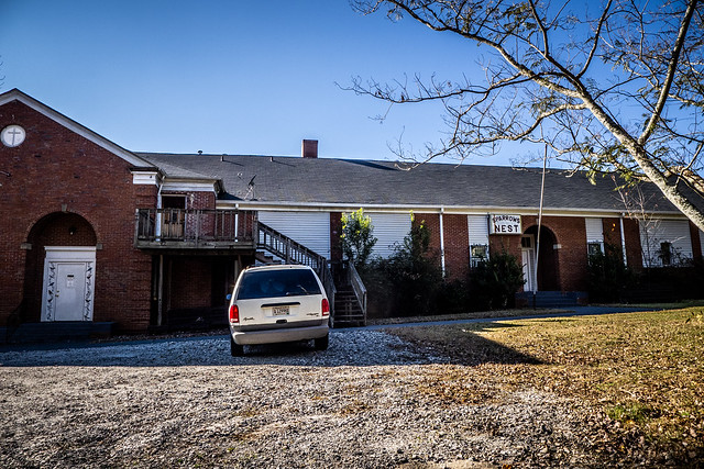
On Monday I was out and about running errands which took me out toward Easley. On my GPS I noticed a road named “Crosswell School Road.” Of course I had to check it out. It was an interesting road that ran along the railroad then reconnected with Highway 123. About a mile along I found the eponymous school, an older brick building now repurposed.
I didn’t have this one on my map of old schools and it didn’t show up in the GNIS data. Not far from here off of Saluda Dam Road is the new Crosswell Elementary, part of the Pickens County School District. The school’s website describes their history…
The first Crosswell School was organized in 1889. John Easley donated his cotton house for the school building, which was located across from Crosswell Baptist Church on what is now Fish Trap Road. Miss Carrie Easley, sister of John Easley, was the first teacher. Parents paid approximately three dollars ($3) per month for the teacher’s salary. There were five or six children enrolled.
The following year, in 1890, Crosswell School was built on Crosswell School Road near what is now the Upper State Fair Grounds. Daniel W. Massingale and O.W. Garrison donated the land. The building was a one-room frame structure with no water. In 1908 this building was torn down and another frame building was erected. A well was dug, but with every rain it filled with surface water so it could not be used. The third building, built in 1915, had two rooms with an auditorium upstairs. It was heated with potbelly wood stoves and had outdoor toilets. Water was carried from across the road. This building was built in accordance with plans and specifications as set forth by the School Commission of South Carolina. Mrs. Charlie Johnson started the first hot lunches. Each child brought his own plate and spoon and was served from a big boiler on a potbelly stove. A T-Model Ford, driven by Lawrence Garrison, was the first bus to carry children to and from school.Crosswell Elementary School Website
In the 1920’s a new brick building with six classrooms and an auditorium was built. The old school building was moved and converted into a house for the school custodian. At the time the building was built there were four teachers. Beginning with 25 books, the first school library was started. The state, the pupils and teachers donated money for these books.
Now I’m curious about this “School Commission of South Carolina” and what school plans it described. Regardless, I was able to find another extant old school and add it to my map.
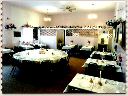
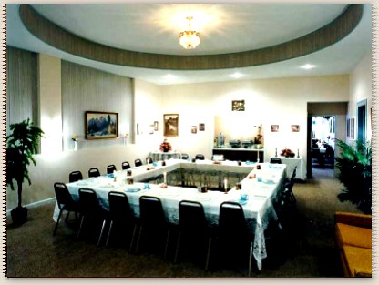
Signs indicated that a business called “The Sparrow’s Nest” operated out of the old school. When I checked I found that it was a catering/restaurant/event venue. The website seems to still be intact, but it looks like they have closed permanently. That’s a shame because from these images I found on the website it looks like they had done a wonderful job of transforming the old school.

Pickens Flea Market
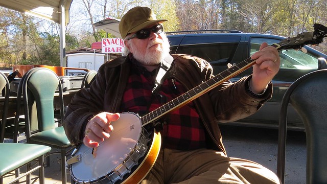
I’ve become such a regular here that unless something spectacular happens, it just doesn’t warrant a separate post. This particular Wednesday morning it was COLD, 23º when I got up. I waited until 9:00 before heading out. I had my banjo, my Alvarez guitar, melodica, and tin whistle. I did not take my amp.
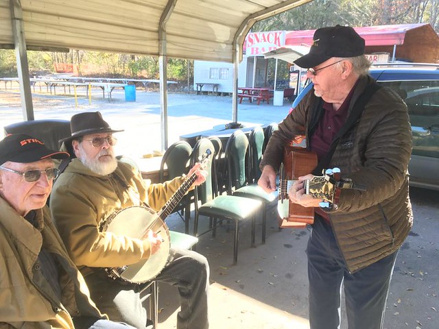
A few had decided to brave the cold weather, but not many. I was able to drive in and park right at the shelter. Ralph Perry had the fire going, but no one was playing. Soon Phil Cheney and Jack Ellenburg showed up, so I grabbed my instruments and things got underway.
Annette joined us with her guitar and banjo and another young man dropped by with his guitar. Mostly, though, it was Phil, Jack, and me, and that suited me just fine. The three of us get along great and seem to complement each other. I played banjo and melodica most of the time. One of my favorite pieces was a medley of Johnny Cash’s “Ain’t No Grave” combined with “Poor Wayfaring Stranger,” which has a similar feel. I also did a banjo solo on “Sweet By and By” and played “Be Thou My Vision” on tin whistle with Phil accompanying me on banjo. I was glad I had braved the cold and now I’m really looking forward to next Wednesday.
Horsepasture Valley
Once again I turn to tales from my family history. During the summers my father worked as a counselor at Rocky Bottom Camp on Highway 178 in northern Pickens County. At that time the Pentecostal Holiness Church held its youth camps at Rocky Bottom. Given my parents’ penchant for exploration, our family travelled many of the dirt roads in the region, including the areas now under Lake Jocassee.
I remember three distinct trips. In the first we came to a rickety wooden bridge crossing the Horsepasture River. My mother made all of us get out of the car and walk across the bridge, then Dad drove across as quickly as he could in the family Pontiac. I remember a second trip with my Taylor aunts when I had Glynda’s Kodak Brownie Box Camera. The third such trip we were on a winding dirt road which seemed never to end. It was dark, and everyone we met said that the main road was only “five more miles”, regardless of how far we had travelled.
Many years ago I hiked with Bob Donnan down a series of old logging roads and dirt roads. We started at Rocky Bottom and camped at the top of Laurel Fork Falls. A couple of years ago I left from the same general area in my old Subaru and drove up to Jump Off Rock. We didn’t have GPS on my childhood trips, but I suspect that the Jump Off Rock trip and Laurel Fork Trip were close to some of those earlier trips.
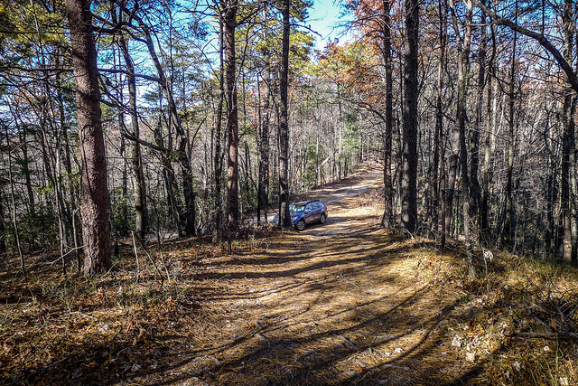
On this particular Wednesday, after my session at the flea market, I wanted to head back up to Jump Off Rock. The road was just as difficult as I remembered, but not too difficult for the new Subaru.
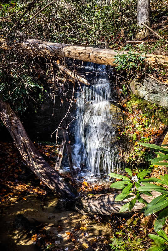
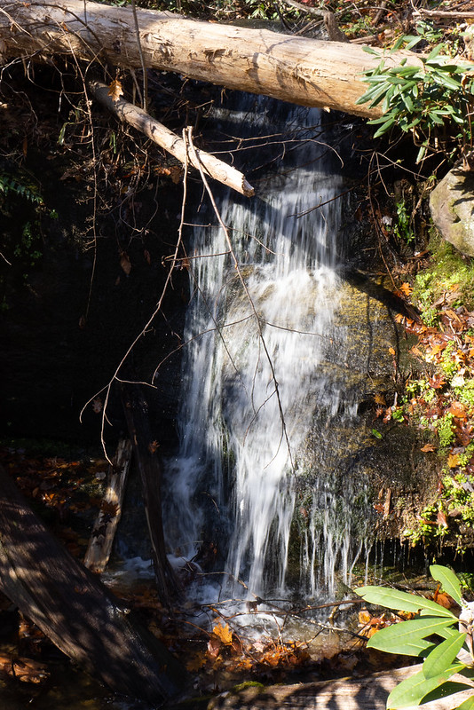
I came across a couple of small waterfalls.
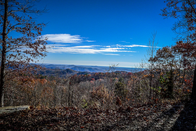
I gained the top of the ridge and paused to get a couple of shots of the lake below.
Still, this wasn’t the view I remembered from a couple of years ago.
The road was tricky and didn’t really look familiar and I was starting to second-guess my navigation. I came to several intersections and paused at each. At one there was a sign pointing to Highway 178, back the way I had come and another pointing toward Cleo Chapman Highway. I turned that way.
Continuing along I realized I wasn’t on the right road. I was turning away from Lake Jocassee. My GPS was no help.
I even came to a wooden bridge across a stream, hearkening back to the Pontiac/Horsepasture incident from decades ago. There were two routes for this crossing, one across the wooden bridge and one fording the stream.
Along the way there were signs indicating designated camp sites. I was thinking these would be great for drive-up camping, since I’m long past the point of hauling camp gear on my back.
After several more dicey dirt road miles I started to see signs of civilization, then eventually reached pavement at the Cleo Chapman Highway. I took a miss turn toward the cursed Cliffs community, then found my way back to Highway 11.
It was a good day out and about. The weather headed downhill toward the end of the week, so I wasn’t able to get out much more. Maybe next week I can head out a bit more and explore.


