Ghost towns, odd bits of masonry, abandoned towers, derelict schools, old cemeteries, old dirt roads – these are items that speak of a hidden history. These are the things you may pass many times daily and never give any thought. However, if they are brought to your attention, you never look at that area the same way. Just recently my Geocaching friend Larry Easler (aka HockeyHick) made me aware of a whole new genre of interesting historical remnants – Airway Beacon Markers.
Larry found one of these things fairly close to us and did the initial research and background history. He has since placed a geocache at the location as part of his “Hidden History” series of geocaches. On a cold morning after the recent snowfall, Tommy Thompson and I decided to check it out.
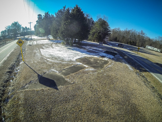
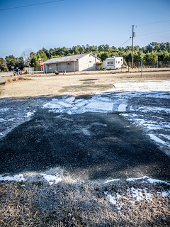
So, you’re driving along highway 417 just south of Reidville. At the intersection of Greenpond Road, aka Dillard’s Crossroads, you might not notice anything unusual.
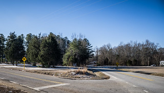
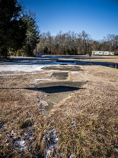
However, if you pull over and look at the southern corner of the crossroads, you will see an odd concrete arrow pointing to the east.
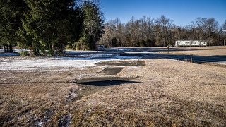
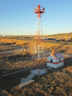
This arrow was part of the early Airway Beacon System, built in the 1920s as a visual aid for pilots on transcontinental air mail routes.
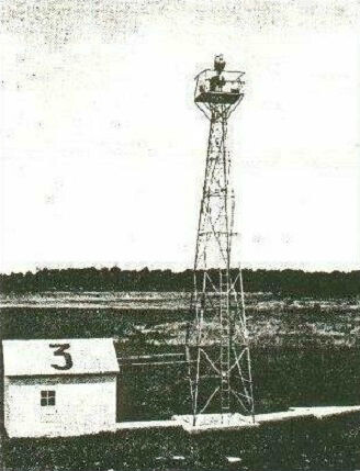
The airway beacon consisted of a concrete arrow with two pads. The arrow points to the next beacon. The middle pad had a lighted beacon, and the end pad held a maintenance shed.
![]()
These markers were found across the US. The locations indicate the routes of these early airways.

Some of the locations only had the concrete pad, and some only had a beacon without the arrow. As you might imagine, many of these have long since been destroyed, or paved over. After searching through the locations in Google Earth, this is the only arrow in South Carolina that I could find. It looks like there might be a beacon at the Anderson County Airport. Perhaps I’ll get down that way and check it out.
With the wide open spaces out west, more of the arrows survived. A couple of these have been restored as historical locations, but others remain along hiking trails, etc.
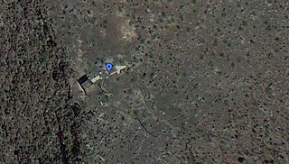
So, a bit of hidden history just over in Spartanburg County. Tommy and I photographed the concrete arrow from various angles, and took a moment to find Larry’s geocache and sign the log.
If you want to know more about the Transcontinental Airway System, here’s a link to my list of resources. The Google Doc also includes links to maps showing locations of the various beacons and arrows.
Tommy and I continued our travels throughout the day, but this was a good start to a photographic ramble.
Thank you, it was an interesting read
Someone has recently painted the marker yellow and it is very noticeable now.
My son Alex was in ROTC at Byrnes Freshman Academy last spring (2015) and one of their projects was to clean up and paint the Reidville Air Beacon arrow. If you look at it now, you will see it is an orangish yellow. I will send you a picture if you email me an email address.