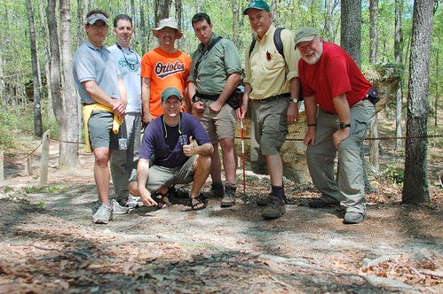
This Saturday our Lowcountry Unfiltered group gathered for its monthly outing. We rendezvoused just southwest of Columbia to explore the Peachtree Rock Nature Preserve, managed by the Nature Conservancy and the South Carolina Department of Natural Services. Dr. John Nelson, botanist at USC, director of the state’s Herbarium, and member of our group would serve as our guide for the day.
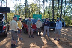
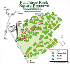
In addition to John and myself, five others joined us. We gathered at the entrance to the preserve at about 9:00, and got some preliminary information from John. The area is one of the first set aside by the Nature Conservancy, and contains several unique habitat areas, including a long-leaf pine ecosystem. The geology is also unusual. A hard layer of rock called ironstone covers softer layers of sandstone. The sandstone has been eroding out from under the resistant upper layer, creating unique geological formations such as the namesake Peachtree Rock.
One theory about the name is that the erosional patterns created a structure reminiscent of a peach tree. John said that there were two other theories as to the name, including one being a distortion of a Native American term.
As we started out, John launched into full professor/lecture mode. The information was fascinating, but I was missing much of it because I would stop to take pictures. My solution? I took my little Sansa Clip MP3 player and put it in record mode, then clipped it to his backpack. We led him to believe that it was a GPS tracker so he would speak freely.
The strategy worked. I got good audio of the entire hike, and was able to go back and match up descriptions of the plants with some of the photos I took.
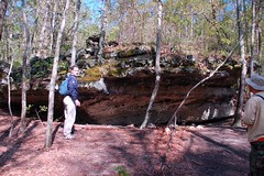
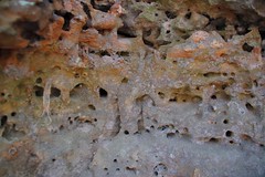
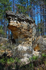
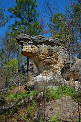
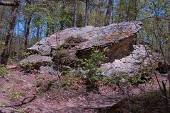
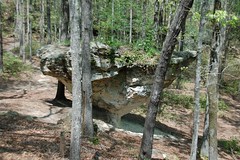
After a bit of walking we reached a ridge and rock outcropping. Here we could see the erosional patterns of the upper resistant and lower soft layers. The lower layers were perforated with holes made by various organisms. This layer is supposed to be full of fossils.
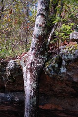
Trees have sprouted underneath the overhang, but as they grow taller that grow around, and actually into the rock.
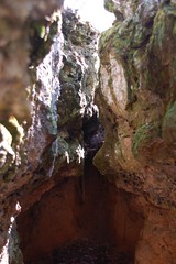
There were several of these rock formations. Some of these had deep clefts that almost formed miniature canyons.
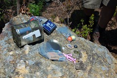
Prior to setting out I had downloaded all of the geocaches for the area. The GPS show that we were right on top of one. About that time Rob Dewig pulled out a film canister, saying, “Oh, you mean this thing?” He had thought it was trash and was about to remove it.
I told the group about geocaching, and they were immediately hooked. We signed the log and replaced the cache, and they wanted to know if there were any others in the area. There were, and it looked like they would be along the trail we were following.
There were a couple more outcroppings, but we continued on. We took one diversion to look for another geocache. Unfortunately, it was nowhere to be found, even with seven of us scouring the area.
We soon gained another bit of high ground and found ourselves in a very sandy area. It was quite evident as to how the Sandhill Region of South Carolina got its name.

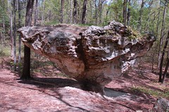
A bit further on along the trail brought us to another ridge and Little Peachtree Rock. This balanced rock stands just a little apart from the rough ridge line. We paused here to rest a bit.
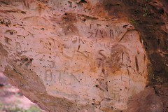
The soft rock had been vandalized a lot, as people had carved their names and initials into the soft stone.
About 300 yards from Little Peachtree we found our second geocache of the day. This was a little container shaped like a mailbox and covered with camouflage tape. Once again, the group was excited about the find. I think we’ve got a new activity to add to our outings.
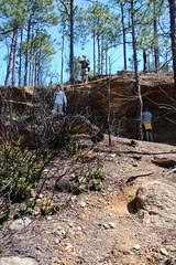
This area was subjected to a controlled burn by DNR a few years ago. “Controlled” is a misnomer, as it got a bit out of hand and burned more than intended. The area is recovering slowly, but much of the unique undergrowth is taking longer than expected to return. Also, a fire brake was carved right through the preserve, an even more obvious scar than the actual fire.
The trail ran along the top of this ridge. We came across the remains of an old moonshine still along the way. Soon we were at more rock outcroppings. Some of these looked like that had been like Peachtree Rock, but the underlayer had eventually eroded completely away.
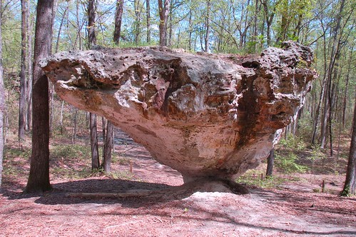
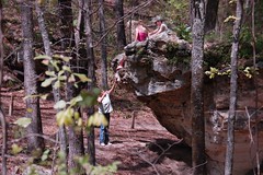
Finally we reached the main attraction. As I approached I saw that someone was on top of the rock. At first I thought it was a young couple, but it turned out to be a brother and sister with their parents. The parents were actually encouraging the kids to climb up on top of this delicate geological feature. I was furious and started taking pictures of faces, just in case a ranger happened by.
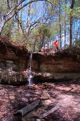
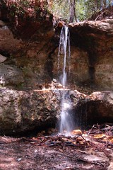
I rejoined the group at the waterfall. This happens to be the only waterfall on the coastal plain. The recent rains added more volume to the twelve foot cascade.
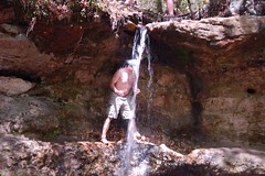
The rock itself is balanced on a small point just a few feet in diameter. As with the smaller Peachtree, there had been quite a bit of vandalism over the years as people carved their names into the rock. And it was evident form my earlier encounter that some people still don’t give a rip about it. Eventually, this rock will topple over, too. But we can try to preserve it as long as possible.
We had to pose for a shot in front of it.
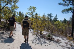
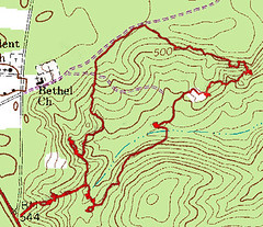
At this point we were almost back to our starting point. The images below show our trek through the preserve.

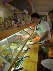
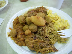
However, we weren’t done. John led us on one more trek to the exact opposite side of Columbia for some barbeque. We thought we were on a wild goose chase, but eventually we arrived at Little Pigs Barbeque. There was a buffet with just about any kind of BBQ imaginable. Of course it’s hard to go wrong when there’s a sign up that say’s “Little Pigs Loves Geocashers” [sic]
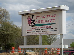
![Little Pigs Loves Geocashers [sic]](http://farm4.static.flickr.com/3054/3433750531_09f9149692_m.jpg)
Here’s the link to the rest of my photos of this trip.
Man, I’d love to check those sites out (the preserve AND the Little Pigs). Maybe I can get Cindy to trek over there.
It’d be interesting to know what kind of local flora would be in that area had it not been burned. Certain times of the year can be fascinating with that stuff.
I’m up for another trip! My weekends through May are getting pretty booked, but I’m sure I could work something out.
I’ll drop a note if I’m over at mom and dad’s. They are in southern Greenville County, which would be better from a travel standpoint.