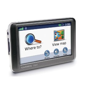
I figured it was time for a round-up. I’ve been talking a lot about doing various things with a GPS, but haven’t gone into much detail. Chances are that you got a GPS for your car because you feel like you’re directionally challenged, or you just the convenience of plugging in an address and getting directions. That’s about the extent of what most people do, but there is so much more.
Thought it might be time to talk about automobile GPSs in general, and how they can really benefit a serious rambler like myself. The one I use is a Garmin Nuvi 205, but most of what I’ll cover here should work with just about any unit. If you’re into geocaching, you’ll already be familiar with most of these concepts.
Basics
Most automobile GPS units come preloaded with Points of Interest (POIs) for things such as restaurants, shopping, tourist destinations, etc. In addition, most will let you add your own POIs on the fly. Usually this is a simple matter of pressing a button to mark where you are on the map. Most will also let you mark your home location, so you can select it quickly without having to scroll through your list of locations. Using just these internal tools, you can create a fairly large list of places.
Even so, a GPS becomes even more powerful if you can use external resources. The GPX file format has become the de facto standard for most GPSs. This is just a text file with location names and lat/long coordinates in a specific format. It also contains your GPS track, and any routes that you may have set. You could actually edit the file in a text editor on your computer, should you so desire.
Data from your GPS can be saved as a .GPX file, and you can upload these files to your GPS. How this actually takes place depends on your GPS. Some units connect via a USB cable to your computer, and software that came with the GPS facilitates the transfer. When you connect the cable in some units, it sets itself up as an external drive, like a thumb drive, and you can copy GPX files to and from the unit as if you were copying any other file. Some units have external memory such as an SD chip that you can use to transfer the data. Some, like the Garmin Nuvi series, can do all three of these.
It might not hurt to clear up some terms here, too…
- Waypoint, Placemark, POI – these are all terms for specific locations that have been marked on your GPS.
- Track – This is a record of where you’ve been. The GPS records your travels and can display that on a map.
- Route – Different from a track, this is shows how to get from one location to another.
Tools
As mentioned before, your GPS may have come with some software. However, there are three other tools that EVERYONE ought to have. These are free, and in my opinion are essential.
- EasyGPS – This is a great tool for creating and organizing GPX files. In addition to being able to save these files, you can transfer selected locations directly to the GPS via cable. You can view and edit POIs, tracks, and routes. There is also a geocaching mode. EasyGPS works with most GPS units, both automotive and handheld.
- GPSBabel – If your GPS unit uses something other than GPX files, GPSBabel is essential. It can convert just about any type of GPS file from one type to another. It’s also very handy for converting Google Earth files into GPX files for GPS units. More on that later.
- Google Earth – Given the HUGE number of resources available for this program, it only makes sense to include it. GE can read GPX files so that you can view your tracks and locations on a map, however, the free version doesn’t write GPX files. That’s where GPSBabel comes in. You can take any placemark in Google Earth, save it to a KML file, then use GPSBabel to convert the file to something your GPS understands.
There are other online resources I’ll point out in a bit.
Things to Do…
1. Track your vacation (or ramblings)
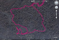
This is the the easiest to do. Just download the GPX track from your GPS unit onto your computer. Open the GPX file in Google Earth, and you can see where you’ve been. This is also great for hiking and kayaking, if you want to keep track of your travels.
Most GPS units also have a track log that you can activate showing a “snail trail” on the unit itself. If you suspect that you’ve been going in circles for the last hour, this would confirm it.
2. Share your favorite locations
Got a list of favorite fishing spots? As you find and visit these, mark the location as a POI. Save these as a GPX file, and you can share that file with others.
3. Keep places of interest always at the ready in your GPS (just in case)
I’ve written enough about my obsession with lookout towers. I had all of this data in Google Earth. I used to GPSBabel to convert the KML file to a GPX file and just uploaded it to my GPS. Now, if I happen to be in a new area, I can check to see if any towers happen to be nearby.
This method works for just about any thing of that might catch your interest. If you’re into birding, you can download a list of birding sites in South Carolina in KML form from the Carolina Birding Club site. Just download this file and convert to a GPX file, and you’ll always have those locations in your GPS.
Roadside America has an extensive list of quirky, weird stuff. Unfortunately, they don’t provide a KML file that you can download. However, they do show the locations on Google Maps. You could create your own KML file in Google Earth by putting placemarks on the locations, then use GPSBabel to convert it to a GPX file. That way, you can see if you’re actually within range of The World’s Largest Ball of Twine, or just how far off of the interstate the World’s Largest Frying Pan actually is.
These are just a few suggestions. Any site that has Google Earth files can be used, including the resources on my wiki site. So, as much data as your GPS already has in it’s memory, don’t limit yourself to those options. Create your own opportunities for exploration based on YOUR interests.


In addition to Google Earth, a lot more people are choosing to quickly and easily organize, personalize and share their geo-data on free consumer location-based social networking sites, such as myGeoDiary (www.myGeoDiary.com). The data is for personal use only, and users can keep it private or publish it via widgets to any web site they choose (e.g. Flickr, a personal blog etc.) You might want to check it out.
Hello. Besides those three tools you’ve mention, here’s another free and reliable software program to convert gpx to Google Earth files (kml) or the other way around, when you need. See here: http://gpx2kml.com/ more details about the converter.