The Hole-in-the-Wall is notorious among sailors. It’s a narrow opening between two cliffs that separates the Swinomish Channel from Skagit Bay. The currents can be strong and tricky, the wind howls between the rock faces, and the tides can be extreme. Add to that an old rock breakwater with its own tricky hole-in-the-wall and siltation from the Skagit River, and you get a recipe for a paddling trip not lightly attempted. Yet, that’s just what I did, and I had a blast doing it.
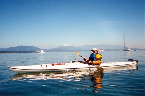
I always try to do at least one organized paddling trip while I’m out here on the island. Friend and next-door neighbor Duff McDaniel has kayaks that he graciously lets me use for short trips, but I also like to broaden my range. Each time I’ve tried to select different venues. I’ve launched a couple of trips from Anacortes, once from the Cap Sante side around the western side of Fidalgo Bay, and once from the western side of Fidalgo Island around Burrows and Allan Islands.
What I really wanted to do this trip was see if there were tours or rentals available on some of the glacial lakes up the Skagit River. Heck, I’d even be happy with a trip downriver if I could find a company that did such a thing. Alas, the only rentals I could find were at Ross Lake Resort. You have to take a water taxi early in the morning just to get there. Logistics would be a bit tricky for this trip. There were no other options in the Cascades, that I could see. That sent me back searching for island trips.
Since I’d already done the Burrows Bay trip, I looked for other options. That’s when I discovered La Conner Kayaks. That area was new to me, as far as paddling, so I decided to give it a shot. I gave them a call and spoke to the owner, Bob. He didn’t have an organized tour scheduled, but offered to take me out on my own private evening trip. Sounded perfect to me.
Monday evening came and I headed over to La Conner. I’d come prepared for paddling. I had my paddling jacket, gloves, Lycra skull cap and neoprene boots. It wasn’t immersion proof, but it would keep me warm.
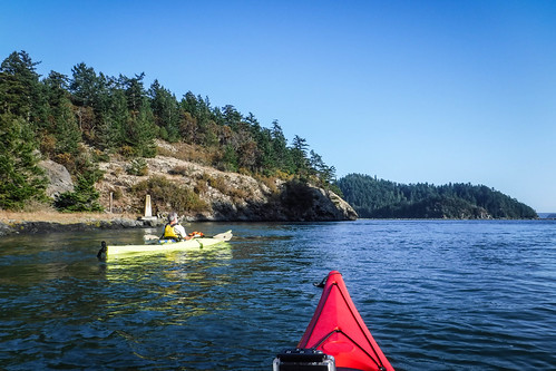
I arrived early, and soon Bob showed up. It would be just the two of us. Originally, another couple was going on the tour with us, but they had cancelled. They were newbies, and it was probably a good thing.
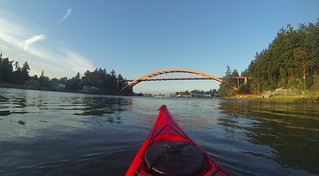
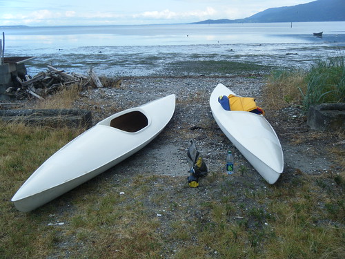
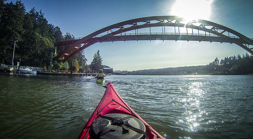
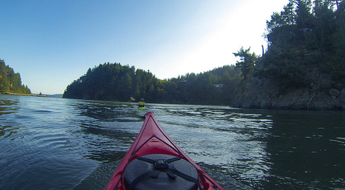
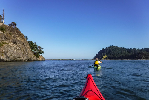
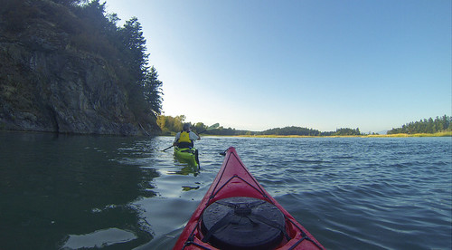
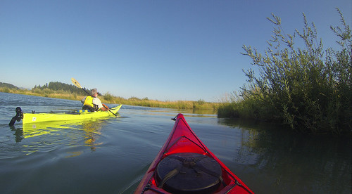
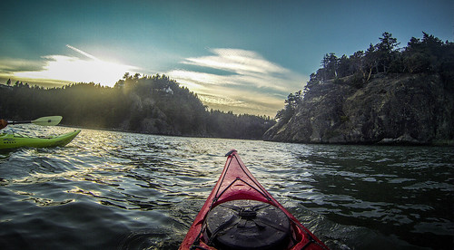
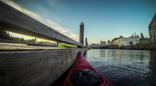
We got our gear squared away, and Bob introduced me to my sweet ride for the evening. I would be paddling a 17′ Necky Louksha sea kayak. The cockpit was a bit tighter than I like, with thigh braces pressing down on my legs. I had to get used to a rudder, but later in the trip I was glad I had it.
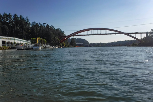
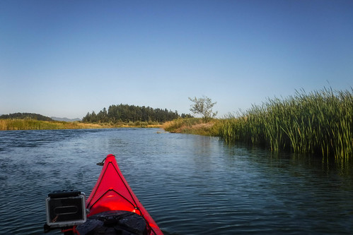
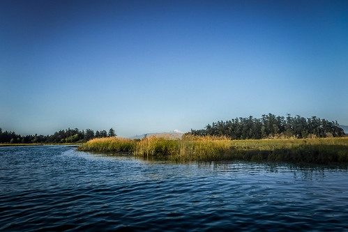
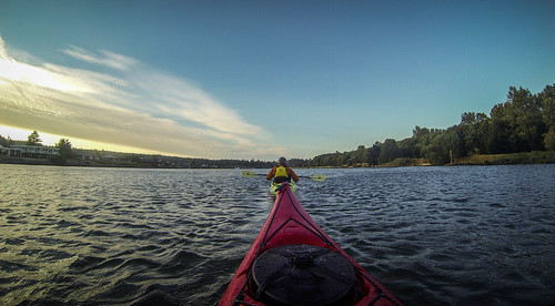
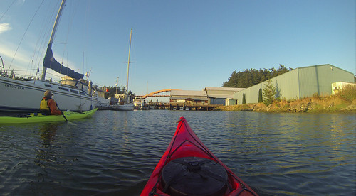
We launched from the dock and paddled south under the Rainbow Bridge, against the incoming tide.
As we passed the docks on the south end of La Conner, Bob pointed out the sail boat where he lives. He said it had been around the world twice, once with him on it. He had been a landscape architect in California, but had retired and moved up here, where he started his kayak tour business.
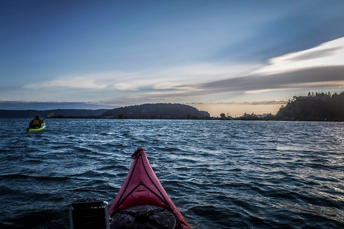
A bald eagle soared over us as we passed under the bridge and crossed over to the west bank of the channel. Closer to the shore is an eddy which would help us paddle against the current. Frankly, though, I was having no trouble with the current in this particular boat. If I stopped to take a photo I would feel it pushing me back toward the north, but making headway against it wasn’t too bad.
The west side of the channel is part of the Swinomish Indiah Reservation. The spectacular houses along this stretch are occupied by non-Indians, but with a tricky financial arrangement. Residents can build a house much more inexpensively here than elsewhere, but they can only lease the land upon which it sits from the reservation. We passed a development on an enclosed area called Shelter Bay with lots of large trawler yachts and other big boats. Apparently that arrangement isn’t a problem for people with means.
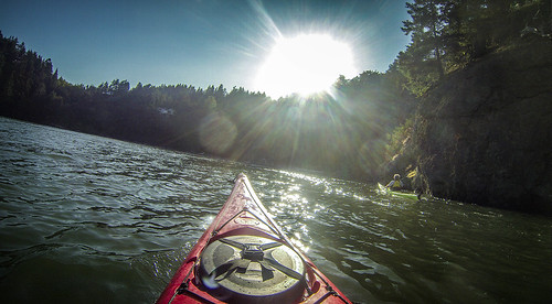
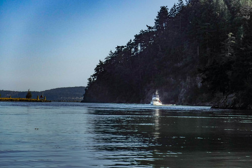
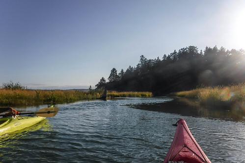
The land began to rise south of Shelter Bay, with a large rock cliff marking the west bank. Bob had us move further out into the channel so that the wind and current wouldn’t push us into the rocks. A trawler coming into the channel gave us a wide berth, but provided additional wake to bounce us around.
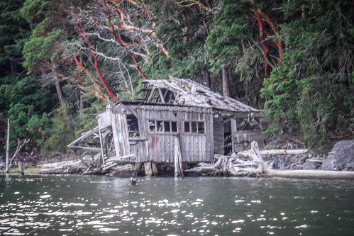
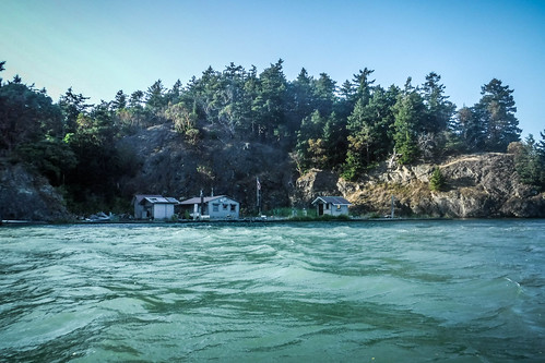
Just around the rocks we found ourselves in a sheltered cove. Bob said he often uses this beach as a resting point for his tours. There were some abandoned ruins that had once been part of a boatyard. “Hippies” had taken it over as a commune in the 1960s and 70s, but it was now just an open beach. The hill above the abandoned buildings was dotted with beautiful arange-barked madrona trees.
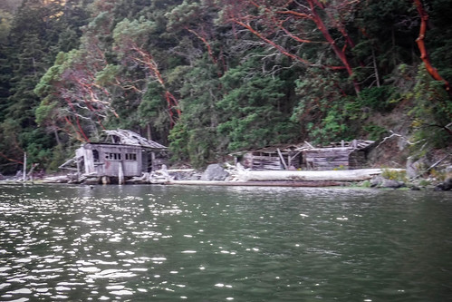
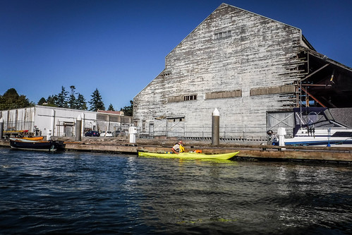
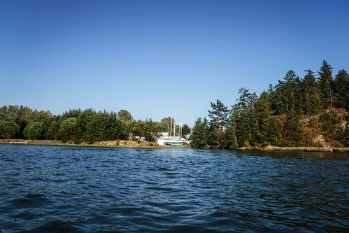
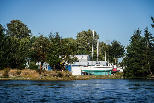
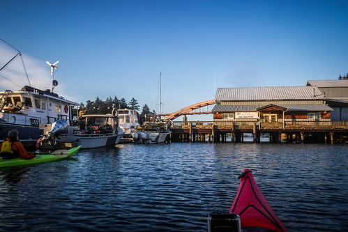
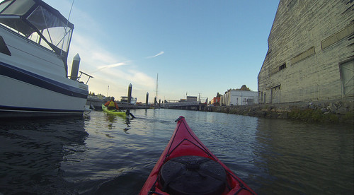
The boatyard that had been in the cove had moved to the east side of the channel, closer to La Conner. It was also in a sheltered cover, but this area was flatter than the cliffs next to us.
We didn’t stop at the beach, but Bob pulled close to the cliff and plucked a bit of plant from the rocks. He handed me some, and told me to take a bite. It tasted a bit like salty asparagus, and was rather good. He said that the plant, whose name I can’t remember, was reach in protein. It reminded me a bit of the glasswort found in eastern salt marshes. With his background in botany, Bob also offers “foraging tours” where participants go out and sample edible wild plants. I may have to do that trip next time I’m out here.
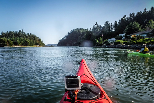
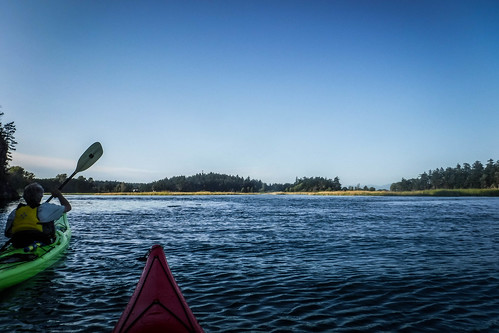
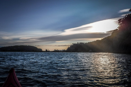
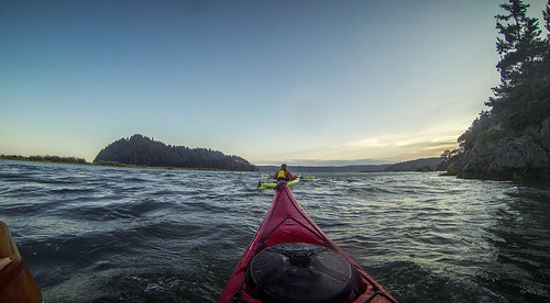
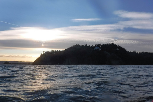
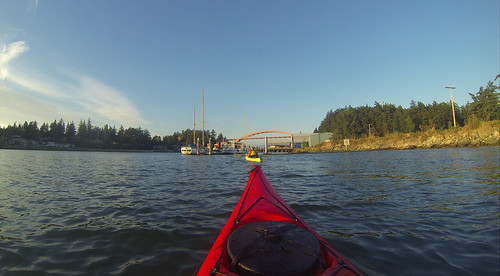
Just beyond the cove the cliffs rose again on either side of the channel marking the official “Hole-in-the-Wall.” As we approached the opening the winds and waves increased, coming from the south-southwest. A couple of spectacular mansions topped the point right above HITW. In Bob’s opinion, these ruined the view.
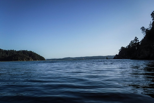
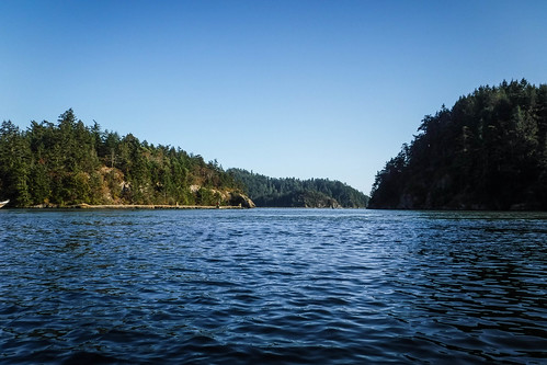
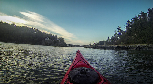
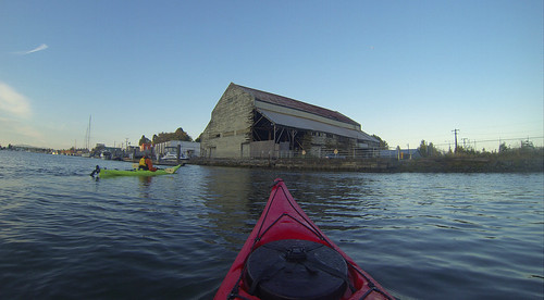
To our left, on the east bank was McGlinn Island. Like Samish, McGlinn is no longer an island, but a peninsula created from siltation from the Skagit River. There is another sheltered beach cove where Bob likes to stop with his tours, but this evening there was a family on the beach, and a small boat struggling to get over to them. We decided not to head that way.
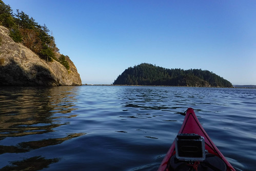
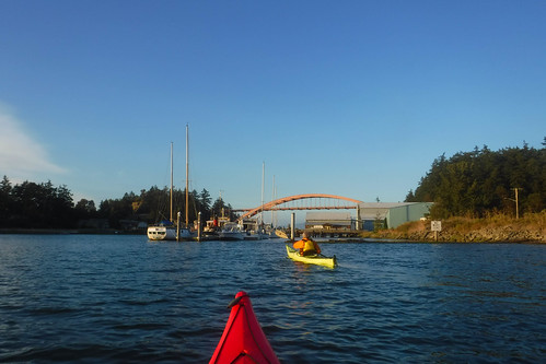
In front of us was Ika Island. Bob said that the island was named for a local doctor. The story goes that the doctor saved a businessman’s life, and in gratitude the businessman gave the doctor the island. He said that at one point you could paddle around the island, but silt made that impossible now.
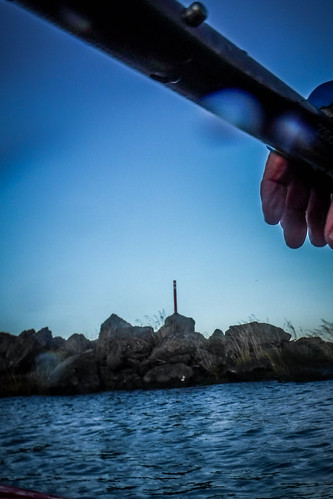
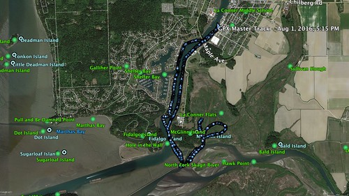
I don’t have any photos of the next bit of our trip. The GoPro’s battery had run out, and I had my hands too full to take photos with my other camera, much less change a battery. In front of us was a low stone breakwater that protects the boat channel from log jams and silt flow from the Skagit River, just to the east. In that wall is another hole-in-the-wall, barely 20 feet across. It’s wide enough for kayaks and small motor boats, but not much else. We had to approach and tack at an angle so that we didn’t get pushed into the rocks by the wind. Once through, we were once again buffeted by waves, and had to make a sharp left turn so that we didn’t get flipped and so that we’d be pointed in the direction we needed to go. I made it through with no difficulty, but I was grateful for the rudder on the kayak.
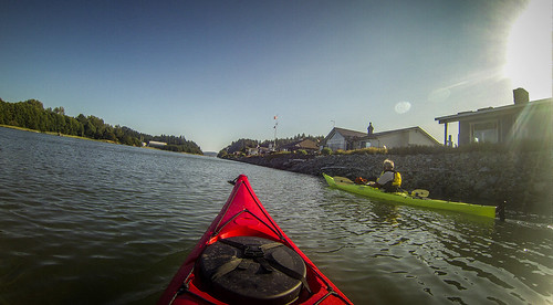
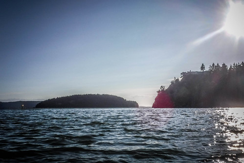
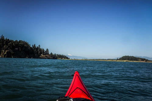
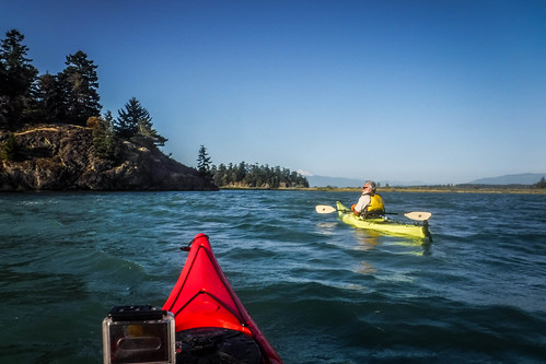
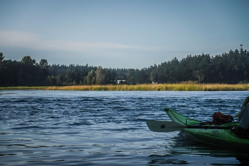
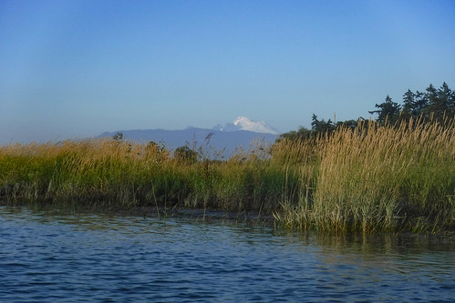
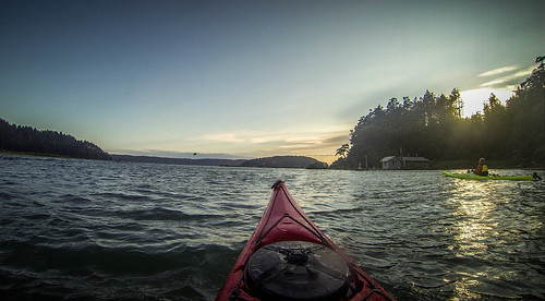
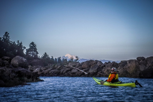
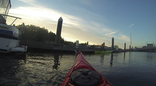
Once past the breakwater I could float along with the waves rather than paddle against them. That gave me a chance to change batteries. Rounding the point at McGlinn Island provided us with views of the Skagit River delta and of Mount Baker in the distance. A remote beach house occupied another sheltered cove on the island.
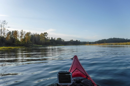
The current was still clipping along pretty well. I had to rush my battery changes so that I didn’t get pushed into a collection of driftwood that was looming fast. Soon, though, things calmed down, and we were on the smaller backwater channels of La Conner Flats and Sullivan Slough. Grasses and cattails lined the banks.
We circled a small island and came back to McGlinn. Bob pulled over to put on a jacket as things were really getting chilly with the evening breeze. I paddled on up the flats a bit behind the boatyard we had seen from the other side.
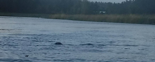
As I came back around to meet Bob a playful seal kept me company. If I turned around to take a photo he would dive back under. Finally I managed to catch him by continuing forward, but pointing the camera back over my shoulder.
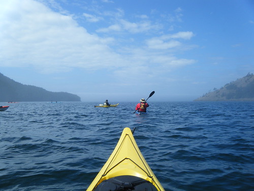
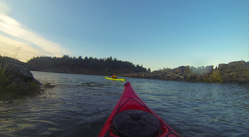
I paused to don my own paddling jacket, and a few minutes later I was glad I had done so. We headed back out into the open waters and were met with even stiffer winds and white caps. The sea kayak had no problems with it, and I never once felt like I was uncomfortable or not in control of the boat.
The trip back through the little hole-in-the-wall was even trickier. We had to paddle out past the opening and make our turn in a protected eddy. I got broadsided by one whitecap which splashed into the cockpit, making me wish I had a spray skirt. The cold, cold water soaked the side of my pants, reminding me that hypothermia is a real danger out here, even in summer. We made the turn safely, though, and came back through the opening into the boat channel.
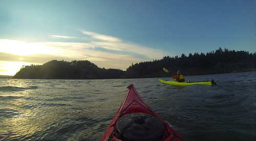
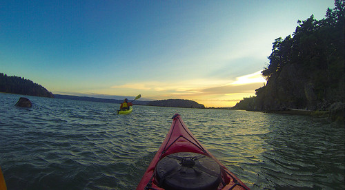
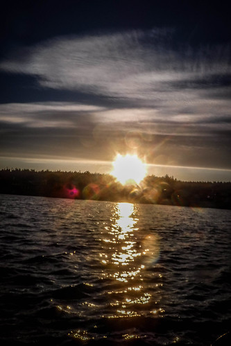
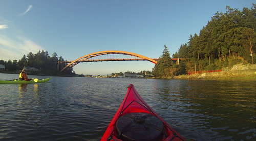
We paddled back through the big Hole-in-the-Wall and onto the Swinomish Channel as the sun started to set behind Fidalgo Island.
The current carried us swiftly back toward La Conner. Several herons kept us company as we paddled along.
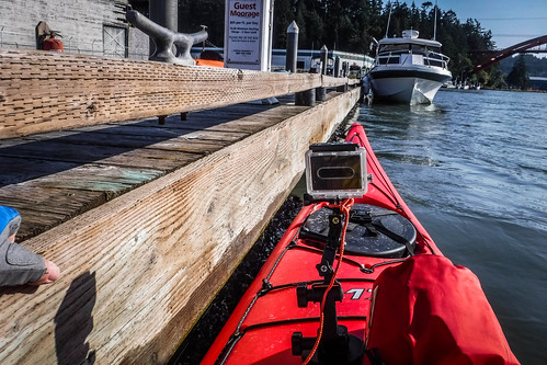
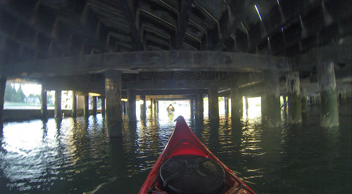
As we approached the dock where Bob’s sailboat is moored, Bob wanted to paddle under the pier connecting the boat house to the dock.
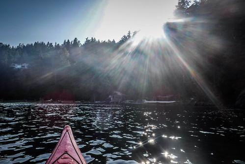
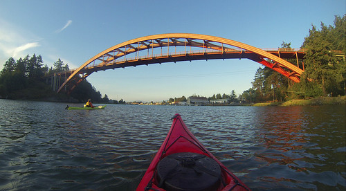
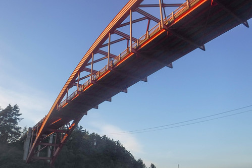
On the other side of the pier the light from the setting sun was perfect on the Rainbow Bridge.
From there it was just a short paddle up to the dock where we started. I managed to get out of the boat onto the dock without too much hassle.
The tour had taken about three hours and coverd 5.2 miles, according to the GPS. That’s short for one of my usual paddling trips, but there were some unique challenges. I had a blast, though, and it was great getting to know my tour guide, Bob. He appreciated the fact that I was prepared and seemed to know what I was doing. Yet, I took nothing for granted, and differed to Bob’s expertise at all times. It was a great trip, and I would definitely do another tour with his group.
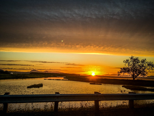
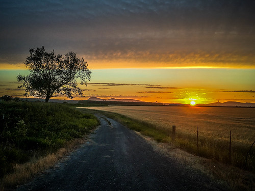
Driving home I was given one more treat. The sun setting over the San Juan Islands was simply incredible. I pulled over a couple of times to get some final shots.