A couple of weeks ago my friend Ken Cothran and I were discussing the Musgrove Mill State Historic Site in Laurens County. It seems neither of us had been there in quite awhile, and we wanted to return to do some photography. Even though it was supposed to be scorching hot, we set out early Tuesday morning to see what we could find.
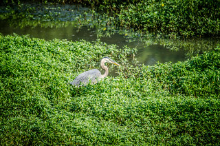
Our route from Clemson took us down Mauldin Road. Ken had not seen the improvements to the Lake Connestee park, so we took a brief detour past the old mill and dam site. I managed to capture a great blue heron with my long lens.
We drove by the old Macbee Chapel, but then from Connestee drove pretty much straight down to the site, taking the Highway 56 exit from I-26 at Clinton.
It had been years since I’ve been down here. The last time, Bob Donnan and I used this as a take out for a kayak trip down the Enoree. We put in at Yarborough Mill up on Highway 49 and floated down to this point
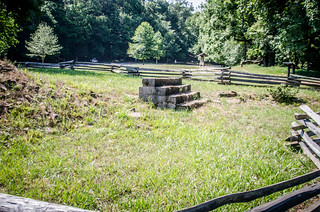
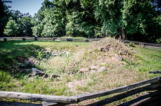
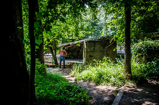
When we arrived at the site it was already hot and humid. We saw indications of trails, but felt no inclination to walk in the heat. In front of the visitors center are the remains of the old Musgrove home place. There was a a set of concrete stairs and some piles of bricks and rubble.
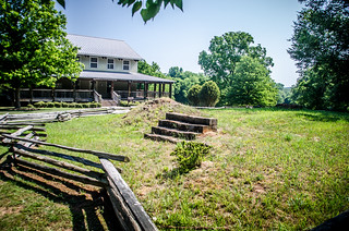
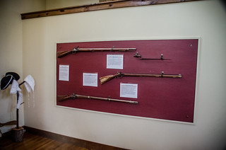
We walked over to the visitors center…and found it closed. Disappointed, we walked around the porch of the building and looked out over the site, seeing if we could catch a glimpse of the river. Back at the front of the building a park ranger came riding by on a Gator. She had been out doing some grounds work and came by when she spotted us. She asked if we wanted to go inside, even though they were supposed to be closed today. Of course we said yes!
There we found several artifacts displays and those things typically found in a South Carolina State Park…
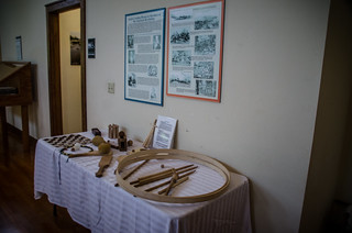
Most interesting, though, was the narrated diorama of the Revolutionary War Battle of Musgrove Mill, with LEDs showing Patriot and Tory positions. The actual battlefield is on the other side of the river. I remember walking over it as a child with my father before any of this developed. The battle itself was a skirmish between a small Patriot contingent and a much larger Tory force encamped at the mill. Using guerrilla tactics, the Patriots were able to drive back the larger force. The Patriots won the day, but themselves had to retreat because of the fear of reinforcements from the British (which never materialized.)
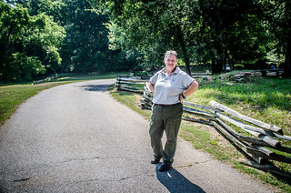
Back outside our host, Ranger Dawn Weaver, provided us with more information about the site and told us the best way to get down to the river. We thanked her profusely, and headed back to the car, preferring an air-conditioned drive to a hike to the river.
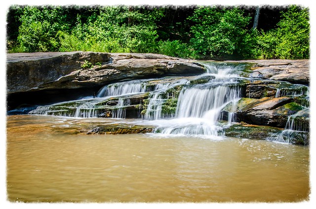
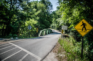
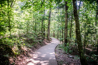
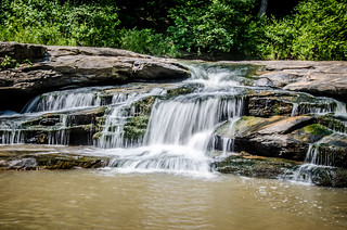
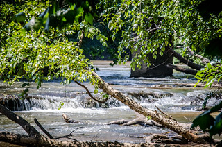
We crossed the Enoree River and continued on to Horseshoe Falls Road. The park has developed a nice parking area with access to the falls on Cedar Shoals Creek. One other car was there, and as we parked and got camera gear organized, another vehicle pulled up with a family. We walked down the developed trail to the falls themselves.
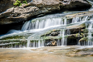
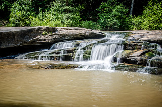
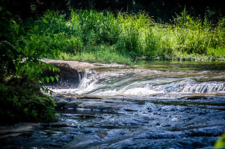
Horseshoe Falls is a small set of falls – only about six feet or so in height. The creek splashes down into a nice swimming hole. I wanted to get some long exposure shots of the falls.
Unfortunately, the other visitors cared nothing about photography. The family that arrived with us promptly set up shot at the top of the falls right within the scope of where I wanted to shoot. Two young girls started scrambling all over the falls.
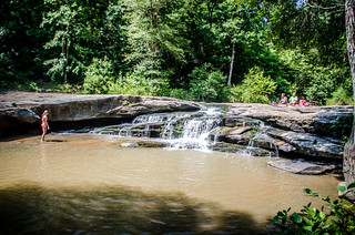
I couldn’t blame them. If I’d brought swim trunks I might be tempted to sit under the cool water as well. I waited patiently as the girls moved out of the frame, and I tightened up the field of view a bit. I wasn’t able to get a good wide shot of the the entire falls, but I was able to get some with long exposure.
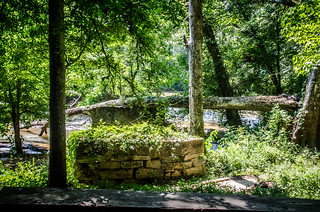
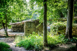
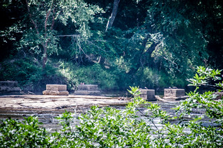
Ken and I made our way back to the car and drove around to where the road dips down to the Enoree River. There is now a paved parking area here with room for a couple of cars. I’ve used this spot as a take-out for Enoree paddling trips in the past. The spot marks the location of an old bridge that connected with the mill on the other side of the river. The stone pylons in the middle of the river are all that remain.
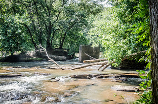
Ken and I walked up and down the river bank. I didn’t remember the rapids being as significant as these – still only Class II at most, but more challenging than I remembered. I tried to get shots of the trickiest bits, but was thwarted by lots of overhanging undergrowth.
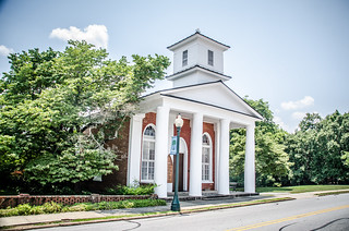
It was already close to lunch, so we headed back toward the fast food places near the interstate, where I promptly devastated my fledgling diet. We had been thinking about venturing on into Union County and toward Rose Hill. However, we now seemed to be pointed back in the opposite direction. Ken said that he had never seen Presbyterian College, so we headed on into Clinton.
We drove through the town and I paused at various places for Ken to get a couple of shots. I personally didn’t take any photos, but still enjoyed a quick tour through the campus. I reminisced about taking piano lessons for years in the music building here, and singing under the direction of Charles Gaines in various community groups.
We took Highway 308 out of town, crossing I-385. I turned down Long Branch Church Road to point out the church where Dad had preached, and the earliest church I remembered attending. Mom had said something about the church now being closed, and that appeared to be the case. That thought saddened me.
We crossed 308 and continued, taking the creepy tunnel under the Interstate. As we drove I pointed out places of family history. I knew Ken was into old churches as much as the rest of my weird friends, so we headed on over to Rocky Springs Presbyterian Church, where the Taylor Family originally settled.
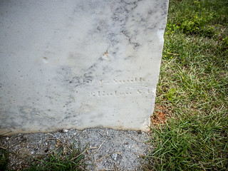
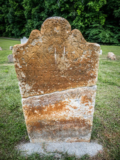
We wandered among the headstones, many distant relatives of mine. I was surprised to see one signature stone. However, this one was not from Charleston, but was by a J. C. Smith from Clinton.
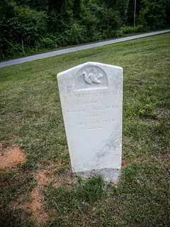
There was another surprise. The church has done a good bit of maintenance, and there seemed to be more old stones and field stones than I remembered. I’d always heard that my great-great-great-great-great grandfather William Taylor’s grave was down near the creek, and had been lost. However, there was a stone with William Taylor’s name now up in the main cemetery. It looked like some restoration had been done on the stone. Although much of the inscriptions were illegible, I was able to make out the date of death – 1804. This agrees with the genealogy data I have for William Taylor.
We drove on into town, passing more family landmarks. The farm I grew up on looked completely overgrown and unkempt. That was a bit disturbing. Otherwise, things seemed about the same in this sleepy part of the county.
Ken had never seen the Laurens Square, so we headed in that direction. We made the circuit, and I pointed out local landmarks, such as the former Redneck Shop.
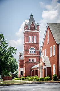
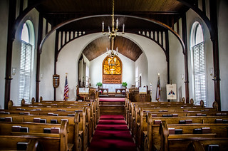
I’ve been working with the Laurens County Museum to develop a walking tour of the square and West Main Street. I remembered that the Episcopal Church of the Epiphany is always open for folks just to drop by. I decided to test that theory. We pulled into a parking lot across from the church. Ken was just as fascinated with the line of steeples going down West Main – Methodist, Baptist, and Presbyterian.
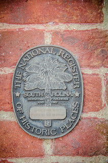
A sign proclaimed that the church was, in fact open. The National Register seal was on the other side of the entrance. The church is on the register as part of the larger Laurens Historic District, which encompasses the square and parts of West Main.
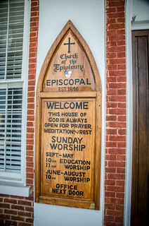
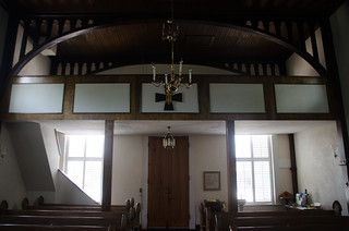
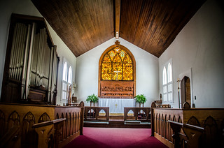
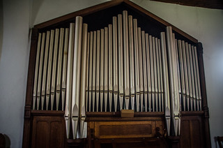
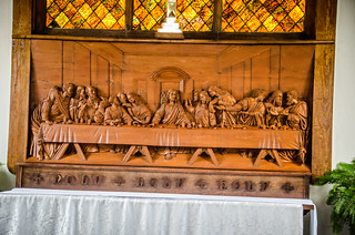
The door was, in fact, open, so we entered. The sanctuary is a simple, but beautiful space, with a small single-rank organ, choir at the front, and stained glass. A wood carving of Da Vinci’s Last Supper adorns the space below the stained glass. A small balcony is in the back of the chapel.
It was nice and cool in the church, so we lingered a bit. Soon, though, it was time to continue our travels. As we drove down West Main I did more reminiscing. I had been music director at First Presbyterian for a number of years, and loved rambling over the old structure.
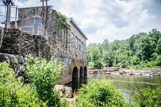
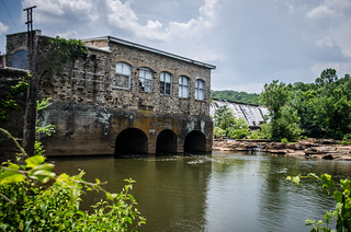
We drove on out of town, past the high school, then turned onto Highway 252. From there we continued until we got to Boyd’s Mill Pond. I crossed the Reedy and pulled into the power plant parking area that fishermen use. Ken and I wandered down to the river’s edge. We didn’t linger, though. By this time it was terribly hot and humid. We snapped a few shots then headed back to the car.
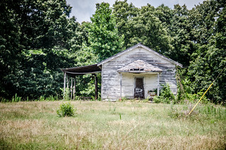
Before I took Ken back to Clemson he wanted to drop by his parent’s place in Possum Kingdom. That was actually on our way back, but, of course, we wanted to take a couple of detours. First up, Ken directed me onto McCullough School Road. I’ve mentioned before that roads with names like that always intrigue me, but often turn out to be disappointing as the thing for which the road is named is usually long gone. In this case we were not disappointed. Ken pointed out a building I would have easily overlooked. It was a classic one room school building, to which a shed had been added. Ken said that his mother attended here from grades one through five.
From here we drove over to the Holiday Dam area. I didn’t stop for photos, but one thing I noticed was that there didn’t seem to be any river access, apart from a very rutted dirt road. It was getting late, so I didn’t explore further, but I do want to check it out as a possible access point to the Saluda. A paddling guide for the shows access at Cooley Bridge just upstream, but not at the dam because of steep banks.
As we drove through Possum Kingdom it was Ken’s turn to point out family haunts. I’ve spent some time in this area myself, but didn’t have the same depth of knowledge about the area. We headed on up through Pelzer, then took the cross country roads back to Clemson. It had been a hot, but good day out and about.