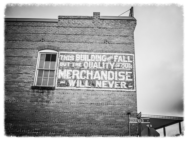
I promise you, we did eventually make it to Modoc, but we saw lots of stuff before we got there. Alan and I had already found an old school, found a church of which we were previously unaware, and spent some time at Lower Long Cane ARP Church. We still had lots to see.
We headed northwest from Long Cane and reconnected with Highway 28, headed southeast. Just past its intersection with Highway 81 the road crosses Long Cane Creek where it connects with upper Clark Hill Reservoir (or, Lake Strom Thurmond, as it is properly called, I guess.) Alan and I decided that this had to be a future paddling venue for us.
Once of our placemarks was the Buffalo School about a mile southwest of the Long Cane Bridge we had just crossed. We had planned to stop, but there were lots of trucks parked around the old school, and it looked like hunter-types were headed inside. Obviously this old school was still in use as a community center. We decided to keep going.
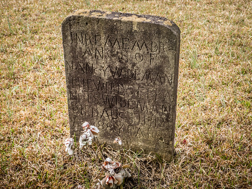
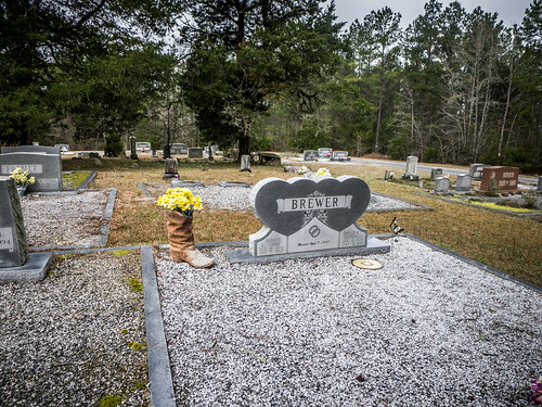
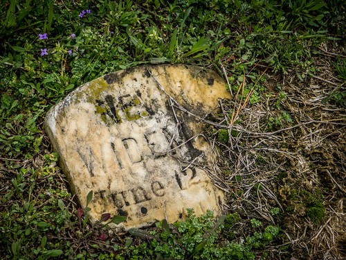
Wideman Cemetery
We turned northeast onto Wideman Cemetery Road. The eponymous cemetery was our next target. Alan had spotted it in Google Earth, and thought it would be interesting.
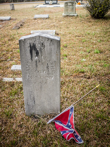
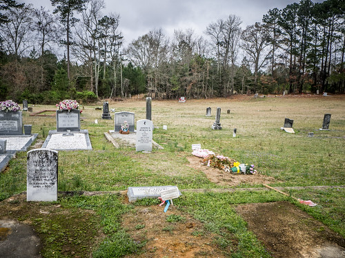
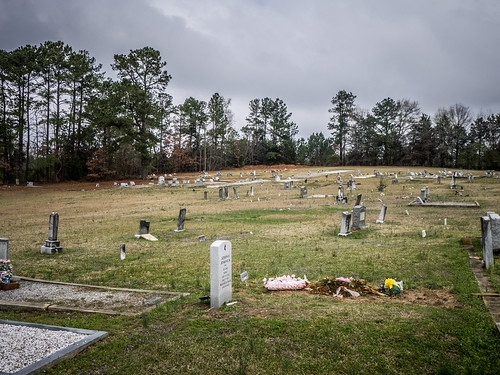
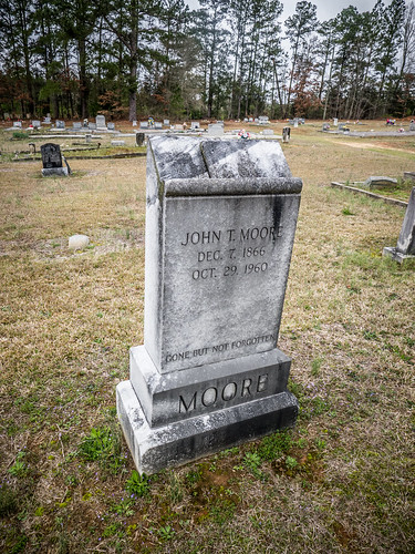
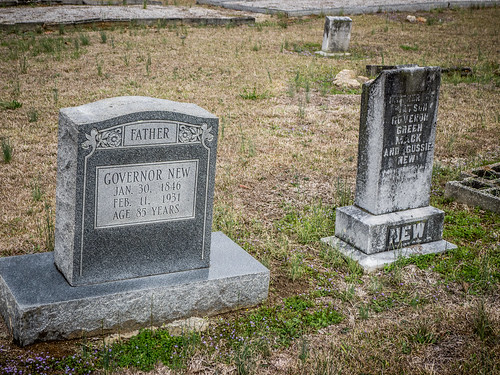
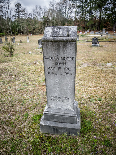
The cemetery had a paved loop, and seemed more like a large church cemetery than a family plot. Since there is a Wideman School for GNIS data nearby, I’m guessing the name refers to the community rather than just a family. That being said, there were lots of Widemans interred here, as well as some Confederate veterans.
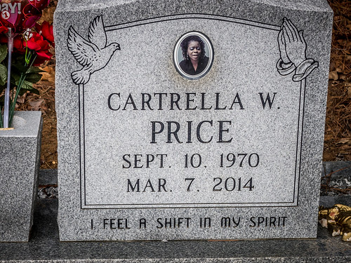
This was still an active cemetery, and there were some new headstones.
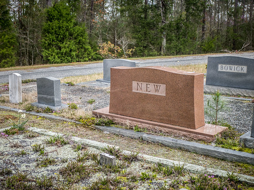
Cheap jokes aside, some of the more modern headstones had some rather…unconventional imagery.
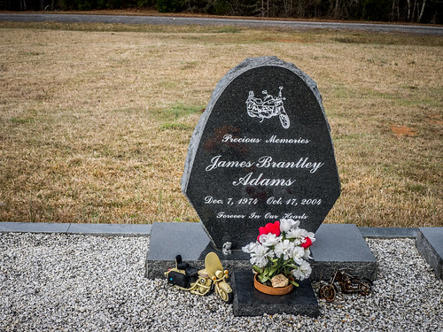
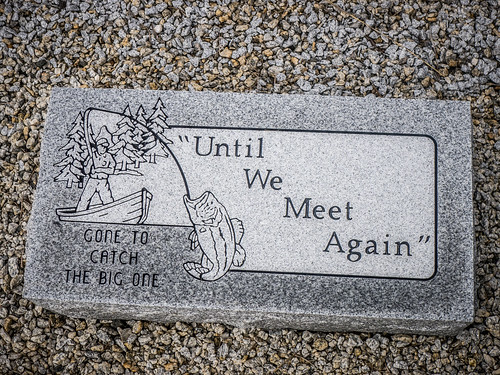
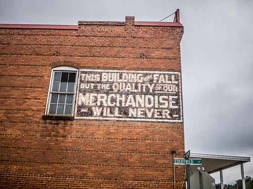
Nothing like advertising a brand name long after you’re gone.
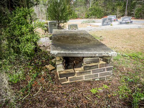
There were still quite a few older headstones. One tablet vault was in very bad shape.
We had another church just on up the road, but as we were heading up that way my GPS bonged with another potential school. Turns out it was the Wideman School. We spotted a potential building that was close enough to the target, so we turned in to check it out. While interesting, it just didn’t really look like a school. It also didn’t have a place for students to arrive and gather, either – all the common features you would expect to find in a school.
Turns out the actual Wideman school didn’t have any of those amenities, either. It didn’t look anything like a school, in fact.

At the actual GNIS location of the school there was nothing but obvious residential buildings.
Shiloh AME Church
We connected with Highway 10 and headed north toward the town of Troy. Just before the road dips through a culvert under the railroad one finds Shiloh AME Church. The church itself is a more modern brick building, but the cemetery is quite historic.
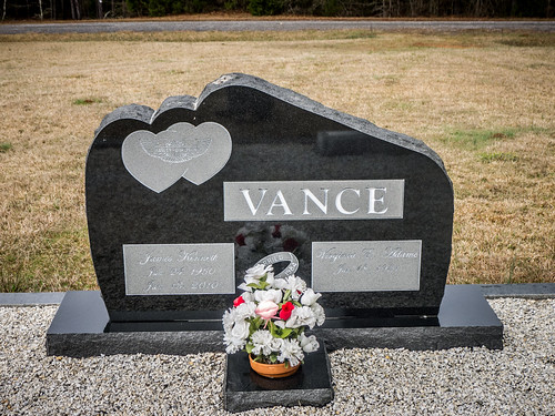
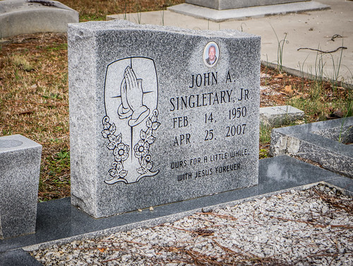
There were Widemans here, as well. There were also several of the lectern styled headstones that Alan and I had seen at Long Cane.
Since this is still an active congregation and cemetery, there were some recent burials.
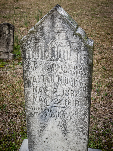
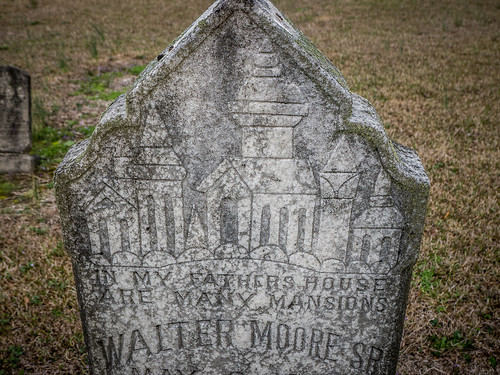
There was also other interesting funerary art. I had not seen a “many mansions” motif before now.
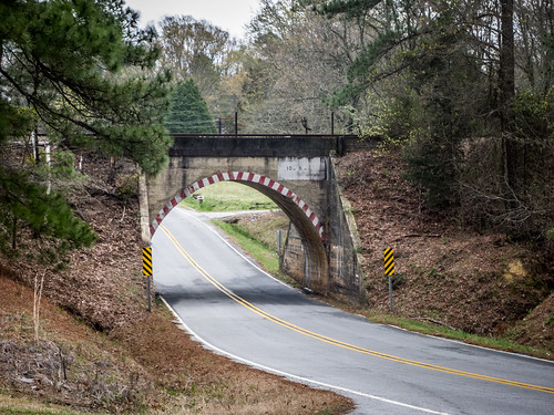
We browsed a bit, but it was time to move on. We paused for a moment to take a photo of the railroad culvert.
We continued south on Highway 10 until we reached McCormick. Apart from taking a turn down Main Street we didn’t linger, but continued south on 10. One of these days I’m going to have to take a tour of the Dorn Mill, but this was not the day.
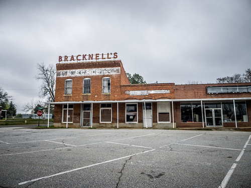
Plum Branch
I had driven through the town of Plum Branch for the first time on our Old South Tour with the Upstate Minis. We paused a moment to take a couple of photos of Bracknell’s Store.
There was an old store that looks like it was in a former bank building. An unpublished 1932 Sanford Map of the town seems to indicate that this was a post office, though.
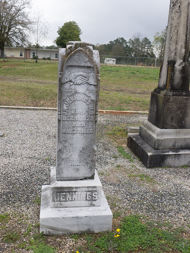
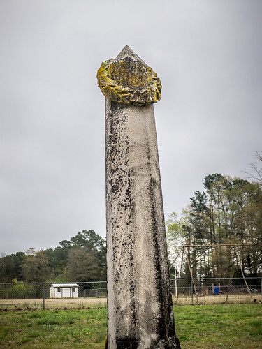
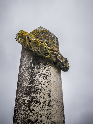
What caught my eye was an old school down Old Edgefield Road. First, we pulled into the parking lot for the First Baptist Church and encountered a couple of unusual graves. There were three graves and two monuments right next to the church. There was no other cemetery as far as I could see. The one tall obelisk had a wreath at the top that looped like a ring toss game.
The school in question was set back off of Old Edgefield Road. It looked like an Equalization School, but I couldn’t find it on the listing for South Carolina. Now it bore the emblem of the US Postal Service, and apparently housed other social services as well.

From Plum Branch we continued south on 28 through the town of Parksville without really stopping. The road skirts the edge of Clark Hill Reservoir at this point. We had nice views of the lake, and there were signs point to lakeside parks along the way.
Not too far past Parksville my GPS started bonging again. We were within range of the old Washington High School. We turned in and crossed the railroad and found ourselves at a dead end with No Trespassing signs everywhere.
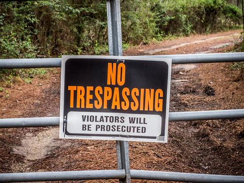
We stood at the fence and took a couple of photos of the brick two-story building.
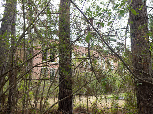
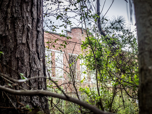
A man in a truck pulling a boat pulled up and accosted us with his eyes. I pulled around to him, told him who we were, and asked about the property. He said that he was the property owner. I asked if we might be able to take some photos, and he declined. Oh well. It’s a shame, because it was a magnificent building that looked like it was falling into ruin.

Eventually we made it to the town of Modoc, the southernmost point on our trek, and the unofficial name for the ramble. I wanted to come here mostly because of the weird name. Supposedly it was named for the Modoc tribe found in Northern California. During the Modoc War of 1872 some of the captured tribe members were resettled first in Oklahoma, then on the east bank of the Savannah River, though census records for the town itself don’t indicate any tribal members there.
The town itself wasn’t much. It’s just a gateway to the lake with a convenience store and signs pointing the way to various campgrounds.
The other point of interest for me was that the town is the location of the oldest continuous Geocache in South Carolina, Modoc’s Stash. I fired up the Geocaching app on my phone and we set off in search. We headed east on Highway 23 and found ourselves at Modoc’s Bridge over Steven’s Creek. This is another paddling venue that Alan and I wanted to try. As for the cache itself, it looked like it was a bit of a hike – more than we wanted to do this morning.
So, we had finally made it to Modoc. However, we had much, much more to see. I was time to move on to the next stop on our adventure.
Hi Tom.
Great photos of the Edisto River.
Was that you I met at Mepkin Abbey earlier this week?
If not you have a double.
I’ve dabbled in photography since high school in the ’60s and I appreciate it like art.
Best,
Paul
No, not me. Last time I was there was about a year ago, so it must have been my evil twin. 🙂