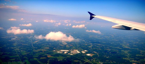
No matter how many times I’ve flown, the concept of this massive machine lifting into the air still strikes me as weird. I’m still fascinated. And unlike those jaded fliers who prefer the aisle seats, I still like to look out the windows at both the ground below and at unique cloud formations.
This summer I took a couple of trips across country, so I’ve had plenty of opportunity to look out windows. On the past several trips it’s struck me how similar the view is to Google Earth, and I began to wonder if I could match up locations with the same spots in Google Earth.
So, I grabbed my camera and started snapping out the window, trying to see if this could be done. Turns out it’s much, much harder than you might think.
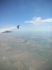
The problems are a lack of perspective and a lack of context. You really have no feel for how far you have traveled. Therefore it’s hard to gauge where you might be when you look out the window. It helps to have a clear landmark, such as the Mississippi, or some other feature. However, that doesn’t even help because the photo you take is out of context. Even if you can identify the river, it’s hard to tell WHERE along the river you might be.
The best chance you have is when you already know what you’re viewing, such as the Gateway Arch or some other unmistakeably point. Even then it’s hard to find the exact view.
Here’s an example…
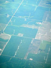
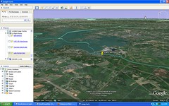
This is a photo of a wind farm somewhere west of Chicago. We had” a layover at Chicago Midway on our flight back from Seattle. When I spotted the wind farm I figured it would be a good candidate – somewhat unusual, with distinctive ground features. Turns out I was very wrong.
I didn’t realize this, but there are several wind farms in the Chicago area. Furthermore, I had no real feeling for which direction we were approaching Chicago. We had to fly around some bad weather, so we could have been approaching from further south, for all I knew. Searching for the exact view was like the old cliche’.
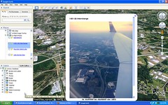
I had better luck when I was closer to home (and at a lower altitude.) Yeah, I know I violated the “no electronic devices below 10,000 ft” rule, but here are a couple of places where I was successful. The first is on the flight from Denver to Charlotte as we were approaching Charlotte-Douglas Airport. This is a photo of the Lake Norman Dam, followed by its corresponding view in Google Earth…
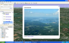
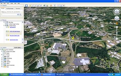
Still not exact, but close enough. Probably my best match was on the short hop from Charlotte to Greenville, where I captured the intersection of I-26 and I-85.
One possible solution might be to use some sort of automatic geotagging. You would need to have a GPS running constantly during the flight, though. I guess you could turn it on once you’re cleared for other electronic devices. Even then, I don’t know how the GPS would perform at airline speeds.
With so many planes now offering in-flight WiFi, I think the coolest thing would be some sort of app that provided a real time update to Google Earth/Maps. Several airlines have a rudimentary map that updates, and that’s been helpful on long flights, there’s been nothing at the level of detail that Google Maps provides. Maybe it’s time for iPad to come out with a flight tracking app. Even then, though, I’ll probably still stare out the window and occasionally snap a photo.