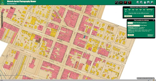
Sometime last week the Greenville Cageliner had an article about a new website from the Greenville County GIS Office (http://gis.greenvillesc.gov/historicalimagery/). The website features historical aerial photography imagery as a map, similar to Google Earth. Images are available for 1955, 1965, 1979, 1989, 1997, and 2009, and cover the downtown area, along with a bit of the county. Also included is the Sanford Insurance Map of the city from 1920.
I could spend a HUGE amount of time exploring the site. Looking at how the city has changed over the decades has been fascinating, and somewhat depressing. The patterns of urban sprawl are quite clear at a distance, and it can be sad to look back on landmarks that are no longer there. On the other hand, there have been some marked improvements in areas such as along the banks of the Reedy River, and these images show that very clearly.
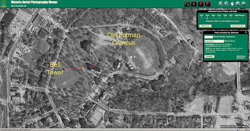
I started with the area around the old Furman campus. I had never really understood the location of the old bell tower in relation to the rest of the campus, but this imagery makes it very clear. (Click on the images for a larger view.)
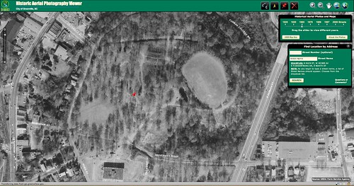
By 1965 Furman had moved to its new campus. The city wasted no time in removing the old buildings.
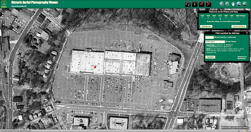
This image from 1979 shows the Belltower Mall, which, if I remember correctly, was already in decline at this time. I remember trying to go see a movie at the theatre there, but the building had been flooded.
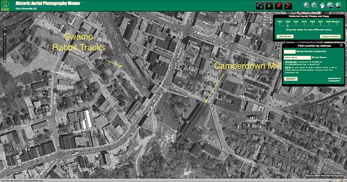
Dramatic changes can also be seen around the Reedy Falls area. In 1955 the Reedy was a polluted industrial blight. Camperdown Mills were at the top of the falls, and the falls themselves were actually dammed, allowing only a small portion to be free-flowing. The tracks for the Swamp Rabbit can be seen crossing the river, then continuing on eastward around the city.
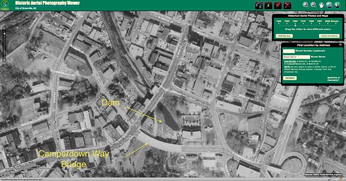
In the 1965 imagery the dam is even more visible. The falls themselves have now been obscured by the four-lane Camperdown Bridge. The Camperdown Mill has been removed.
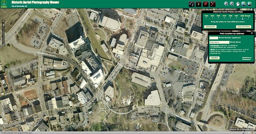
The images for 1979 and 1989 don’t show much change, as the area was in decline and Falls Park was never used. 2009 shows the most change, with the Peace Center, River Place, and the Liberty Bridge making their appearances.
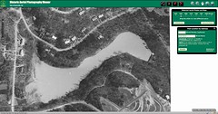
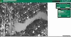
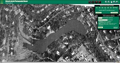
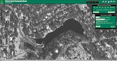
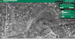
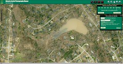
Of course, I had to check out my own neighborhood, and this is where it got really depressing. This set of images dramatically shows how our little lake has silted in over the years.
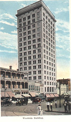
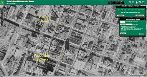
In addition to general areas, it’s fun to try to spot specific landmarks. The 1955 and 1965 images show the 25-story Woodside Building, once the tallest building in South Carolina. I remember seeing the building as a child when we would venture downtown. The building was constructed in the 1920’s.
Also in the 1965 shot, you can see where Coffee Street continued westward past Main Street. There was an interesting angle intersection right about where Piazza Bergamo is now.
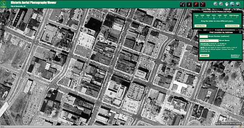
1979 was before real downtown revitalization was taking place. The Woodside Building is gone, and Coffee Street is no longer a thoroughfare. The interesting angle of the buildings along the plaza, including what is now Mast General Store, show the remainder of the angle intersection. Also note that Main Street is a four-lane road.
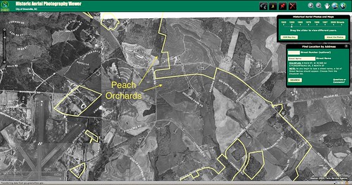
That curious little angle to the buildings points out that there is often a historical reason why things are the way they are. Those buildings are cut like that because they once fronted a street. Place names can also give a clue about what once was. The Orchard Park area around Haywood Road is now a commercial area with the Greenville Hospital System taking over much of the area. At once there were actually peach orchards here, as can be seen in this 1955 image.
The County GIS department has done a fantastic job with this website. I just wish that more imagery was available. It would be interesting to see how the area around the current Furman campus has changed, as well as the areas around Paris Mountain. Even more so, I wish all of this imagery could be available for the entire state. I’ll have to be satisfied with what we have for now, though. Perhaps this imagery can one day be incorporated into Google Earth’s historical imagery layer, too.
I keep trying to zoom in beyond the images’ ability to provide detail. I do see the railroad connections on the west side of downtown at the river, which I remember from my childhood days coming to shop at Belks. Sad that landmarks like the Woodside Building were lost – we lost SO much in the 60s and 70s.
Just for clarification, this site was designed and provided by the City of Greenville GIS, not the County of Greenville. This is why only data within the city is available.
I have looking for a photo of the old Bell Tower Mall in greenville.I would be willing to purchase one.Thanks,Randy