Skip to content

Random Connections

A collection of photography and exploration focusing on Upstate South Carolina and beyond.

  • Home
  • About Us
  • Photos
  • Resources
  • Other Voices
  • Post Archives
  • Podcast
  • Home
  • Historical Maps

Tag: Historical Maps

Greenville Historical Aerial Imagery

Posted on April 5, 2011 By Tom 3 Comments on Greenville Historical Aerial Imagery
History and Genealogy, Internet, Local

Downtown Sanford 1920

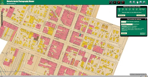
Sometime last week the Greenville Cageliner had an article about a new website from the Greenville County GIS Office (http://gis.greenvillesc.gov/historicalimagery/). The website features historical aerial photography imagery as a map, similar to Google Earth. Images are available for 1955, 1965, 1979, 1989, 1997, and 2009, and cover the downtown area, along with a bit of the county. Also included is the Sanford Insurance Map of the city from 1920.

I could spend a HUGE amount of time exploring the site. Looking at how the city has changed over the decades has been fascinating, and somewhat depressing. The patterns of urban sprawl are quite clear at a distance, and it can be sad to look back on landmarks that are no longer there. On the other hand, there have been some marked improvements in areas such as along the banks of the Reedy River, and these images show that very clearly.

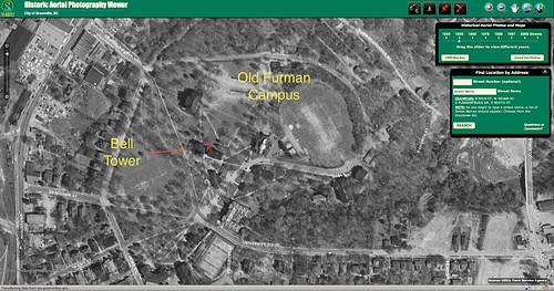
I started with the area around the old Furman campus. I had never really understood the location of the old bell tower in relation to the rest of the campus, but this imagery makes it very clear. (Click on the images for a larger view.)

Old Furman Campus 1955

Read More “Greenville Historical Aerial Imagery” »

Categories

  • EdTech (197)
  • Entertainment (201)
  • Family (123)
  • Gear (114)
  • General Technology (98)
  • Geocaching and Maps (208)
  • History and Genealogy (275)
  • Internet (141)
  • Local (458)
  • Miscellaneous (557)
  • Music (202)
  • Paddling (264)
  • Photography (781)
  • Podcast (15)
  • Rambling (233)
  • Rants (161)
  • Recipes (36)
  • Religion (48)
  • Restaurants (165)
  • Science (48)
  • Things Overheard (29)
  • Travel (413)
  • Uncategorized (142)
  • Washington Sabbatical (113)
  • Weirdness (59)

Recent Posts

  • Six Layer Bourbon Grits Bowl
  • How’s the House? Part 2
  • Carolina Ghost Towns – Merrittsville
  • Gimme Shelter
  • From Kingsbury to Stoneboro – Rambling in Lancaster County

Recent Comments

  • Curtis V Fink on Chasing the Swamp Rabbit – Part 3, Sievern and Edisto Academy
  • Bobby Stan Gillespie on Exploring Jacks Township
  • Richard Thornton on Paddling Up the Long Nose
  • John Guerrant on From Kingsbury to Stoneboro – Rambling in Lancaster County
  • John Guerrant on Gimme Shelter

Tags

blogging cemetery Christmas Columbia Edisto River edtech Entertainment family Flickr Florida Furman Furman University gear Georgia geotagging Ghost Town Ghost Towns Google Earth Google Maps GPS Greenville Greenville Chorale history Instructional Technology kayaking Lake Jocassee LCU Lowcountry Unfiltered maps Music North Carolina Paddling Photography rambling restaurant Restaurants review singing social networking South Carolina time-lapse Travel video Washington Washington State
May 2025
S M T W T F S
 123
45678910
11121314151617
18192021222324
25262728293031
« Apr    

Copyright © 2025 Random Connections.

Theme: Oceanly by ScriptsTown