As much as I love all things map and GPS related, I don’t know why it took me so long to get hooked up with geotagging. Basically, geotagging is the addition of lat/long data to the metadata associated with images, blog posts – or just about anything else that can be "tagged" with descriptors.
Any time I start to invest in learning about a new tech process I have to ask myself why I would want to do this. Some answers are obvious, such as recording where a particular picture was taken, or where I was when I wrote a particular article. I can imagine how much more interactive our trip across country a couple of years ago would have been if I’d been geotagging all of my posts (and I may still go back and fix those.) However, I wouldn’t want this to be an automatic process – no need for everyone to know where I am/was in EVERY picture or post. If not automatic, I would want it to be an easy process, and while things are improving, it still takes a bit of effort to geotag what I want.
Geotagging images is fairly simple if you use a hosting service such as Flickr.com. Flickr is so popular that there are several tools available to facilitate the process. You simply add the following three tags to any image…
geotagged
geo:lat=xx.xxxxx
geo:lon=yy.yyyyy
…and the image’s location can be displayed in Google Maps and Google Earth.
Of course, you have to know the lat/long data for the image. If you can record it at the same time you take the picture, all the better, which means having a GPS with you when you snap the shot. One writer recommends taking your picture, then snapping a quick shot of the GPS itself. The Nikon D200 and the new Ricoh Pro G3 both have built-in GPS for recording lat/long in the image EXIF data.
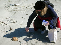
Even if you don’t have a GPS with you when you snap the shot, you can still geotag images in Flickr. Using the Geocoder.us scripts, you can enter any address and get the lat/long coordinates. Another free geocoder from InfoSports uses the Google map interface to allow users to browser to a location and place a marker, which returns the coordinates. The best of these that I have seen is from BeeLoop. This free app lets you browse to a location, similar to the InfoSports app. However, it also generates the needed tags for your Flickr images which you can copy and paste, as well as a link for your image description field which will open a map in Google Maps. Below is an image of Laura at Bull Island I tagged and linked…
If you click on this image, it will display it’s location.
Tagging is one thing. Actually displaying the location is something entirely different. Once upon a time, there was a site called Geobloggers.com that would take Flickr feeds and format them for Google Earth or Google maps. As one zoomed into an area in GE, all geotagged images for that location would be displayed. Unfortunately, this service is no more, and nothing has really come along as a replacement. I suspect this is because the guy who created the service works for Flickr, which is owned by Yahoo, competitor with all things Google.
About the closest I’ve been able to find is maps.Yuan.cc, but in order for it to work you must have a Flickr account and have installed GreaseMonkey and several other scripts in your Firefox browser. Hardly user friendly, and even then, it doesn’t seem to work half the time. FlickrMap has similar functionality, but uses its own mapping system instead of Google. RoboGeo has provided a nice script that will link a single image to either Google Maps or Google Earth with his product called FlickrFly. There is also geobloggers.tafoni.net, which will show a single image if linked from Flickr. For my money (that would be free) I still say BeeLoop is the best and easiest to use.
One other interesting tidbit – there is a Flickr Geotag search engine called Flyr that will return multiple images. However, you have to either know the Flickr user’s name, or search by tags. It’s still pretty cool.
I’ve spent all this time writing about tagging images, but you can also tag other data. I have installed a plugin for WordPress that lets me geotag these posts. I haven’t found a way to display them on any kind of mapping system yet, though. Also, there is a project call Freesound which does for WAV files what Flickr does for images. The files are listed on the right, with a Google API on the left.
UPDATE: I got a comment from CK at Yuan maps. He states that Greasemonkey is not necessary for the maps to work in Flickr. Also, it turns out that my Internet filter at work blocks yuan.cc as a "phishing" site, hence it’s not working sometimes. CK, you might want to check that out.
[tags]geotagging, geotags, Google Earth, Google Maps[/tags]

Hi
I am the author of Yuan.CC Maps. I would like to clarify that maps.yuan.cc is a standalone web application and doesn’t require Greasemonkey installed. The one needed Greasemonkey is GMiF, my prior work. The two are indepentdent. Welcome to try it again.
Many thanks for mention of Yuan.CC Maps. I appreciate your feedback.