This year’s weird weather has wreaked havoc with our normal paddling schedule. The second Saturday of July was supposed to be our infamous Beer Commercial paddle on the Edisto River, AKA the Rope Swing Extravaganza, AKA “Hey, Ya’ll! Watch this!” Yet, even the daredevil nature of Lowcountry Unfiltered had to bend to the forces of nature, as the Edisto swelled from its banks with the excess rain. On our way back from Florida we stopped by the put-in, and found it completely flooded.
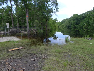
The situation did not improve over the week, so come second Saturday we decided to postpone the trip for a week to see if matters improved. They did not. So, with water levels cresting at nearly 14 feet, 4 feet over flood stage, we needed to find a new paddling venue. It seemed that a lake might be better than a river, so we looked to our favorite location, Lake Marion.
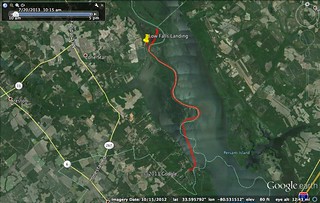
For this trip we would be heading to Low Falls Landing. I had stopped by here a couple of times, and had paddled from here once. I had mapped out several potential routes, with a combination of swamp, river, and lake paddling. To help make the decision, I placed a call down to one of the landing about water levels and conditions, and the news wasn’t good. According to one operator the current was ripping out on the river channel, and the swamps above the railroad were not passable. Most of my routes had significant portions of paddling upstream. Those were out, based on the news. Time to think of something else.
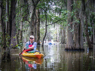
Ultimately we decided on a point-to-point trip, starting from Low Falls Landing and ending at Poplar Creek Landing, about seven miles downstream. We could explore some of the swamps and cypress forests near Low Falls, check out the river, and paddle with the current. Things were looking good.
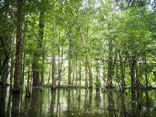
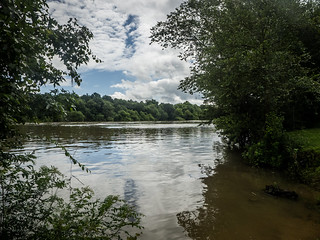
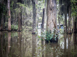
Lake Marion is truly a unique paddling experience. The Santee River maintains a distinct course with high banks through much of the upper lake. To either side of the river are the dense cypress forest swamps of Rimini and Low Falls. Eventually this opens up to the main body of the lake. The whole area is bathed in mystery, beauty, and submerged history. On this trip we were going to hit several of those different environments.
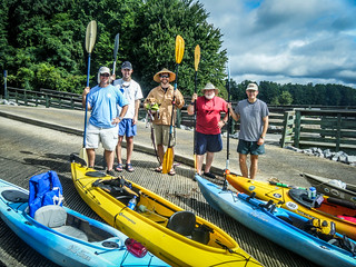
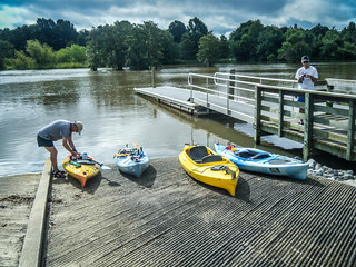
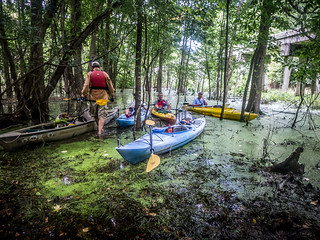
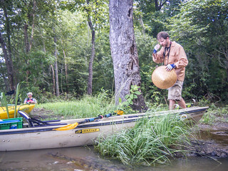
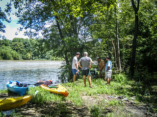
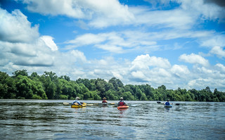
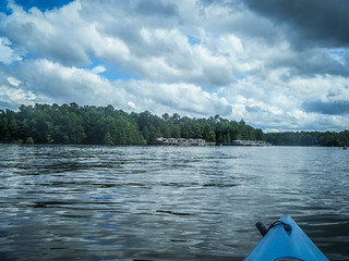
I drove down to Columbia and picked up Dwight, and we forsook the interstate and took smaller roads cross-country. Once again I would have loved to have stopped in Gaston, Fort Motte, and other cool places. however, we had an appointment to keep. As usual, we beat the Lowcountry guys to the appointed landing. There were only a few parking places taken, and not many boats out. Water was high, but it didn’t look flooded. In fact, it looked like a great day to be out on the water.
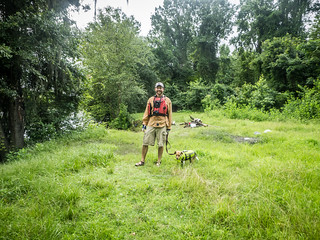
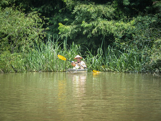
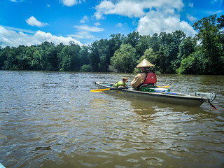
The rest of the guys showed up not much later. They had already stopped to drop off a vehicle at Poplar Creek, so we wouldn’t have to run a shuttle. Our group was seriously pared down from a typical beer commercial float. Only three made the trek up from Bluffton, bringing our total to five. Matt, Lowcountry Alan, Scott, and Lucy the beagle rounded out our group.
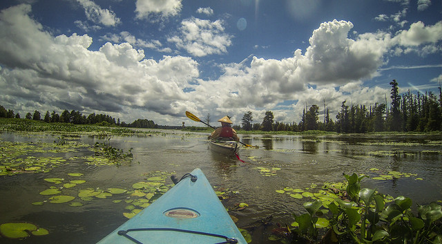
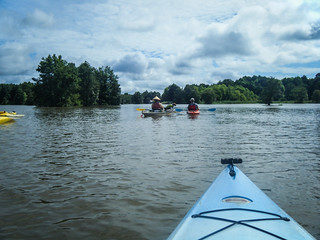
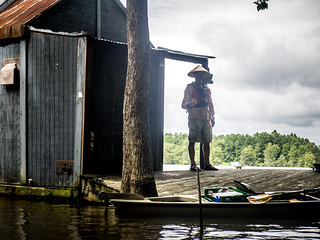
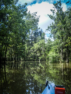
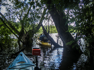
We set out with a bit of a breeze. Our plan was to head north past the railroad trestle and paddle through the dense cypress forests. This would take us past some of the floating shacks that dot the lake around here. The water was only slightly bouncy, and we made good time up to the trestle. We got sidetracked by a couple of the derelict shanties.
One was sorely listing to the side. It appeared to be mostly sunken.
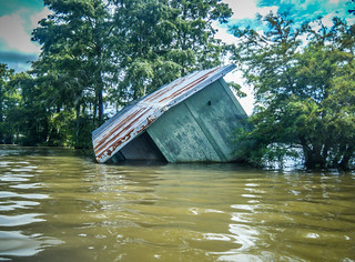
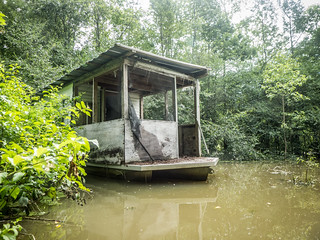
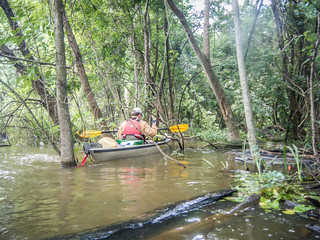
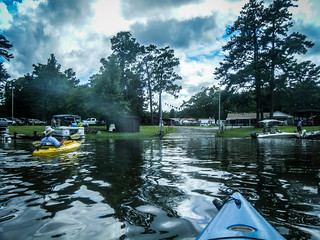
Instead of paddling on out to the trestle, we decided to cross this particular stretch and see if we could break through to the river. We entered the cypress forest, but became distracted by another shanty. Matt decided that he had to check it out.
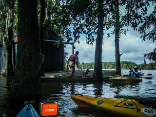
Here’s a short video clip from the GoPro showing the approach to the cabin.
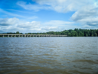
We continued deeper into the cypress, pressing toward the river. Eventually we reached an impasse at another cabin, and turned upstream. Through the dense foliage I could see that we were right at the railroad trestle.
There was no channel along the trestle as there is from the river eastward. Matt and I decided to see if we could walk over to the river, so we beached our boats and started exploring. We found a semi-pathway that led along the trestle past huge mounds of ants. Soon we reached the river proper, and found that it was not as high and roaring as we had feared. We would be OK paddling on the river.
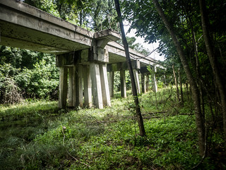


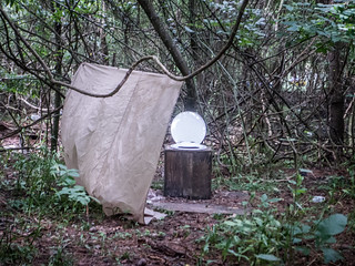
Continuing to explore, we checked out a campground at the trestle. It seemed like a nice place, but was a bit trashy. Further in we found two makeshift latrines. We decided to skip the facilities.
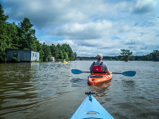
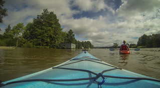
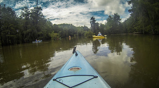
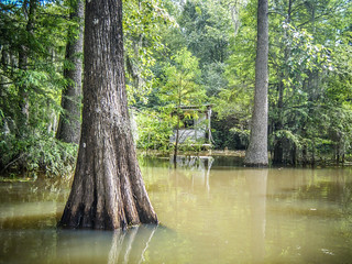
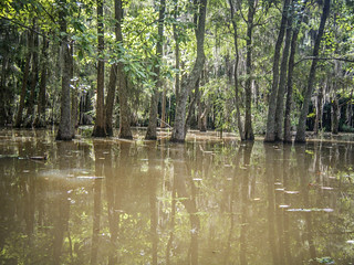
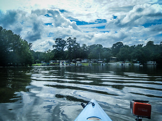
Back with the rest of the crew at the boats we decided to head downstream and look for the closest cut-through to the river. We passed by more cypress, reminiscent of Sparkleberry Swamp, but not as dense. We passed by many more floating cabins. With the shanties and Spanish moss, it had more of a feel of a Louisiana bayou (not that I’ve ever been to one.) We heard what were either wild pigs or alligators grunting off to our left closer to the river bank.
Here’s another little 90 second clip to give a flavor of this section…
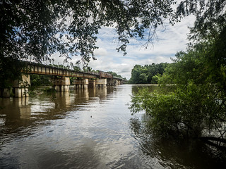
We knew were weren’t too far from the “official” cut-through that boats use to get from the landing to the river, but we were impatient. With the high water, we figured we had to be able to get through somehow. We found an opening and went for it, breaking through the vegetation and into the current of the Santee River.
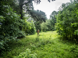
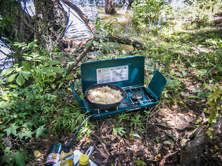
Just on the other side of the river we spotted a clearing with a trash can. Looked like as good a spot as any for lunch. The area was very wet from recent rains, but we were able to find enough dry ground to hold our river communion of bratwurst and sauerkraut. I tried to find a place to string my hammock, but was unsuccessful.
The day was getting on. I had originally plotted out a 7+ mile trip, assuming that we took the river route rather than the lake. With our previous morning’s ramblings, we were still a good bit upstream even from the landing, so we had a ways to go. Fortunately, there was good current in the river, so it seemed like we might make good time. Suitably sated, we set out.
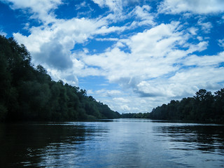
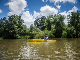
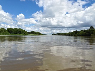
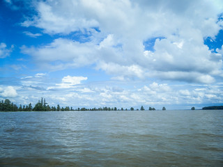
It really was odd to be paddling on a distinct river in the middle of a lake. There were banks to either side, with a definite current. Yet, we knew that just on the other side of those banks were large open stretches of flat water. Elliot Flats bounds the river to the northeast, and Stump Hole Swamp bounds it to the southwest. The river was very wide, but still retained the characteristics of a river rather than a lake.
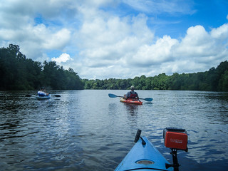
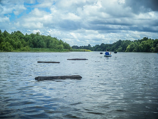
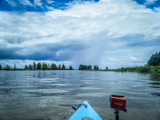
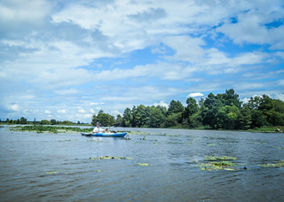
At first the current pushed us along quite well. There was lots of debris in the river, probably washed down by the rising floods upstream. These weren’t really a hazard to us. We could see them and avoid them. However, I could see them posing a problem for a fast-moving motor boat, of which there were a few out an about on this day.
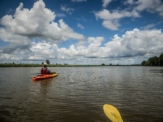
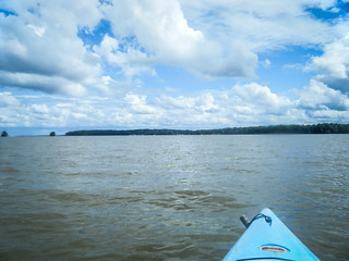
The breeze increased, bringing with it some spectacular clouds. Unfortunately, the breeze was from the wrong direction. Any headway we were making with the current was counteracted by the wind. We decided to see if we could cut over to Stump Hole Swamp. There appeared to be a couple of openings into the vegetation, so we headed in, with Matt leading the way, me behind, and the rest of the crew following. We squeezed through several yards of dense growth, only to be stymied by thick grasses that looked impenetrable. We retraced our steps back to the river.
We decided not to try any more side trips. We weren’t that far from the confluence with Lake Marion, and any more time spent struggling through vegetation would be time wasted. However, it was tempting to explore the openings to the left into the other part of the lake.
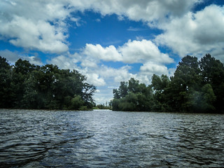
Soon enough I could see the confluence ahead. The banks and narrower course-way ended, and the expanse of the lake opened up. I was the first to cross the boundary, with my companions not far behind.
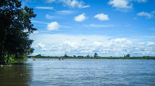
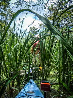
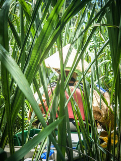
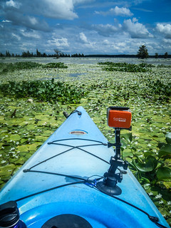
Channel markers indicated clear passage southward. This section still follows the old riverbed, and even though there are no longer tree-lined banks, there was still dense lilypad fields on either side of the channel. Initially we stuck to the channel. Off in the distance we could see rain clouds building. Oddly enough, the tops of the cypress trees in the distance looked more like the Pacific Northwest than South Carolina.
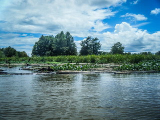
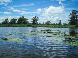
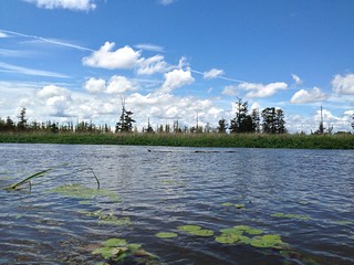
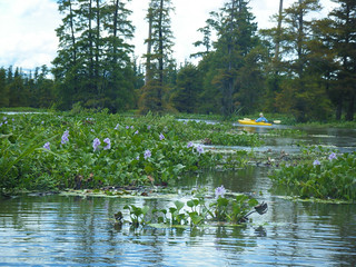
We got out of the channels a couple of times to check out the scenery. In addition to the lilypads, we encountered dense floating fields of pickerel weed. At first I said that paddling through these was like trying to climb the staircases at Hogwarts – the path keeps changing with the floating islands of vegetation. I soon changed to a different Harry Potter analogy, though. It was more like Devil’s Snare. “If you struggle you’ll only die faster.”

Again, another short video clip from the GoPro…
The channel began to open up a bit more. We could see a landing on the lake shore, but, disappointingly, it wasn’t ours. It was Stump Hole Landing. If we had known how much we were going to goof around upstream, we may have opted for the closer landing instead of Poplar Creek.
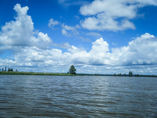
We had a brief passing shower, but it was only a few splashes to cool things down. Soon we left the cypress and lily pads and paddled across open lake. Pontoon boats and jetskis were more common as we got close to Santee State Park. On the other side of the lake we saw Persanti Island, where we had paddled previously with Lowcountry Unfiltered. I could catch a glimpse of large trucks on I-95 in the distance.
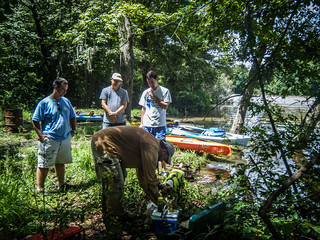
We made our way past the skiers and turned down the cove that leads to Poplar Creek. Eventually we rounded the bend to the landing. We loaded all of the boats onto Matt’s truck, piled in, and headed back to Low Falls Landing.
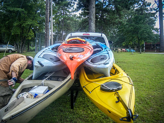
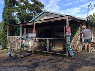
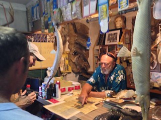
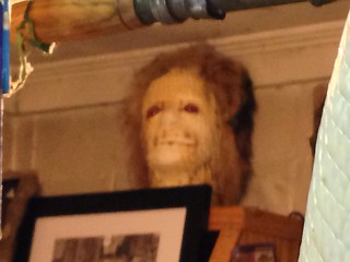
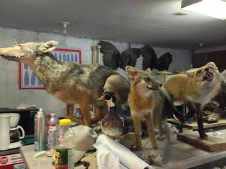
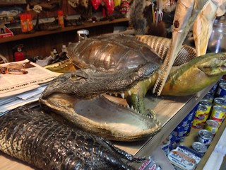
Back at Low Falls we redistributed boats and passengers and prepared for the next stage of the trip. However, we had one more stop. We stopped in at Low Falls Bait Show to view Dan Daniels’ fantastic collection of taxidermy. Dan is a storyteller, and was more than willing to tell us about his collection. He even broke out newspaper clippings where he had been featured. One of his creations was a fanciful “swamp ape” with all manner of anatomical oddities. His shop is a must-stop for any padding trip from this location.
Despite the dire warnings about paddling conditions, it turned out to be a great trip. In all, we paddled 10.2 miles. Here’s our route…
…and here’s a slide show for all of the photos from the trip, including videos…
[fsg_gallery id=”6″]
Looks and sounds like a great trip! Sorry I missed it.