I had been on an excursion to track down the Swamp Rabbit Railroad – not the well-known one in Greenville County, but a lesser-known railroad that ran from Blackville in Barnwell County to the ghost town of Sievern in Lexington County. I was following a map developed by Mitch Bailey of Lexington, with data points form the map loaded into my GPS. So far I’d traced the railroad from Blackville to Springfield, but I still had a ways to go.
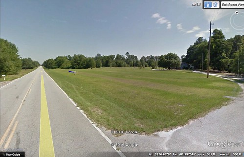
Leaving Springfield in Orange County Highway 39 closely follows the right-of-way for the railroad. As I made the five mile-drive from Springfield to Salley I spotted lots of evidence of the old Swamp Rabbit, especially where crossroads and driveways crossed the railroad. I didn’t pause for photos, but this capture from Google Earth Street View clearly shows the path of the tracks across a lawn.
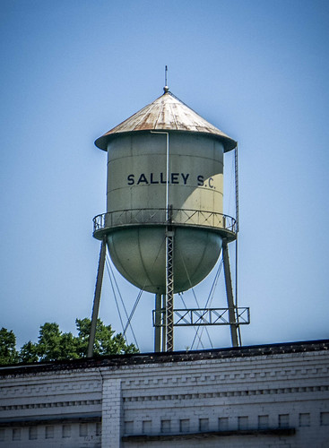
Salley
Soon I was entering the town of Salley. Growing up, the only thing I knew about the town of Salley was its infamous Chitlin’ Strut, held each November. Cooked pig intestines sounded disgusting to me, and for whatever reason that disgust was transferred to the town itself. It was one of those young, ignorant biases. Given all the weird stuff I’ve eaten in my travels, chitlins might even seem tasty. Even so, I think I’ll just focus on the town for now.
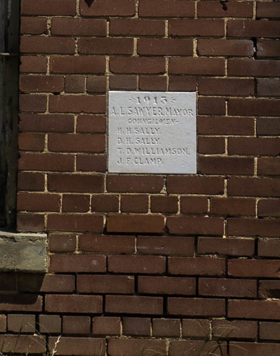
In the mid-1800s Dempsey Hammond Salley owned a large plantation in the area. He managed to get the railroad routed across his farm, and laid out the streets and plots for the new town. Salley was a member of the state legislature at the time, and was able to push through a special act so that the towns of Salley and Springfield were incorporated on the same day, December 19, 1887.
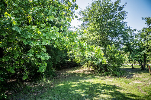
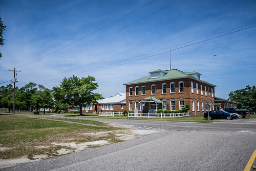
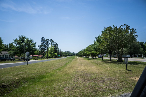
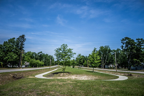
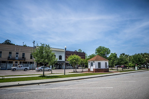
Entering the town of Salley, the Swamp Rabbit right-of-way emerges from an overgrown path and continues with a pedestrian walkway, similar to the ones I’d seen in Springfield and Blackville.
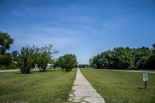
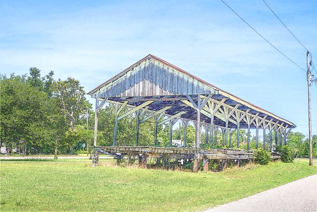
As with those previous towns, a street runs on either side of the railroad. In the middle of this greenway is an old open-air freight depot.
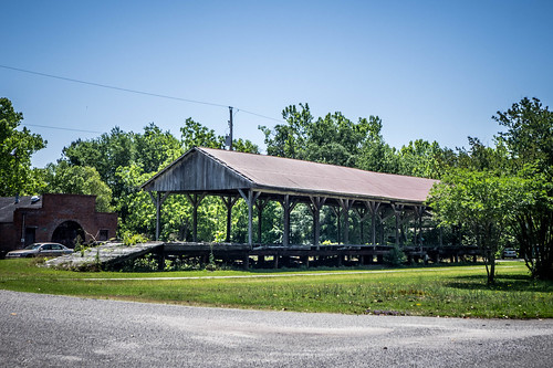
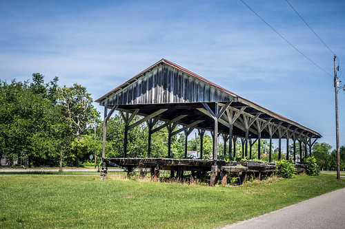

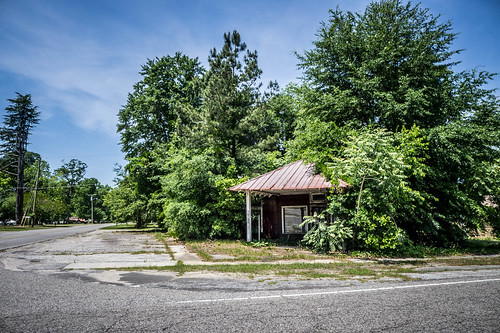
The path continues down to another small utility building, just like the one I’d seen in Springfield.
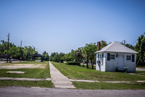
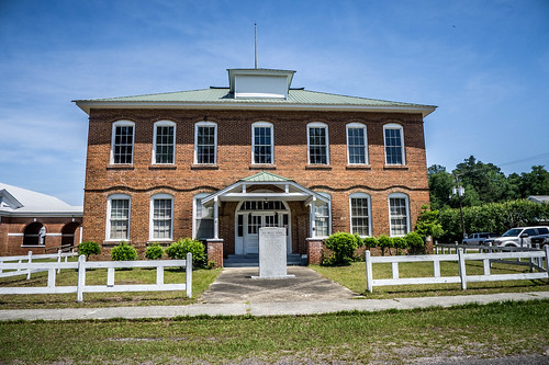
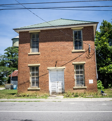
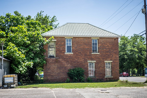
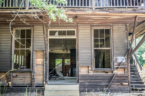
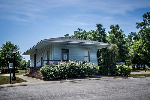
The passenger depot is still extant, and now houses town services.
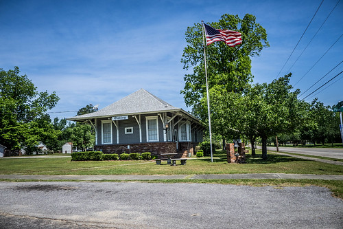
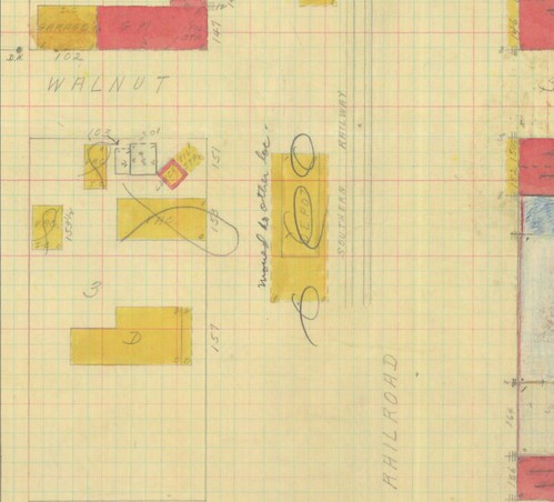
It struck me that the depot was a bit far from the railroad, and I suspected that it been moved, since it was no longer right next to the tracks. An unpublished 1937 Sanborn Insurance map confirms that the depot was relocated. The map even has a hand-written annotation in pencil that reads “moved to other location.”
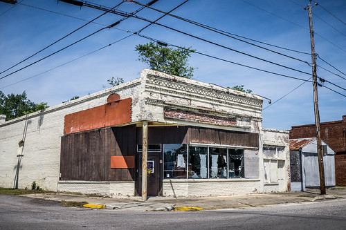
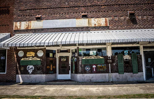
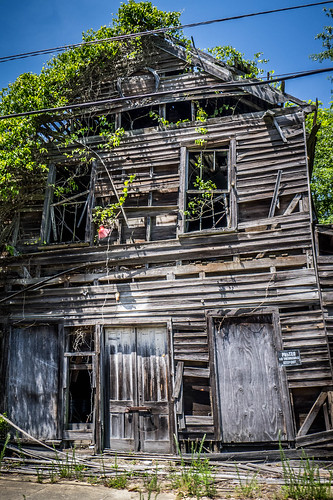
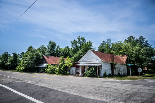
The downtown area of Salley didn’t seem quite as clean and lively as Springfield. The business section wasn’t as large, and there didn’t seem to be as many viable businesses.
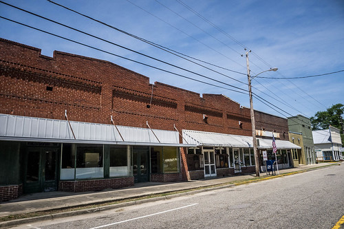
Even so, almost all of the town is included as part of the Salley Historic District for the National Register of Historic Places. Speaking of the National Register, the nomination also states that the rails were removed from the right-of-way in the 1980s, which seems a bit late to me.
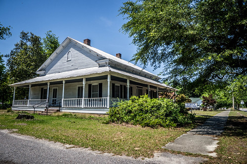
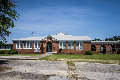
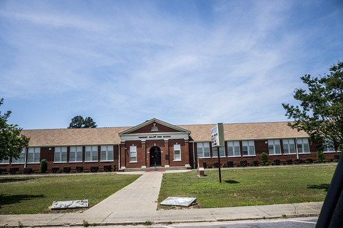
I drove through the town, taking photos of some of the historic houses, including a photo of the Salley School. Much like Springfield, this school also houses community services.
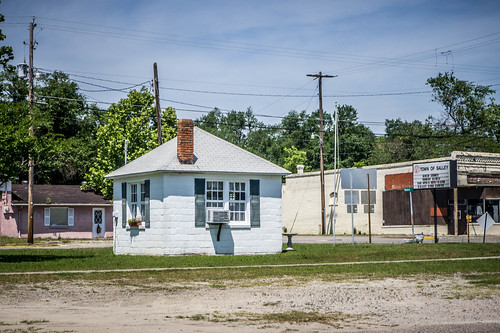
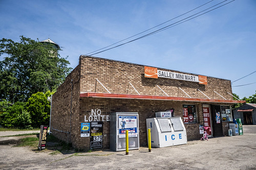
Driving through the town the smell of barbecue wafted through the car. It was getting close to lunch time, so the smells were making me hungry. I had passed a BBQ place, but it was closed. I pulled into a little quick shop for a drink and a snack to tide me over. There was some…interesting spelling on the walls, although the folks were friendly enough.
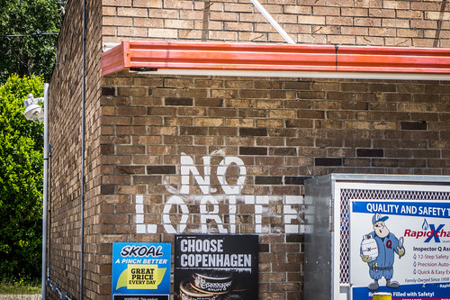
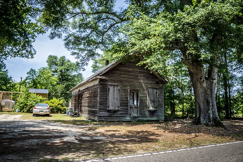
Next to the quick shop was an interesting building. According to the NRHP nomination form this was the town jail, built in 1915. It looked like it had bars over the windows.
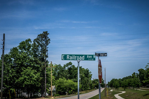
As I drove out of town I noticed more evidence of the railroad right-of-way.
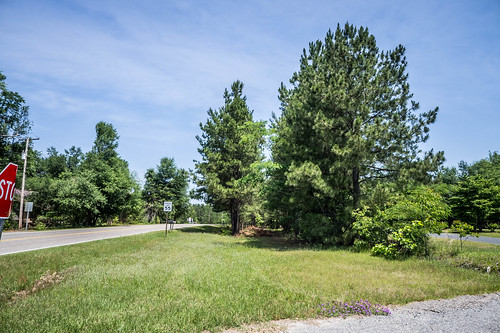
Once again, Highway 39 ran parallel with the railroad along the stretch from Salley up to the next town, Perry.
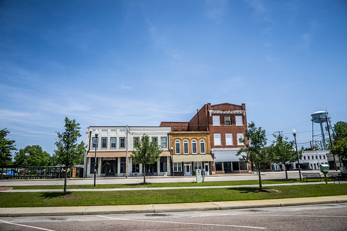
Perry
And, once again, the railroad right-of-way ran through the center of town, and the area had been converted into a walking path. I’m guessing each of these towns received some sort of grant funding for this.
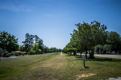
It’s a shame they couldn’t have obtained the right-of-way and connected the trail through all of these little towns. It would have been quite the endeavor, crossing two county lines, but I don’t think it would have been as long as the current Swamp Rabbit Trail in Greenville. Oh well.
Speaking of Greenville’s Swamp Rabbit, here we have a coincidental connection between that railroad and this Swamp Rabbit. One of the early investors in the BA&N was none other than Colonel Benjamin Perry, former governor and resident of Greenville. Perry’s home, Sans Souci, became the first country club in Greenville, and lent its name to the surrounding neighborhood. Here in Aiken County the town of Perry was named for the former Governor. The town was founded in 1887, the same year as Springfield and Salley.
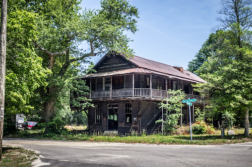
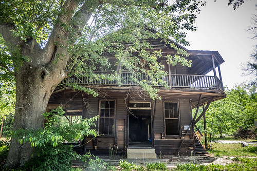
Perry was the smallest of the towns I’d explored so far. There was one very prominent house, a rundown large house, and three small country stores. There were other houses on side streets that I didn’t explore.

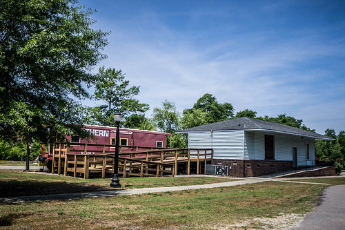
Perry’s passenger depot is still there right next to the old railroad. It doesn’t look like it has been moved. As with Salley, the depot houses town services. And, like Springfield, there is a Southern Railroad caboose on the property to promote the town’s railroad heritage.
Just beyond the railroad was a Y junction. The Swamp Rabbit continued on toward Wagner, while the later Southern Railroad branched off toward Pelion and Columbia. Sadly, my GPS didn’t indicate this detail, and I didn’t have my maps handy. Otherwise, I would have looked for evidence of the junction. As it was, I headed on out of town on Highway 39.
The pattern was repeated – several miles of highway running parallel to the railroad right-of-way. Once again there was clear evidence of the railroad all along the route.
Wagner
As with the other towns, a linear park follows the path of the railroad. In this case there was a very new pavilion and plantings in addition to the paved route. There was also one of those little utility buildings. However, this one was hexagonal, rather than a square.

According to the town’s historical marker, Wagener was originally named Guntersville, or Gunter’s Corner. When it was incorporated in 1888 it was renamed for George Wagener, a president of the BA&N.
The town was the largest I’d visited so far. I didn’t stop to walk around, but I did take photos when I paused.
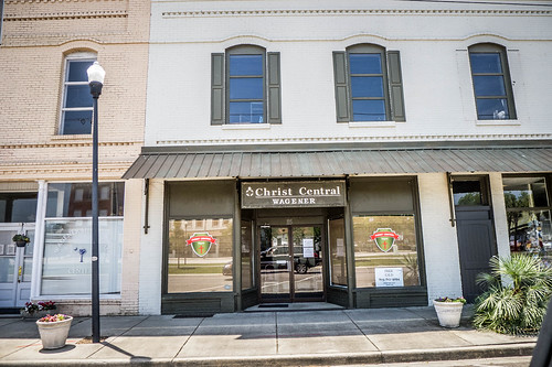
I didn’t see a passenger depot, and the SC Depots website didn’t have listed. However, the Bailey map lists it as a “principal station.” There is a museum that has a display specifically on the Swamp Rabbit.
The Wagener Museum is a featured stop on the South Carolina National Heritage Corridor. Visit the Wagener Museum and journey back in time to the era of the family farm and “The Swamp Rabbit” train. The Wagener Museum displays artifacts and documents telling of the life and times of community residents since the coming of the railroad in 1887.
Of course, it was closed. I may have to come back.
So far chasing the Swamp Rabbit had been fairly easy. I had driven through towns that were proud of their railroad beginnings, and had turned the remnants of the old route into a central showcase for their communities. That was about to change, though. From here on out remnants of the railroad would be much more difficult.

The Y just north of Perry is still quite noticeable on a satellite view, being bounded by Arizona Ave. West, E. Railroad Ave., and Walter St. : Google Maps Satellite link. It’s fascinating how abandoned railroads can leave such noticeable traces of their existence for so long after the rail has been gone.
Indeed. I spotted the junction in Google Earth both before and after the trip. However, for some reason it didn’t get transferred to my GPS. Oh well.
No big deal. There’s always next time. And you still had a great adventure!
What struck me were the red Southern cabooses, almost as if having one is a requirement for a heritage display. If you remember we also saw one at Shoals Junction, and Hendersonville’s depot has one too.
There is also the one in Wellford. That might be another list of “things” one could track on Google Earth.
Thanks for the tip about the Southern caboose in Wellford! I’ve added them to my POI map.
Does your map include the one on Highway 14 north of Greer? https://www.google.com/maps/@35.01293,-82.26024,633m/data=!3m1!1e3
It does now. 😉 I forgot about that one. There’s also one in Pelion.
I did photograph that one. No just haven’t written up that part of the trip. 😉