Saturday was the second Saturday of the month, and time for another Lowcountry Unfiltered adventure. However, in this case Upcountry outnumbered Lowcountry. Matt was the lone adventurer from the lower part of the state. Alan and I would make up the Upcountry contingent. Marc would join us from Columbia. After bouncing around several ideas for paddling venues, we decided upon something relative mid-state, equally inconvenient for all of us. We would be paddling a section of the South Edisto River beginning at Aiken State Park.
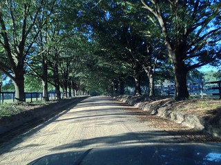
I got an early start and picked up Alan along the way. Our route left the Interstate at Newberry, and took us down through the country past Batesburg-Leesville, Wagener, and other small towns. We passed lots of interesting old stores, churches and other buildings, and both of us wanted to stop and take photos in the rising sunlight. However, we had an appointment to keep.
Our original plan was to paddle from the state park to Keadle Bridge. I had measured it at about 12 twisting river miles – quite a paddle. When we got a call from Matt saying that he was Windsor bridge, and for us to meet him there, I was relieved. That would cut four miles off of the trip, and make it more reasonable. I adjusted my GPS and we headed on down for our rendezvous.
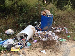
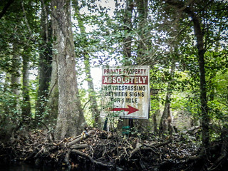
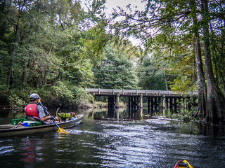
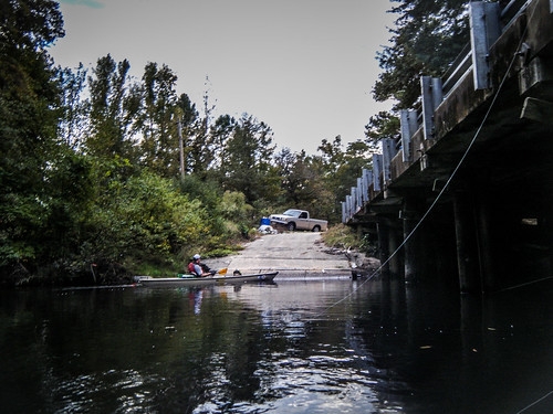
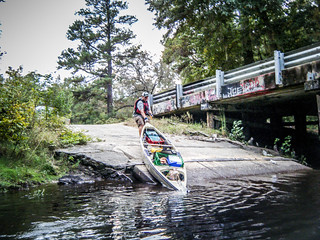
Windsor Bridge was down a dirt road in the heart of Aiken horse country. There were lots of horse farms along the route. The river access itself was a single lane boat ramp covered in trash and graffiti.
A man in a pickup parked on the other side of the bridge, and gave us some background. He said that Buster Hudson, who owned the land on the other side of the bridge, had paid the state to put in the boat ramp. Buster took great pains to maintain the river and clear it of deadfalls between the state park and his land. However, he was now deceased, and the man in the truck said that he couldn’t guarantee the condition of the river. His comments were an omen of things to come.
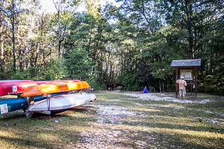
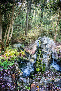
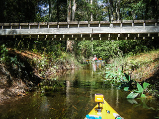
We loaded our boats onto Matt’s truck and drove on up to Aiken State Park. Here, again, I had made an error. I had assumed we would be putting in at Pine Log Bridge, where Highway 53 crosses the river. I was wrong. Our put-in was another couple of miles upstream in the park, proper. We entered the park and drove quite a way down to the river access. An Artesian well marked the access point.
Meanwhile, there had been no sign of Marc. Both Matt and I tried calling several times, but it only went to voice mail. We found out later that Marc had waited at both Pine Log Bridge and the state park access, and had given up on us. We waited at the put-in, and eventually decided to proceed without him. I hate that we weren’t able to make contact. It would be only the three of us.

We finally got on the river by 10:00 am. We would have a full day’s worth of paddling ahead of us.

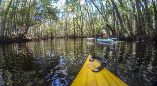
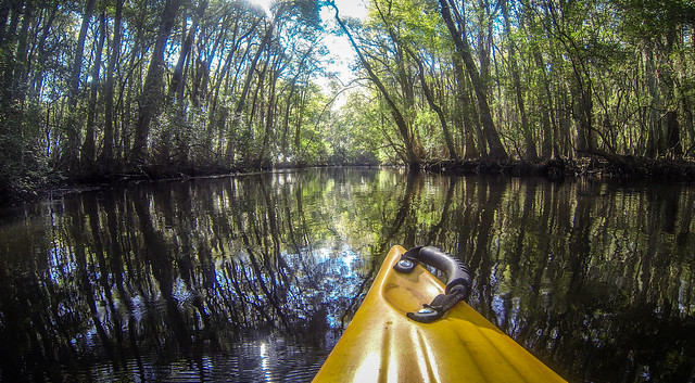
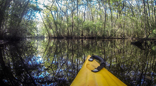
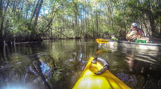
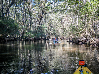
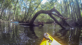
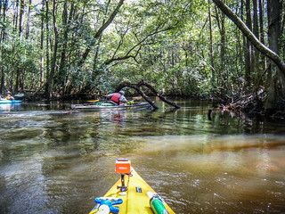
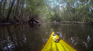
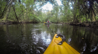
The river was not wide, but was fairly deep with a swift current. More importantly, the river would bend back upon itself every 50 or 60 yards or less. That meant that we had to make sharp turns in fast water constantly. As Alan put it, it was a “very inefficient river.” This video clip gives some idea of the twists and turns:
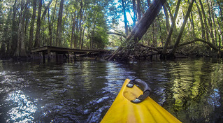
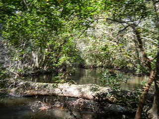
Fortunately, the route through Aiken State Park was fairly clear. The river trail was well maintained, and even though it looked like we might have problems when we came around a bend, we would find that fallen trees had been cut and that there was a discernible path.
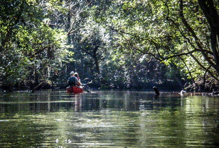
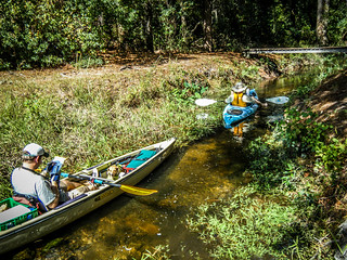
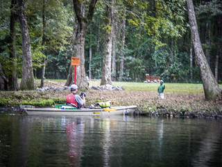
Not long after we launched two canoes launched and passed us. They were making good time, and we were being our typical ADD selves, easily distracted by photographic opportunities.

The inefficient nature of the river bugged us. There were places where it looked like we might be able to take shortcuts if there had been only a foot or so more water. In some places a shortcut had been created across a meander. In those places the strong current almost forced us into the smaller channel. Rarely did we find these wide enough for us to pass. In most cases it was better to stick to the main channel, twisty as it was.
Here’s a place where we were able to find a short cut that would work:
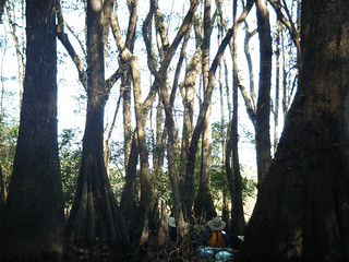
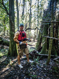
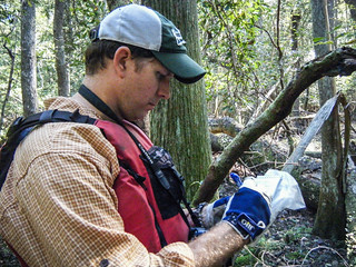
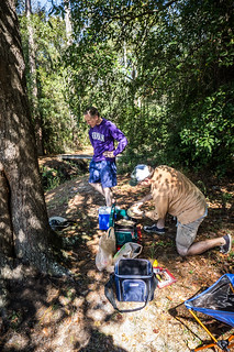
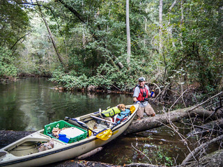
Matt had recorded one Geocache along the route, so he and I stopped to find it. It was a fairly easy find, located in the hollow of a large cypress tree. We recorded our find and replaced it.
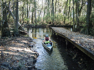
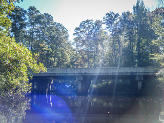
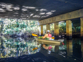
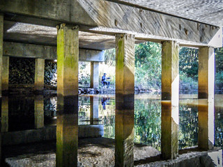
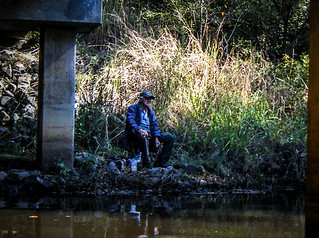
After what seemed like several miles of paddling we finally reached Pine Log Bridge over Highway 53. It was a bit discouraging to think that we had already been paddling quite awhile and were just now reaching what I thought was going to be our starting point. We were still within the state park, so the river was fairly clear, but we weren’t sure what would happen beyond. I paused to admire the coruscating reflections on the roadbed overhead, while a fisherman contemplated the current as we drifted on by.
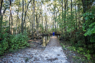
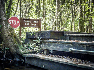
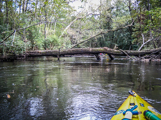
Rounding a few more bends brought us to a log that almost completely blocked our path. The log was intentional, and forced us toward river right, where there was a stop sign and take out sign. Wooden steps were built down to the river. This was the end of the Aiken State Park Canoe Trail. That section, by itself was a reasonable paddle for a day. However, we had a long way to go before we were through.
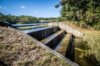
We rounded a few more bends, then heard the sound of a waterfall. That seemed a bit odd. When we explored the side channel we paddled under a small footbridge, then found ourselves at the bottom of a dam for the fishing lake in the state park. Concrete stairs lead up on either side of the dam. We pulled the boats out to check it out.

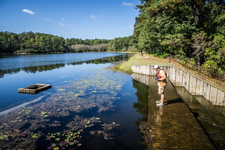
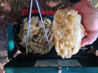
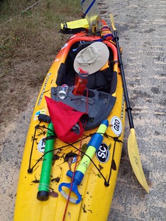
It was a little past noon, and we decided that the clear, shady spot just below the dam was going to be the best place we would find for lunch. Matt hauled out his stove and I pulled out the bratwurst and fixings. Accompanied by Beck’s Beer (illegally on state park grounds) we had our own Octoberfest on the river.
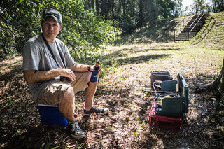
We were relaxed, and it was hard to get going again. Alan even suggested paddling back upstream to the canoe take out and calling it a day. Many times after that splendid lunch did I regret not taking his advice. I think later we all regretted eating four bratwurst apiece, since we had brought food for more paddlers, and didn’t want to waste it. Reluctantly, we loaded back up and continued on downstream.
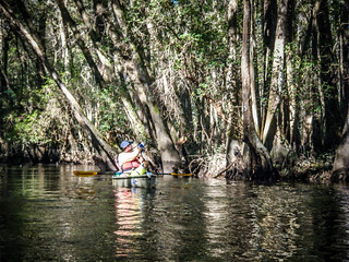
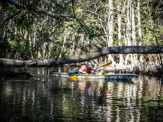
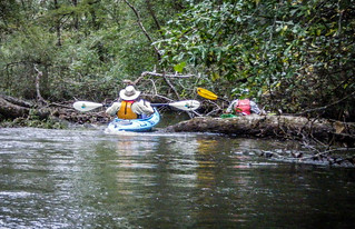
Almost immediately the character of the river changed. While the twists and turns remained, the river path was not maintained, and we encountered multiple dead falls. Matt had a small limb saw, and we needed it several times to cut a path. Occasionally we would come to a place where a limb had been trimmed previously, and we would thank the ghost of Buster Hudson for providing a way through.
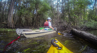
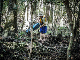
There was no place to relax. You couldn’t just float along because after a few yards the current would push you where you definitely didn’t want to be. We had to do one portage around a downed tree, and we had to jump or pull our boats over several others. There was the constant danger of submerged snags. It required all of our paddling skills to keep going.
Here’s a video of me jumping a log:
Along the way Matt would give updates as to our progress. We didn’t seem to be getting any closer to our take-out. It was already late afternoon, and Matt said that we had six more miles as the crow flies. That translates to about eight more river miles. Disheartened, I asked him if he had updated our take-out since we were using Windsor Bridge instead of Keadle Bridge. Turns out he was still using Keadle as our take-out. We still had a long way to go, but at least we were closer than we had thought.
Low-hanging limbs proved as much of a problem as submerged limbs. At one point a limb snagged my hat and I was nearly garrotted by my chin strap. Matt also had his hat knocked off and I had to retrieve it for him. On one of the shortcuts I was tangled up in some limbs, and looked up to see a snake hanging over my kayak. We had just seen a large cottonmouth, and this one had the same markings. After a brief moment of panic, it turned out to be a non-venomous water snake. The small snake dropped onto my deck console, then slid over the side of the boat. I’m not sure what I would have done if it had fallen into the boat. I would probably sworn as much as Samuel Jackson. No photos of that encounter, though. I did catch Matt losing his hat, though.
We did see some other wildlife – herons, kingfishers, woodpeckers, and even deer. We didn’t see any other humans – paddling or otherwise. We had the river to ourselves.
Eventually my GoPro camera gave out, and I didn’t have a place to stop to change the battery. With all of the low-hanging limbs, I was afraid I was going to lose it again, so I did managed to get it off of the front of the boat and stored safely. To tell the truth, I didn’t take many photographs later in the trip, period. Anytime I stopped paddling to take a photo, I usually wound up where I didn’t want to be. One bend in the river was starting to look like every other one, so I’m sure all of the photos would have looked just like the ones from earlier in the trip.
Over the course of the afternoon it got cloudy, and we wondered if we were in for rain. More importantly, though, it was getting later and later and it didn’t seem like we were any nearer our destination. We were exhausted. Matt phoned the rangers at Aiken State Park just to make sure that his truck wouldn’t be locked in, and the ranger freaked out a bit, thinking that we had taken their boats beyond the park boundaries. Matt reassured them that we were experienced paddlers in our own boats, and that the didn’t need to come rescue us – yet.
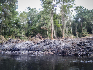
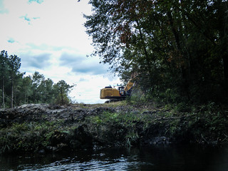
Eventually there were more signs of civilization. We came to one area that had been clear cut right down to the water’s edge. There was another area with a boat ramp and some weird statuary. Matt’s dog, Lucy, was particularly upset by a concrete lawn jockey. We also could hear traffic on the road that parallels the river. It made us think that the bridge was closer than it actually was.
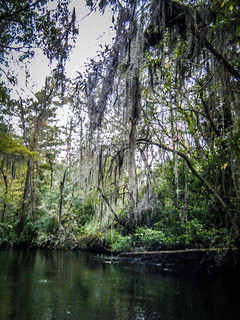
Even with these splashes of civilization it seemed that the river kept getting darker and creepier. There was more Spanish Moss, and it was getting later in the day. We still had a ways to go, and logs and limbs still blocked our path. I always carry tarp and materials for an emergency shelter, and I was beginning to wonder if we would need it.

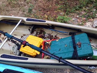
Eventually, we did see the blessed sight of Windsor Bridge. When we pulled our boats it, it was after 6:00 pm and we were dead tired. Our boats (as well as ourselves) were absolutely filthy from our encounters with branches and everything else.
We made the shuttle back to state park and retrieve Matt’s truck. On the way out we had one more encounter. A copperhead crossed the road in front of Matt’s truck. Matt stopped, and so did the snake. We all hopped out to encourage the snake on its way, but it turned on us. It was amazing how fast that thing was. Even so, having a venomous snake moving at me aggressively was not nearly as panic-inducing as having a non-venomous one drop on my boat.
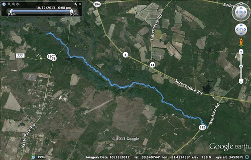
According to my GPS we paddled 9.55 miles. I’m not sure how accurate that is because the GPS didn’t seem to keep up with all the twists and turns in the river. Here’s the GPS track:
I didn’t have the GoPro on for the entire trip, but I did create a time-lapse of the 971 shots it did take. It gives some idea of the twisting nature of the river.
Finally, here is a slide show of all of the photos form the trip, including the video clips.
[fsg_gallery id=”22″]