So far Tommy Thompson and I had found an old airway beacon pad, and had visited a wonderful old chapel. There was more to see, though. I had several places I wanted to check out in Cherokee County that Glynda and I had explored previously, including the ghost town of Coopersville and the abandoned Cherokee Nuclear Station. After the morning’s successes, this bit of the trip was an exercise in frustrations.
Upon leaving Mulberry Chapel, we decided to see how close we could get to the Cherokee Nuclear Station. We drove through the community of Asbury, then headed north toward Gaffney. Just on the outskirts of town we came across a couple of landmarks that caused us to turn around to catch some photos.
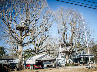
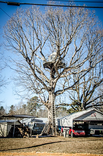
First up was an elaborate tree house. This thing was multi-level, and VERY high up in a tree. Actually, there were two tree houses in two different trees. The lower one looked like a gazebo that had been impaled by a tree. The other looked like it was accessed by a rather precarious ladder leaning against the tree.
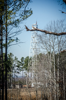
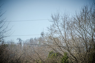
Just up from the tree houses I spotted a fire tower set back off of the road. The tower looked like it was in excellent condition, but also looked like it was out of place. I suspect that this was one of the surplus towers that was sold, then moved to this location.
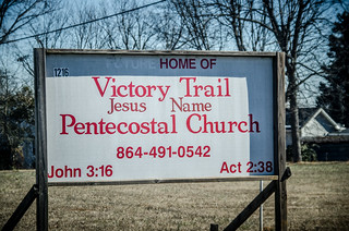
We also found that elaborate church names aren’t limited to the lowcountry…
We drove through the community of Draytonville. I’ll need to do a bit more research to see if this might make my list of ghost towns. It seemed to be an interesting community surrounding one of the small monadnocks prevalent in this area. Archives indicate that at one time it had an interesting old school building.

Soon we found ourselves at the gates of the Cherokee Nuclear Plant. There was a gatehouse, and several vehicles parked at the entrance. Very clear “No Trespassing” signs were posted everywhere by Duke Power. We continued on, looking to see if there was a place where we might catch a glimpse of the power plant.
So why would a nuclear power station be of such interest?
The Cherokee Nuclear Station was being built in the 1970s, about the time of the Three Mile Island disaster and the movie “The China Syndrome.” Construction was discontinued in 1980 due to “economic problems.”
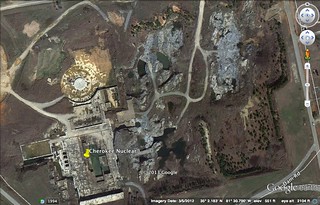
In 1987 the site was being promoted as a movie set. In 1988 the containment building was flooded and used as a set for the movie “The Abyss,” released in 1989. Since that time the location has been a favorite of urban explorers, especially the Deep Core set.
![]()
To thwart trespassers, the set was finally dismantled just recently, and reports are that it is just a flooded mess right now. Here’s the latest view from Google Earth…
We tried circling the plant to see if there was a ridge or something where we could gain a view. Alas, no. No trespassing signs were everywhere.
It wasn’t until I got home that I read that another nuclear plant was being built adjacent to the abandoned one. In 2007 an application was filed for the William States Lee Nuclear Generating Station. Its licensing is still under consideration by the Nuclear Regulator Commission.
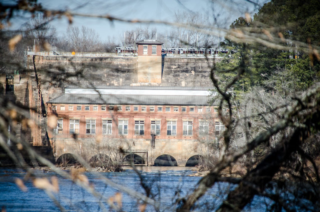
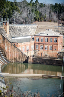
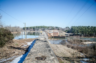
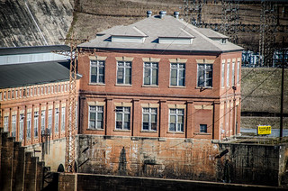
Once the access roads did take us down to the Ninety-Nine Islands Dam. Built in 1910, this 100+ year old dam and power plant are still generating energy. It looked like it would be an interesting place to put a kayak for a bit of paddling on the Broad River.
Next up was Cooperville.
Cooperville is on my list of ghost towns. Prior to the Civil War there was a string of iron works in the area, from Thicketty Mountain all the way down to the southern part of the county. One of the largest was the Nesbitt Iron Works at Cooperville.
Apparently the iron works are still an active archeological site. The National Register of Historic Places listing for Cooperville has been severely redacted, so that the address has been obscured. With a bit of investigative work, I was able to make a guess at the location. Glynda and I were able to make a visit, but I wasn’t able to explore as much as I would have liked.
We headed back to the Cherokee Ford river access that Glynda and I had visited…only to find more No Trespassing signs everywhere. I don’t remember these signs on our last visit. Tommy and I were tempted to ignore them and continue on down to the river. What turned us back was the steep dirt road that was still iced over. Trespassing is one thing. Getting stuck while trespassing is something else entirely.
For what it’s worth, I did check out the Cherokee County tax maps and found that this land is owned by the county recreation department.
Thwarted again.
It was getting to be lunch time, so we decided to make our way back to Gaffney to find something to eat. Along the way we swung back by Draytonville Mountain, where we found another fire tower. Alas, more No Trespassing signs were along the access road to the top of the mountain. I was getting a bit tired of seeing those things.
We headed on in to Gaffney to find lunch, and yet another blog post. Stay tuned.