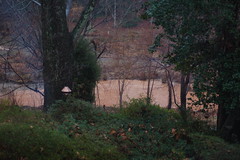
Remember this view from yesterday?
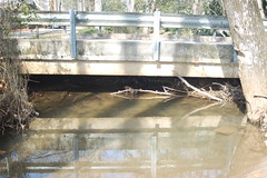
This is what it looks like today…
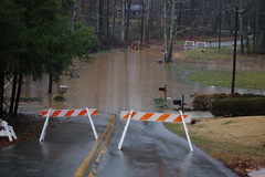
We’ve had a fairly steady rain all day, but nothing major. Here’s what happened in the low spot in the street…
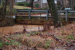
One could also see the change right behind our house. At some point during the morning the flow turned very red, as if silt from an upstream source finally made its way downstream. Compare these two photos. The one on the left is yesterday, and the one on the right is today…
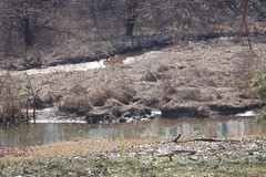
This morning’s Greenville News featured quotes from their discussion forum regarding the flooding issues. Most of them went something like, "I don’t see why my tax dollars should go to buy these people out. They chose to live in a flood plain." These people are clueless. The houses weren’t in a flood plain until construction and silt filled in the lake.
County Council continues to be dillusional. They contend that the Brushy Creek watershed is completely developed, and that further development won’t exacerbate the problem. Excuse me, but that’s complete hogwash. Any time there is construction, even of supposedly "developed" areas, it disturbs the topsoil and sends loads of crashing into our lake, making the flooding worse. Yes, the area is very much developed, and few permeable surfaces remain upstream. Council is allowing Bob Jones University to destroy one of the few remaining stands of trees and permeable land to build high density housing. This means that pretty soon, McCarter Creek will look just like Brushy Creek, and the county will have to buy out even more houses.