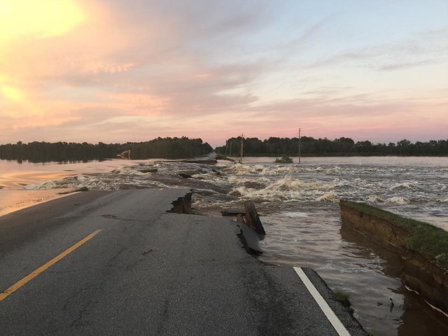
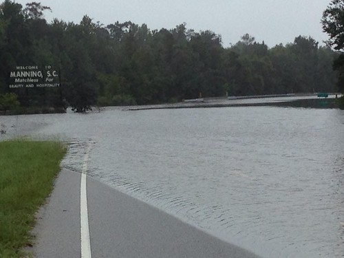
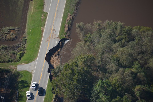
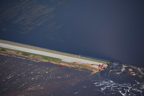
It’s as I feared. The floodwaters that inundated Columbia are now washing downstream. The image above is of Highway 301 between Manning and Turbeville, the very area I explored a couple of weeks ago. This image was posted on Facebook by John McLeod, a Manning Resident. He also posted this image just northeast of the town.
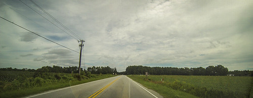
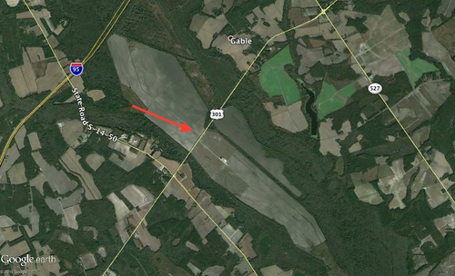
The Highway 301 image above is right where it crosses the Black River. On either side of the river are large farms with open fields. This is what it looked like when I drove through the area.
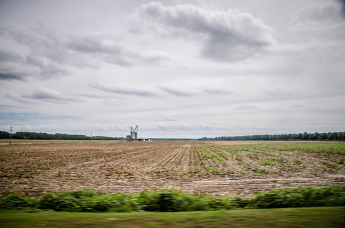
Here’s another shot of the fields pre-flood.
This is what it looks like in Google Earth.
The waters are still moving south. I’m sure there will more reports of damage, but I just hope there is no more loss of life. Things can be replaced. However, this does confirm that I’m not heading back out on the Tobacco Trail for quite some time. I may even wait until winter, when things have gotten a bit closer to normal.
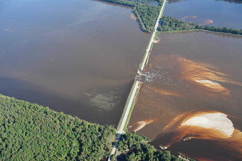
UPDATE: Fellow techy and friend Jay Lindler share several photos that were taken by his Civil Air Patrol group. These images are now available on the FEMA Flood Journal website. The images below are of the same stretch of Highway 301 as shown in the first photograph. The map also shows damage further along 301 near Florence and Marion.
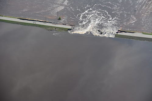
Tom….Those photos are indeed impressive. The one with the flooded farmland and washed-out Highway 301 consisted of cleared converted swampland. Roughly 30 or so years ago, it was all heavily timbered and, usually, very wet swamp woodland that was clearcut, ditched, and turned into agricultural fields. That proves that you better not mess with Mother Nature. She will bite back. Actually, most of the swamp to the northeast of 301 up to I-95 was similarly converted to fields at the same time, but has been “restored” to swampland in recent years.
The other photograph, with the “Manning” sign, is where Highway 301 and Highway 521 converge at the edge of Pocotaligo Swamp going into Manning, about 1 mile further on. This swamp is a combination of the confluences of many branches that drain the entire city of Sumter, plus much of Sumter county. I was at a friend’s home in Sumter this afternoon that had 5 feet of water in his house (now back on dry land) on one of those “minor” branches.
The two swamps represented by those photographs merge 9 miles east (downstream) of Manning, and then join with other drainages before going into Kingstree on the Black River, thence with others before going into Andrews, then Georgetown. Is there any wonder that those areas are beginning to bear the brunt of the flood, especially since they received as much, and in some locations, even more, rain than we did?
This will be remembered for many a year. My damage was paltry, yet I am becoming more depressed each day as I see more of it….
Bentley Fishburne
Sumter
Error in the above: The sentence …. Actually, most of the swamp to the northeast of 301 up to I-95 was similarly converted to fields at the same time, but has been “restored” to swampland in recent years…. SHOULD READ….Actually, roughly an equal amount of the swamp to the northwest of I-95 was similarly converted to fields at the same time, but has been “restored” to swampland in recent years.
If you post this, would you please make that change for me?