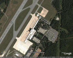
 I have just spent every free minute of this weekend touring the world, courtesy of Google Earth. This has got to be the coolest program I’ve seen in a long time. I’ve become a GE evangelist, and am trying to tell everyone I can about this program, especially teachers.
First came Google Maps, which was the first online mapping site to incorporate XML formatting for it’s data. This open source approach allowed creative users to develop their own "hacks" for Google Maps, including things such as overlaying GIS data with their mapping system. For example, real estate agents could develop websites that showed properties available, and with Google Maps it was easy to switch from maps to satellite imagery. Pretty neat.
Google Earth takes the capabilities of Google maps to a whole new plane of existence. GE still uses an XML implementation for it’s data source, but it also incoporates 3D modeling for very realistic flyovers of the entire earth. Users start with a view of North America, and can zoom down to a view of individual houses and buildings, depending on the satellite detail available for that particular location. Some of the most fascinating locations are the Great Pyramids of Giza, New York City, Washington DC, the Eiffel Tower, and my personal favorite, the Grand Canyon. Users can create virtual tours that bounce from one location to another anywhere on earth. The potential for teaching geographic concepts is incredible.
In addition to creating tours, Google Earth lets users measure distances between points, and save their favorite lo cations. There are also layers that can be activated showing streets, political boundaries, and other map data. Google Earth Plus is available for $20, which includes the ability to draw lines and polygons, as well as the ability to import data from spreadsheets. Google Earth Pro ($400) has full GIS implementation for professional applications. I haven’t explored everything on the free version, but I’m about ready to upgrade to the Google Earth Plus version so that I can try importing some of my Geocaching and genealogy GPS data.
As I’ve played the role of GE evangelist, my converts have been equal parts fascinated and disturbed by the capabilities of the program. The ability to put in an address or lat/long coordinates and get a detailed overhead shot makes some worry about privacy. In reality, this provides no more advantage than what’s always been available with most mapping software and online systems such as MapBlast. However, I did note that the overhead view of the Capitol Building in DC has pixellated distortion, and the White House is blanked out.
You make an excellent evangelist! A dozen people like you could change the world.
Have you found the Google Earth Community? bbs.keyhole.com Be careful — it could cost you the rest of your time. 😉