Last time I talked about my inherited propensity and motivations for rambling. This time I’m going to be a bit less random, and discuss some of the tools I use for rambling and how I choose particular targets.
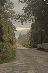
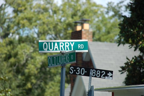
I love to explore aimlessly, and there is always some component of randomness to any of our explorations. Especially, if I come across a road with an intriguing name, such as xxxx Mill Road, or yyyy School Road, there might be the potential to find the actual school or mill for which it was named. However, more and more these have led to disappointment. The historic mill or school for which the road was named is long gone, and has been replaced by development. With the price of gas as high as it has been, I’ve had to refine my technique a bit.
Geocaching used to get me out and about to explore with a specific goal in mind. However, I found that focusing on a small container of trinkets often made me miss the big picture and the potential for even more discovery. I now tend to be less specific with my targets, and try to hit a broader area. It’s that art of refining that broader area into a reasonable target that often gets tricky.
As mentioned in my last post about rambling, I often rely on several of my online friends who have explored areas before me. If they have visited an interesting area, I may try to get there myself. I also get ideas from various history books – A. V. Huff’s history of Greenville has been a great resource, as has The South Carolina Encyclopedia. Probably the best resources are “South Carolina, One Day at a Time” by Caroline Todd and Sidney Wait, and The South Carolina Atlas and Gazetteer by DeLorme, which contains detailed topographic maps of the entire state. The various ghost books I’ve been reading are also a good source, not because I believe in ghosts, but because these tales are often associated with interesting historic areas.
For online resources I first turn to Sciway.net. Their history section gives a county-by-county listing of historic sites. Geocaching.com and waymarking.com are also good online resources, because folks tend to place these in interesting places. I will also browse for geotagged images from both Flickr and Panoramio in Google Earth, and will turn on the Google Earth Community layer to get ideas for future visits.
Once I have a general area selected, I’ll try to find out some more specific details. I’ll use the resources previously mentioned, but I’ll also do some more specific keyword searches for locales within the target area. Keyword searches in Flickr based on the place name can also bring up some good information. I use Google Notebook to gather the info, and Google Maps/Earth to organize specific locations. I can copy interesting placemarks into one KML file, and even upload points from Google Maps directly to my Garmin GPS using Garmin’s browser plug-in. I don’t think Magellan has developed analogous plug-ins, but I haven’t really checked.
For one of my trips I had created a shared Google Map so that others could contribute locations. As more people get involved in the expeditions, I may try using something like a wiki to collect information and suggested sites.
Even with all of this planning, I like an element of surprise. If a neat-looking dirt road catches my eye, I’ll head off in that direction. We may linger at a spot longer than planned, but that’s OK, too. As long as I can keep that sense of discovery alive, I’ll consider the trip to have been a success.
Tom, that ‘road’ photo at the top of this post is brilliant…