Skip to content

Random Connections

A collection of photography and exploration focusing on Upstate South Carolina and beyond.

  • Home
  • About Us
  • Photos
  • Resources
  • Other Voices
  • Post Archives
  • Podcast
  • Home
  • Lake Moultrie

Tag: Lake Moultrie

Exploring The Jungle of Lake Moultrie

Posted on August 10, 2020August 10, 2020 By Tom No Comments on Exploring The Jungle of Lake Moultrie
History and Genealogy, Paddling, Photography

The Second Saturday of August meant time for another adventure with my friends from Lowcountry Unfiltered. Matt and I bounced a few ideas around before settling on The Jungle, a section of Lake Moultrie featured as part of the Berkeley County Blueways. It was a new venue for us, and turned out to be a … Read More “Exploring The Jungle of Lake Moultrie” »

Return to Old Santee Canal

Posted on May 18, 2017 By Tom No Comments on Return to Old Santee Canal
Paddling, Photography

Old Santee Canal-50

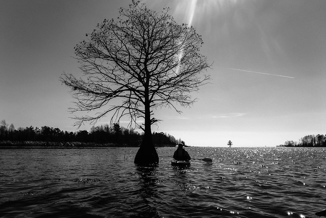
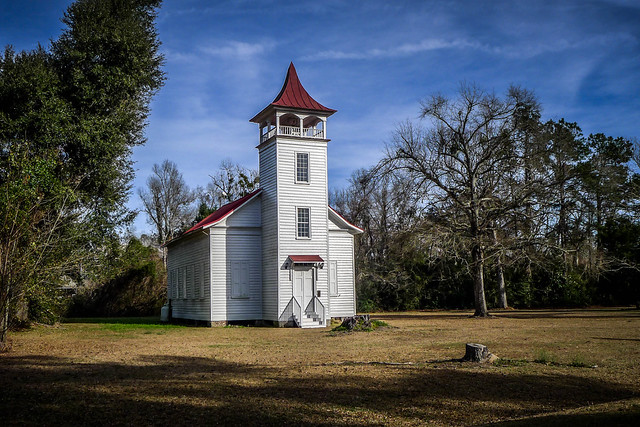
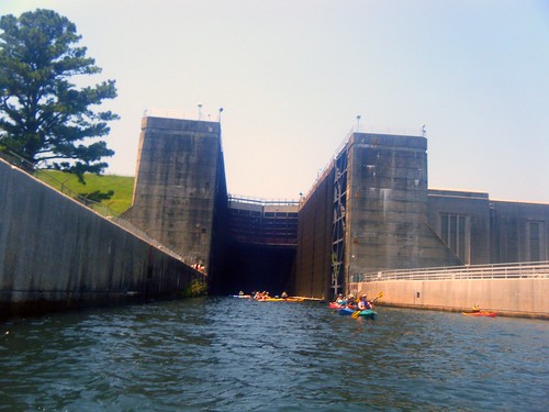
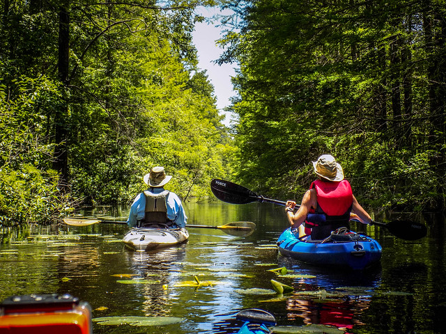
I’m always looking for new paddling companions. Not that there’s anything wrong with the close friends I’ve developed in my other paddling groups, but different people bring different perspectives and and expertise on new paddling venues. The more the merrier (most of the time.). So lately I’ve been keeping track of the Tri-County Blueway Paddlers Meetup group. Ed Deal and Deb Mims have been organizing some insteresting trips over waterways I’ve wanted to explore and at times that I can attend. This week they scheduled a trip to the Old Santee Canal which I’d visited back in February with Lowcountry Unfiltered. I enjoyed that trip so much and the scenery was spectacular, so I decided to head back for this trip.

Read More “Return to Old Santee Canal” »

Exploring the Old Santee Canal – Part Four, Paddling the Canal

Posted on February 16, 2017February 16, 2017 By Tom 1 Comment on Exploring the Old Santee Canal – Part Four, Paddling the Canal
Geocaching and Maps, History and Genealogy, Paddling, Photography

Lake Moultrie and Santee Canal with LCU-71

Second Saturday had finally arrived. I’d spent Friday exploring Berkeley County, specifically the Old Santee Canal Park. Now I’d be joined by my fellow kayakers from Lowcountry Unfiltered to explore the upper end of the old canal from where it enters Lake Moultrie. It was time to get on the water.

Read More “Exploring the Old Santee Canal – Part Four, Paddling the Canal” »

Exploring the Old Santee Canal – Part Three, Moncks Corner to Santee

Posted on February 15, 2017 By Tom 2 Comments on Exploring the Old Santee Canal – Part Three, Moncks Corner to Santee
Geocaching and Maps, History and Genealogy, Photography, Rambling

Pineville Chapel

So far I’d had a great day out exploring. I had an interesting visit at the Old Santee Canal Park, and the next day I’d be paddling part of the canal from Lake Moultrie. Now, however, the afternoon sun was sinking and I had to get to my night’s lodgings. Along that route I found some more cool bits of history.

Read More “Exploring the Old Santee Canal – Part Three, Moncks Corner to Santee” »

Paddling the Pinopolis Lock

Posted on June 13, 2010 By Tom 4 Comments on Paddling the Pinopolis Lock
Paddling, Photography

Pinopolis Lock

I had two conflicting paddling opportunities this weekend. My buddies from Lowcountry Unfiltered were going to be paddling the lower Savannah River, and the Greenville Canoe and Kayak group were planning a paddle on Lake Moultrie through the Pinopolis Lock. It was quite the dilemma. Ultimately I decided on the Pinopolis Lock trip because it sounded more like a one-shot deal.

I had seen photos and even a couple of online videos of the Pinopolis Lock. The lock is the highest single-stage lock in the US, and the second-highest in the world. It raises and lowers boats 75 feet from Lake Moultrie to the Tail Race Canal, which then connects to the Cooper River and on to Charleston.

We wouldn’t be paddling quite that far, though. Our plan was to launch from the YMCA beach near the dam, paddle about a mile to our lunch spot, then enter the lock. We would then do a few miles on the canal, then cut back into Wabdoo Creek to our take-out.


View Lake to Lock Paddle in a larger map

Read More “Paddling the Pinopolis Lock” »

Categories

  • EdTech (197)
  • Entertainment (201)
  • Family (123)
  • Gear (114)
  • General Technology (98)
  • Geocaching and Maps (208)
  • History and Genealogy (275)
  • Internet (141)
  • Local (458)
  • Miscellaneous (557)
  • Music (202)
  • Paddling (265)
  • Photography (781)
  • Podcast (16)
  • Rambling (233)
  • Rants (161)
  • Recipes (36)
  • Religion (48)
  • Restaurants (165)
  • Science (48)
  • Things Overheard (29)
  • Travel (413)
  • Uncategorized (143)
  • Washington Sabbatical (113)
  • Weirdness (59)

Recent Posts

  • Carolina Ghost Towns – Paper Towns
  • Kayaking on Wolf Creek Lake
  • Carolina Ghost Towns – Colonial Dorchester
  • Six Layer Bourbon Grits Bowl
  • How’s the House? Part 2

Recent Comments

  • Eric Kincaid on Kayaking and Coffee
  • Daniel S Mawn on Remembering the Walke
  • Judy Hall on The Clock on Wade Hampton
  • Charles Johnson on In Search of the Road Builder
  • Anthony h hannig on From Kingsbury to Stoneboro – Rambling in Lancaster County

Tags

blogging cemetery Christmas Columbia Edisto River edtech Entertainment family Flickr Florida Furman Furman University gear Georgia geotagging Ghost Town Ghost Towns Google Earth Google Maps GPS Greenville Greenville Chorale history Instructional Technology kayaking Lake Jocassee LCU Lowcountry Unfiltered maps Music North Carolina Paddling Photography rambling restaurant Restaurants review singing social networking South Carolina time-lapse Travel video Washington Washington State
June 2025
S M T W T F S
1234567
891011121314
15161718192021
22232425262728
2930  
« May    

Copyright © 2025 Random Connections.

Theme: Oceanly by ScriptsTown