Skip to content

Random Connections

A collection of photography and exploration focusing on Upstate South Carolina and beyond.

  • Home
  • About Us
  • Photos
  • Resources
  • Other Voices
  • Post Archives
  • Podcast
  • Home
  • ArcGIS

Tag: ArcGIS

Secrets Revealed in ArcGIS Explorer

Posted on October 2, 2008 By Tom 8 Comments on Secrets Revealed in ArcGIS Explorer
Geocaching and Maps

ArcGIS-Explore-Screen-Captu

LongArcGIS-Explore-Screen-Captu

Long before Google Earth came on the scene there was ArcGIS from ESRI. There are two (actually, multiple) flavors of this. There were the professional GIS versions consisting of ArcMAP and ArcServer, and a free viewer, ArcExplorer. I attended a couple of workshops on ArcExplorer, was impressed by its potential for the classroom, but never really got into it. Along came Terraserver making free satellite imagery available, then Google Earth took the world by storm, somewhat obscuring these previous free mapping services.

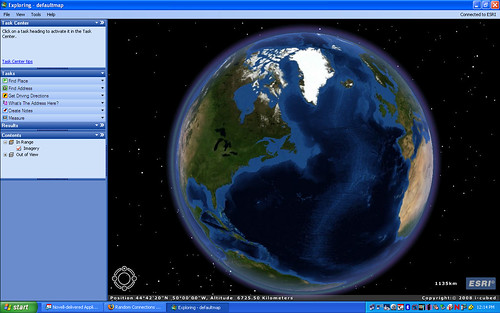
While working on another project I needed to check out ArcGIS Explorer once again, and was surprised to find that it now looks very much like Google Earth with a similar user interface. Navigation is essentially the same – you can zoom in, tilt, and pan just like in GE. There are search functions and you and create placemarks. While Explorer will open KML files, it’s designed to be more compatible with ArcGIS data.

Google Earth has a much larger user-contributed base. However, there is much more accurate GIS data available for Explorer from various GIS organizations around the world. When comparing the free versions of these programs, you could think of Google Earth as being more populist, and ArcGIS Explorer as more professional.

Read More “Secrets Revealed in ArcGIS Explorer” »

Categories

  • EdTech (197)
  • Entertainment (201)
  • Family (123)
  • Gear (114)
  • General Technology (98)
  • Geocaching and Maps (208)
  • History and Genealogy (275)
  • Internet (141)
  • Local (458)
  • Miscellaneous (557)
  • Music (202)
  • Paddling (265)
  • Photography (781)
  • Podcast (17)
  • Rambling (233)
  • Rants (161)
  • Recipes (36)
  • Religion (48)
  • Restaurants (165)
  • Science (48)
  • Things Overheard (29)
  • Travel (413)
  • Uncategorized (143)
  • Washington Sabbatical (113)
  • Weirdness (59)

Recent Posts

  • Carolina Ghost Towns – Mitchellville
  • Carolina Ghost Towns – Paper Towns
  • Kayaking on Wolf Creek Lake
  • Carolina Ghost Towns – Colonial Dorchester
  • Six Layer Bourbon Grits Bowl

Recent Comments

  • Eric Kincaid on Kayaking and Coffee
  • Daniel S Mawn on Remembering the Walke
  • Judy Hall on The Clock on Wade Hampton
  • Charles Johnson on In Search of the Road Builder
  • Anthony h hannig on From Kingsbury to Stoneboro – Rambling in Lancaster County

Tags

blogging cemetery Christmas Columbia Edisto River edtech Entertainment family Flickr Florida Furman Furman University gear Georgia geotagging Ghost Town Ghost Towns Google Earth Google Maps GPS Greenville Greenville Chorale history Instructional Technology kayaking Lake Jocassee LCU Lowcountry Unfiltered maps Music North Carolina Paddling Photography rambling restaurant Restaurants review singing social networking South Carolina time-lapse Travel video Washington Washington State
June 2025
S M T W T F S
1234567
891011121314
15161718192021
22232425262728
2930  
« May    

Copyright © 2025 Random Connections.

Theme: Oceanly by ScriptsTown