It was a Second Saturday and time for another Lowcountry Unfiltered outing. This time we planned to paddle Sparkleberry Swamp. Our group had paddled here a couple of times before, and I’ve been here lots of times, most recently with Dwight and his son Adam back in June. I’ve already written huge amounts about what a magical place it is to paddle. This time we had some newbies with us, and this time we experienced the swamp as we never had before.
There were two factors influencing whether or not we could actually do this trip – weather and water levels. AS you might imagine, the two are closely related. If we don’t get rain, then the water levels aren’t high enough for paddling. However, we certainly don’t want to get caught in the middle of a swamp in a thunderstorm. Ideally, it would dump rain right up until the point that we wanted to go paddling, then stop.
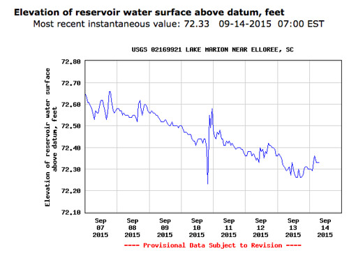
Sparkleberry Landing requires a lake level of 72.1 feet for navigation. Any lower than that and you’re dragging a boat through mud. We had to make the call by Thursday, and the gauge had a reading of 72.55 – low, but doable. The weather forecast looked iffy, but also doable. We were almost wrong on both accounts.
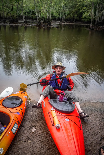
Houston came up from Athens Friday and stayed the night so we could get an early start Saturday. We had discussed camping at Poinsett State Park, or even paddling out to the floating cabin in the middle of the swamp Friday and staying overnight there. Instead, we opted for the comfort of beds at home with martinis and a big screen TV. In the morning Jim Leavell met us at my house and we started the trek southward.
On the drive down the first of our concerns, weather, came into play. Just after we turned onto Garner’s Ferry Road below Columbia the rain started. I checked the weather map, and it looked grim.
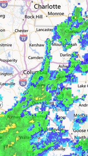
However, a closer observation showed that the rains were moving out, and we should be fine.
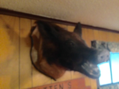
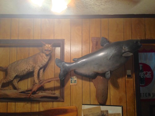
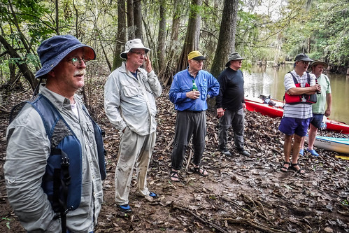
Our first stop was for breakfast at Batten’s in the tiny town of Wedgefield. Dwight Moffit and Marc Epting joined us from Columbia were already waiting for us in the cafe. The food was good, and the ambiance is always eclectic. I always judge a restaurant by the quality of its taxidermy.
The rain was light, but fairly steady. After breakfast we drove on down to Sparkleberry Landing, passing lots of deer hunters along the way. The access road was a bit muddy, but not a problem.
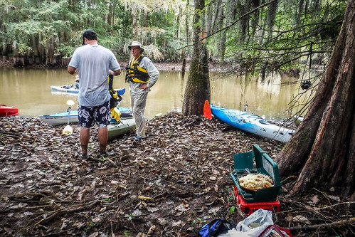
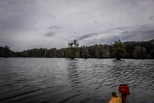
We got to the landing before our Lowcountry counterparts. I pulled around to unload the boats and was shocked at how low the water was. I’d never seen it like that. We were questioning whether or not we would be able to paddle away from the landing, but the presence of trucks with empty boat trailers let me know that they had been able to make it through.
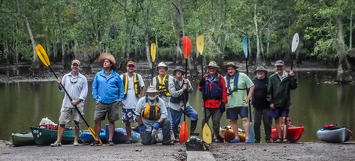
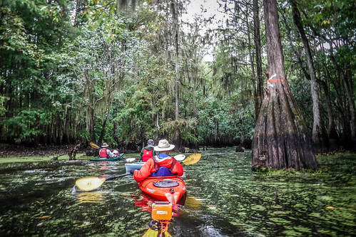
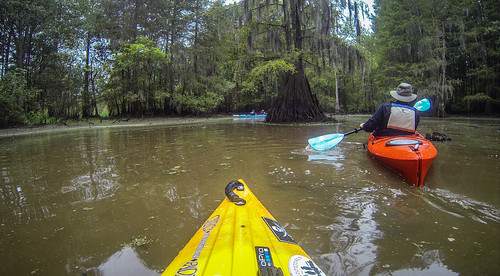
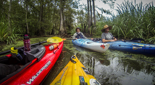
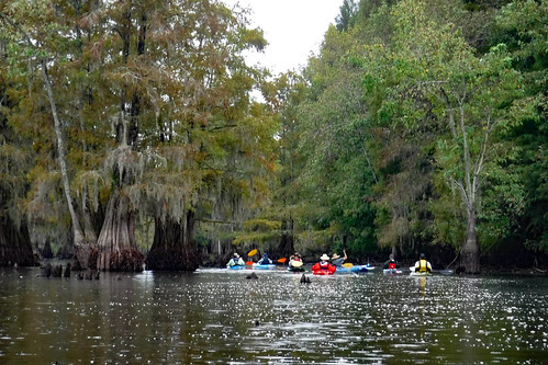
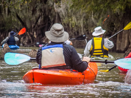
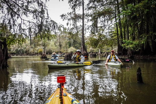
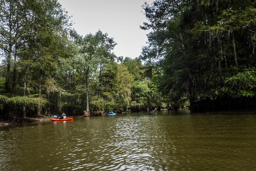
Soon Matt, John, James, and two more newbies, Ray and Todd, joined us, bringing our number to ten paddlers on this cool rainy morning.
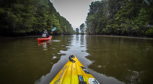
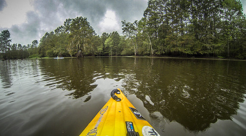
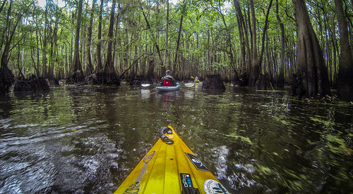
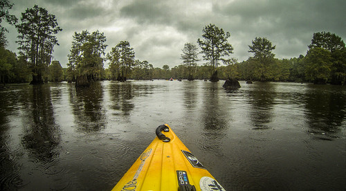
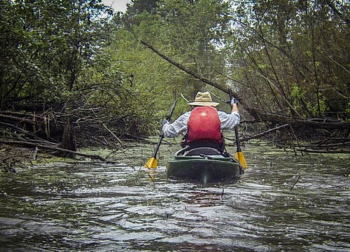
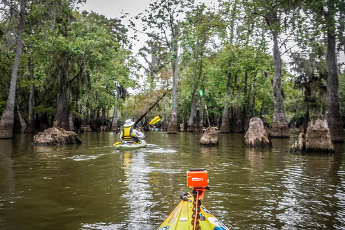
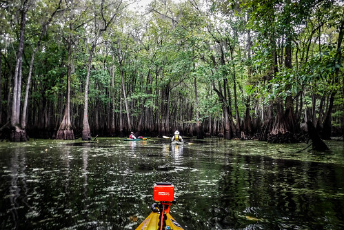
We unloaded and launched, heading out through the narrow canoe cut.
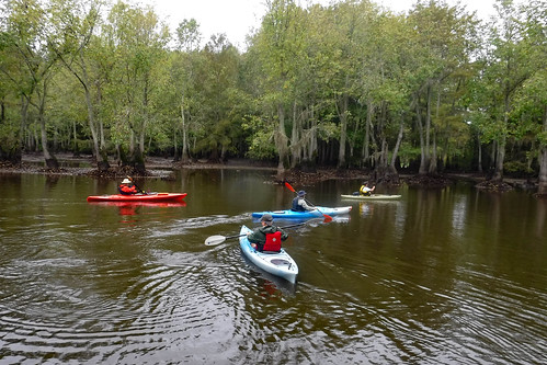
Indeed, it was narrow and shallow. My paddle hit bottom a couple of times, but the boat sailed through with no problem. I had to wonder how those other motor boats had gotten out.
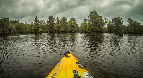
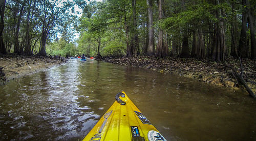
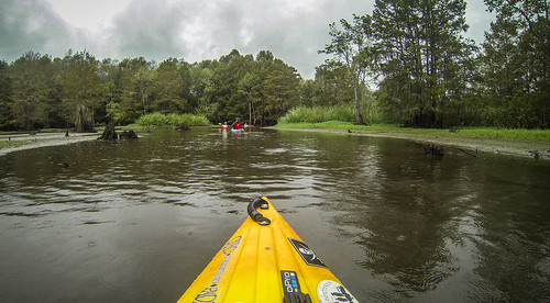
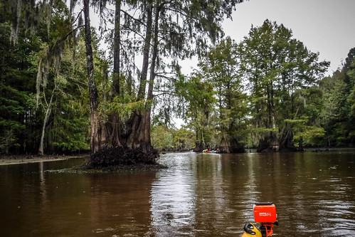
Our plan was to have lunch at the Fifty Fools Creek floating cabin. How we got there was the big variable. The first part of the trip was the same route we normally take. At the end of the canoe cut is a larger channel that eventually opens out to Sparkleberry Flats. From there we have a bit of open water paddling.
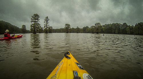
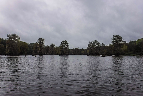
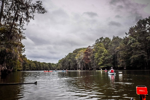
It was still cloudy with light rain. As we rounded the corner onto the open water the wind picked up a bit. I was glad that we would mostly be in the trees, away from the rain.
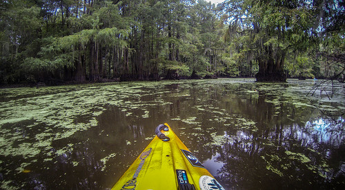
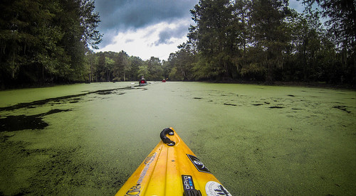
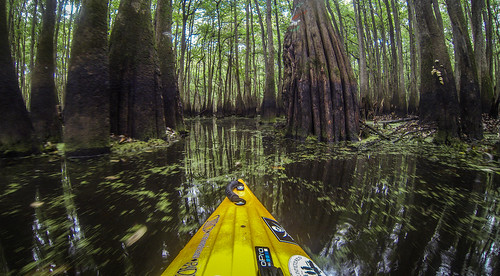
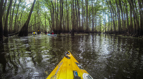
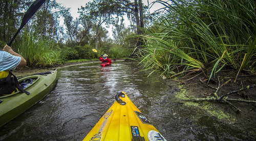
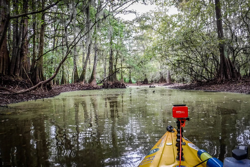
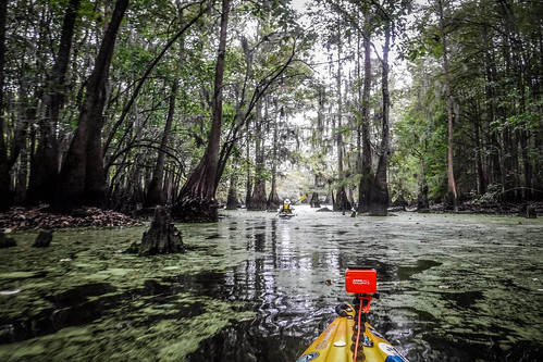
On our last trip we had noticed that the trails were very well marked, and that was still the case. I found the entrance on the other side of the swamp with no problem. The channel on that side was covered in duck week. Our boats made trails, with odd dips where our paddles separated the water.
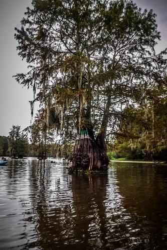
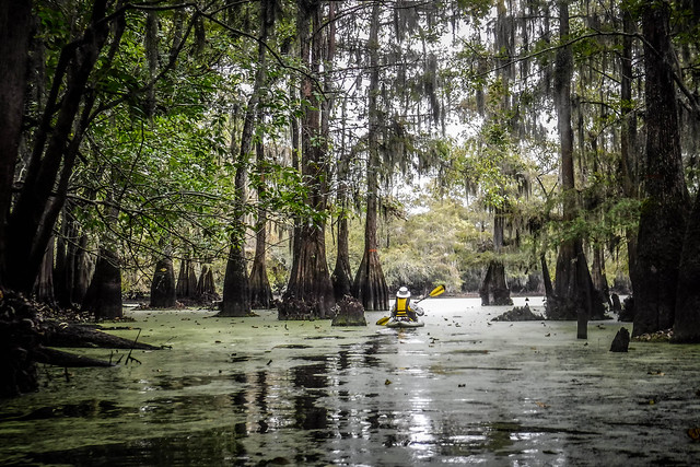
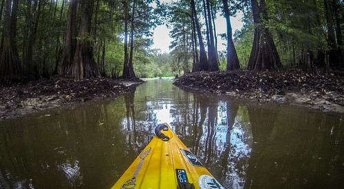
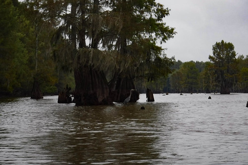
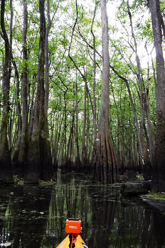
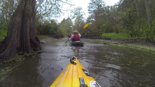
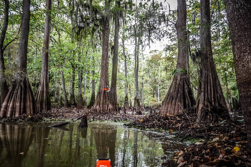
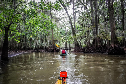
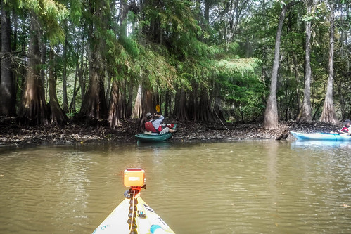
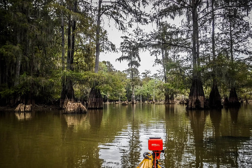
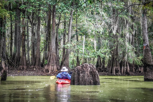
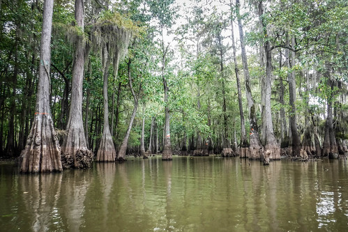
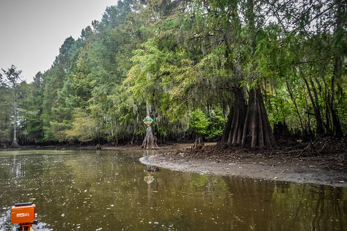
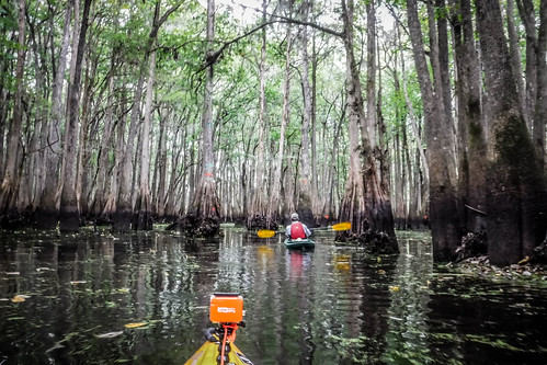
At the end of this channel we reach my favorite part of the swamp – the Cypress Cathedral. I don’t know if this section has a proper name, but that’s what I’ve been calling it ever since I’ve been coming here. Even with the low water the cathedral effect was in play. We just couldn’t paddle anywhere we wanted.
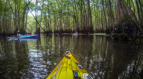
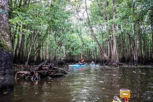
On the other side of the Cathedral we had a choice. We could head south toward Otter Flats, or north toward Jones Flats. Dwight and I had taken the northern route last time and found a beautiful route through the trees back to Fifty Fools Cabin. I wasn’t sure that would be an option with the water as low as it was, but the other guys wanted to see new territory. That was fine with me, so we headed that direction.
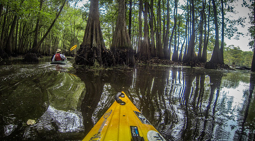
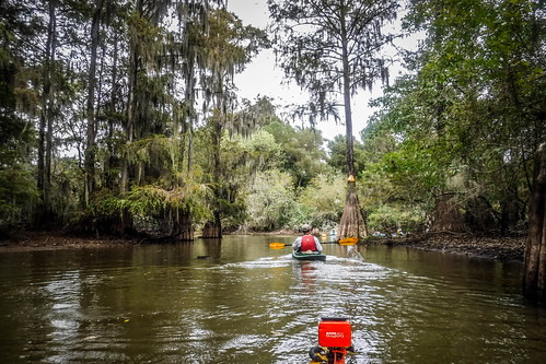
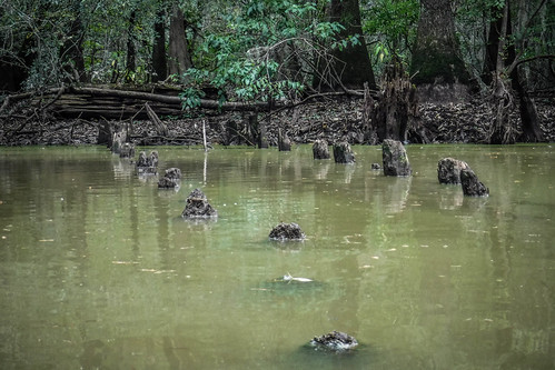
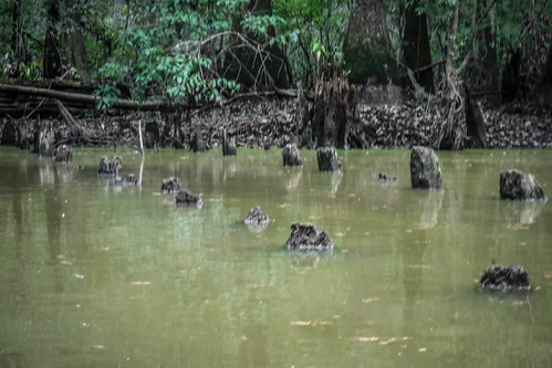
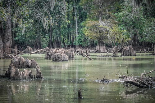
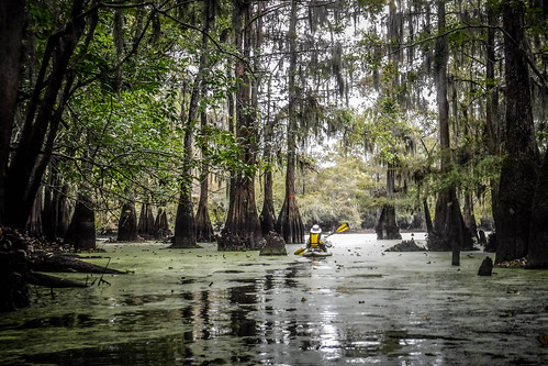
Cypress crowns are always a challenge. Usually they lurk just under the surface, upsetting unsuspecting boats. Now these were very visible, but there were lots of others still under the surface. There were also limbs that usually weren’t a problem at higher levels.
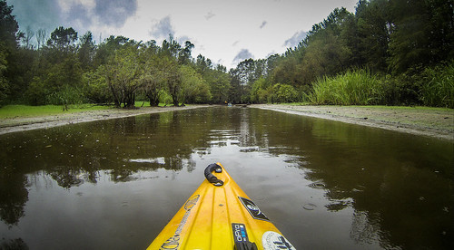
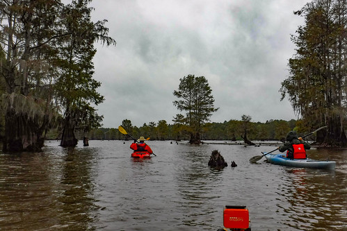
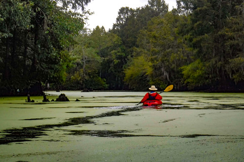
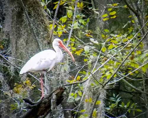
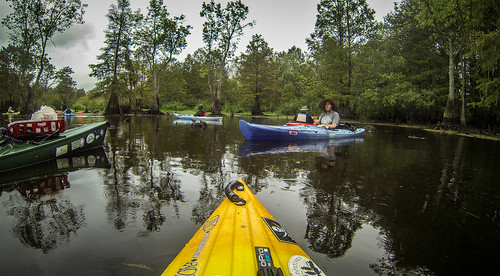
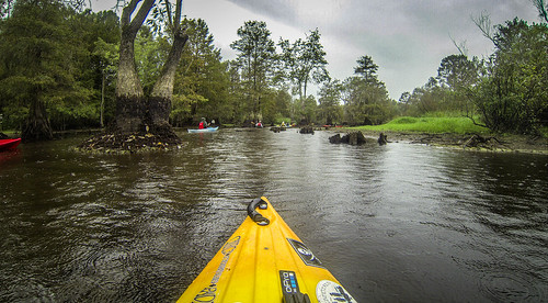
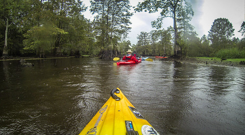
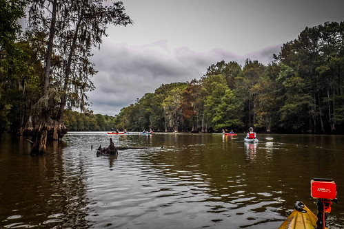
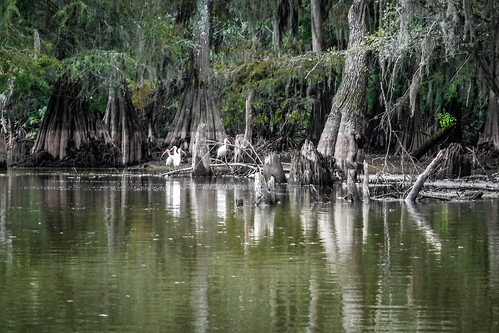
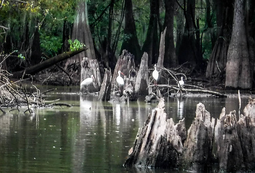
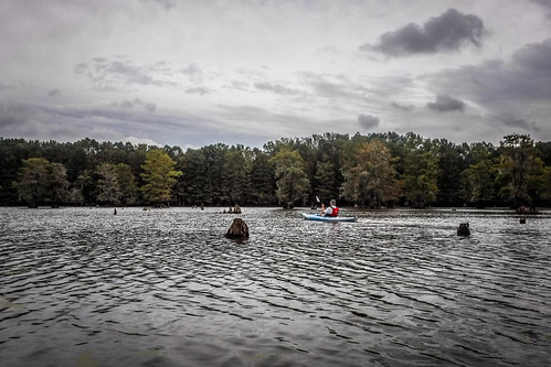
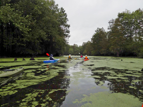
The Cathedral continues for about a half mile more, then opens onto Jones Flat. The rain had finally stopped, and we began seeing herons, egrets, and American ibis everywhere – loads of white birds everywhere you looked.
We continued north, but I wanted to start making our way westward toward Fifty Fools Creek. At normal levels we can usually just paddle across country. This time we were limited to the natural channels of the swamp.
If Lake Marion had never been built, Sparkleberry would probably be more like Congaree National Park. There are parts that flood, but large sections that are dry for most of the year. The backwaters of the lake keep Sparkleberry under water. Both share similar structures, though, as follows:
- Creeks – These usually derive from sources outside of the swamp, and of a definite current. Usually there is always water in these.
- Guts – These are low-lying areas that may flood in a traditional swamp, but are almost always flooded in Sparkleberry.
- Flats – These are the lake-like open areas with fairly shallow waters. There are many of these in Sparkleberry, but not so much in Congaree.
- Lakes – These are deeper, and usually more defined than flats. Wise Lake in Congaree and Risers Lake in Sparkleberry fit this definition.
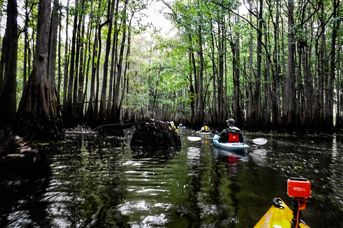
All of these are usually interconnected in some way, especially in Sparkleberry. Unfortunately, as we were soon to discover, that wasn’t the case today. Our route continued to narrow without any obvious escape. We found ourselves running out of stream fairly quickly. eventually, we had to stop and retrace our steps.
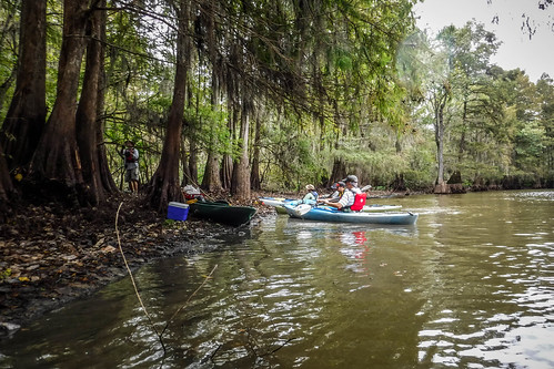
Getting back up in here had been a challenge, and returning was just as bad. Matt used an innovative paddling technique to get through a low spot, separating his paddle and using the halves like ski poles.
Here he is in action.
I used the same technique and found it much easier getting through some of these low areas.
We backtracked across Jones Flats. I kept looking for a route to west, in case I had missed a connection over to Fifty Fools. No luck. Eventually we made it back to the Cathedral just as the rain started back up.
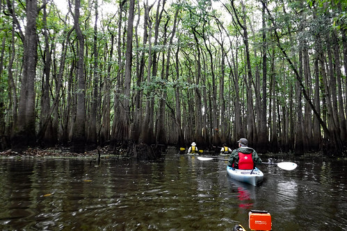
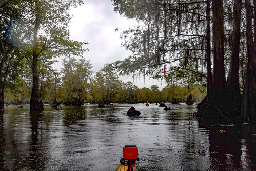
We paddled on south and finally reached Otter Flats. Normally this is wide open, but today the channels were much narrower. Not far from the entrance we found the markings to the entrance to Fifty Fools Creek. It was completely blocked. There was no way we could reach the cabin.
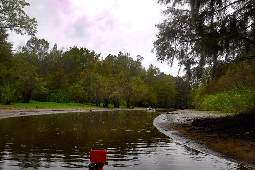
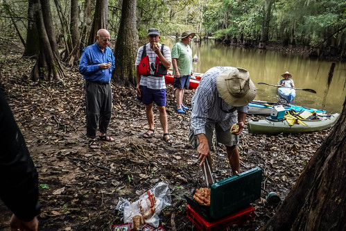
We had a problem. There isn’t a good spot to pull out and have lunch. At least, not one of which I am aware. Most of the time this whole region is flooded. Even with low water those bits that are exposed are muddy. If we just had sandwiches or something light we could eat in our kayaks. Unfortunately, stoves and plastic kayaks don’t mix.
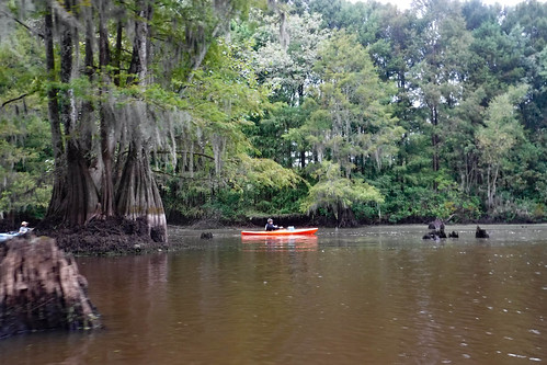
We had two options. We could either paddle back to the landing, or we could paddle on out to the high ground at Risers Lake. That area is popular with with fishers, etc, and there are lots of fire rings and camp grounds. We knew we could find dry ground there, assuming we could get there.
We reached a junction, and Matt consulted his map. He said it was a shortcut to the south end of Risers Lake. I was skeptical. My GPS had this marked as the route to McGirt’s Lake. We took the route anyway.
It did open up onto a lake, but it wasn’t one I recognized. The banks were lower, and probably under water at normal pool.
A quick check of my GPS let me know that we were 1.35 miles from Risers Lake, as the crow flies. We tried to find a cut through back to Otters Flats, but it was futile. We had to backtrack once again.
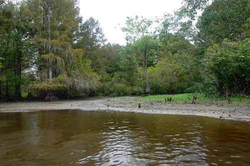
Matt and I gathered for a consultation. If we tried to go back to the cut then paddle out to Risers it would be probably three miles. I also pointed out that wiht the water lower, we would have a steep climb up to the camp area. We decided to try to find a place closer.
My feet sank into mud when we landed, but there was drier ground a few feet further in. Not perfect, but it would be adequate. We broke out the stove and started the brats and sauerkraut. Jim’s wife, Judy, and made muffins for us, too.
Suitably refreshed, we decided to head back to the landing. I had planned to get us back by 4:00, and this would put us back at about that time without being rushed.
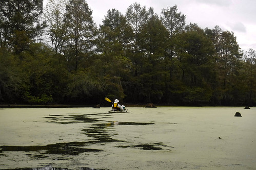
We made it back to Otter Flats, and paddled leisurely along toward the landing. Once again, there were tons of white birds everywhere. Most of these were ibises.
I mentioned earlier that we were seeing structures below the surface that we don’t normally see. I had spotted these on the way out, but as we paddled back we paused to investigate. There were parallel sets of pilings that at one time would have crossed the channel. Dwight postulated that these were the pilings for a short line logging railroad. They must have been part of the Santee Lumber Company owned by Beidler and Ferguson. This would place them circa 1900-1910.
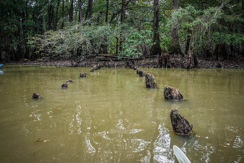
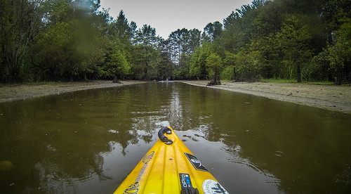
We continued on our homeward trek, past exposed cypress crowns and back through the cypress cathedral.
About this time the sun started to break through, and the skies were clearing. I thought the weather had been great – not too hot, with the rain to cool things off. We corssed back through the duck weed and onto Sparkleberry Flats.
Soon we were making our way back through the canoe cut and found ourselves back at the landing.
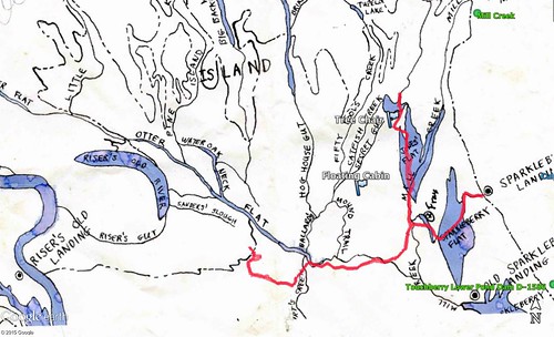
We had paddled 7.66 miles, according to my GPS. Our route showed our backtracking.
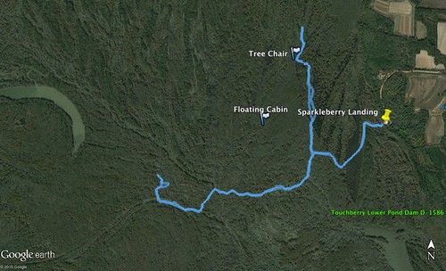
Here’s the route on top of my Sparkleberry Map. It shows more clearly how far we were from Risers Lake, and the location of our target cabin that we never found.
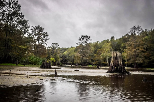
As it turns out, the water was even lower than we thought. On Saturday it was 72.25, just barely above the minimum.
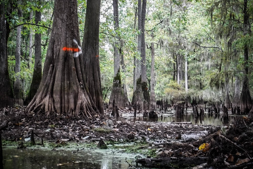
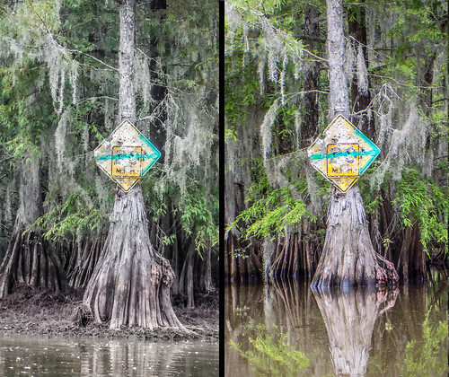
As a comparison, here’s the sign tree from back in June next to the same image from this trip.
It was a great trip. I’m glad I found out what this swamp is like at lower levels, but I certainly prefer more water in the swamp.
Here are Houston’s photos from the trip…
…and here are mine. I’ll try to post links to more as folks post them online.
Still and all, it looks like a great day in the swamp.
Thanks so much for your fantastic trip report. Fotos, maps, gauge info etc. If you see this soon, please email me. I have a few questions for you. Thanks again. Kelly Jamison. Matthews NC. Kjsebaco@gmail.com