It’s one of those blink-and-you’ll-miss-it communities. There are signs for Jalapa on I-26, but unless you know where it is you’ll drive right through and never know you’ve been there. I’ve known about Jalapa for most of my life. My family has a long history both in Newberry and in Laurens, so we’ve passed through it on Highway 76 while making that trek between both towns. Back in my cycling days I made that trip several times, and passed through it at a much slower pace. The important word is the preposition “through”. Not “to”. It’s not a place one usually goes as a specific destination, yet, I was compelled to do just that.
Obligatory Historical Background
As a kid I always thought the name was funny. It had no context in my vocabulary. Yet, it seems that there are several towns named Jalapa in the US. There’s one in Georgia, Illinois, Nebraska, Kentucky, Indiana, Alabama, and two in Tennessee. Like their South Carolina counterpart, these tend to be unincorporated communities, or even ghost towns.
The name of the town comes from Xalapa, Mexico. In 1847 members of the Palmetto Regiment fought in the Battle of Cerro Gordo near the town in the state of Veracruz, including some soldiers from Newberry County. When they returned home, they renamed the community Jalapa. The city apparently made quite an impression. Even Ulysses Grant was impressed and wrote in his memoirs that Xalapa was “decidedly the most beautiful place I ever saw in my life” and its climate “the best in the world.”
Xalapa leant its name to one of my favorite foods, the jalapeño. The peppers aren’t grown there, but that’s where they were first pickled and named. According to one source, it’s also the origin of the term “jalopy”, a name given to old vehicles in New Orleans bound for scrap heaps in Xalapa.
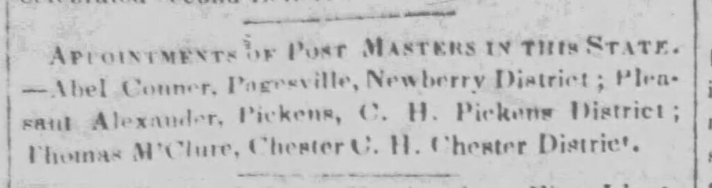
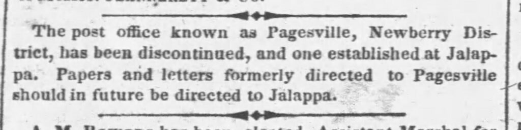
Prior to 1855 the community had been known as “Pagesville” or “Pageville.” I found an 1837 article in the Charleston Mercury about an appointment of a postmaster for Pagesville.
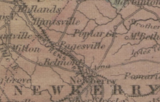
This was the earliest reference for that name that I could find in newspapers archives. It doesn’t show up as a place name in the SC Archives database. The name does appear on Colton’s 1854 map of the state.
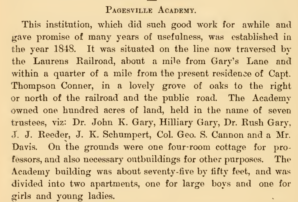
It’s not in the Robert Mill’s Atlas, but The Annals of Newberry, published in 1892, describes the Pagesville Academy.
In 1855 Pagesville Post Office was officially renamed Jalappa, then just Jalapa with one “p.”
Before Jalapa, and even before Pagesville, settlers came to the region and started setting up churches. Newberry is largely Lutheran, but there are Presbyterians and Methodists in the area, too. The church closest to Jalapa was Tranquil Methodist Church. It was first established in the early 1800s at a spot near present-day I-26. In 1827 the church began the first Sunday School in the county. In the 1890s the church was relocated near the intersection of Jalapa Road and US 76, the heart of the community. There was an old Covenanter Presbyterian Church, but I’ve not been able to find much information about it.
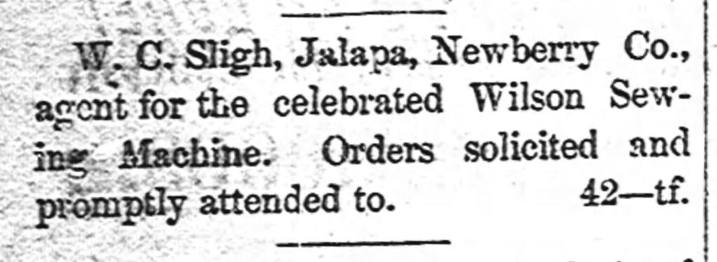
Even though this was largely a farming community, there was commerce. There was a large cotton gin, and by the late 1800s there were at least three stores. I was able to find some advertisements in the local paper.
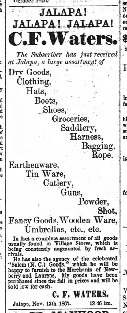
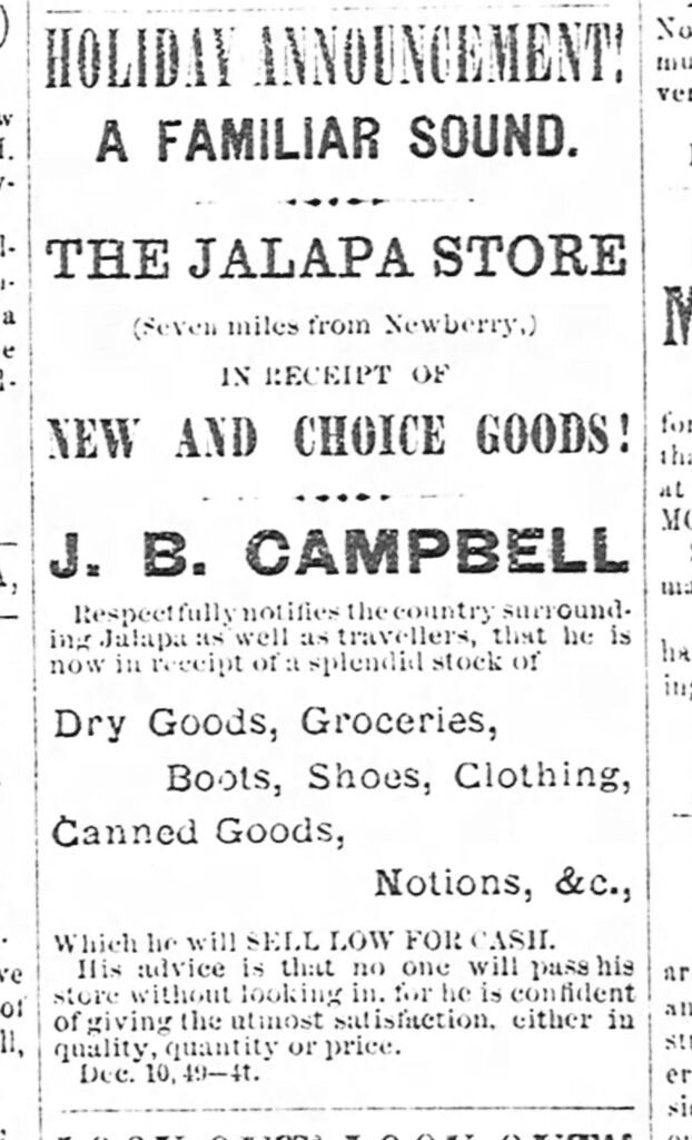
The State Board of Agriculture use to release annual reports on a county by county basis. The South Carolina Resources and Population, Institutions and Industries Report from 1883 confirmed three stores in the village. It also described Jalapa in very racist terms.
Jalapa Township (E. D. 113) Lands hilly and broken. Soil, red clay loam, eight inches to red clay subsoil, underlaid by red clay. Growth, oak and hickory. Three mill sites. Wages, fifty cents day with board. Very little white labor, negro labor very unreliable, only willing to work about one-third of the time.
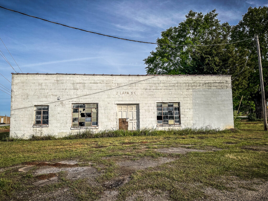
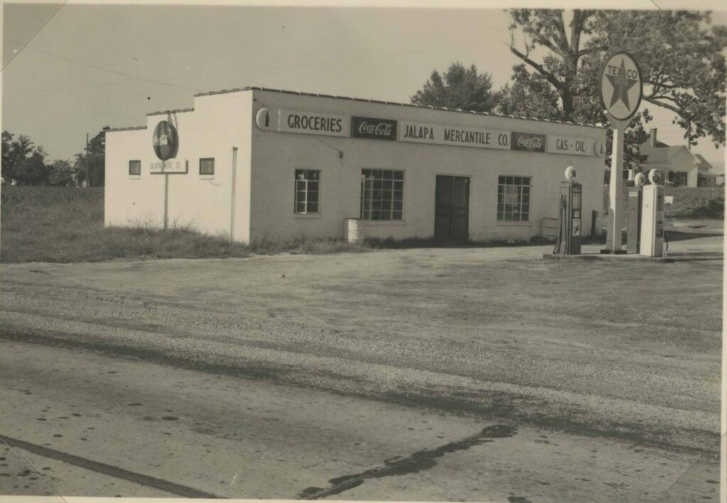
By the early 1900s there was only one store remaining at the intersection of Jalapa Road and US 76. I was able to find a photo of the store from 1943. It’s the same building shown at the top of this post.
Continued on next page…