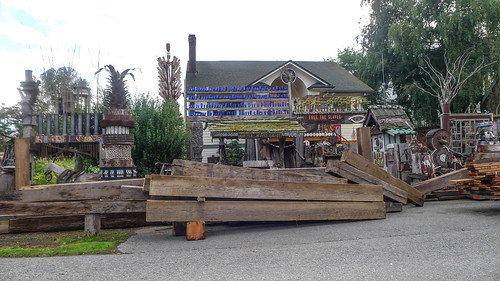
Ghost towns in Washington State? Yes, please! With all of the settling in and touristy stuff we’ve been doing I had not taken time for a good photo ramble. Laura had some Furman work to do, the weather was perfect, so I decided that I head off in search of the ghost town of Skagit City.
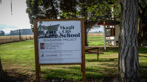
The towns in southern Skagit County fascinate me, especially those along the Skagit Delta. The name “Skagit City” kept popping up on my maps, yet there didn’t appear to be anything there. To top it off, I came across an article in the Skagit Valley Herald talking about restoration of the old Skagit City School. The article was from 2015 and renovations were now mostly complete. There was a ghost town AND an old school, making this particular target even more appealing.

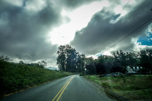
Avoiding I-5 as much as I could, I drove through Burlington and Mount Vernon and headed south on Old Highway 99, the main highway route south to Seattle prior to the Interstate system. (Note for future blog post, drive Old 99 all the way back to Seattle.) I reached the town of Conway, one of the intriguing stops along my route.
I had been through Conway a couple of times. It began as a farming community and commerce hub on the South Skagit in the 1880s. The Great Northern Railroad came through in 1891 designating Conway as a stop, and in 1892 it was incorporated as a town. A flood on the Skagit in 1894 almost wiped out the whole concern, but the town rebuilt.
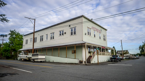
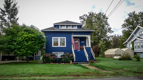
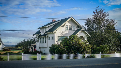
Modern Conway has followed the path of other rural towns in Skagit County like Laconner and Edison. While there are still strong connections with the town’s agricultural past, commercial buildings have given over to pubs, antique stores, and artist studios. Victorian and Craftsman farm houses still line the streets of the small town. The Conway Muse has become a noted local music venue.
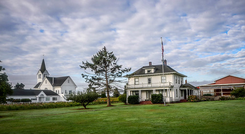
Conway is on the banks of the South Skagit and on the other side of the river was my first ghost town of the day. The town of Fir was about as big as Conway. A ferry connected the two towns.
These images from the Skagit County Historical Society show Fir as a vibrant place with a dock for river boats.
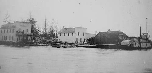
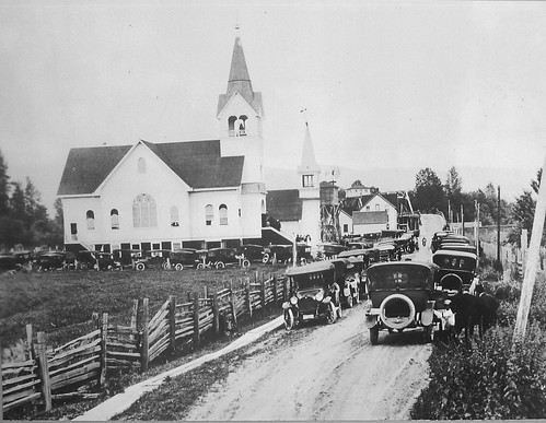
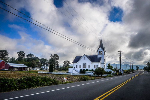
The only remnants of the town are a cluster of farm houses and the Fir-Conway Lutheran Church established in 1888. The current building was constructed in 1902.
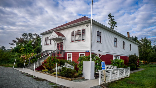
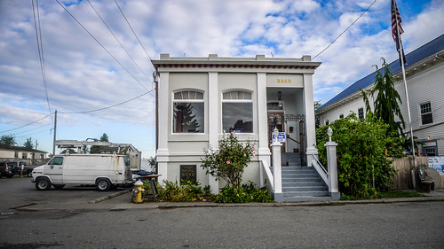
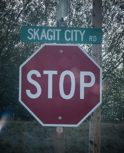
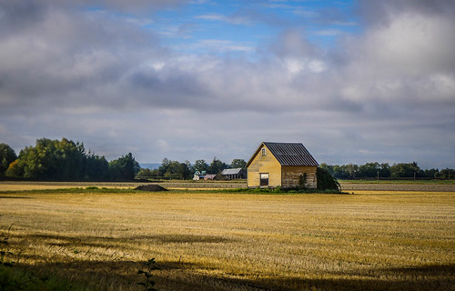
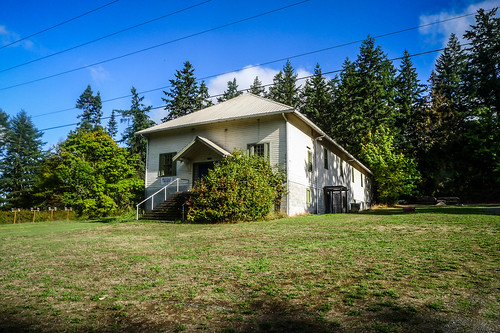
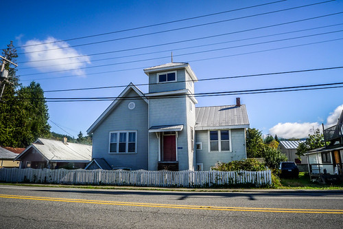
On the other side of the South Skagit, Skagit City Road headed north along the river and through the fertile farmlands of the delta. I could see the school from a long way off across the fields.
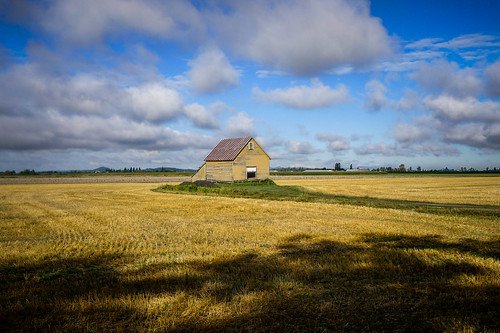
When I arrived at the school I was disappointed. A utility van was parked out front, obscuring the view. I couldn’t get a clean shot of the entire front of the school.
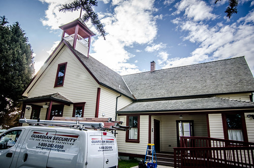
I did what I could, though, using wide angle lenses to try to get past the van.
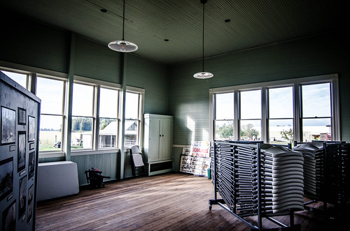
I was able to make the best of the situation. The workmen were there to install a new fire alarm system, and once I told them what I was after they invited me in to take photos of the interior.
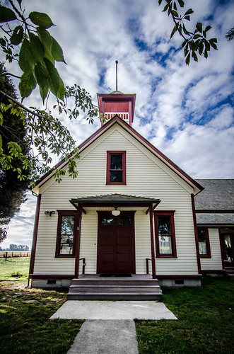
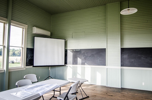
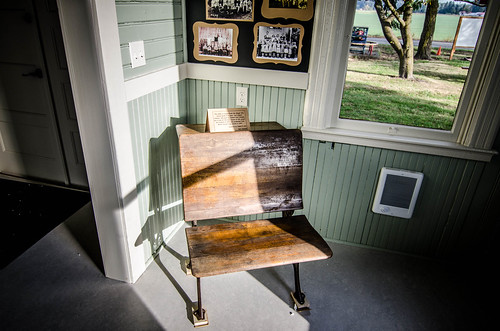
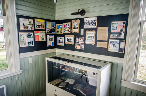
This was a two room building. One classroom had a photo board with historic photos of the region. I’m sure these came from the Skagit County Historical Society, but all of the historic photos I have on this blog post were snaps from that collection. The other room was set up as a meeting room.
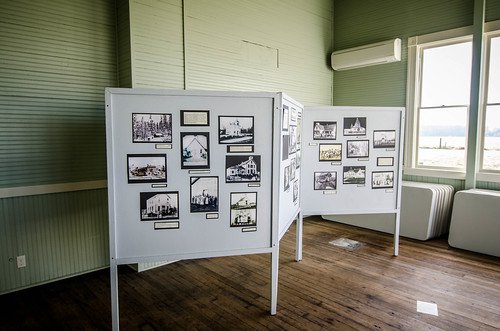
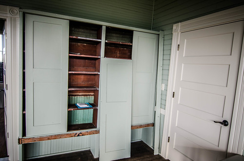
There was a small utility room and an antechamber under the bell tower. There was more historic information here. The school’s original bell was on display out front.
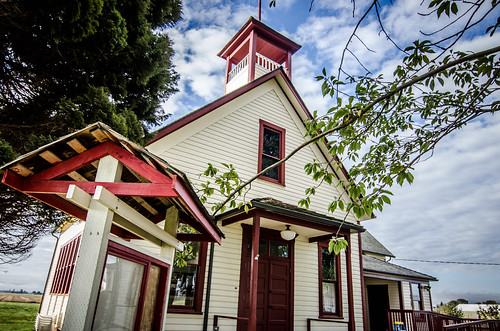
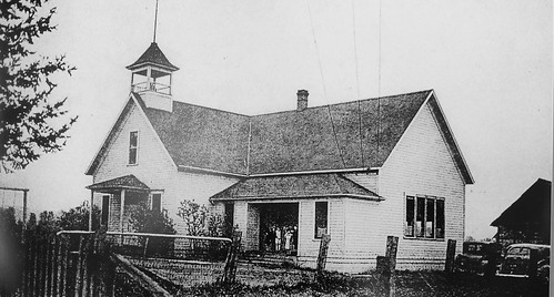
It looks like the Historical Society has done an excellent job restoring the school. I saw one photo that showed the entire building lift about five feet so that a more secure foundation could be built. Here’s a view of the school from 1937.
The Skagit River Journal website gives more details about the history of the school, as well as the history of Skagit City itself. Some of the photos I found in the school are also on this website.
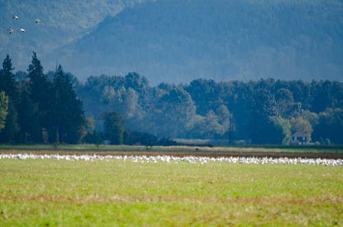
It was time to try to find the namesake town for the school. I continued along Skagit City Road until I reached the area indicated on the old maps. There was a line of well-maintained farm houses on the west/inland side of the road and a high dike along the river to the east. The top image below is looking south, with the dike and river to the left and houses to the right.
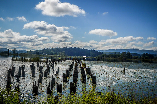
I came to a spot where a dirt road led steeply over the dike and back down. A brown sign stated that this was public fishing access with a Discover Pass, which I happened to have. I drove up and over the dike, grateful for the Subaru’s four-wheel drive. Trails led out to a wide sandy beach on the south fork of the river, just down from where the Skagit splits into the north and south branches. These branches form Fir Island, the delta land between the two branches.
I walked on out onto the beach, trying to imagine this as a bustling river port.
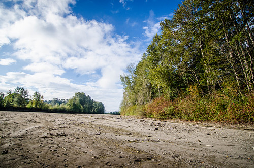
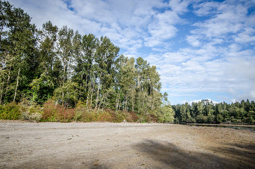
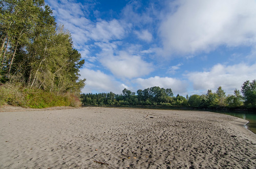
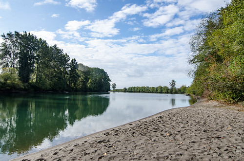
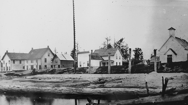
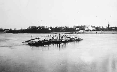
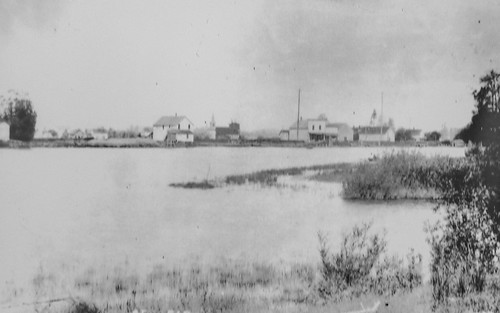
There is a photo of Skagit City in the Historical Society’s collections. It looks like the wide beach I was on is the same one in this photo from the 1920s.
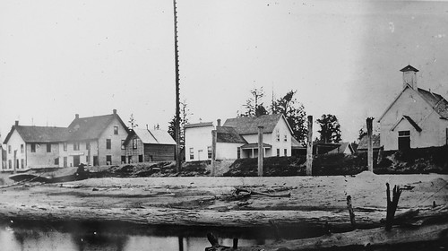
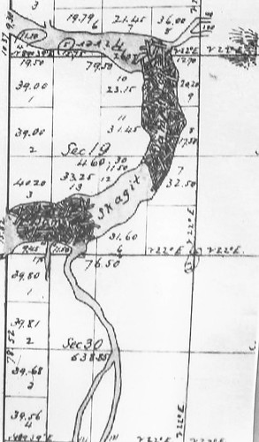
Skagit City was already in decline by the time this photo was taken. In 1877 a log jam on the Skagit River just north of the town was cleared, allowing river boats to make it all the way to Mount Vernon. This map shows the location of those jams.
The Great North Railway also bypassed the town, running on the other side of the Skagit River through Conway and Mount Vernon. Skagit City suffered the fate of so many other towns. The transportation routes changed, and business went elsewhere.
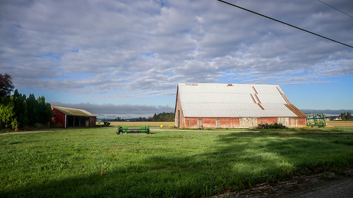
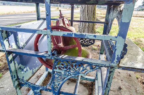
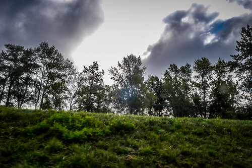
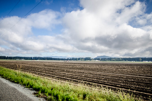
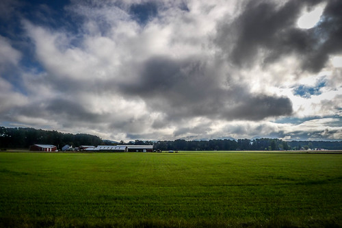
I left the “city” and continued through the delta farmlands. I saw some old home places probably from the time of Skagit City. Out in the fields tractors and trucks were harvesting potatoes. I drove down several roads criss-crossing the delta.

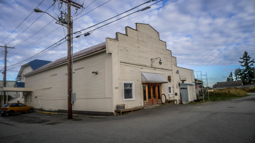
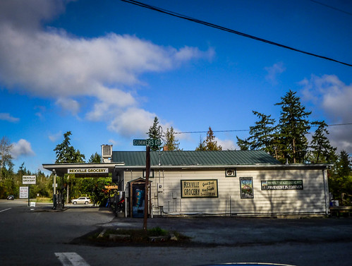
Eventually I crossed the North Fork of the Skagit River and entered the community of Rexville. I don’t have any other information about this community – its size, etc. There was a country store and a grange. It was here that I came to a realization. Several buildings I had previously identified as “schools” in Skagit County were actually grange buildings.
Given the agricultural heritage of this area that makes sense. The grange buildings were probably multipurpose, as a place where not only farmers but other members of the community could come together.
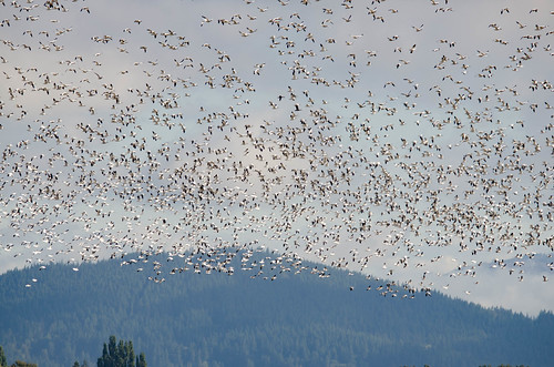
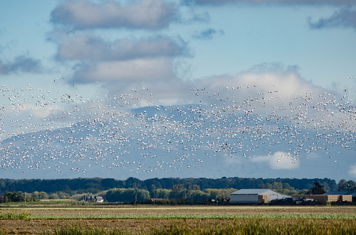
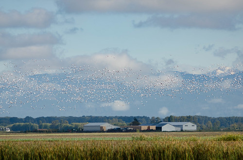
I briefly toyed with the idea of driving into Laconner to visit the Skagit County Museum, but since it was Monday it wouldn’t be open. I’d need to wait for another day. I decided on one more stretch of this ramble to get me home. I drove back through the delta fields toward Conway. As I passed some of the fields I spotted large white swatches in one field. Suddenly thousands of snow geese noisily took to the air. It was amazing.
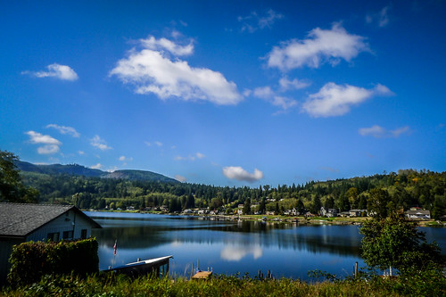
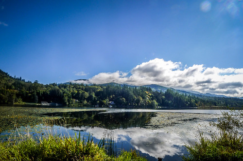
I crossed I-5 on Highway 534. This was a beautiful drive the led me up to the community of Lake McMurray. I couldn’t see any way to get access to the lake, or even pause to take a good photo. I headed north on Highway 9 toward Big Lake, which, as its name would imply, is larger than McMurray. Big Lake was very much built up along its banks and even on the hills overlooking the lake.
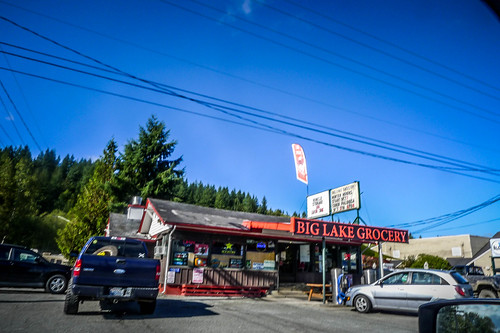
There was one more large lake along Highway 9. Clear Lake and the community of the same name are just a few miles south of Sedro-Woolley. This lake was a bit smaller than the other two, but looked like it had more potential as a paddling venue. At least, it looked more interesting to me.
From here I was back on track for home. I stopped for lunch in Sedro-Woolley at at a place that advertised “Good Food – Lousy Service.” The service was actually better than their food,a nd their food wasn’t too bad. From there I headed on back home to Samish Island. It was a great day exploring, and I’d love to go back down to the Skagit Delta to do some more exploring.

UPDATE: Cathy Enns from Skagit Talk has written an excellent article on the log jams around Skagit City. That article features one of my photos from this post.
Wonderful photography, as usual. Thanks for sharing your rambles.
Hi: I’m a writer for an online “newspaper” called SkagitTalk. I’d like to use your last photo of the Skagit City location (#12) in an article I’m writing. Of course I would credit you. Would you be willing to authorize this use?